https://www.peninsulapmg.com/foo.html     2022-06-04  
Skip to Content
Peninsula Maps & Globes
Home
Shop
About
Contact
English
0
0
Peninsula Maps & Globes
Home
Shop
About
Contact
English
0
0
Home
Shop
About
Contact
English
Back
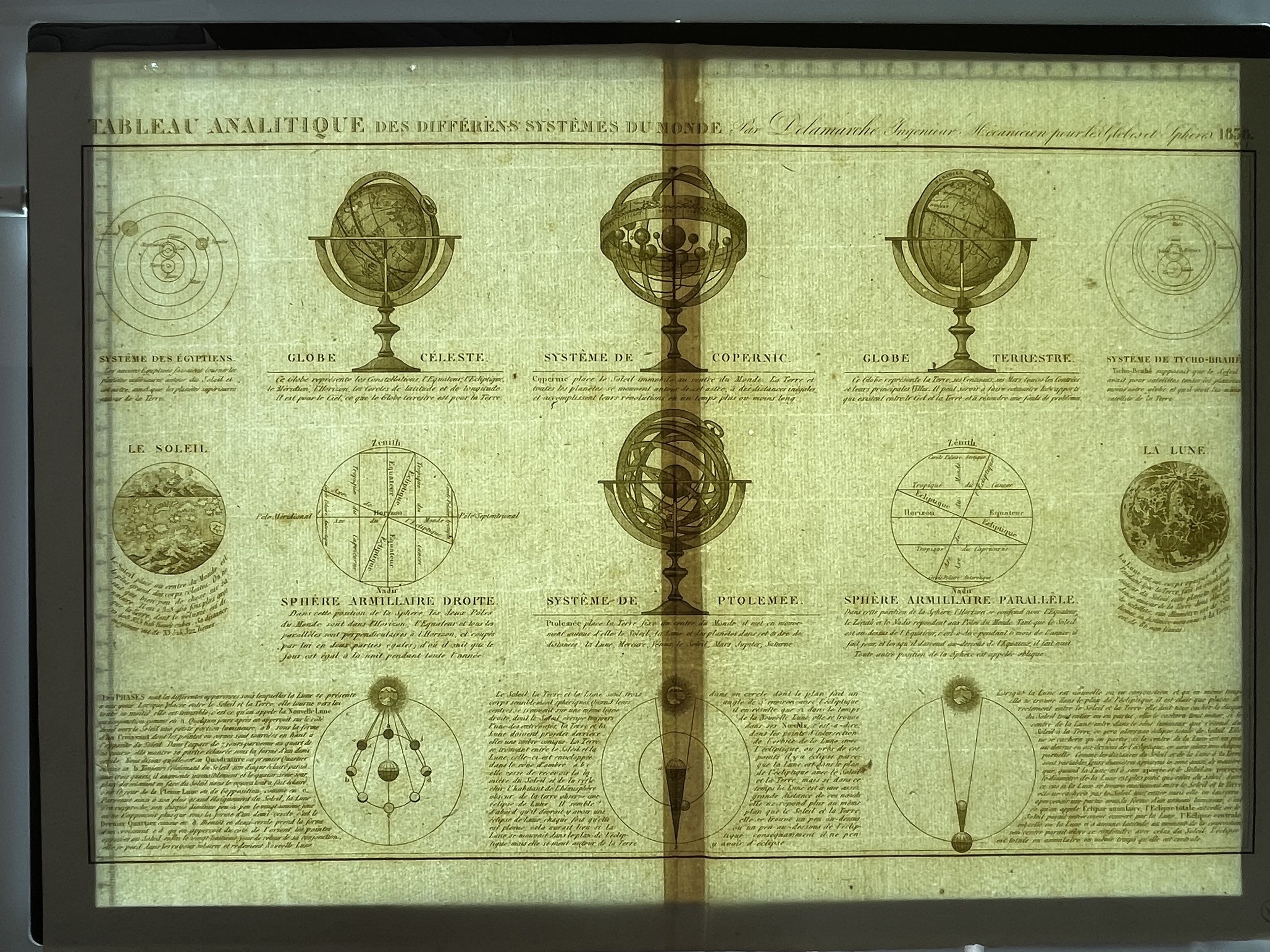
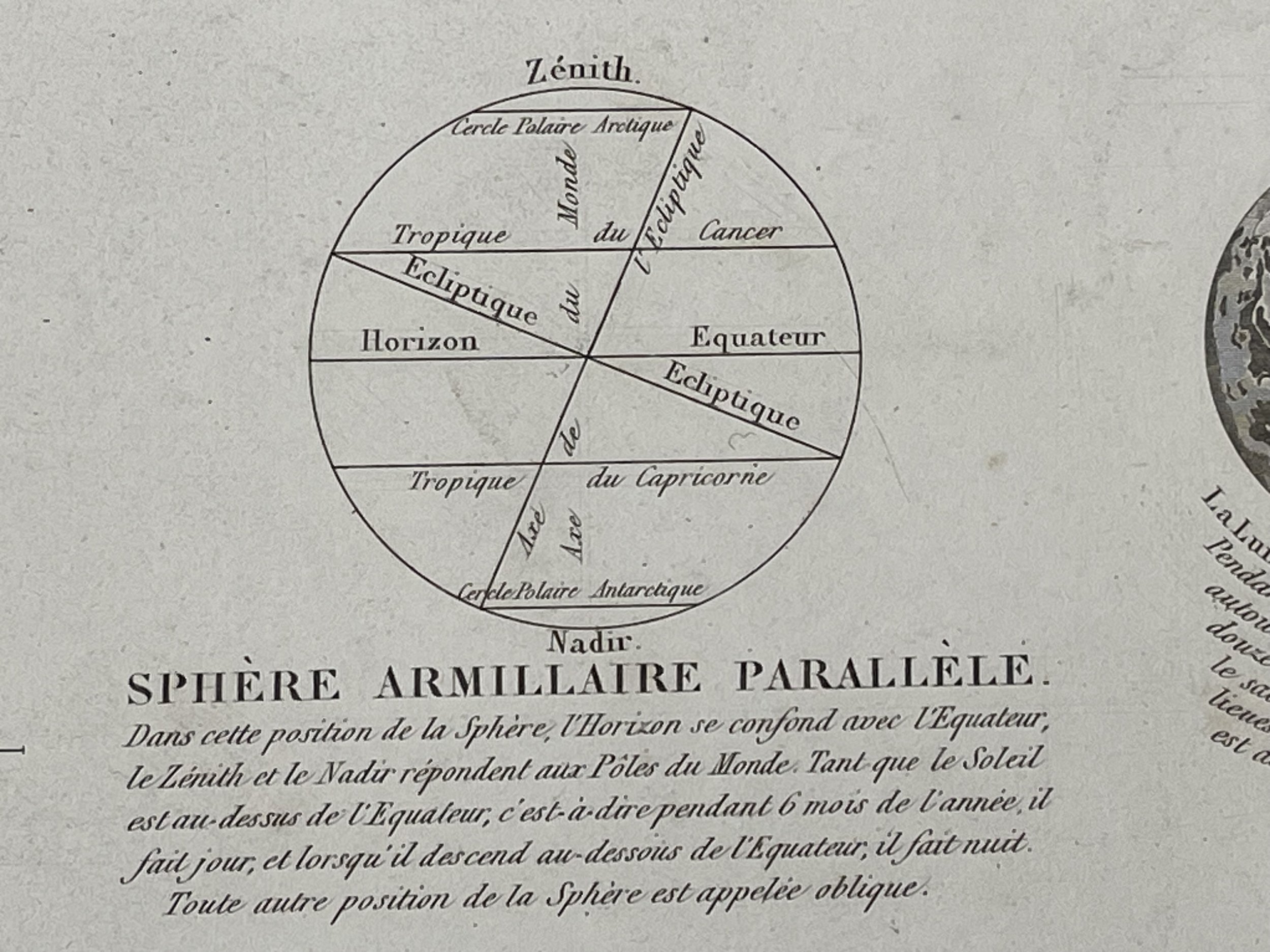
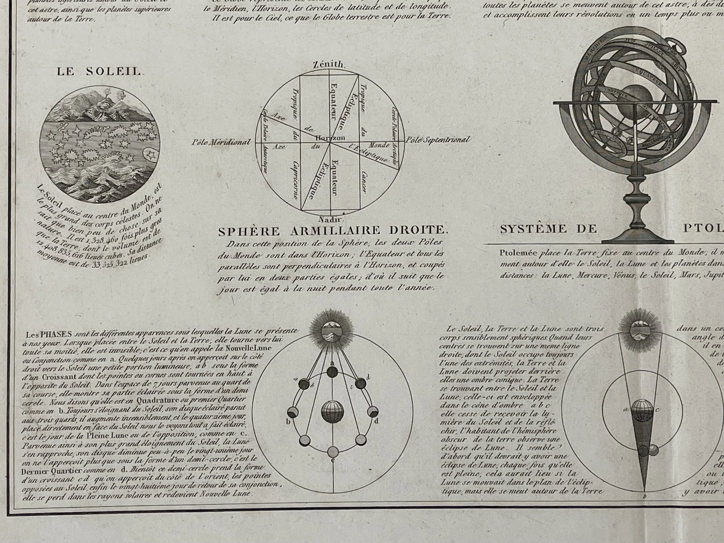
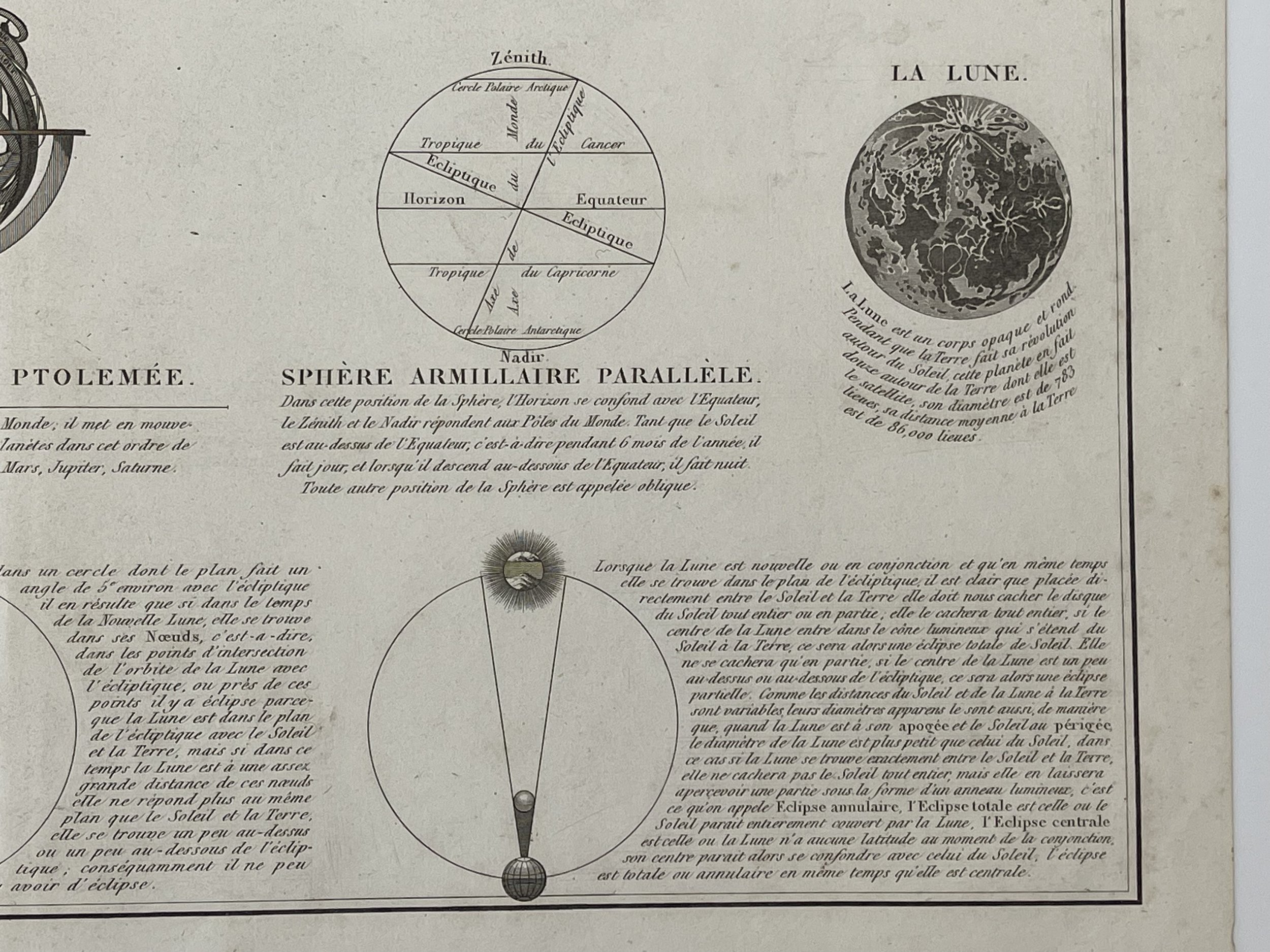
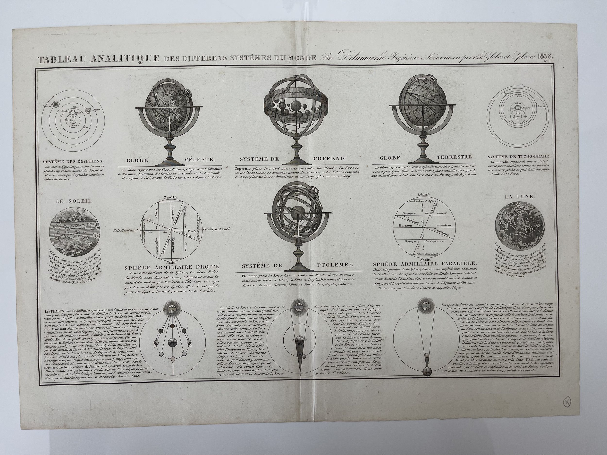
Peninsula Shop Tableau Analitique des Differens Systems du Monde - Charles-François Delamarche - 1838
IMG_0433.jpeg Image 1 of 20
IMG_0433.jpeg
IMG_0452.jpeg Image 2 of 20
IMG_0452.jpeg
IMG_0447.jpeg Image 3 of 20
IMG_0447.jpeg
IMG_0450.jpeg Image 4 of 20
IMG_0450.jpeg
IMG_0448.jpeg Image 5 of 20
IMG_0448.jpeg
IMG_0446.jpeg Image 6 of 20
IMG_0446.jpeg
IMG_0451.jpeg Image 7 of 20
IMG_0451.jpeg
IMG_0449.jpeg Image 8 of 20
IMG_0449.jpeg
IMG_0445.jpeg Image 9 of 20
IMG_0445.jpeg
IMG_0444.jpeg Image 10 of 20
IMG_0444.jpeg
IMG_0443.jpeg Image 11 of 20
IMG_0443.jpeg
IMG_0442.jpeg Image 12 of 20
IMG_0442.jpeg
IMG_0441.jpeg Image 13 of 20
IMG_0441.jpeg
IMG_0440.jpeg Image 14 of 20
IMG_0440.jpeg
IMG_0439.jpeg Image 15 of 20
IMG_0439.jpeg
IMG_0438.jpeg Image 16 of 20
IMG_0438.jpeg
IMG_0437.jpeg Image 17 of 20
IMG_0437.jpeg
IMG_0436.jpeg Image 18 of 20
IMG_0436.jpeg
IMG_0435.jpeg Image 19 of 20
IMG_0435.jpeg
IMG_0434.jpeg Image 20 of 20
IMG_0434.jpeg
IMG_0433.jpeg
IMG_0452.jpeg
IMG_0447.jpeg
IMG_0450.jpeg
IMG_0448.jpeg
IMG_0446.jpeg
IMG_0451.jpeg
IMG_0449.jpeg
IMG_0445.jpeg
IMG_0444.jpeg
IMG_0443.jpeg
IMG_0442.jpeg
IMG_0441.jpeg
IMG_0440.jpeg
IMG_0439.jpeg
IMG_0438.jpeg
IMG_0437.jpeg
IMG_0436.jpeg
IMG_0435.jpeg
IMG_0434.jpeg

Tableau Analitique des Differens Systems du Monde - Charles-François Delamarche - 1838

£95.00

Tableau Analitique des Differens Systems du Monde - Delamarche 1838 Globes

In the field of cartography, the enduring inheritance of tradition can prove to be a valuable asset. The existence of this map serves as proof of this fact. As the successor of the renowned DeVaugondy, the French publisher Delamarche has greatly benefitted from the previous extensive body of work and exceptional standards. Featuring finely detailed engravings and straightforward yet useful cartography, this map by Delamarche ranks among the highest quality of its time.

Charles-François Delamarche (August 1740 – 31 October 1817) was a French geographer and mapmaker.

He was a significant figure among French geographers and mapmakers during the latter part of the 18th century. He followed in the footsteps of renowned geographers such as Nicolas Sanson (1600-1667), Robert de Vaugondy (1686-1766) and Rigobert Bonne (1727-1794), and even reprinted their atlases. Additionally, he was also an educator in geography. Along with creating maps and globes, he authored a comprehensive treatise on the use of celestial and terrestrial spheres. This treatise showcases both Ptolemaic and Copernican systems, as well as provides a list of ancient and modern constellations. His legacy was carried on by his son, Félix Delamarche (18th century- 1st half 19th century).

Works - Usages de la sphère, et des globes celeste et terrestre, selon les hypothèses de Ptolèmée et de Copernic (in French). Paris: Charles François Delamarche. 1794–1795.

Map in excellent condition.. Pricing and grading commensurate.

Add To Cart

Tableau Analitique des Differens Systems du Monde - Delamarche 1838 Globes

In the field of cartography, the enduring inheritance of tradition can prove to be a valuable asset. The existence of this map serves as proof of this fact. As the successor of the renowned DeVaugondy, the French publisher Delamarche has greatly benefitted from the previous extensive body of work and exceptional standards. Featuring finely detailed engravings and straightforward yet useful cartography, this map by Delamarche ranks among the highest quality of its time.

Charles-François Delamarche (August 1740 – 31 October 1817) was a French geographer and mapmaker.

He was a significant figure among French geographers and mapmakers during the latter part of the 18th century. He followed in the footsteps of renowned geographers such as Nicolas Sanson (1600-1667), Robert de Vaugondy (1686-1766) and Rigobert Bonne (1727-1794), and even reprinted their atlases. Additionally, he was also an educator in geography. Along with creating maps and globes, he authored a comprehensive treatise on the use of celestial and terrestrial spheres. This treatise showcases both Ptolemaic and Copernican systems, as well as provides a list of ancient and modern constellations. His legacy was carried on by his son, Félix Delamarche (18th century- 1st half 19th century).

Works - Usages de la sphère, et des globes celeste et terrestre, selon les hypothèses de Ptolèmée et de Copernic (in French). Paris: Charles François Delamarche. 1794–1795.

Map in excellent condition.. Pricing and grading commensurate.

Code : A608

Cartographer : Cartographer / Engraver / Publisher: Charles-François Delamarche 

Date : Publication Place / Date - Circa 1838

Size : Sheet size: approx 47 x 33.5 Cm 

Availability : Available

Type - Genuine - Antique 

Grading A

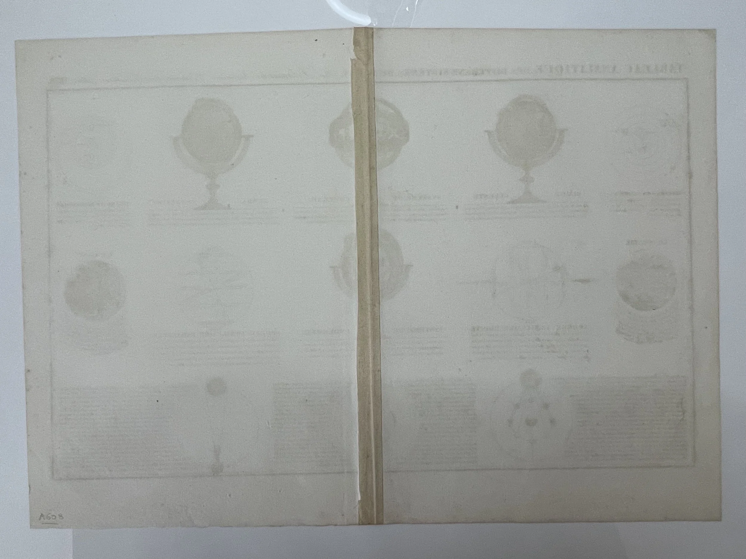
Where Applicable - Folds as issued. Light box photo shows the folio leaf centre margin hinge ‘glue’, this is not visible otherwise.

Tracked postage, in casement. Please contact me for postal quotation outside of the UK.  
Peninsula Maps & Globes - London England

Made with Squarespace

Contact: pmgmapsandglobes01@gmail.com