 Image 1 of 10
 Image 2 of 10
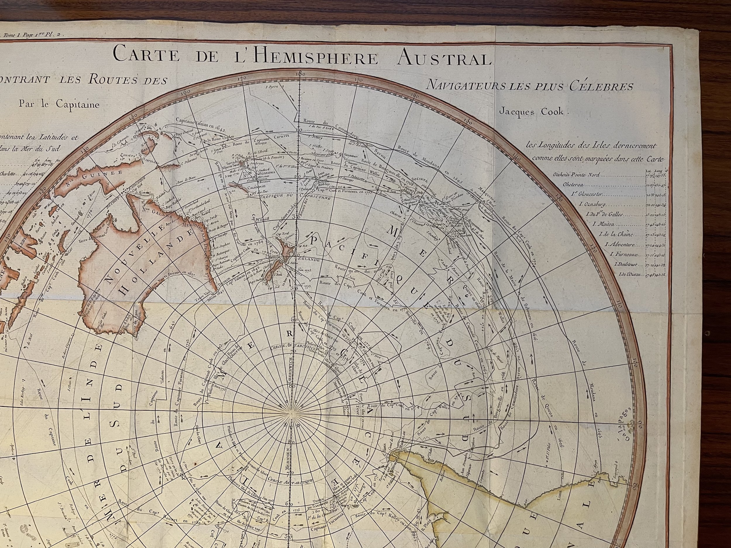 Image 3 of 10
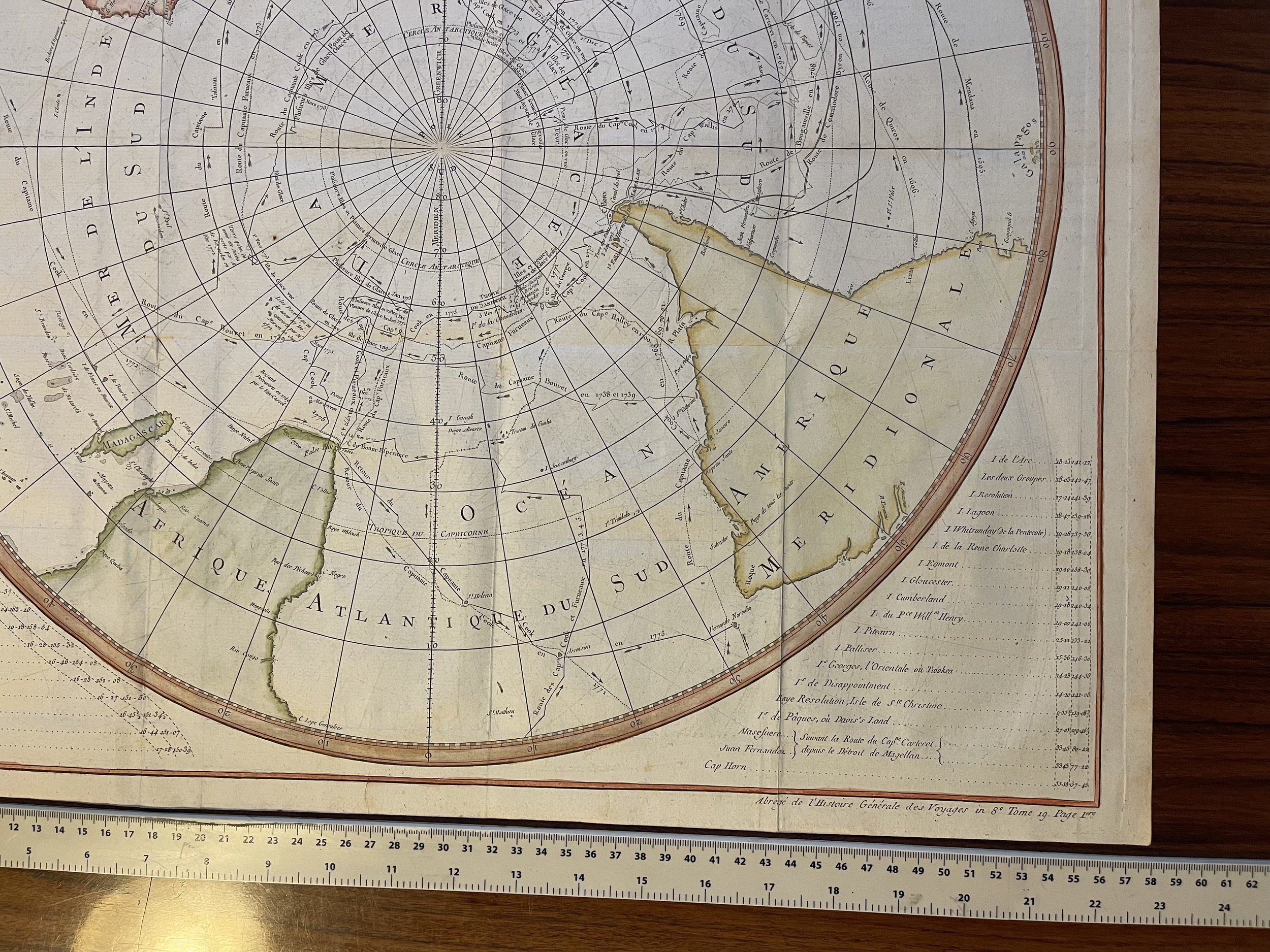 Image 4 of 10
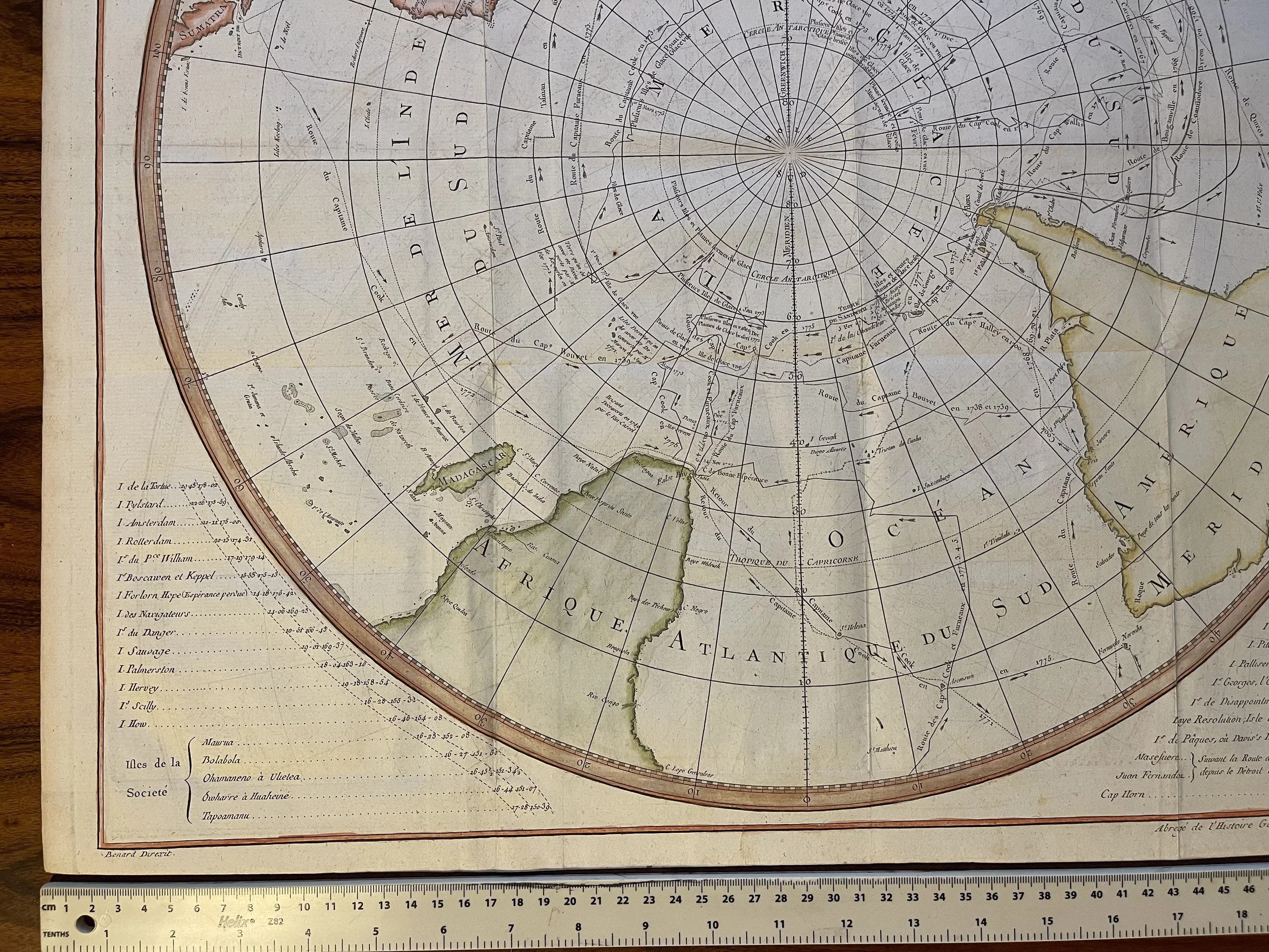 Image 5 of 10
 Image 6 of 10
 Image 7 of 10
 Image 8 of 10
 Image 9 of 10
 Image 10 of 10
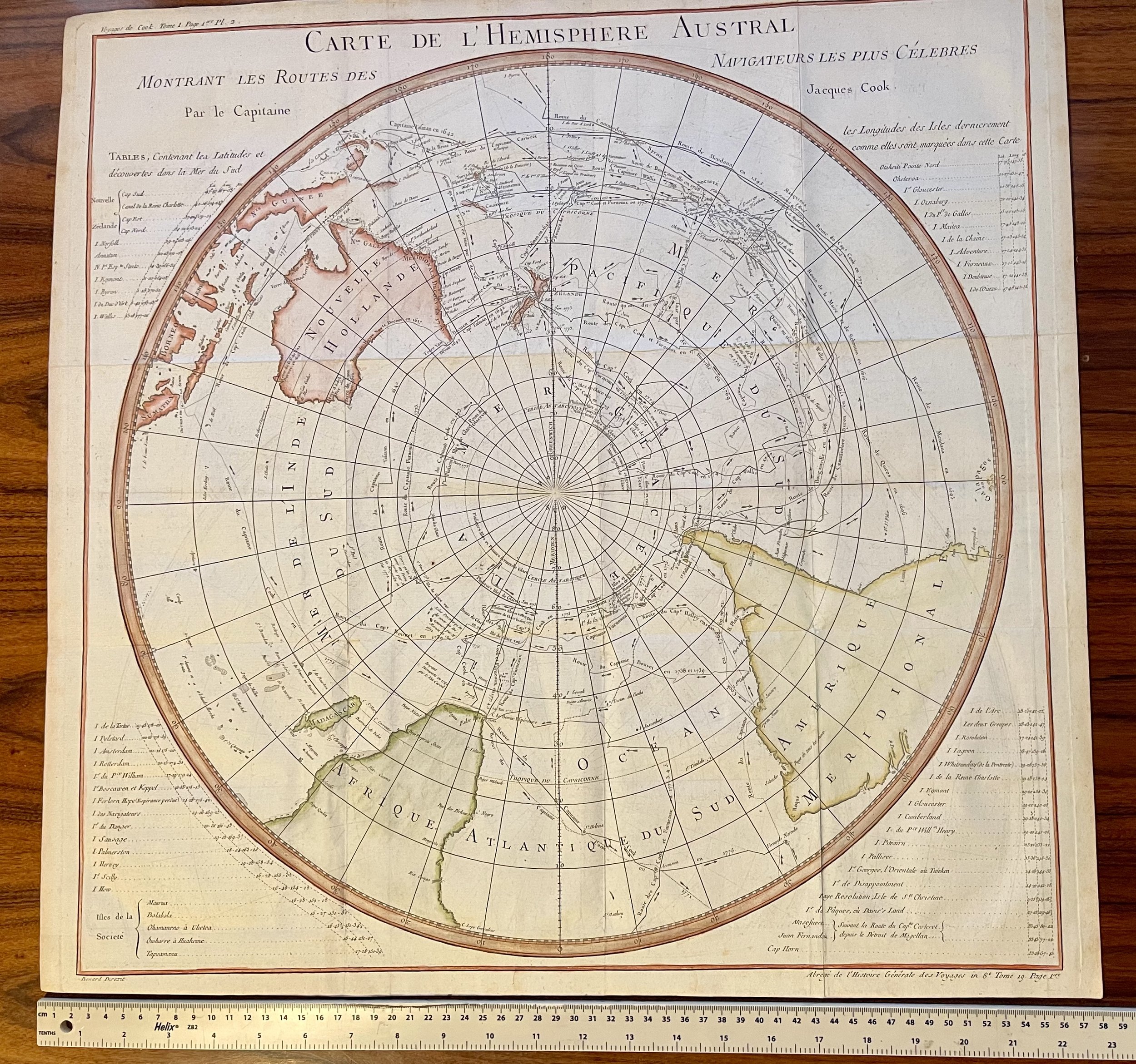
Code : A287
Cartographer : Cartographer / engraver: Jacques-Nicolas Bellin / Jaques Renaud Benard
Date : Paris 1775
Size : Sheet size: 22 x 22 inches
Availability : Available
Type - Genuine Antique
Grading - A