Detailed map showing the Southwestern Hemisphere, including most of America, Hawaii, New Zealand, Australia and the South Pole. Includes decorative celestial models in the corners.
Highly detailed and rare large format map of the Southern Hemisphere, showing the tracks of the major voyages of exploration in the Southern Hemisphere from 1595 to 1775.
Large antique atlas map of the Southern Hemisphere, showing the voyages by Captain James Cook, Roggewein, Mendana, Quiros, Le Maire, Bouvet, Tasman, Halley, Carteret, Wallis, Byron, Bougainville, Schouten and others from 1595 to 1775.The map includes the coastlines of South America, Africa, Australia, New Zealand and Indonesia, lying around Antartica. This scarce antique chart is a French edition of Cook's voyage in the Southern Hemisphere that is drawn in a circular polar-projection. Lists beside the map provide details of discoveries and destinations in the Southern Hemisphere.The chart shows all of Australia, named Nouvelle Hollande, with Tasmania attached to the mainland.
There is a good detail of the East Indies and the Celebes. This is an exact French copy by Jacques Renaud Benard, of Captain James Cook's 1777 map. The French quickly translated and published Cook's accounts of his voyages, reproducing the charts precisely. An important chart for any collector of Antarctic material.
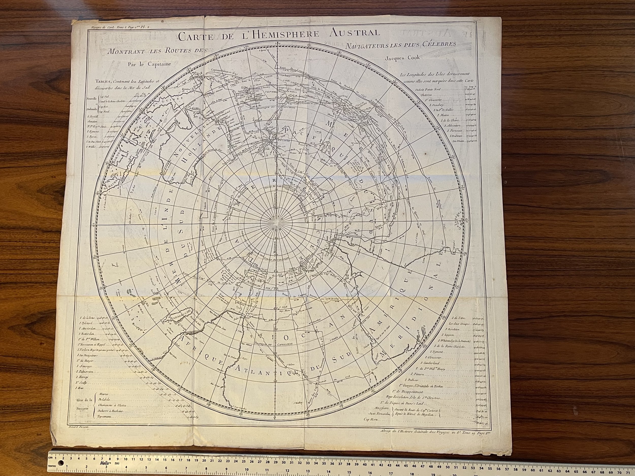 Image 1 of 10
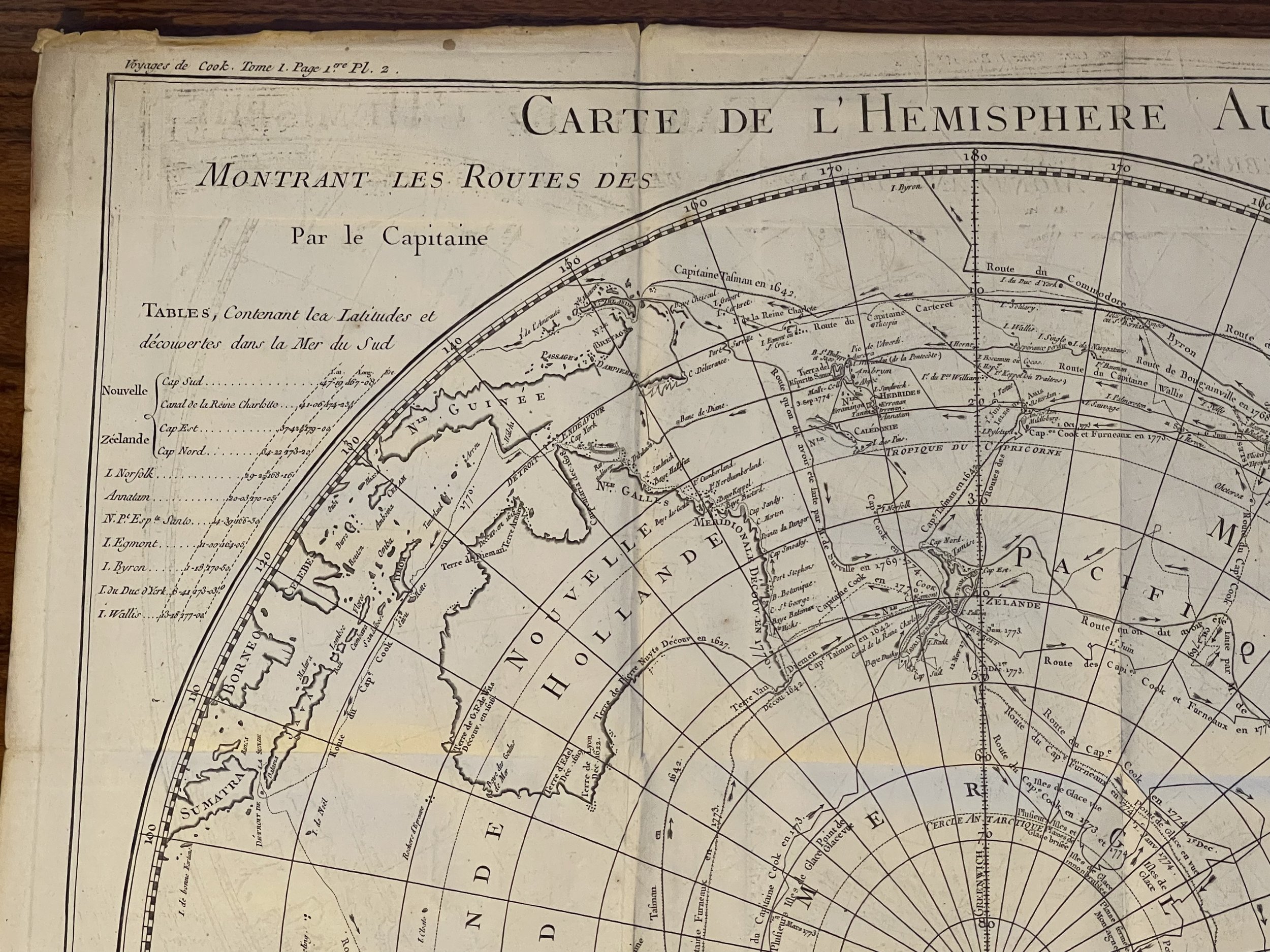 Image 2 of 10
 Image 3 of 10
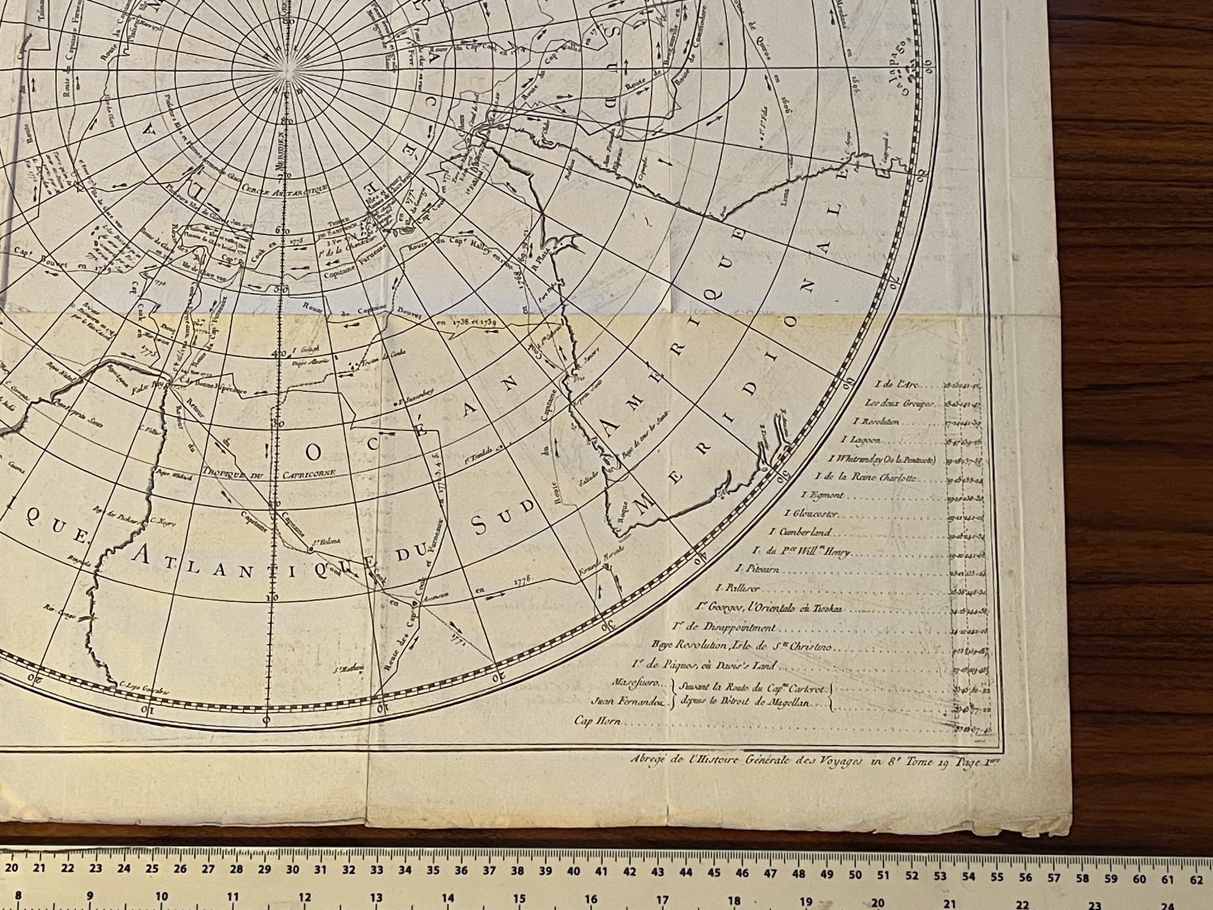 Image 4 of 10
 Image 5 of 10
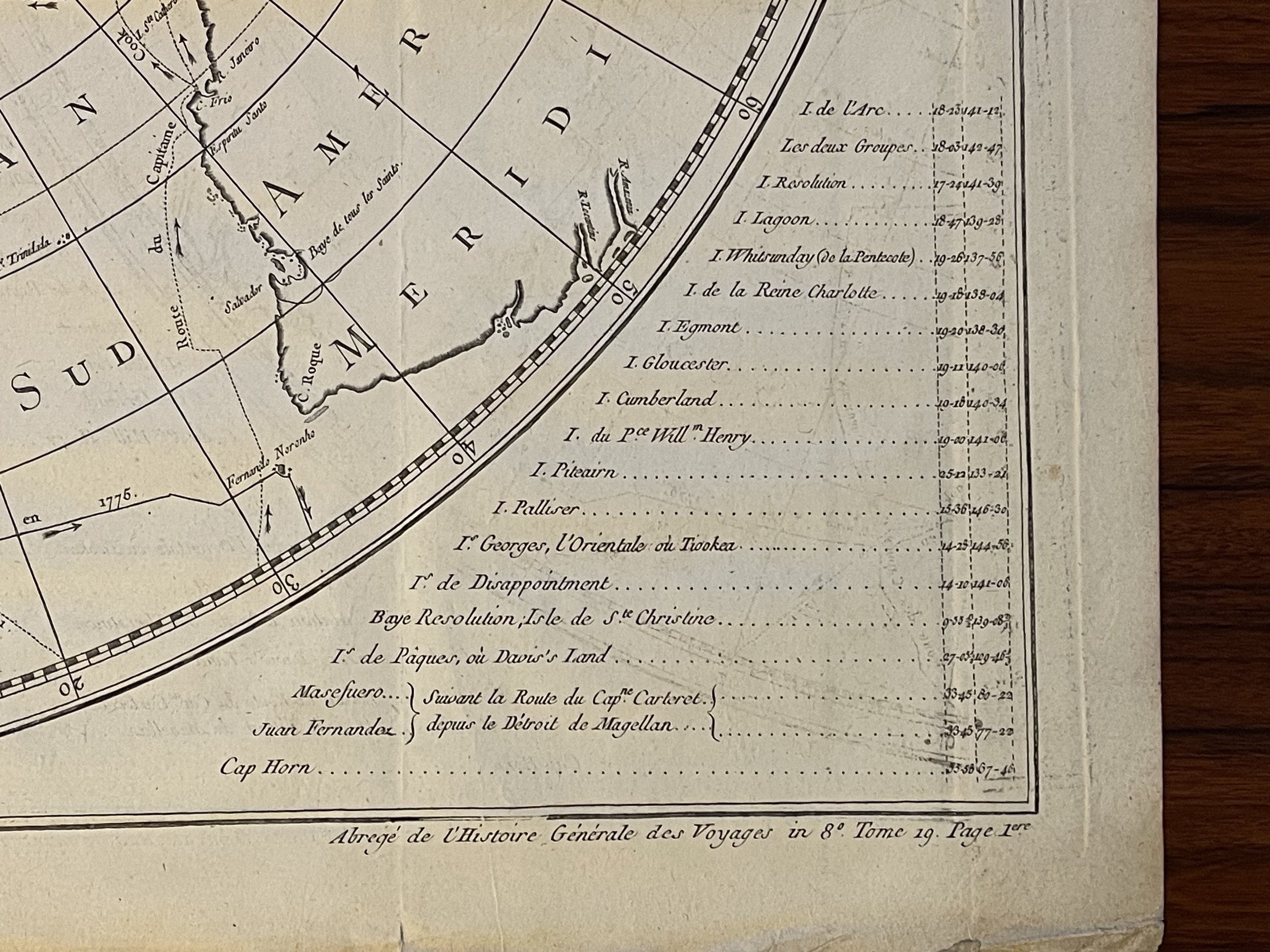 Image 6 of 10
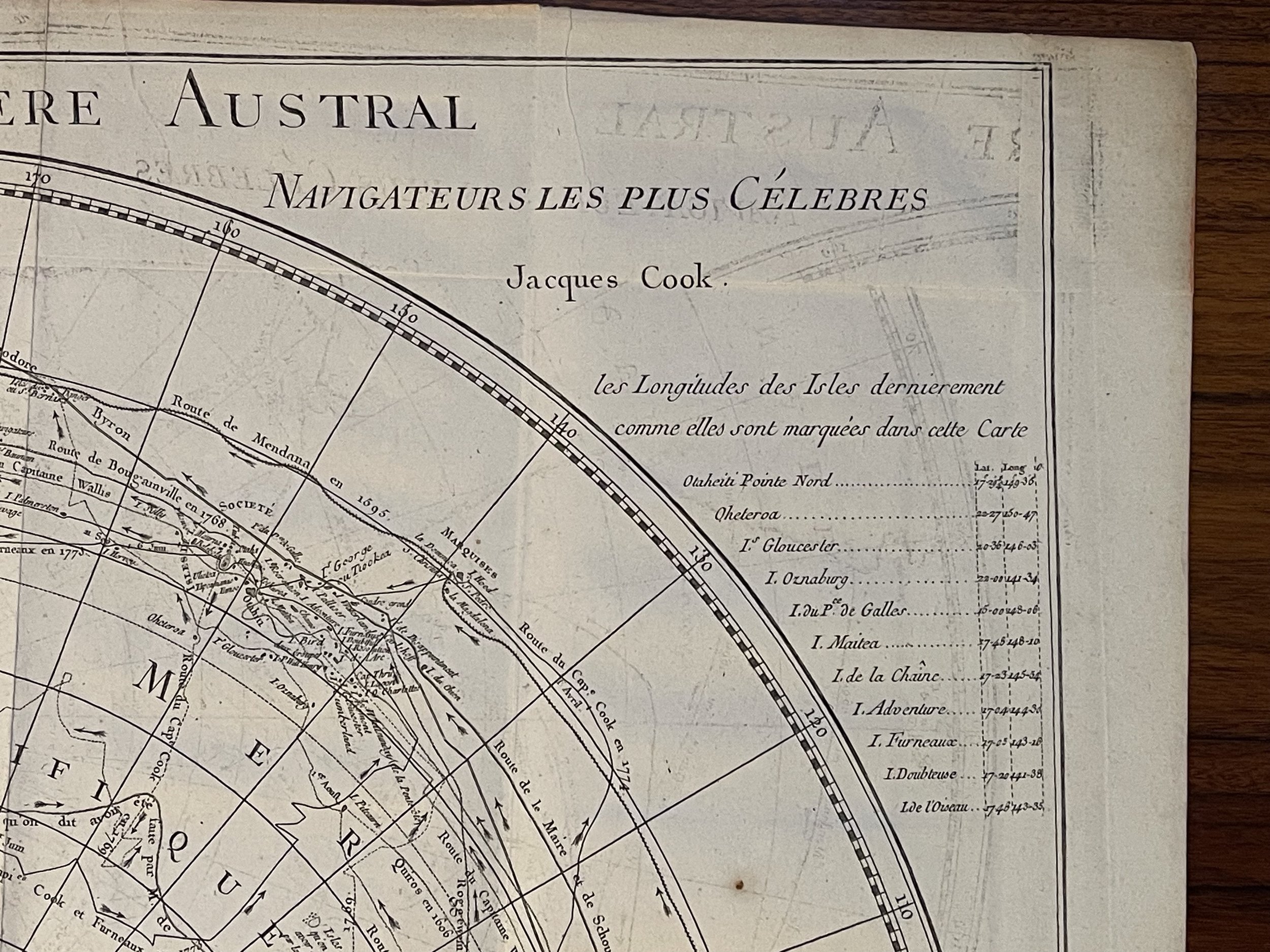 Image 7 of 10
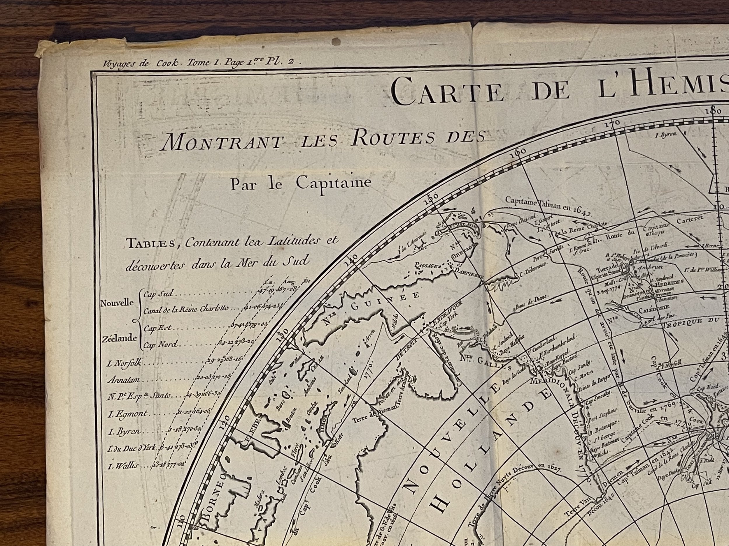 Image 8 of 10
 Image 9 of 10
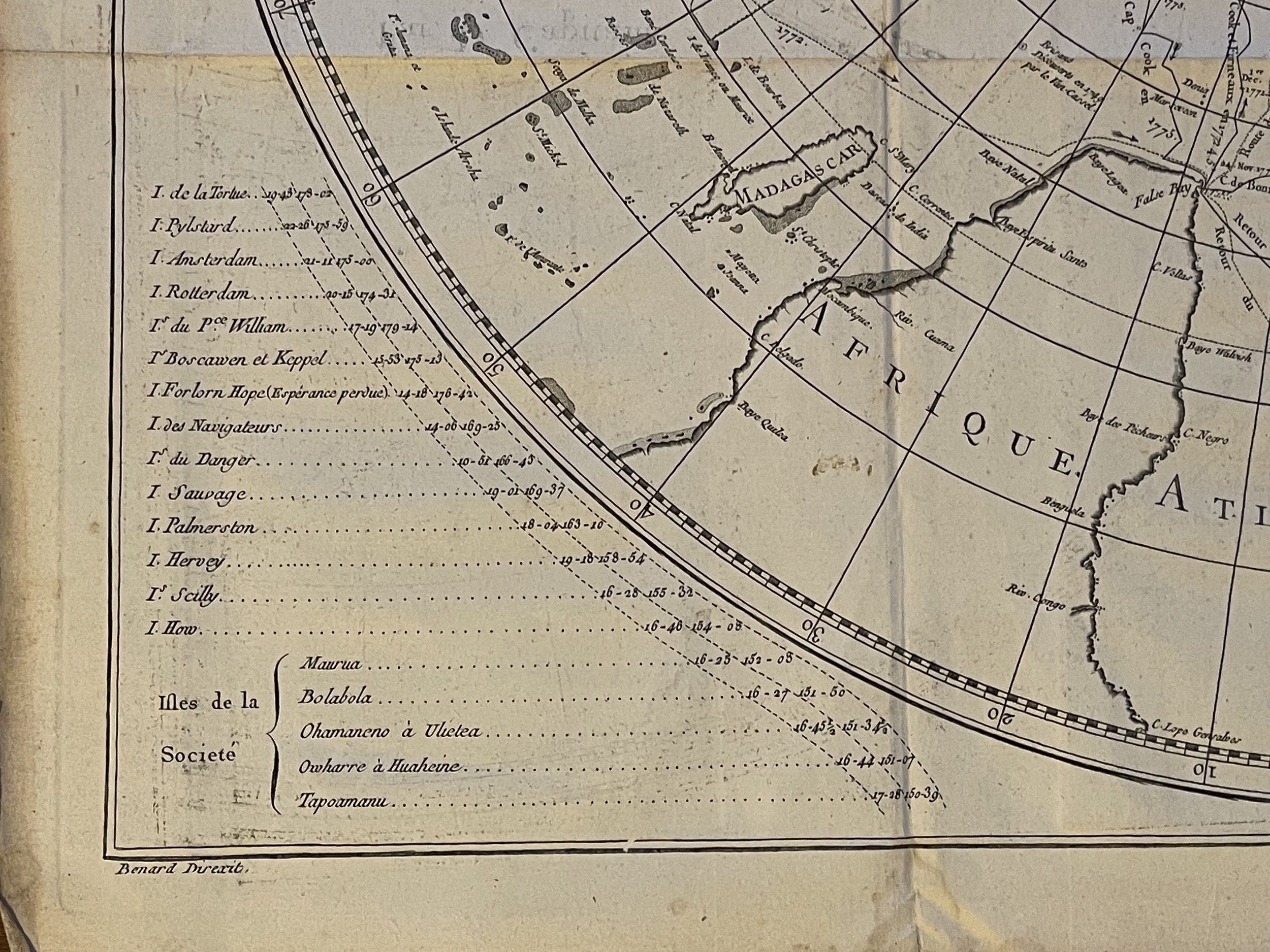 Image 10 of 10