 Image 1 of 4
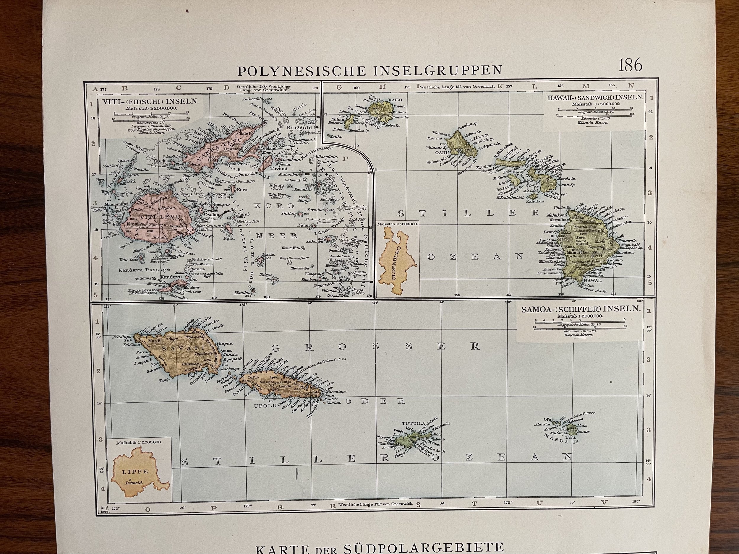 Image 2 of 4
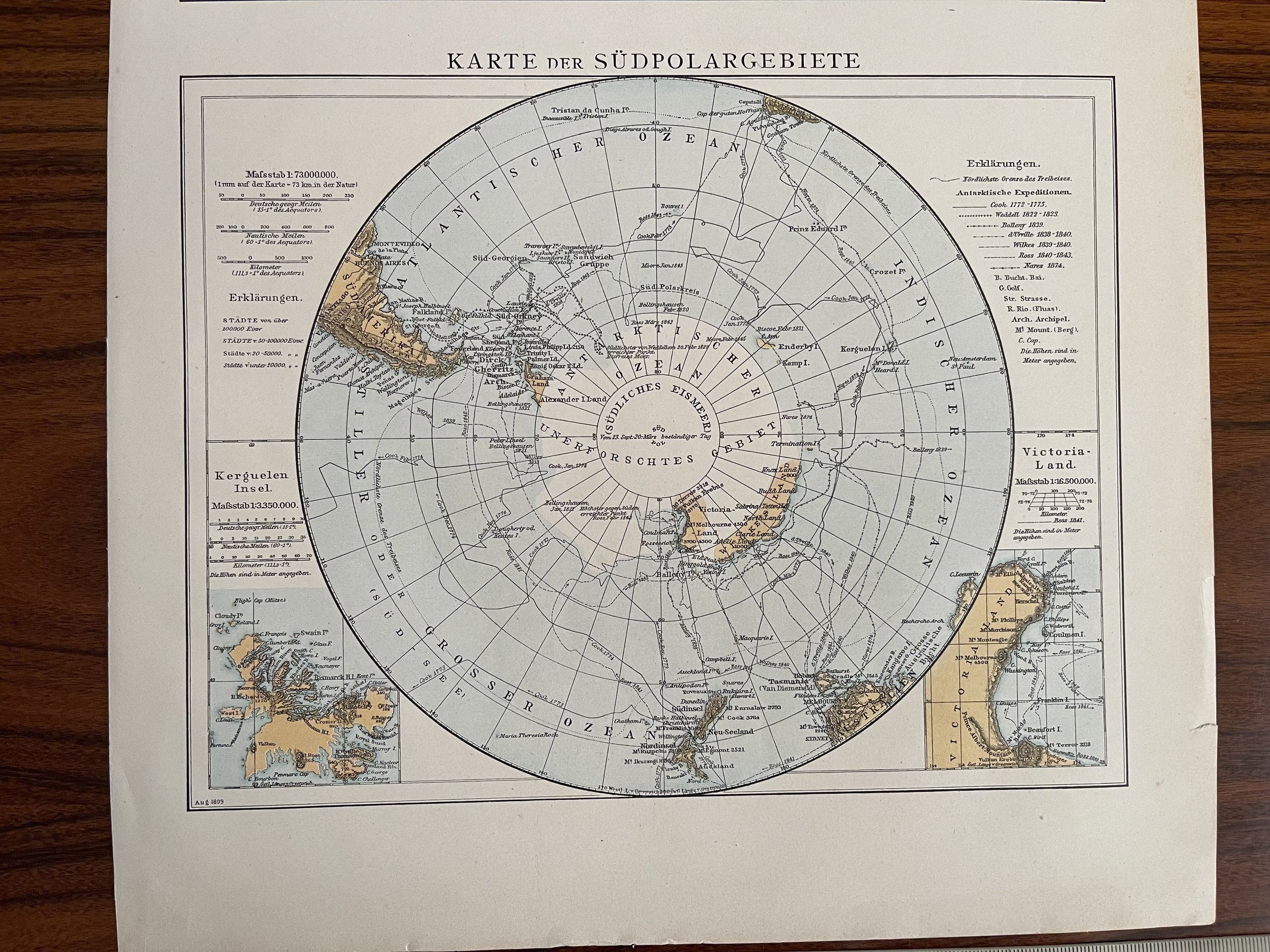 Image 3 of 4
 Image 4 of 4
Code : A138
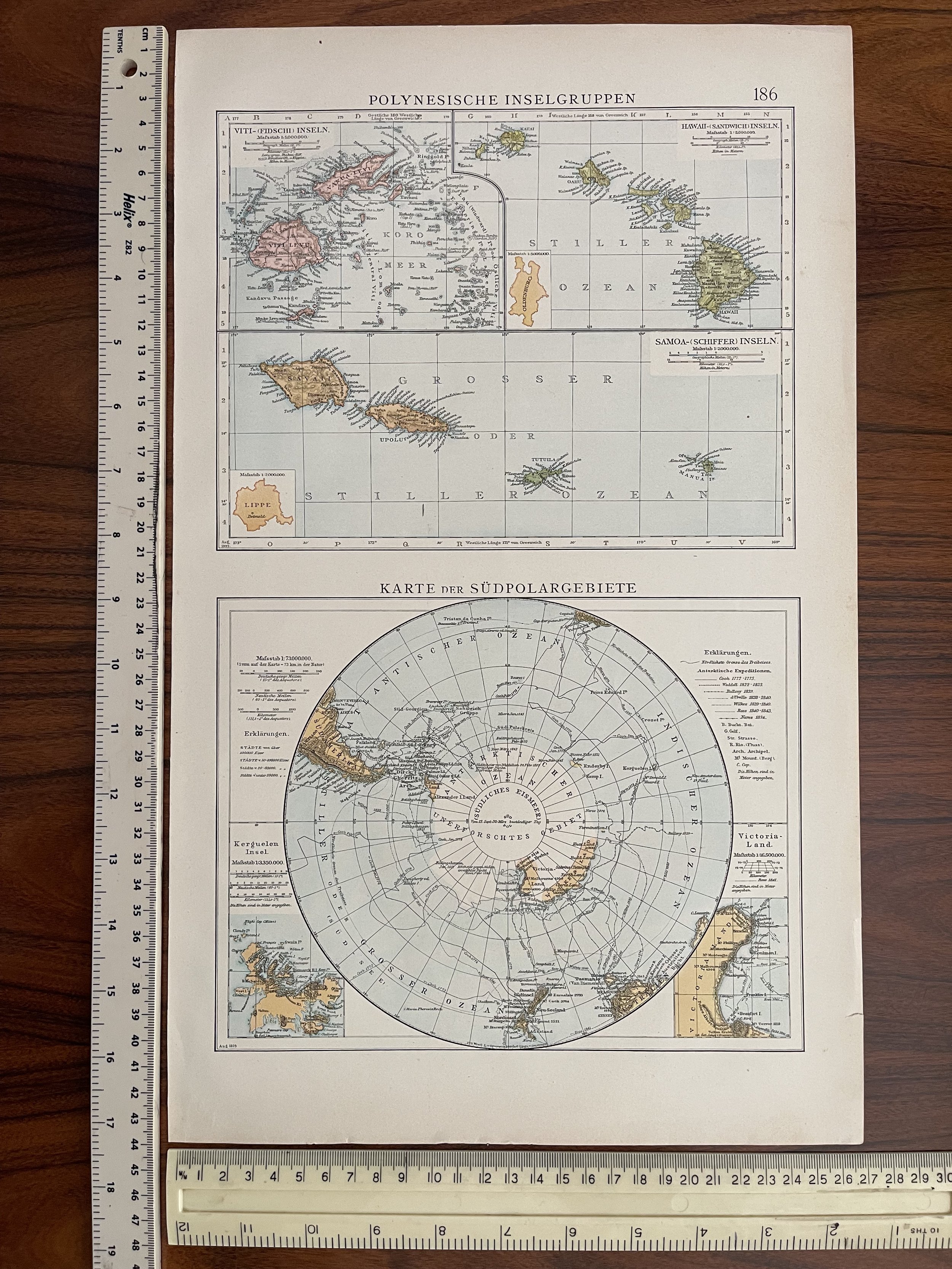
Cartographer : Cartographer / Engraver / Publisher: Andree Allgemeiner
Date : Publication Place / Date - Leipzig 1895-99 Approx
Size : Sheet size: 28 x 42cm
Availability : Available
Type - Genuine Antique
Grading - A
Tracked postage. in tubular casement. Please contact me for postal quotation outside of the UK.