Frankreichs Schuld or "France's Guilt" is a 48 page, heavily illustrated recap of the "sins of France" going back to the year 1925, including personalities like Napoleon, Laurent, Clemenceau, Foch, Poincaré, Weigand, Reynaud, De Rothschild, Dreyfus, Kahn, Salvador, Stern, Mandel, etc.
PLEASE NOTE - THIS SALE INCLUDES THE SUPPLEMENT OF MAPS ONLY AS SHOWN IN PHOTOS.
Illustrierter Beobachter, published by Franz Eher Nachfolger
This cover is a special edition of the Illustrierter Beobachter titled "Frankreichs Schuld" (France's Guilt) claiming that France was just as guilty as England for the war. It was published in 1940. The cover features a grotesque caricature of the French army with a massive black soldier holding the French flag. Standing behind him are a French officer, a North African soldier, and a Jew carrying an Havas newspaper in his left pocket.
Liberty, Egality, and Fraternity flutter mockingly adjacent to stereotypical representations of France’s colonial oppression, powerful ‘financier’ classes (a.k.a. Jews), and the leader of the Free Forces, Charles de Gaulle. The title, translated to France’s Fault, Shame, or Guilt, implies that the cause of the Second World War was directly related to these ‘boogeyman’ forces of imperialism.
The image unfolds to show several political maps of relevant theaters of Allied ‘meddling’. One side presents the Middle East and the Mediterranean, with insets showing the strategically important Strait of Messina, the Dardanelles, Bosporus, Malta, and the Straits of Gibraltar. The verso is a large map of France and the southern coast of England that highlights fortified areas across the region. The Westwall and Maginot Line are evident, along with the significant defensive works surrounding Paris, Antwerp, and Metz. The vast array of fortifications made the successful invasion of France just a few months after publication all the more impressive to the German audience.
Designed by the Bibliographischen Instituts in Leipzig. Published in Munich in 1940 as the outer wraps to a special edition of the Illustrierter Beobachter.
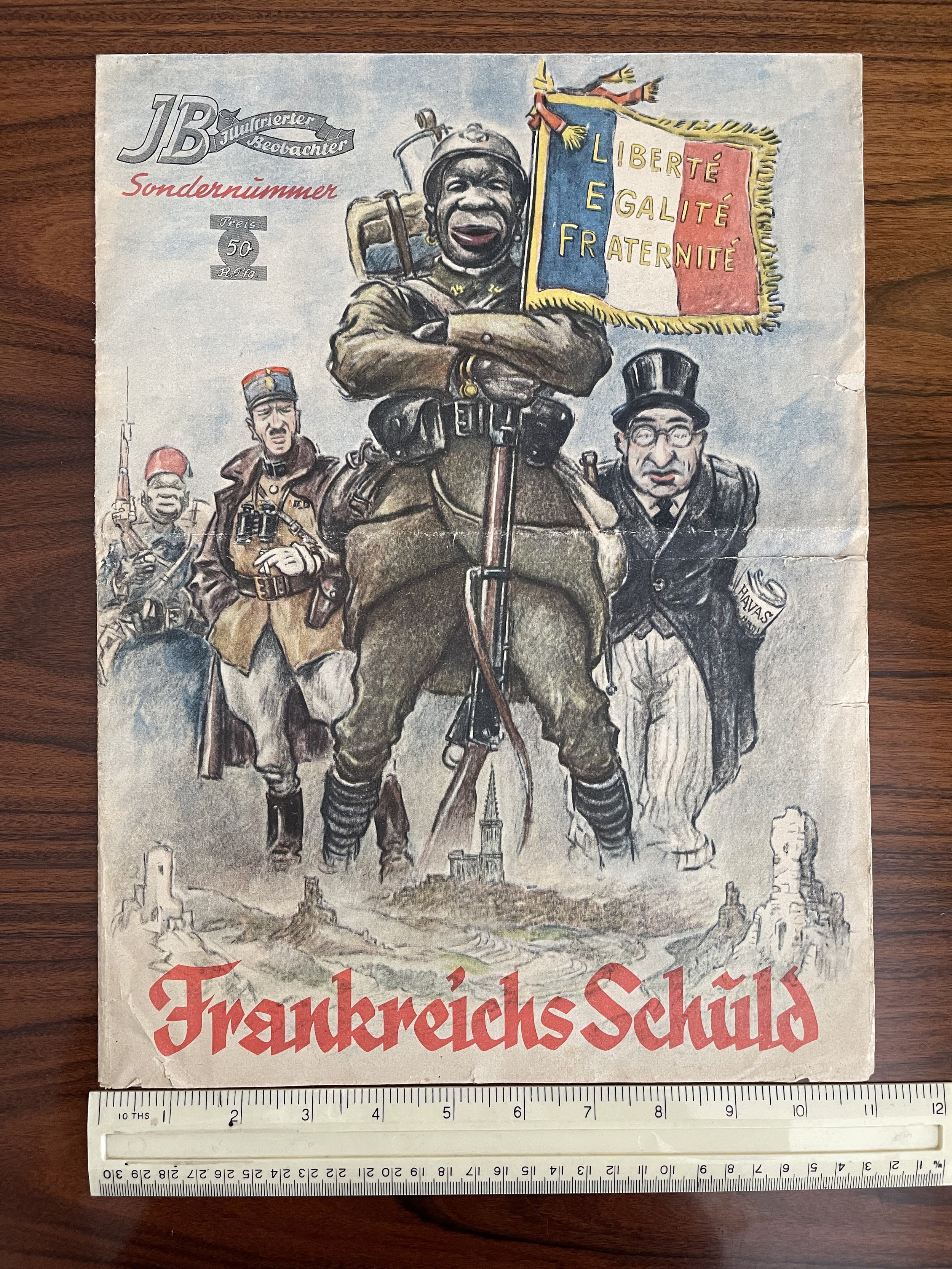 Image 1 of 8
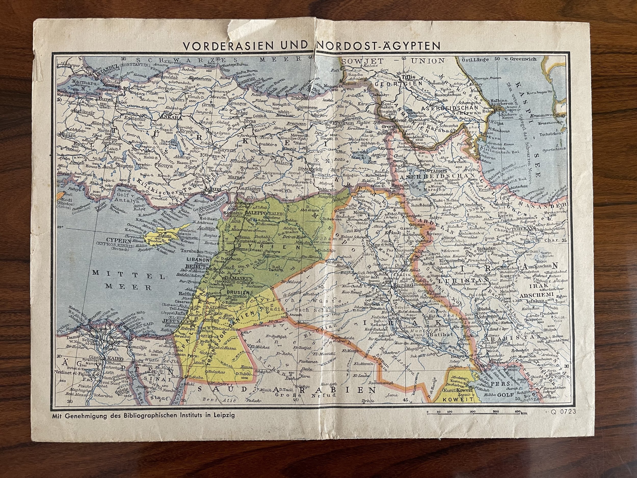 Image 2 of 8
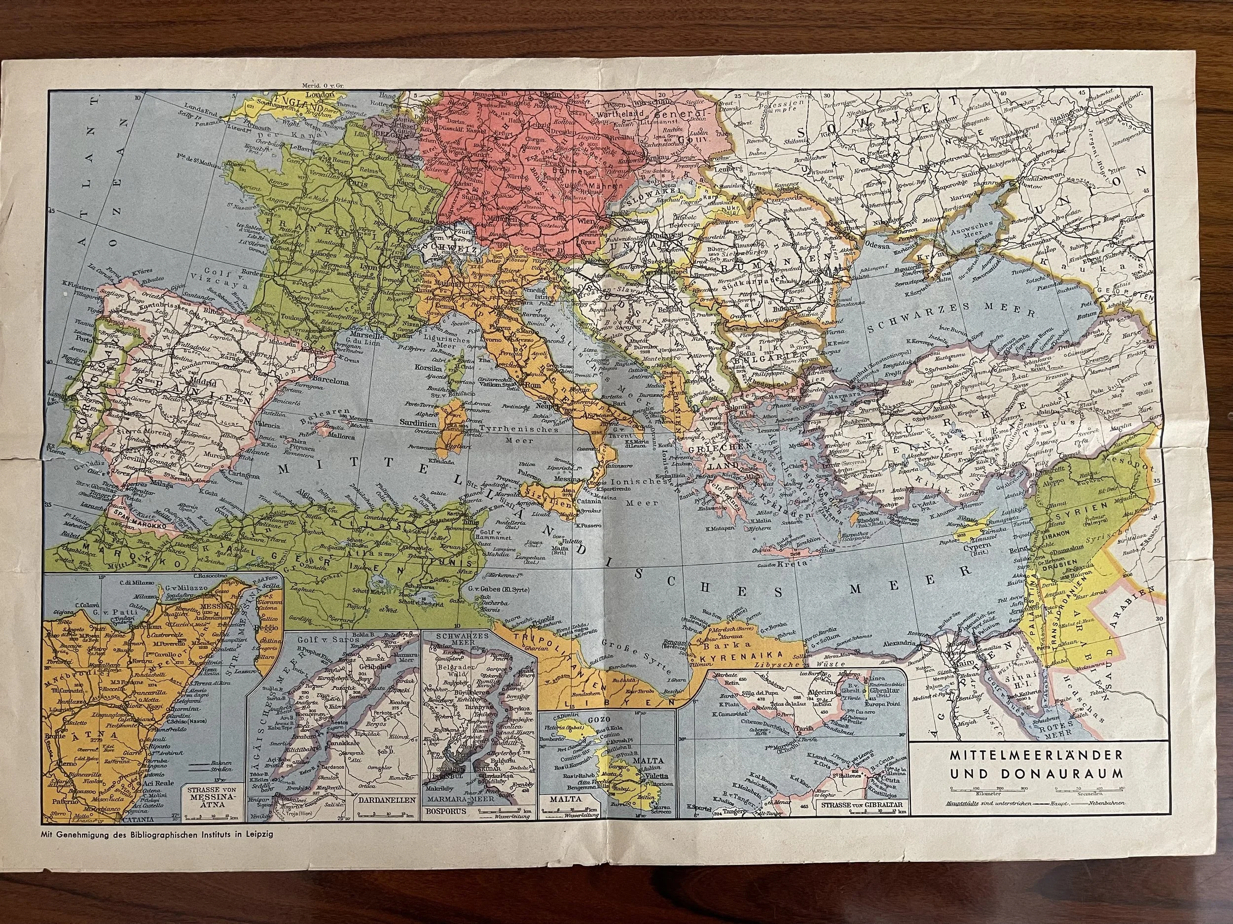 Image 3 of 8
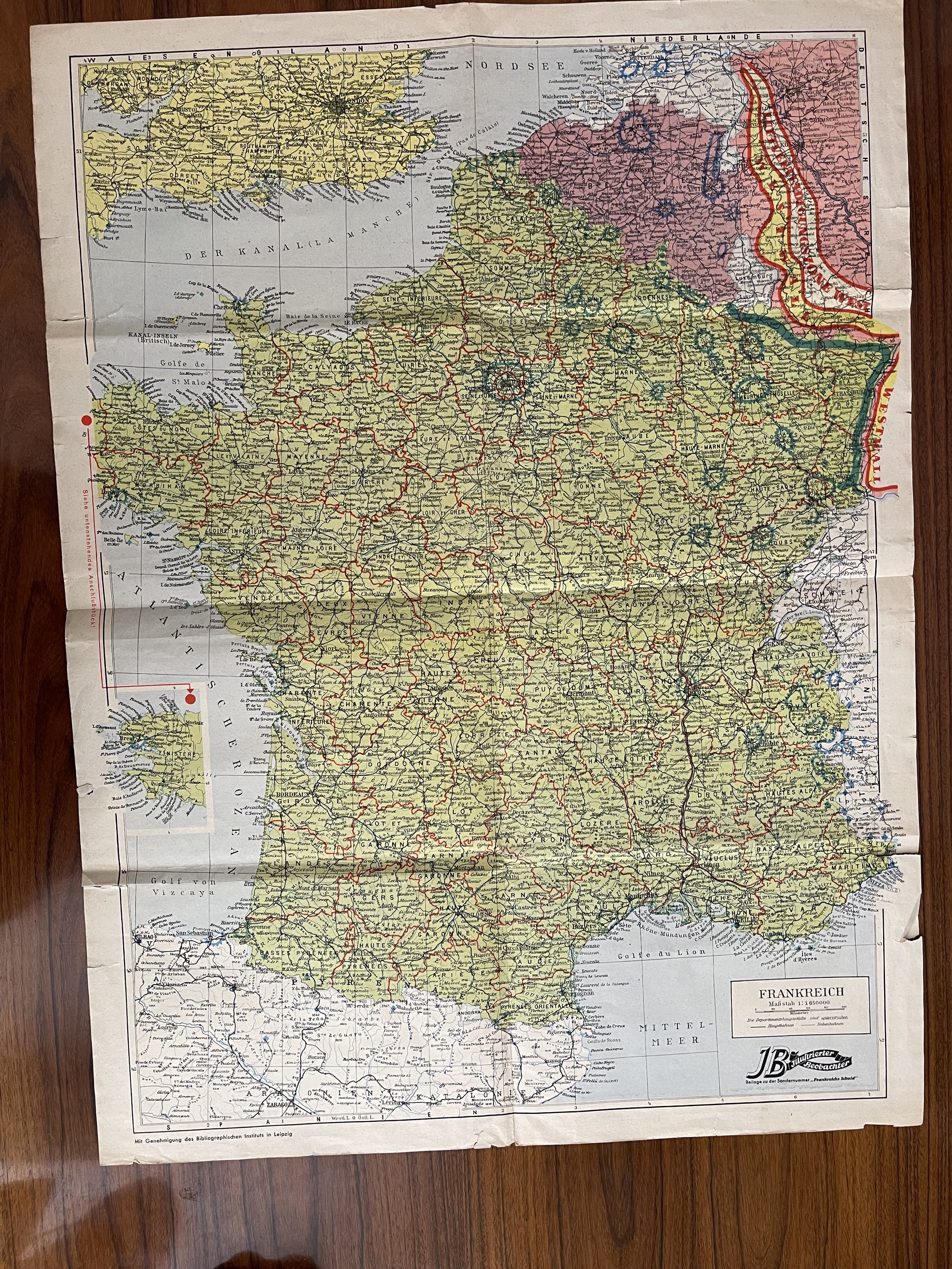 Image 4 of 8
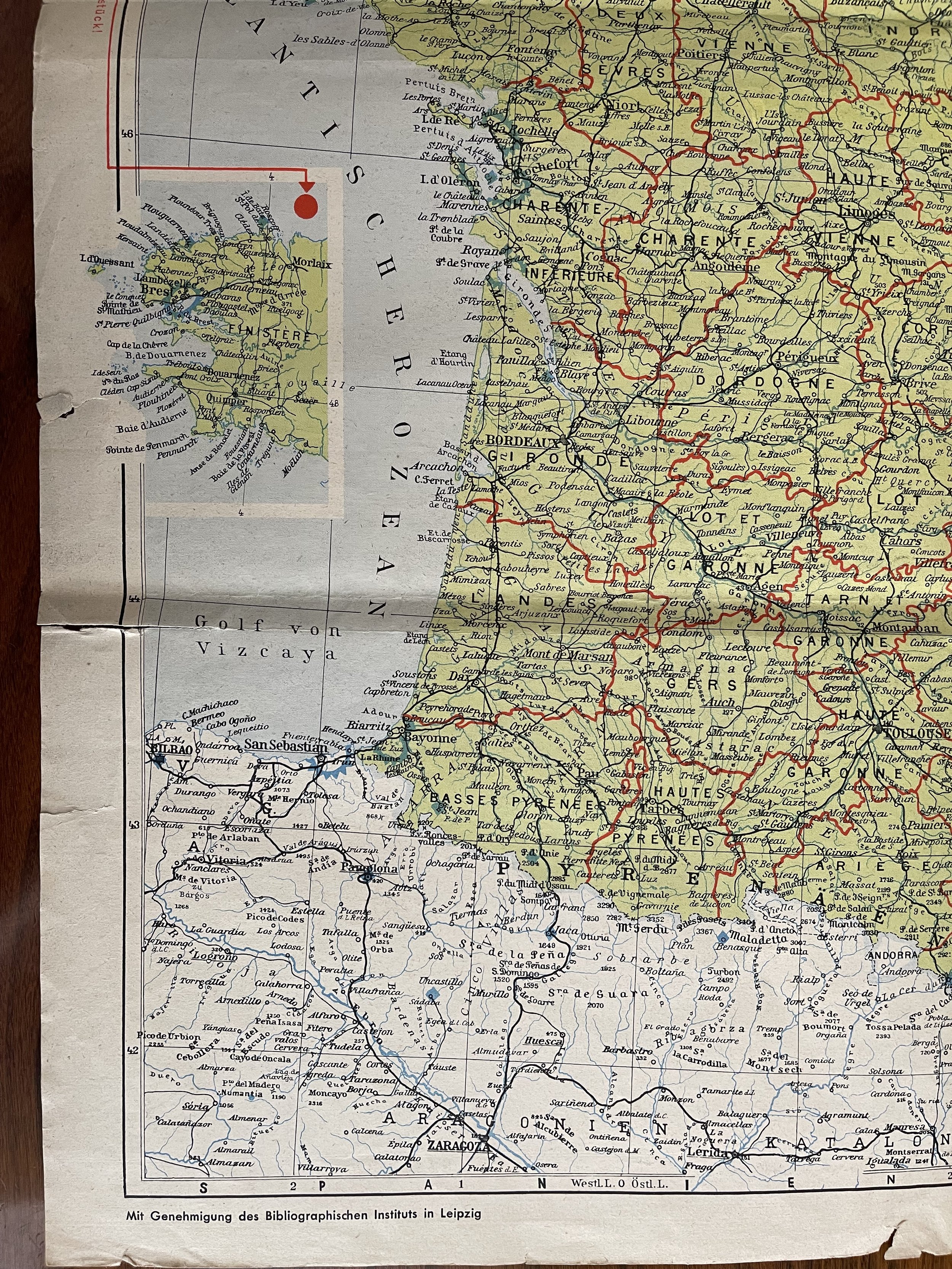 Image 5 of 8
 Image 6 of 8
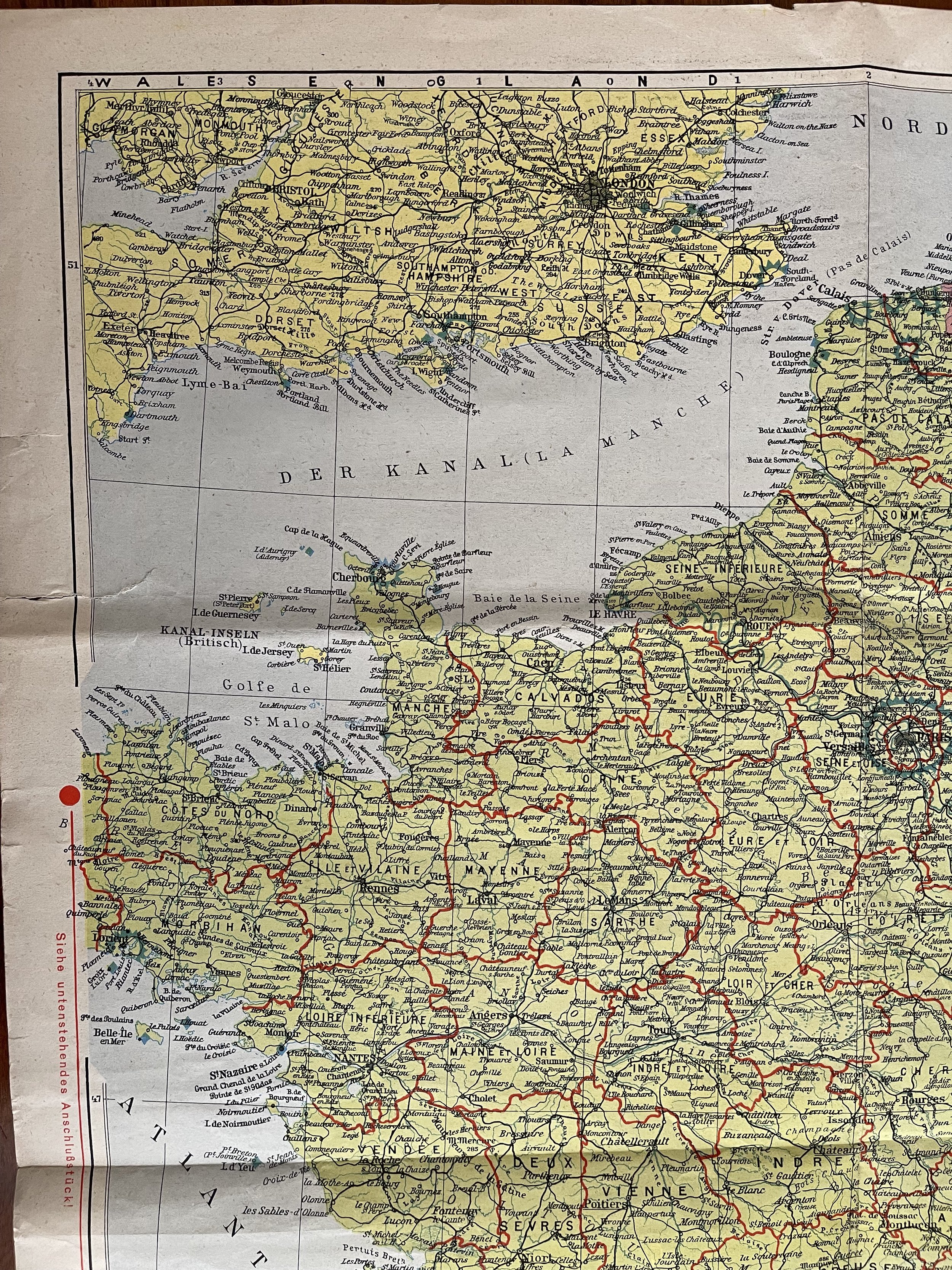 Image 7 of 8
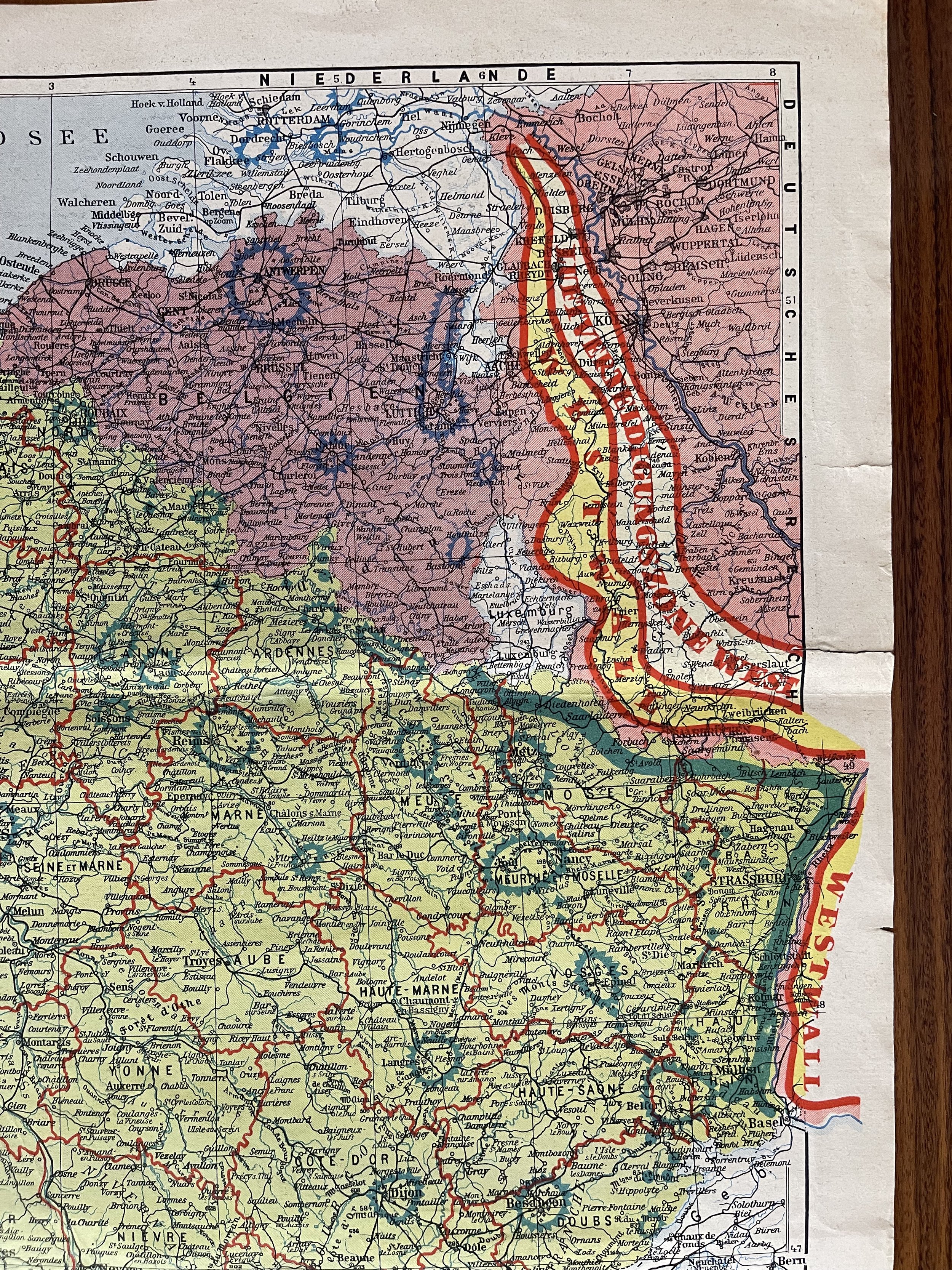 Image 8 of 8