 Image 1 of 6
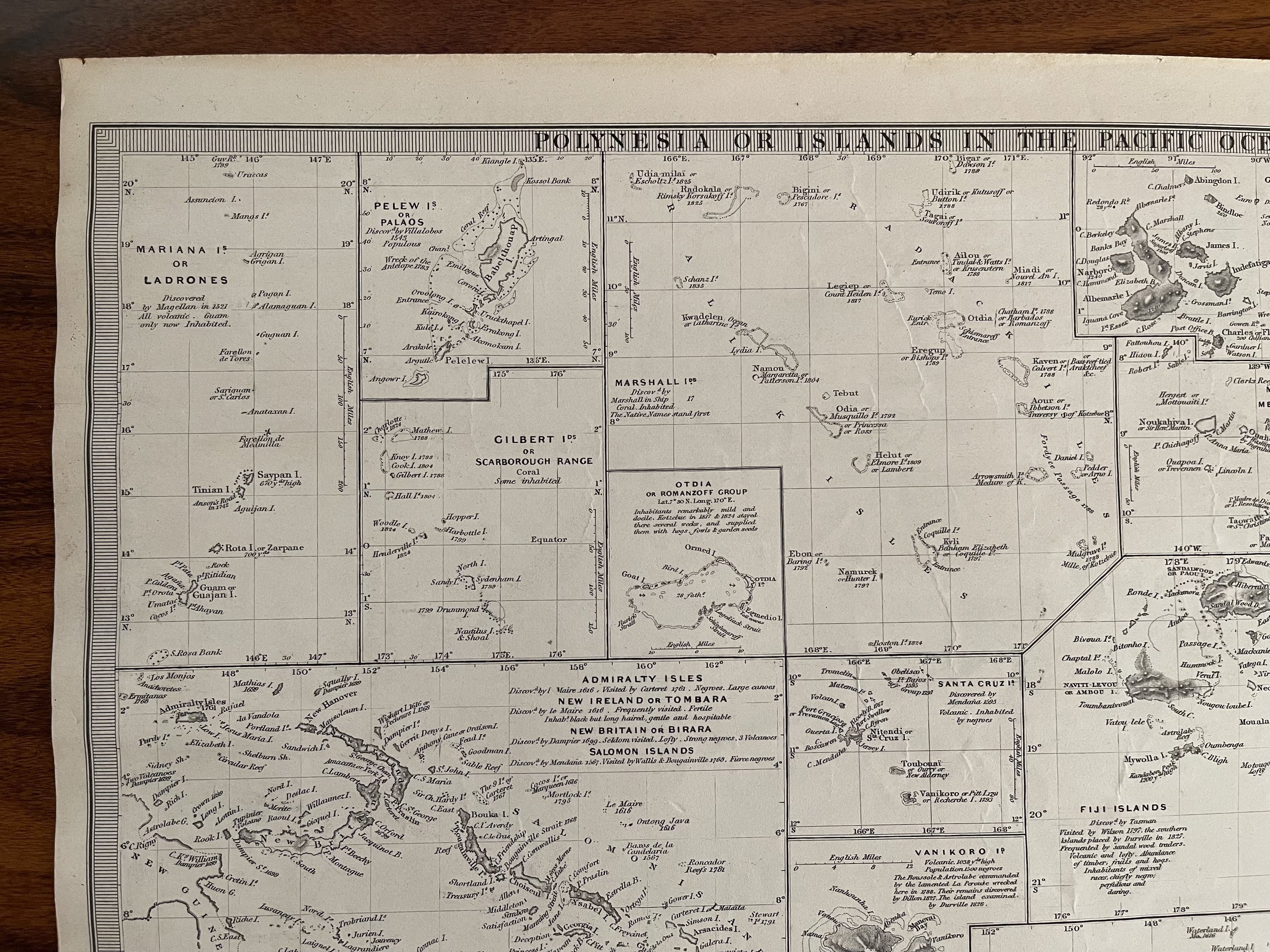 Image 2 of 6
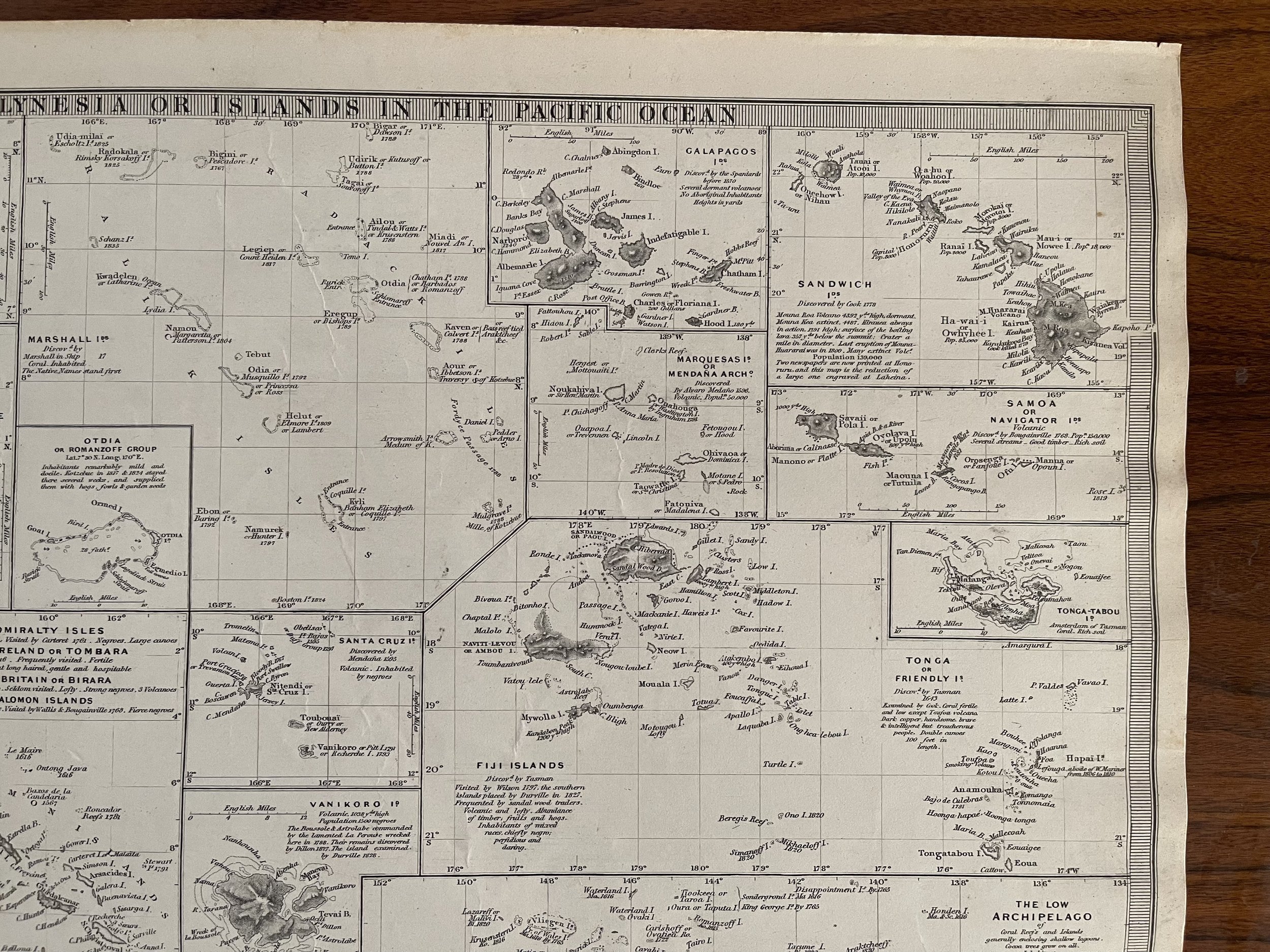 Image 3 of 6
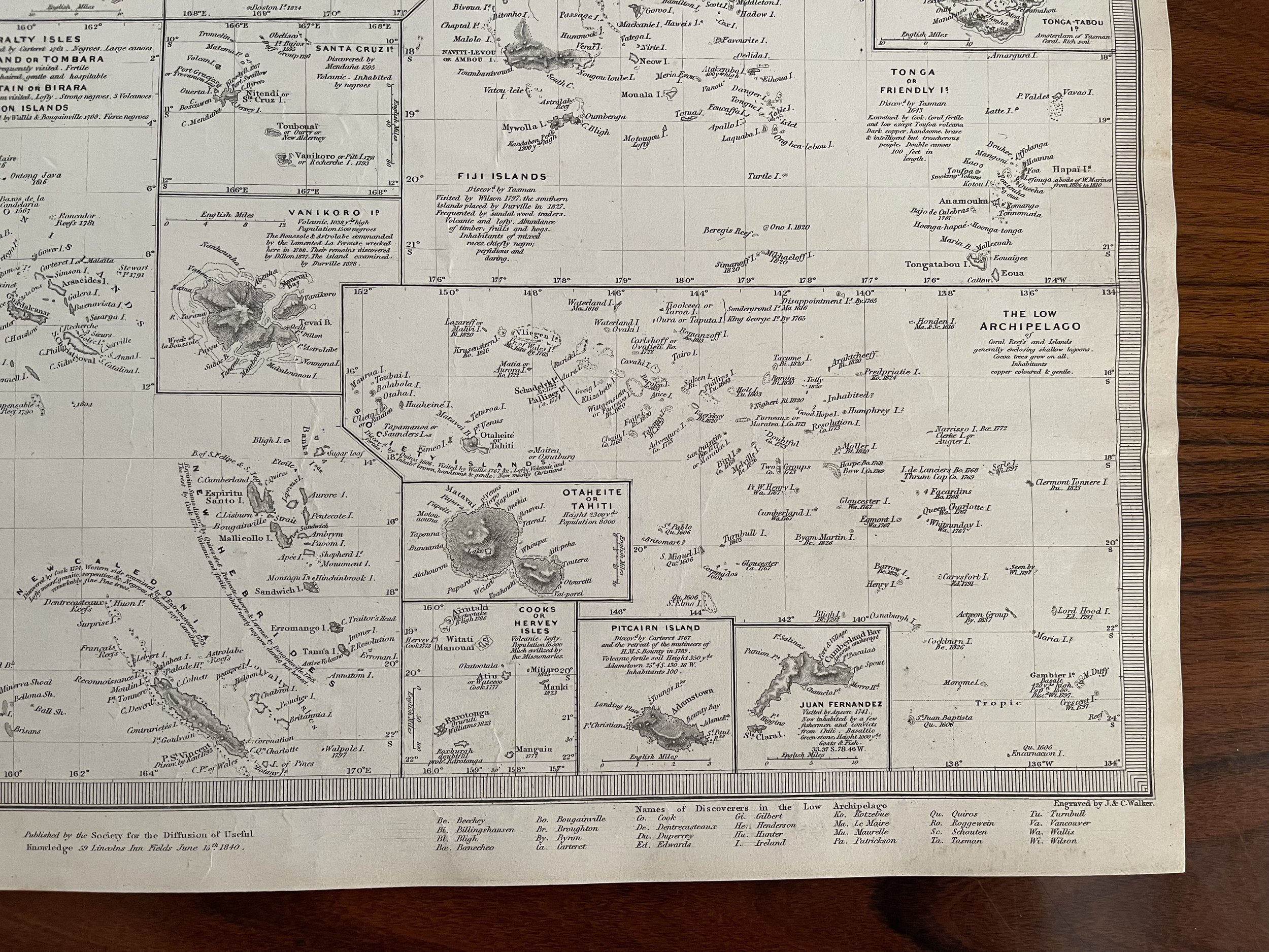 Image 4 of 6
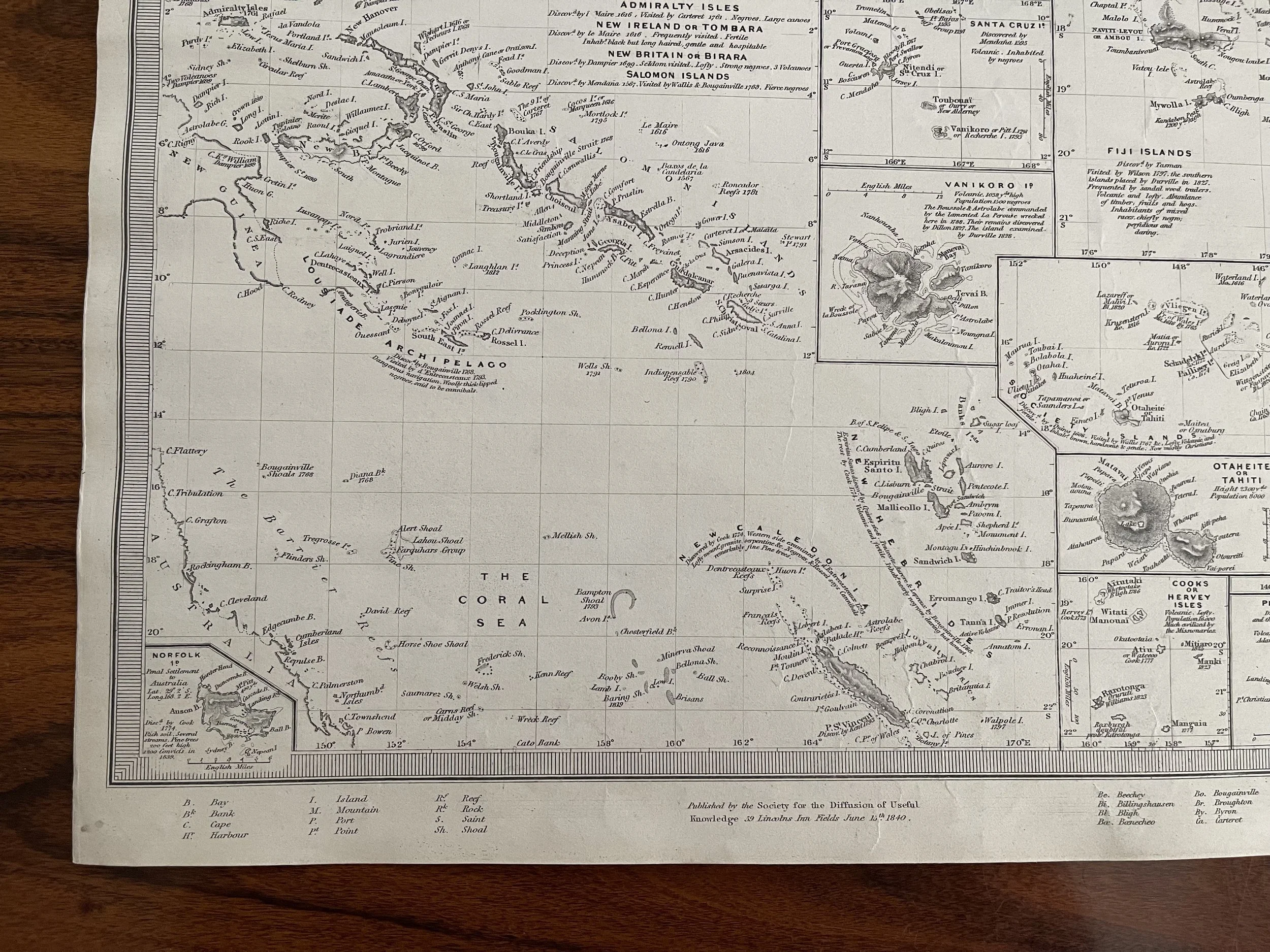 Image 5 of 6
 Image 6 of 6
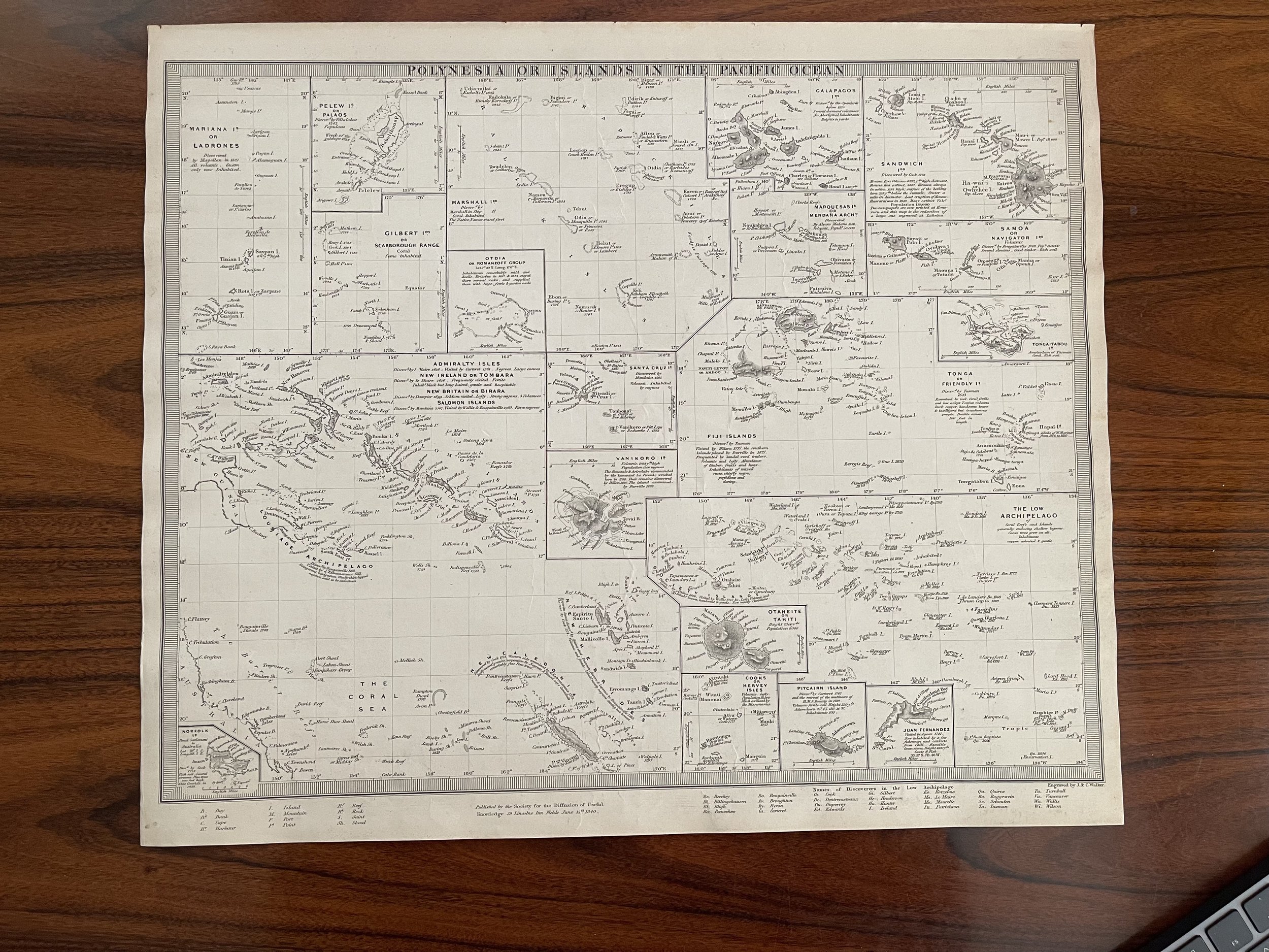
Code : A789
Cartographer : SDUK/Society for the Diffusion of Useful Knowledge.
Date : 1844
Size : Sheet size: 12.25 x 15.5 inches.
Availability : Available
Type - Genuine Antique. Grading - A