This map is an example of mass-marketed maps in the early 20th century of which few survive. It is a pictorial plan of London from 1901, published by the famous gentlemen's clothing company Chas Baker & Co Ltd. It is also an early example of the effective advertising and marketing strategy of using maps to expose the public to a company’s name and goods.
From about 1864 until at least 1939 Chas Baker & Co Ltd were a large and forceful presence in the world of Gentleman’s Clothing. With a head store spanning four buildings in High Holborn and with at least eight other London premises by 1913, they were a dominant feature on the vast London landscape. This menswear label is still in operation today.
This fascinating folding pictorial map of London was one of a series dedicated to and featuring the city, depicting it from Kensington Palace to London Docks. With publishing starting in the late 19th century by the prestigious publishing house Bartholomew, the first map was called London towards the close of the 19th Century, and appeared in 1892.
This 1906 edition, called London in the Beginning of the 20th Century shows the changes which had taken place within a few years during a period of rapid growth. From the early 19th century to the beginning of the 20th, the population of London had grown from 1 million to 6.7 million.
The map is rich in detail and provides much information regarding historical architecture which was still extant in early 20th century London. London’s generous regions of open space, its parks and gardens are all well-defined. The reverse of the map features lovely advertisements from Chas. Baker & Co.’s menswear, with glimpses of the clothing and accessories carried by the company, along with a street map of central London.
The maps were printed by Bartholomew on a frequent basis and usually in vast quantities of up to 30,000 per batch, with a new batch ordered at least once a year and often twice. Beautiful and eye-catching, the map captures and conveys much of the essence of London at the beginning of the 20th century.
The firm Chas. Baker & Co. was a large and forceful presence in the world of Gentleman’s clothing in late Victorian England. With a head store spanning four buildings in High Holborn and an additional eight other London premises by 1913, they were a dominant feature in men’s clothiers on the vast London landscape. Innovative and possessing a good eye for aesthetic and design, they used these talents to great advantage in advertising. This striking map bearing their name could be bought in all their stores.
As this map was supplied as a supplement, many haven’t survived. This folding map has splits to a few of the folds but when flat, has some worm holes as shown in the photos but still has much character for its rarity . Would look great framed.
Grading and pricing commensurate.
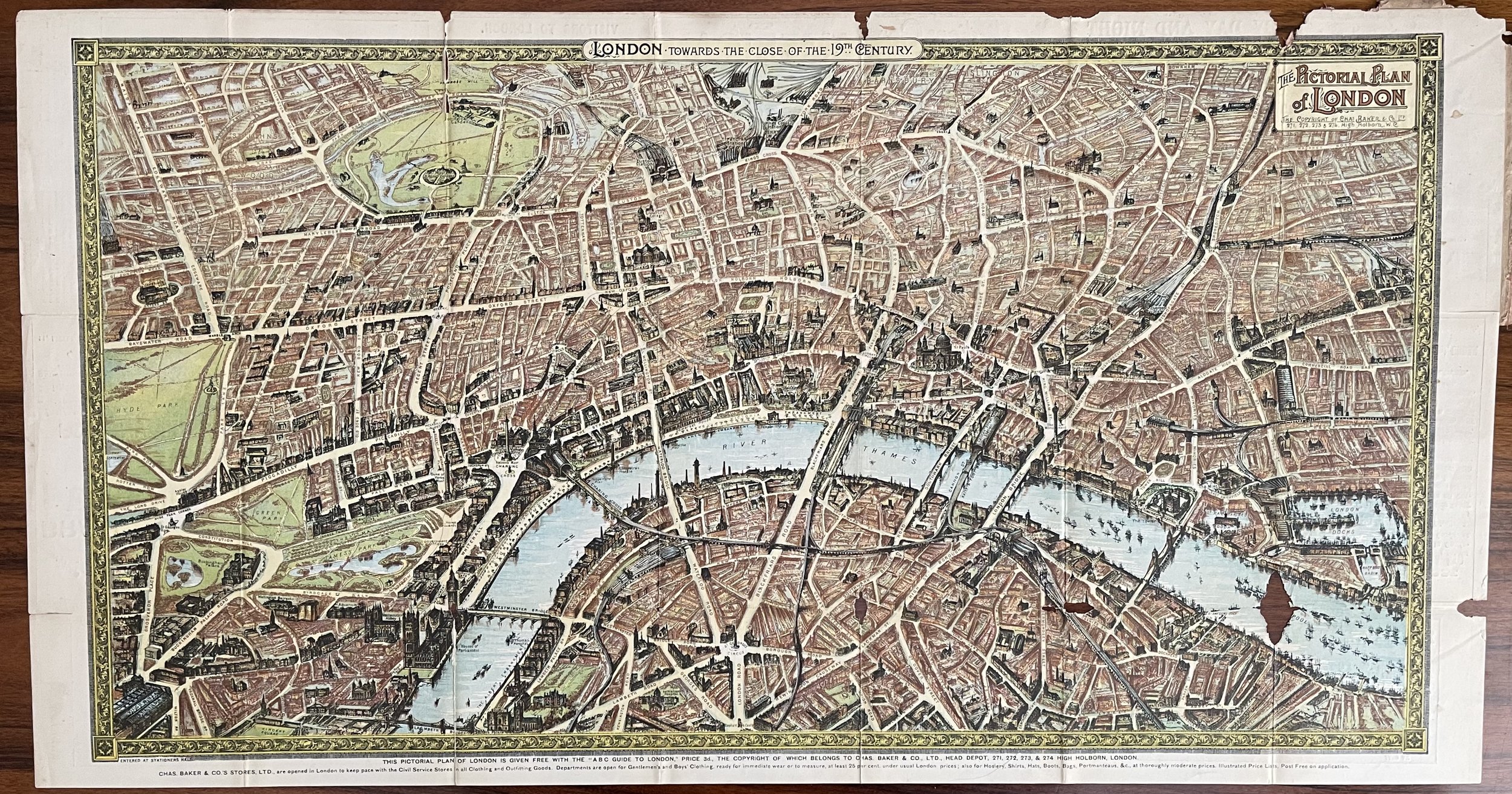 Image 1 of 28
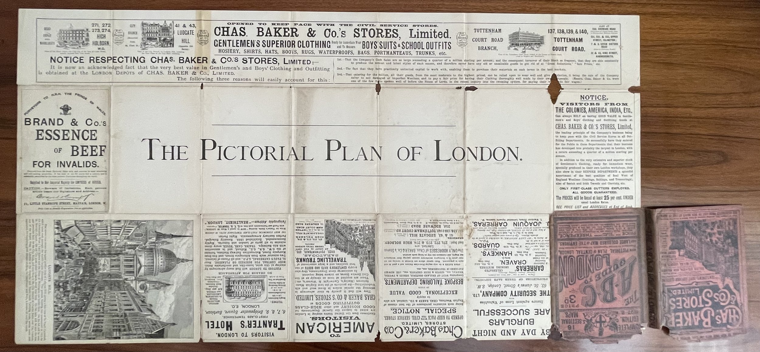 Image 2 of 28
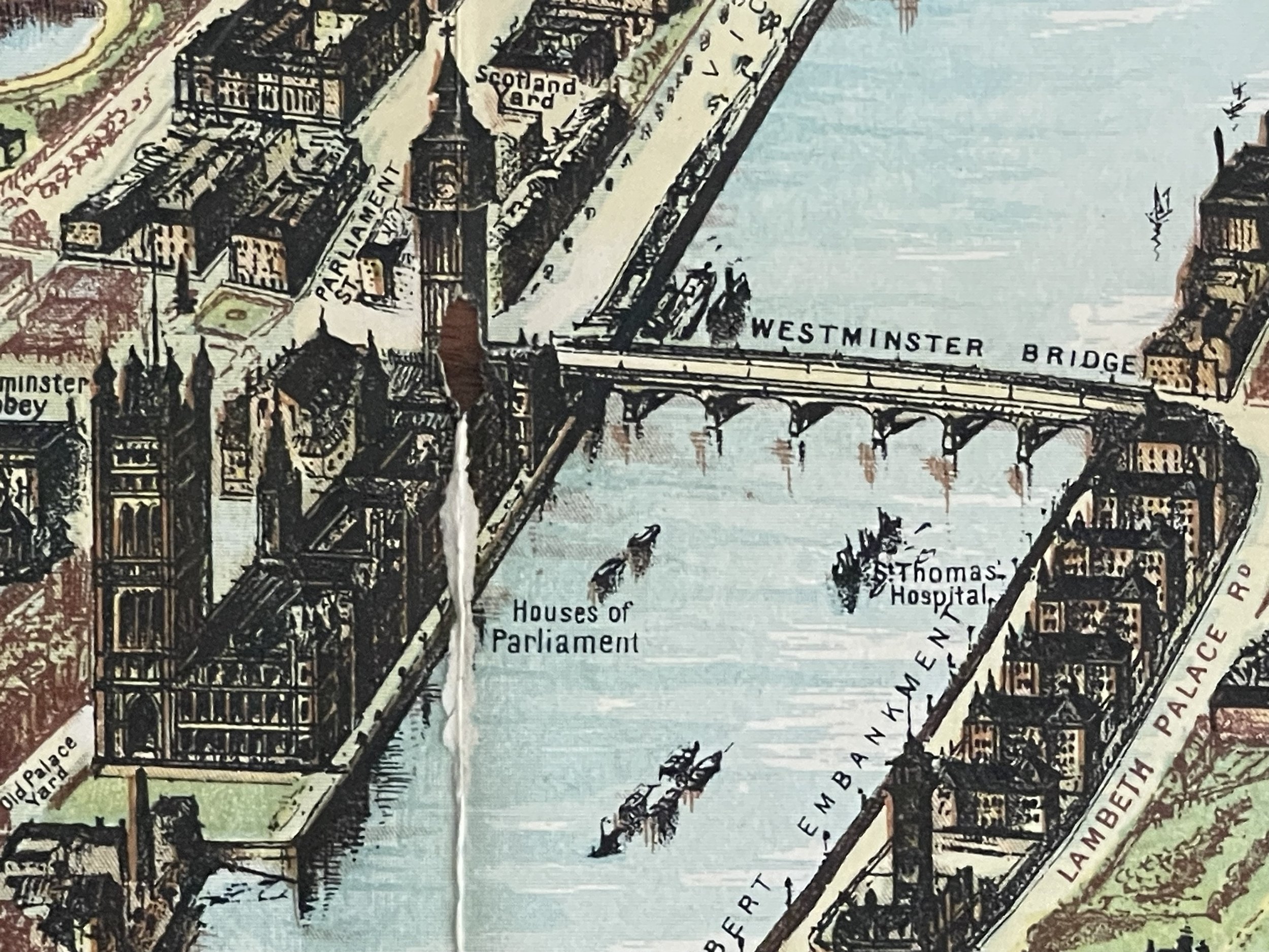 Image 3 of 28
 Image 4 of 28
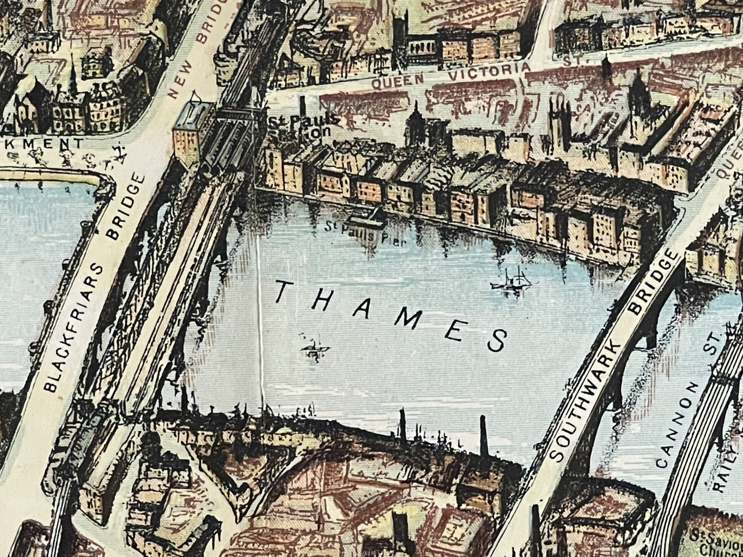 Image 5 of 28
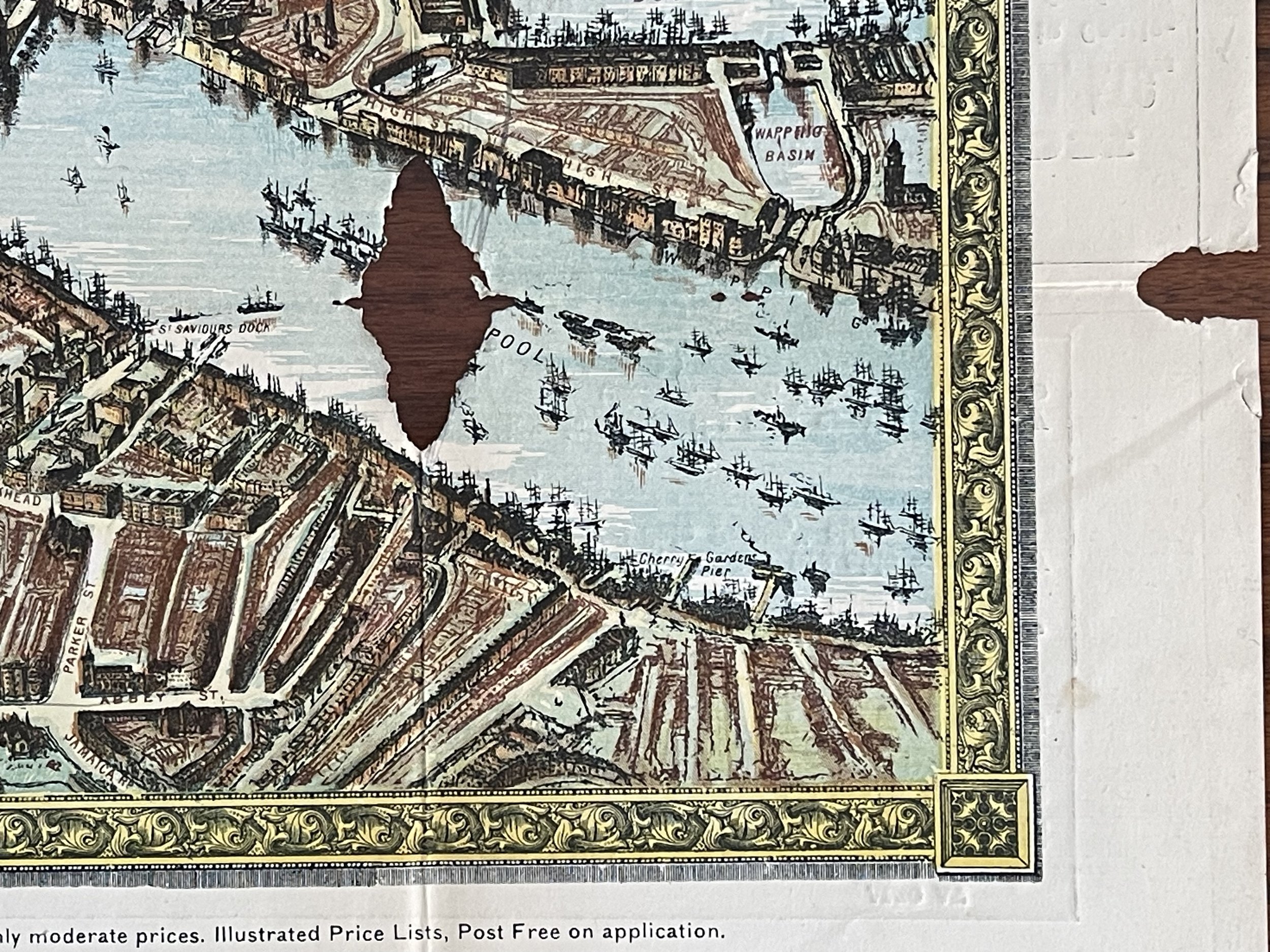 Image 6 of 28
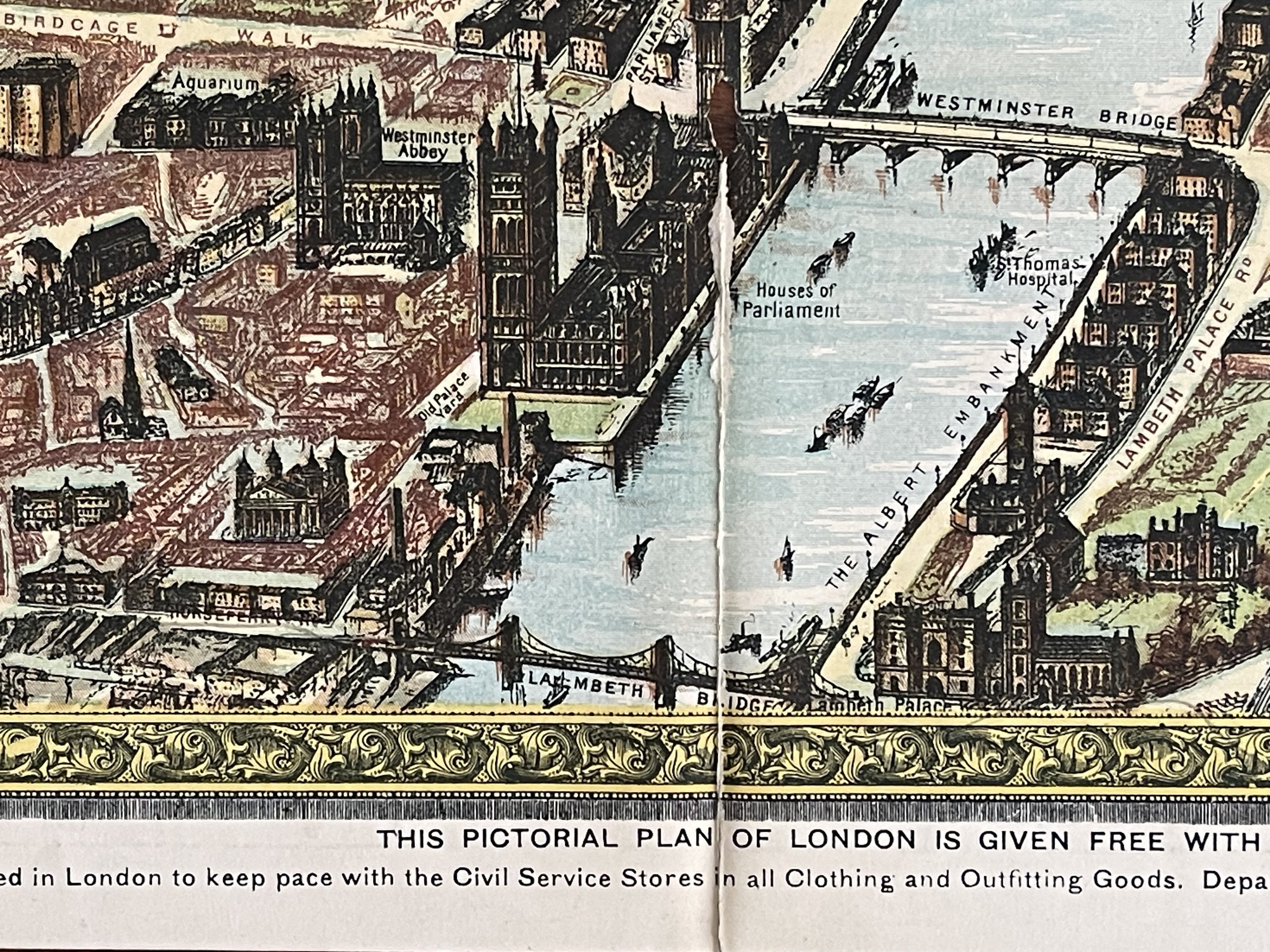 Image 7 of 28
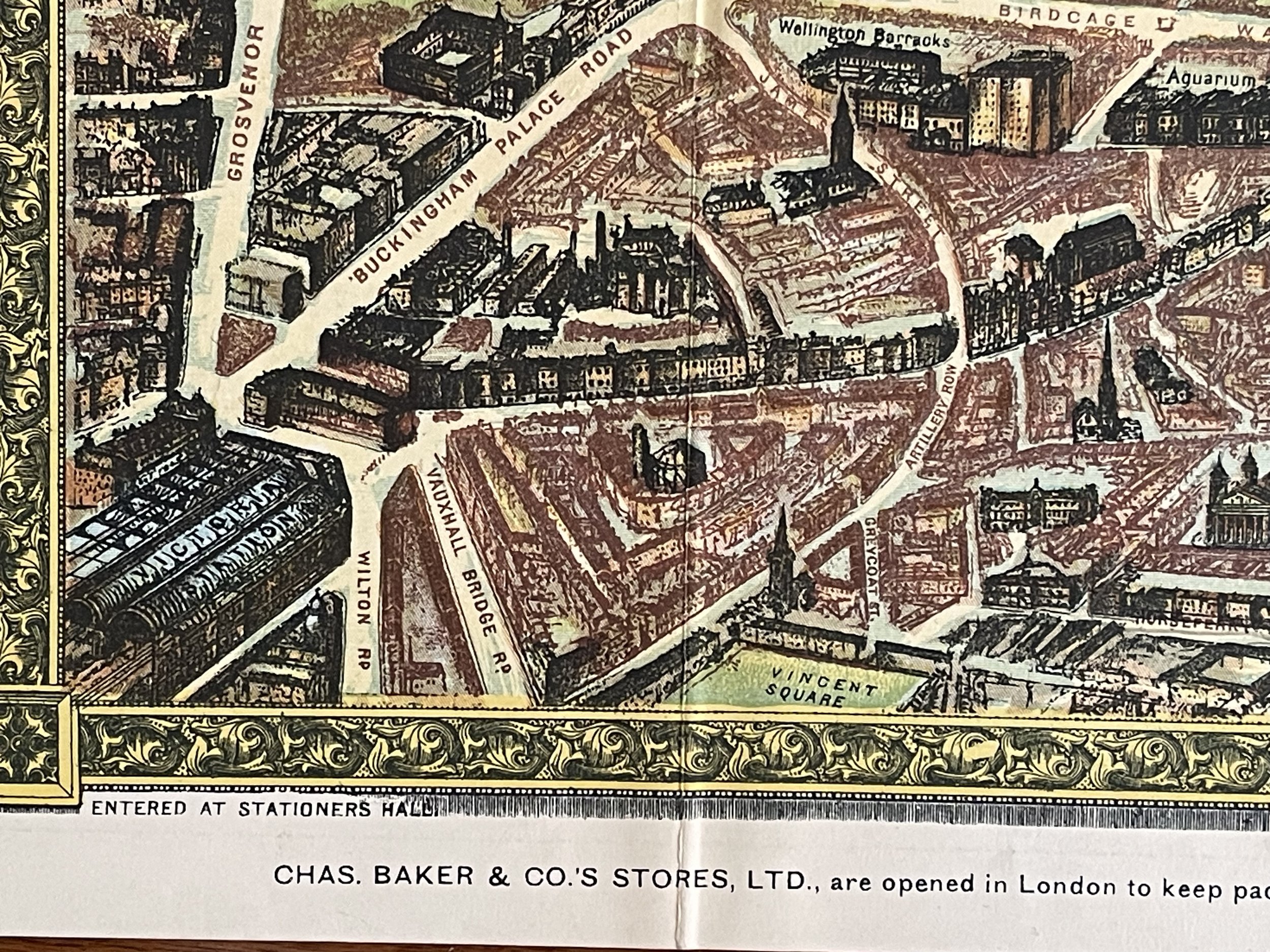 Image 8 of 28
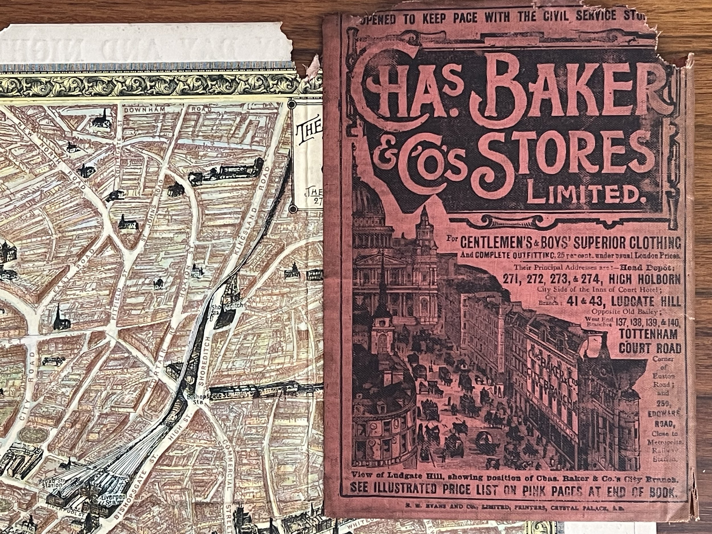 Image 9 of 28
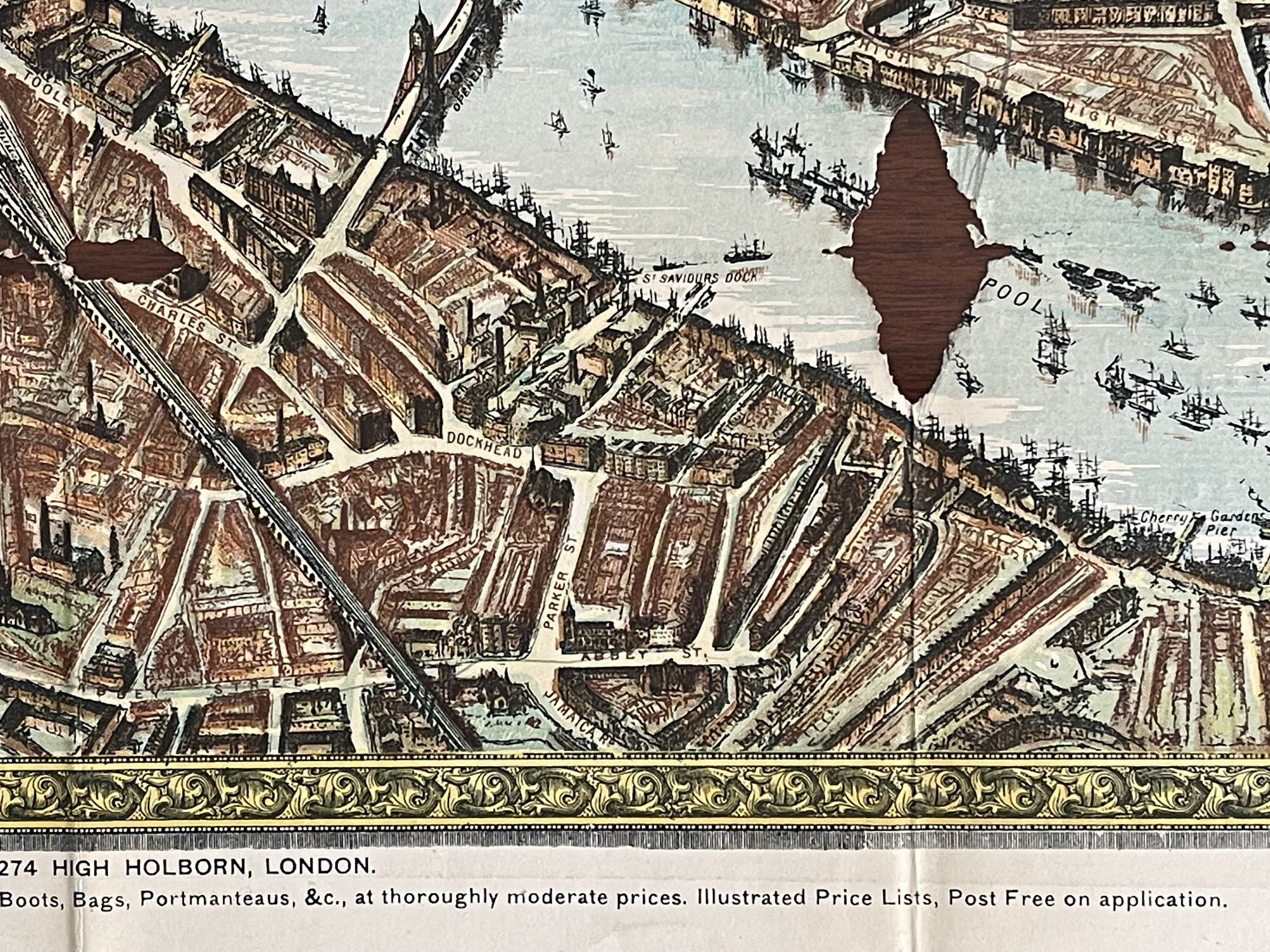 Image 10 of 28
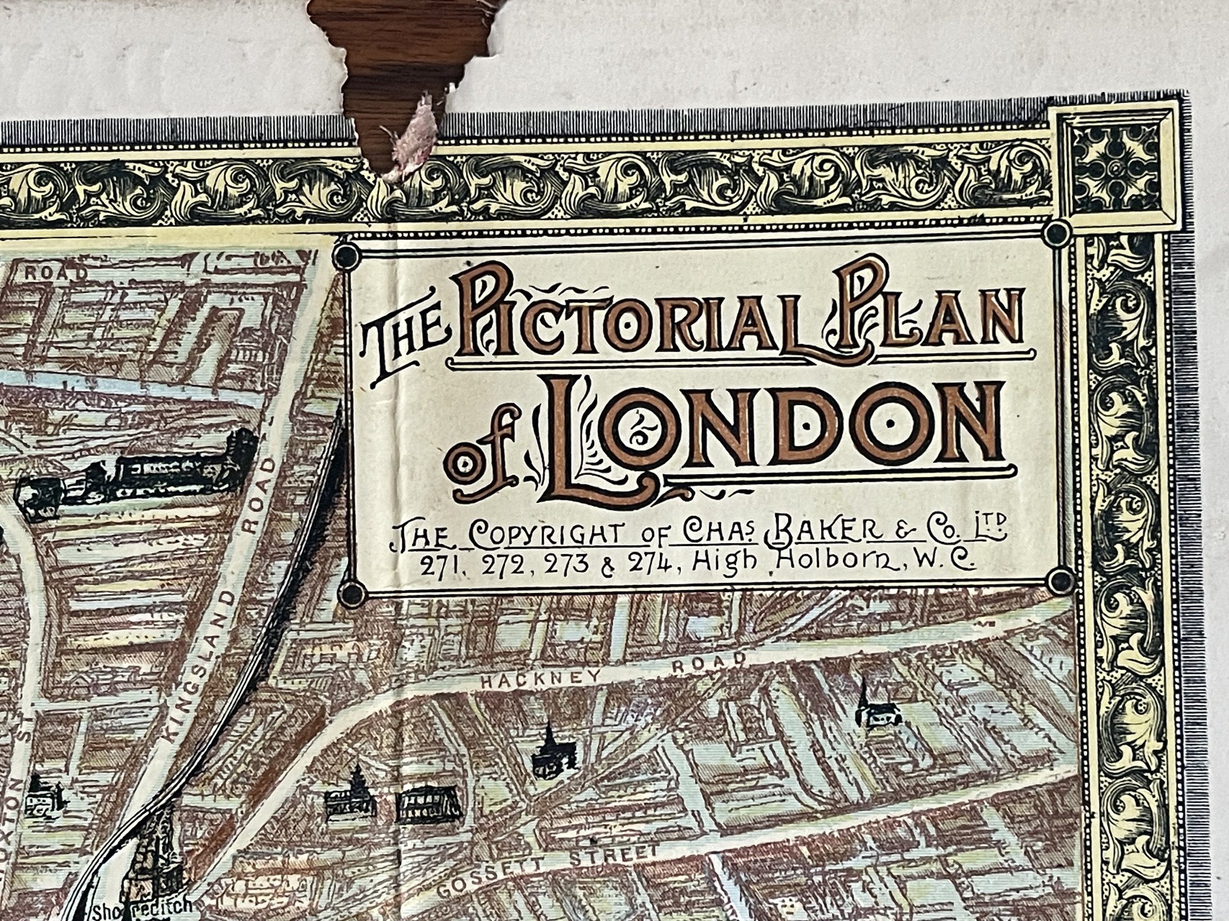 Image 11 of 28
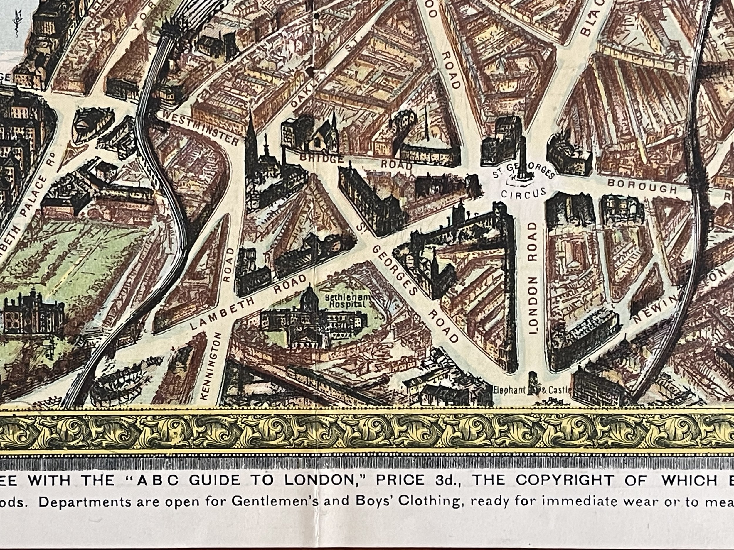 Image 12 of 28
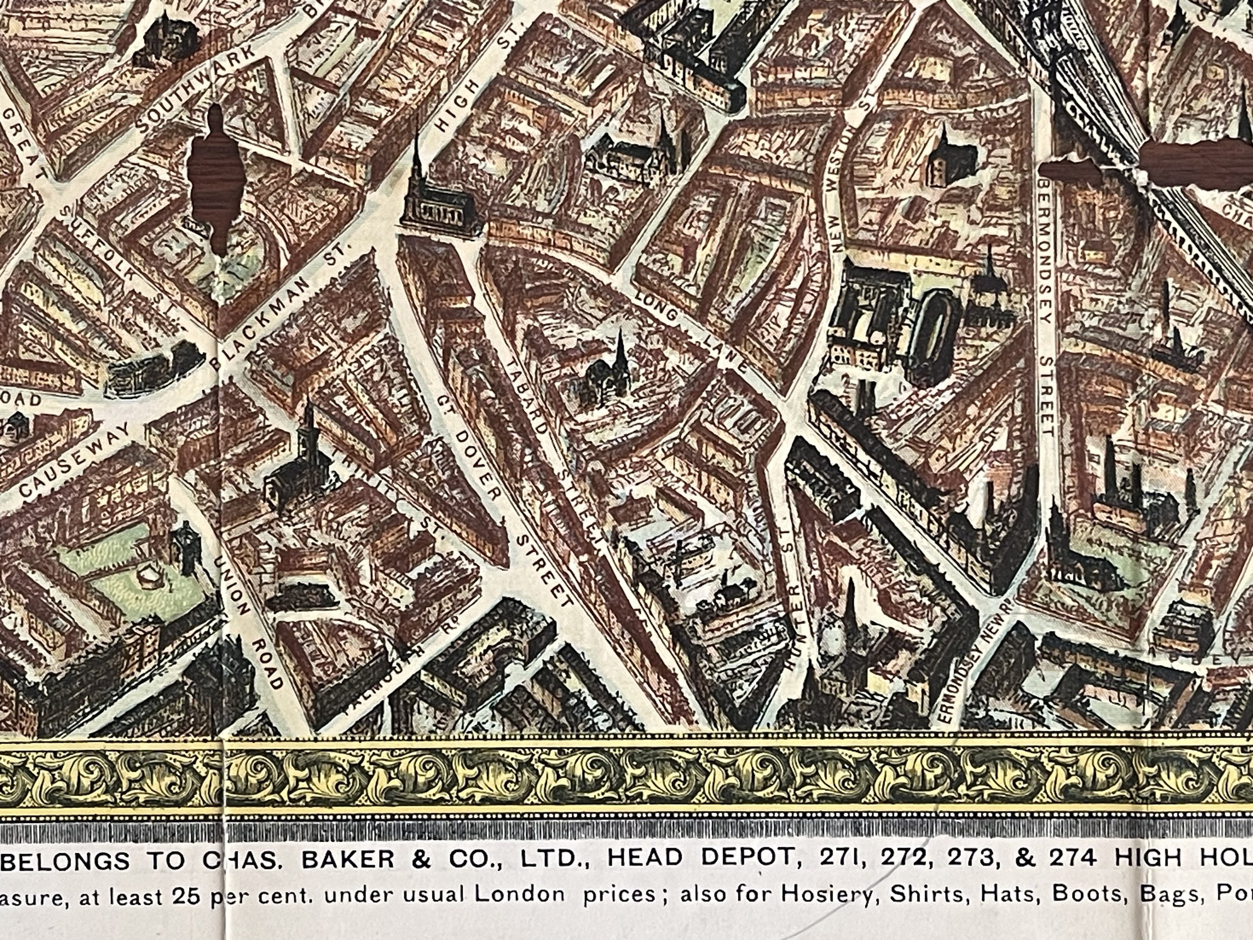 Image 13 of 28
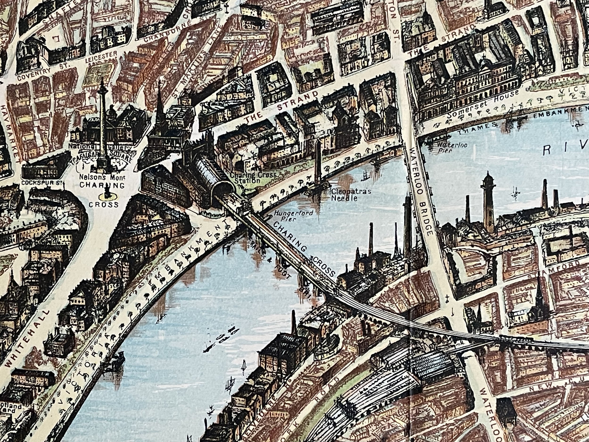 Image 14 of 28
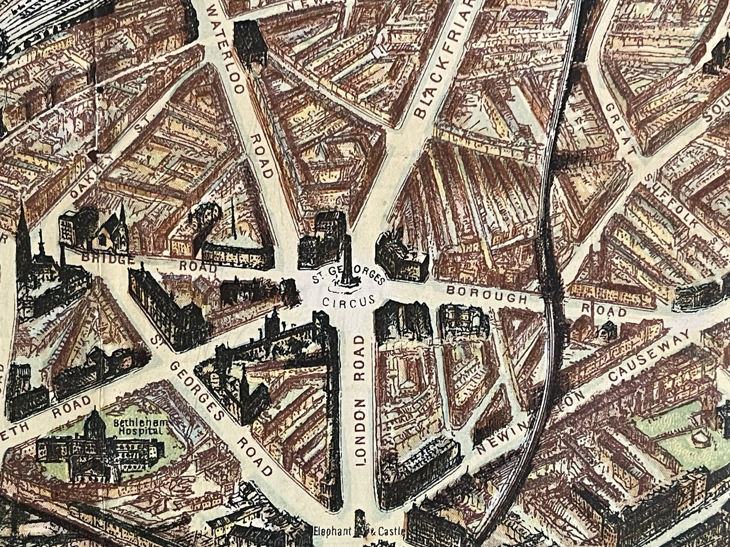 Image 15 of 28
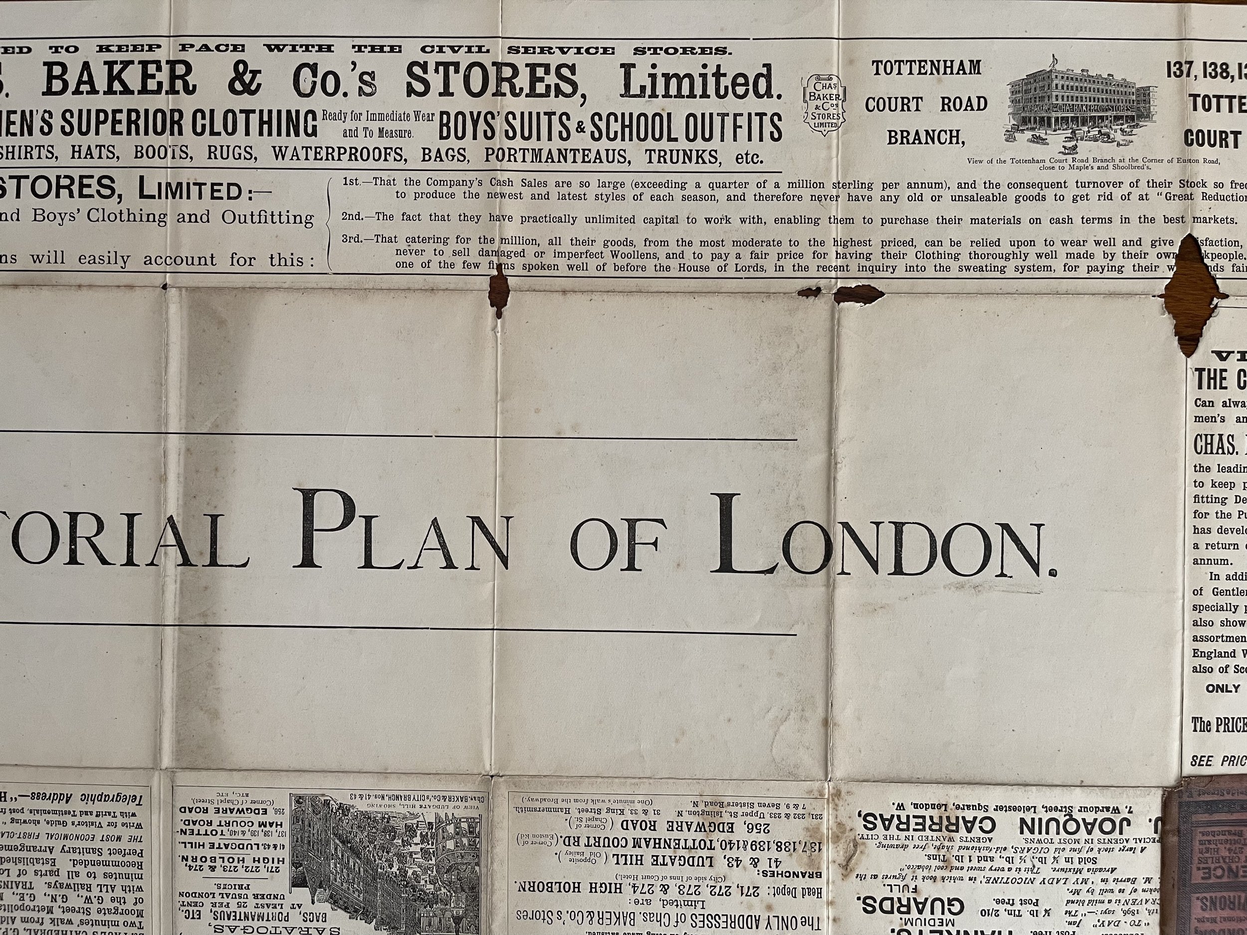 Image 16 of 28
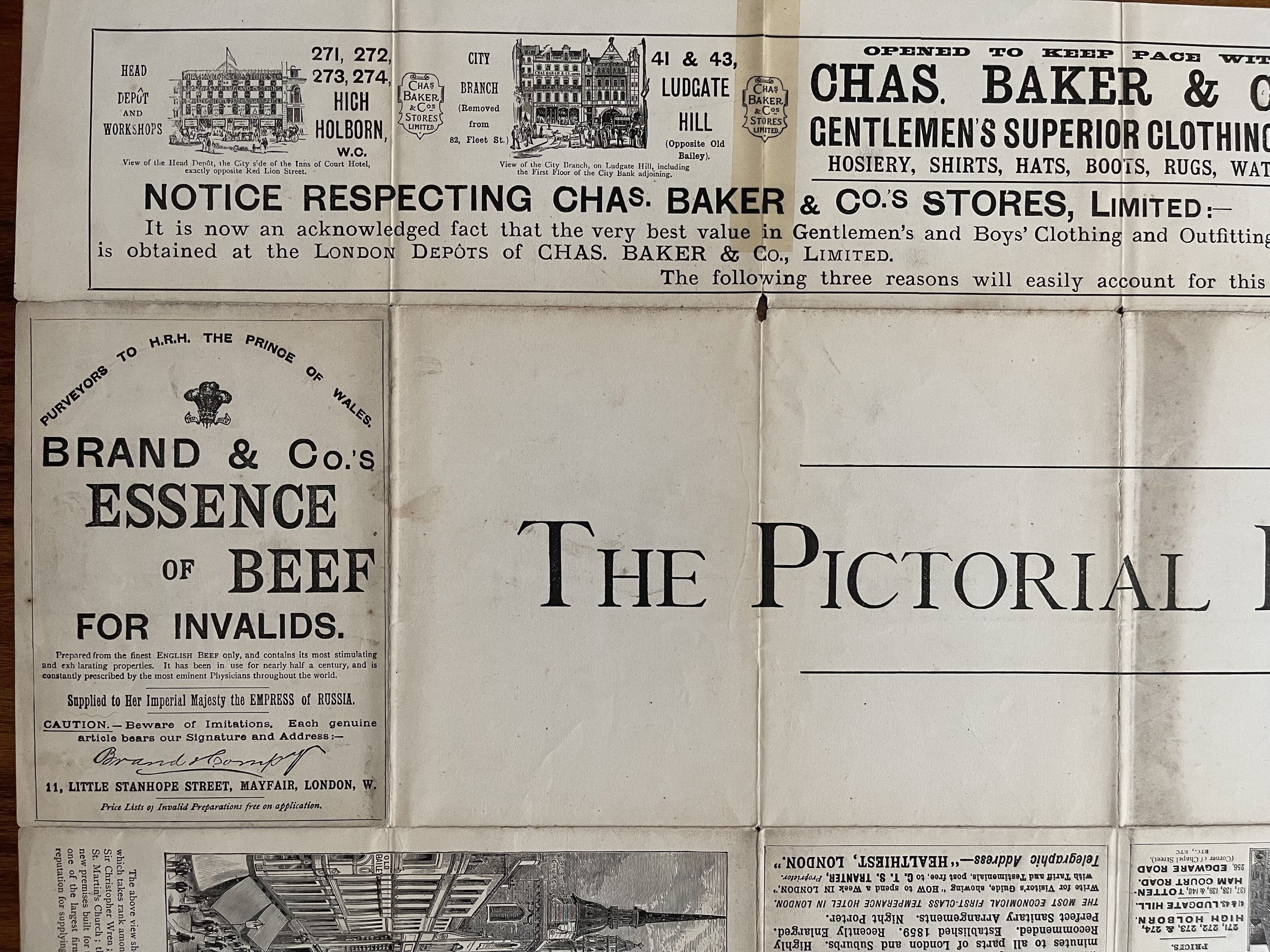 Image 17 of 28
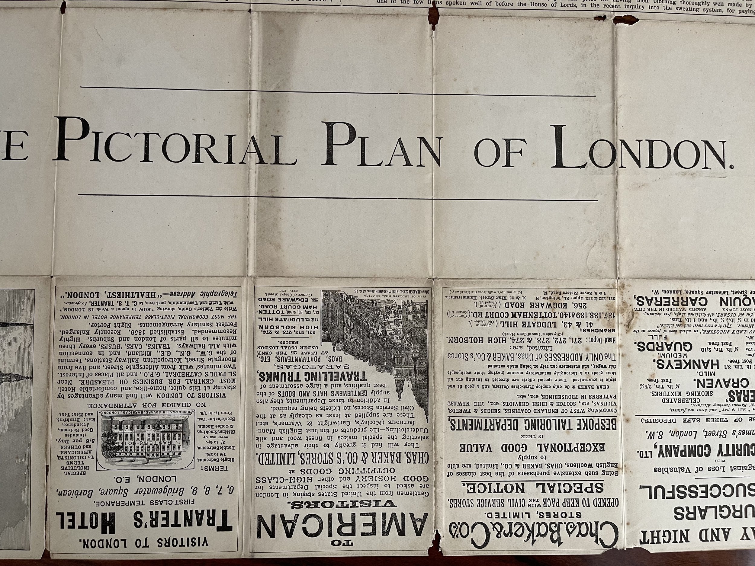 Image 18 of 28
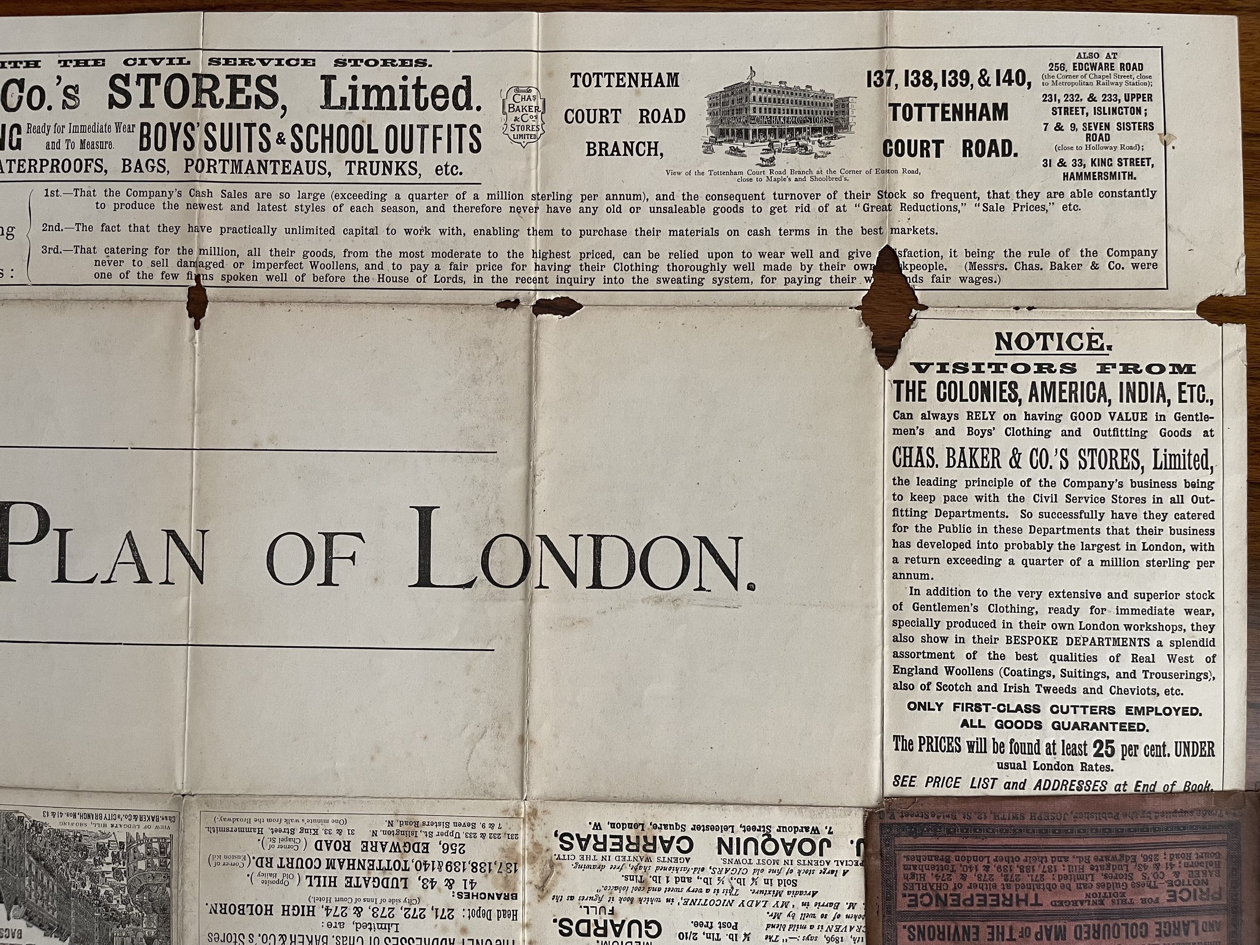 Image 19 of 28
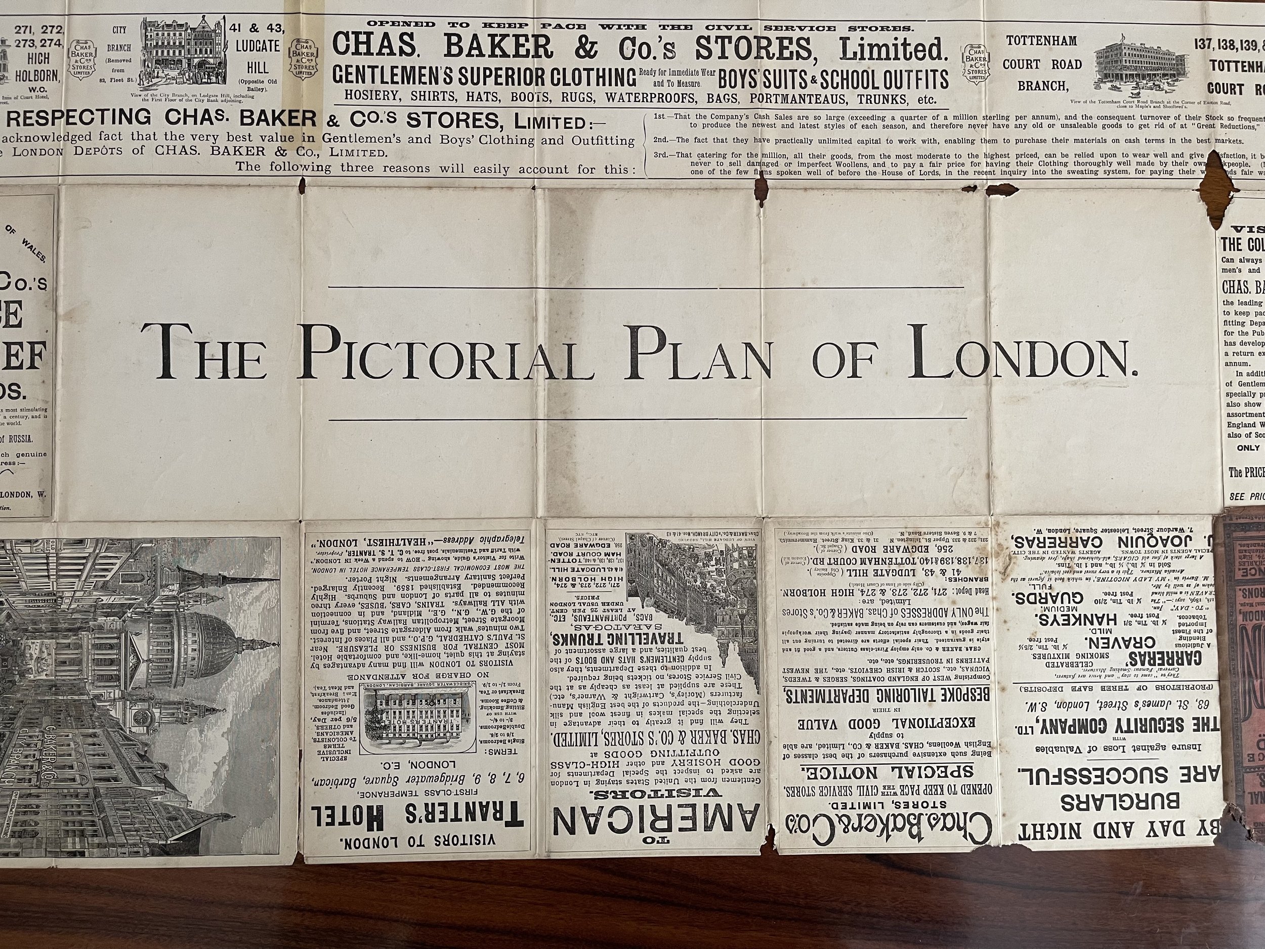 Image 20 of 28
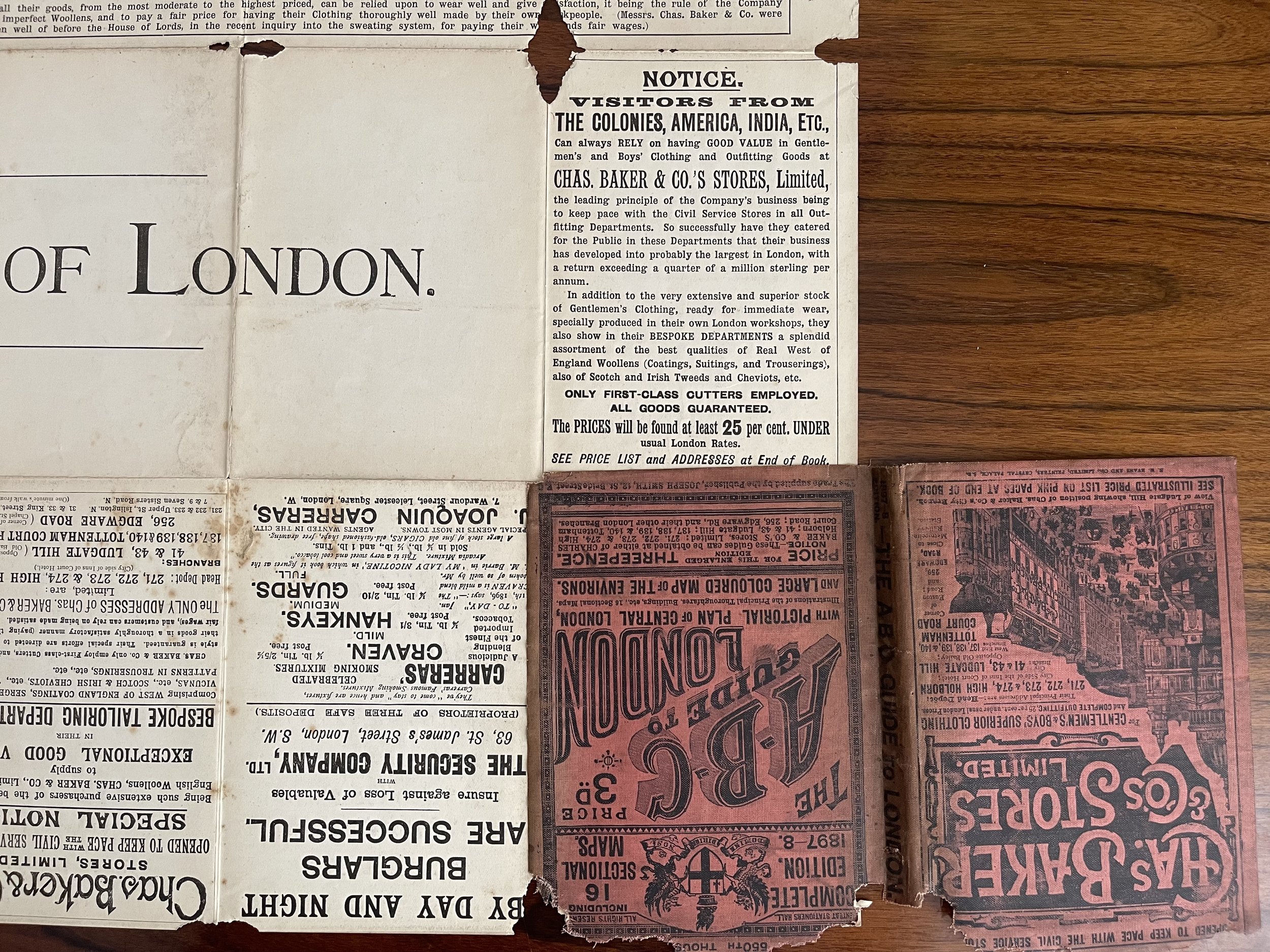 Image 21 of 28
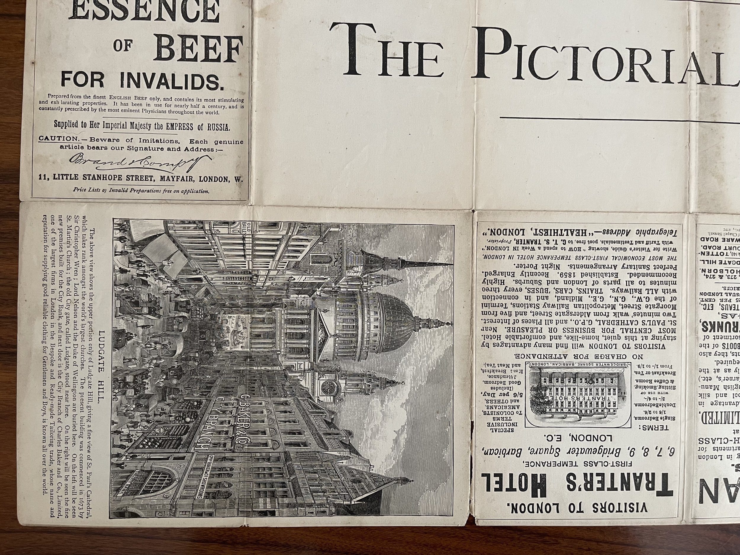 Image 22 of 28
 Image 23 of 28
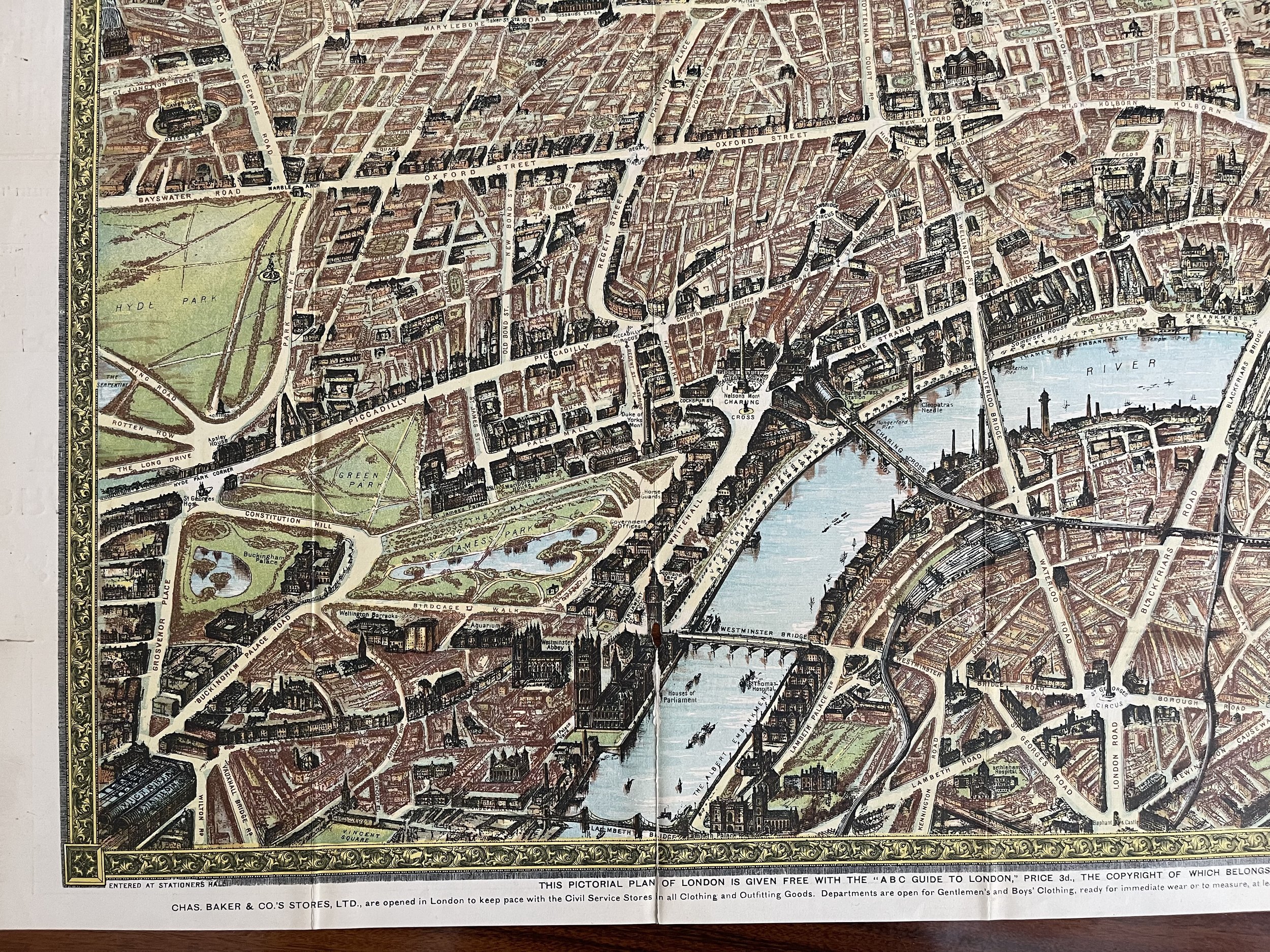 Image 24 of 28
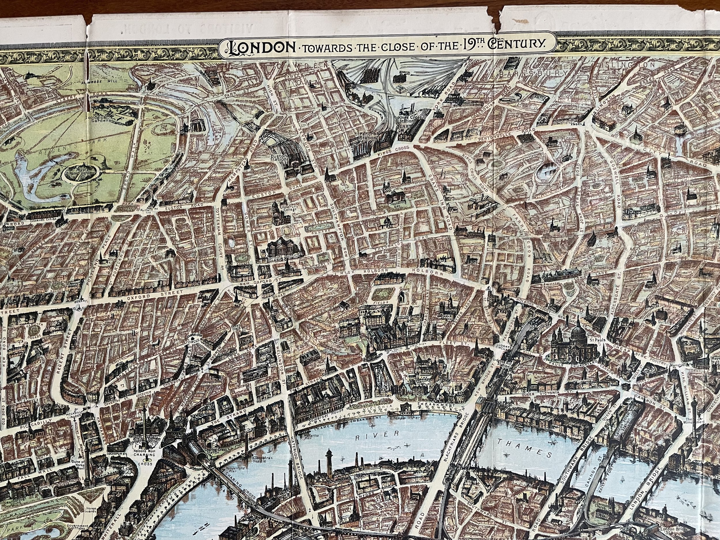 Image 25 of 28
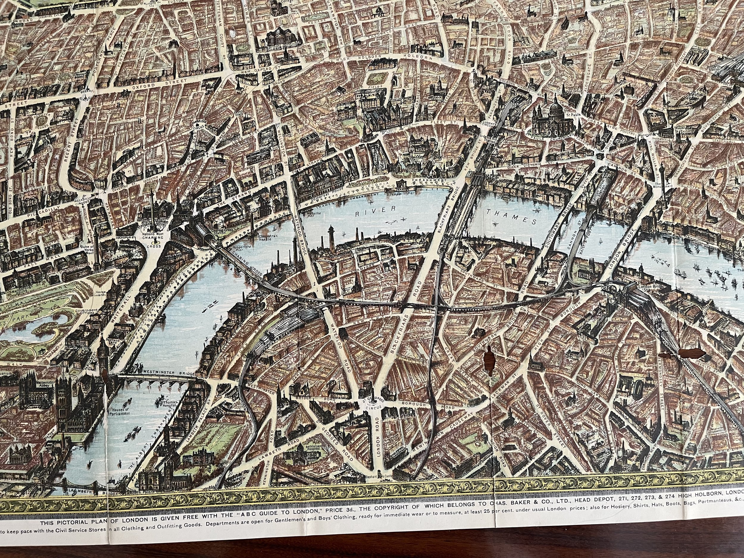 Image 26 of 28
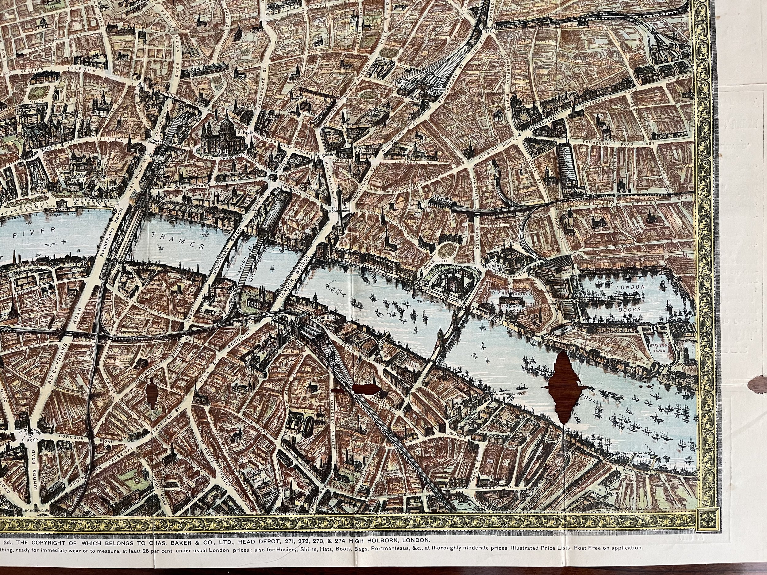 Image 27 of 28
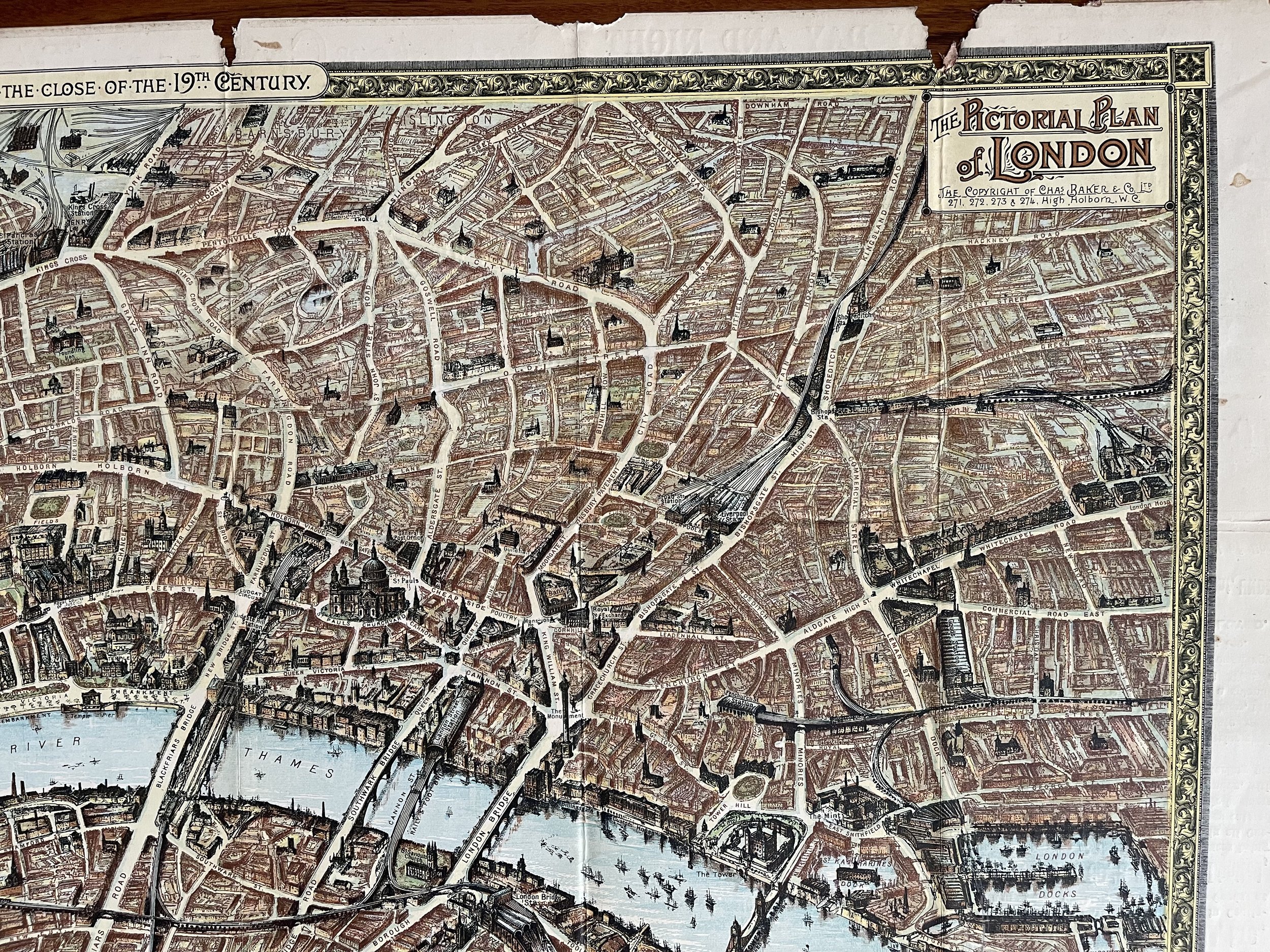 Image 28 of 28