Bowles’s New one-sheet plan of the cities of London and Westminster, with the borough of Southwark; comprehending their outskirts and extent of the Thames from Chelsea to Depford - Exhibiting also the newbuildings, roads and other alterations to the year 1795.
This is an uncommon and scarce folding pocket map or street plan of London, England, created by Henry Carrington Bowles in 1795. The map encompasses areas on both sides of the Thames River, stretching from Hyde Park in the west to White Horse Street in the east, and from Lambeth in the south to Islington in the north. It provides remarkable detail, frequently marking individual buildings, gardens, and estates. The table at the bottom lists key buildings and churches. Bowles originally published this plan in 1777 and made regular updates until the end of the 18th century. This particular edition was released shortly after Bowles's passing in 1793, by his firm, Bowles and Carver, from their offices located at No. 69 St. Paul's Church Yard, London. Size - 66cm long X 45cm wide.
Biography
Carrington Bowles - 1724-1793 - publisher/printer; British; Male
Son of John Bowles (q.v.) to whom he was apprenticed in 1741, and with whom he was in partnership as John Bowles & Son, at the Black Horse, Cornhill, London, from 1752 or 1753 to c.1762. He left in order to take over the business of his uncle, Thomas Bowles II (q.v.) in St Paul's Churchyard. When Carrington died in 1795, the business passed to his son (Henry) Carington Bowles (q.v.).
The Bowles Family (active circa 1714 - 1832) were publishers and map merchants operating in London from around 1714 to approximately 1832. The firm, led by Thomas Bowles (active 1714 - 1763), John Bowles (1701 - 1779), and Carrington Bowles (1724 - 1793), as well as under the name Bowles and Carver (active 1794 - 1832), produced an extensive range of works that included numerous atlases, pocket maps, and wall maps. This publishing legacy spanned four generations, beginning with Thomas Bowles, a print engraver active in the late 17th century. His son, Thomas Bowles II, produced the company's first maps at St. Paul's Churchyard, London. Thomas's brother, John Bowles (also known as 'Old John Bowles' or 'Black Horse Bowles'), ran a successful publishing business at No. 13 Cornhill and is regarded as one of the earliest publishers of William Hogarth's works. It was here that John's son, Carrington Bowles, was introduced to the industry. Carrington took charge of the Cornhill bookstore and later united it with his uncle's shop in St. Paul's Churchyard. Following Carrington's death in 1793, the business was inherited by his son Henry Carrington Bowles (1763 - 1830), who teamed up with his father's former apprentice Samuel Carver (1756 - 1841), renaming the firm to 'Bowles and Carver'. This imprint continued to publish maps and atlases until 1832. Although Henry Carrington Bowles passed away in 1830, Samuel Carver, despite his advanced age and declining health, managed to sustain the business for an additional two years before closing it down.
Bowles and Carver were the proprietors of a London publishing house, operating from 1793 to 1832, formed by a partnership between Henry Carington Bowles II and Samuel Carver. They continued the Bowles family business in St. Paul's Churchyard, London, publishing maps, prints, and atlases under the "Bowles & Carver" imprint.
Partners: The partnership was formed by Henry Carington Bowles II (1763-1830) and Samuel Carver.
Location: The business was located at 69 St. Paul's Churchyard in London.
Business: They published a variety of materials, including maps, atlases, and prints.
Succession: The business was a continuation of the long-standing Bowles family publishing tradition, which had been started by Thomas Bowles (I) and passed through several generations.
The partnership continued the successful business previously run by Henry Carington Bowles I, who died in 1793.
Key Details about Samuel Carver:
Apprenticeship and Early Career Carver was initially apprenticed to Carington Bowles I (Henry Carington Bowles II's father) in 1770 as a joiner, a common path into the print trade at the time. He became a "freeman" in 1777.
Partnership In 1793, following the death of Carington Bowles I, Samuel Carver entered into a partnership with the son, Henry Carington Bowles II, to continue the family business at 69 St Paul's Churchyard.
Business Practices The partnership was commercially astute, known for acquiring existing art plates (such as those by John Collet) to establish a monopoly on specific engraved images and republishing them under their own imprint.
Later Life and Legal Matters The partnership traded successfully until around 1832. A "friendly" legal case was brought by Carver in 1830 to resolve the complex provisions of Henry Carington Bowles II's will and an earlier marriage settlement.
Death Samuel Carver died in 1841 at the age of 85 and was buried in Enfield. At the time of his death, he was living with the younger Henry Carington Bowles (his partner's son) and his family.
A separate individual named Samuel Carver (1781-1837) also worked as a map engraver in London during a similar period but was a different person, likely a nephew of the publisher.
Key aspects of their business:
Publications They published a wide variety of materials, including maps, atlases (such as Bowles's New Medium English Atlas), topographical prints, humorous and satirical prints, and instructional drawing books.
Works of Art They often republished existing plates from earlier artists and publishers, such as those by John Collet and Carington Bowles I, often removing the original publication dates.
Proprietors The imprint "Printed for the Proprietors Bowles & Carver" on their items indicated their ownership of the original plates and the right to publish the works.
Their prints and maps are found in the collections of major institutions like the British Museum and the Victoria and Albert Museum.
Condition - Commensurate with its 230+ year age. Exceptional good for its ages, hessian backing and individual plates in good order. A few inscriptions to the rear with the map (see photos), frontispieceMap itself, is in very good order for its 230+ year age. Coloured in places.
A rare and well preserved survivor of the period. Would look great framed.
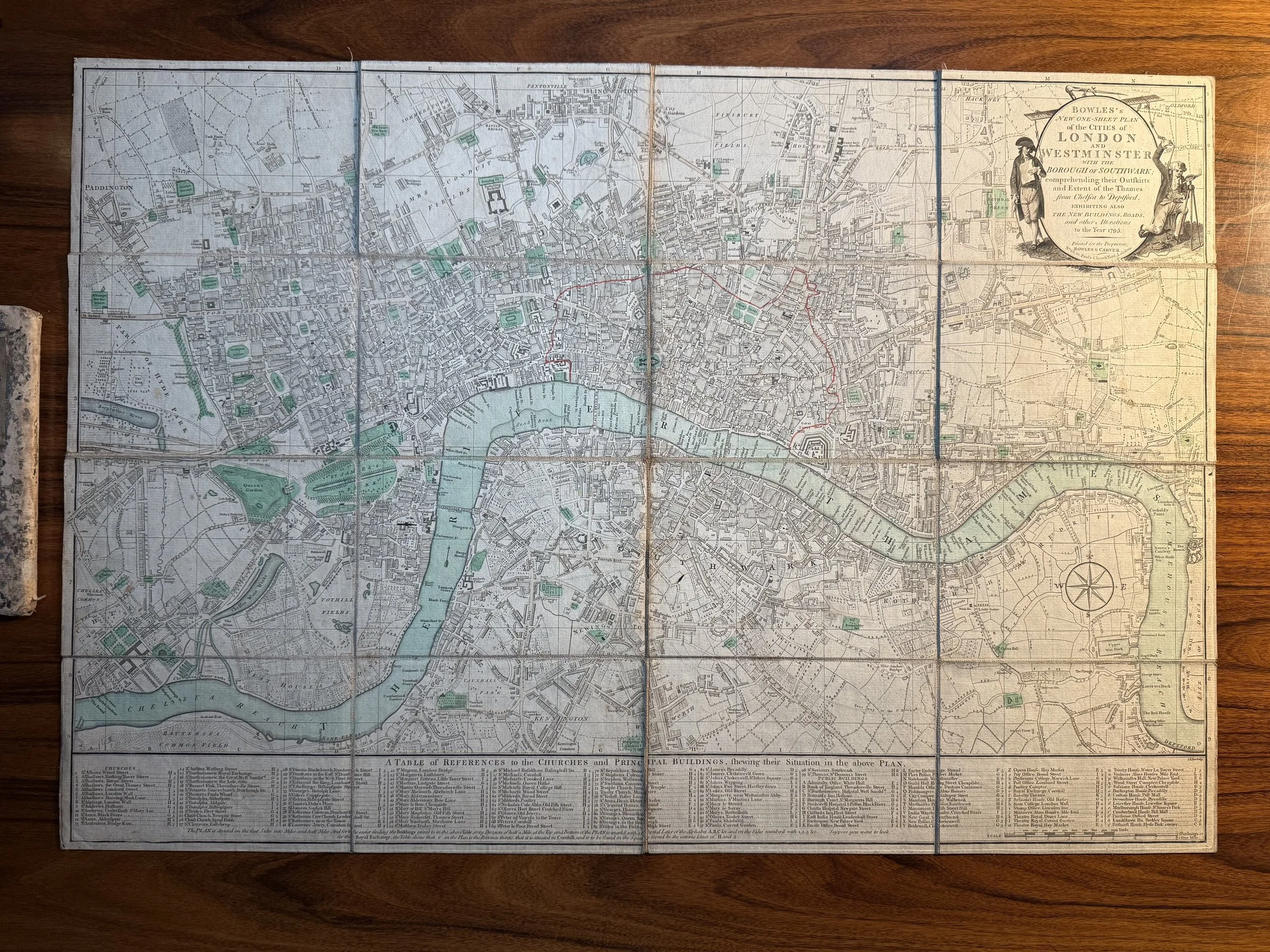 Image 1 of 17
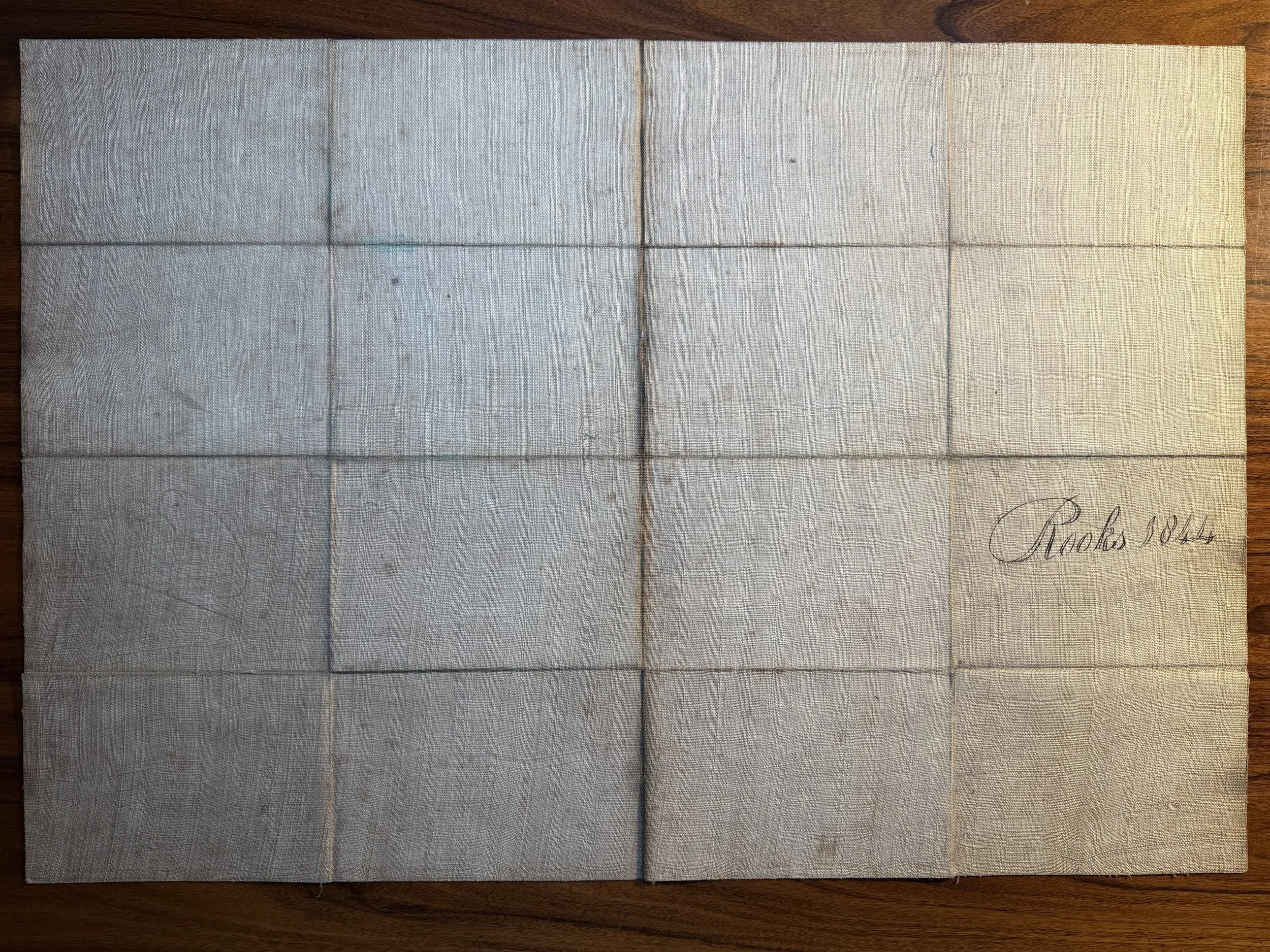 Image 2 of 17
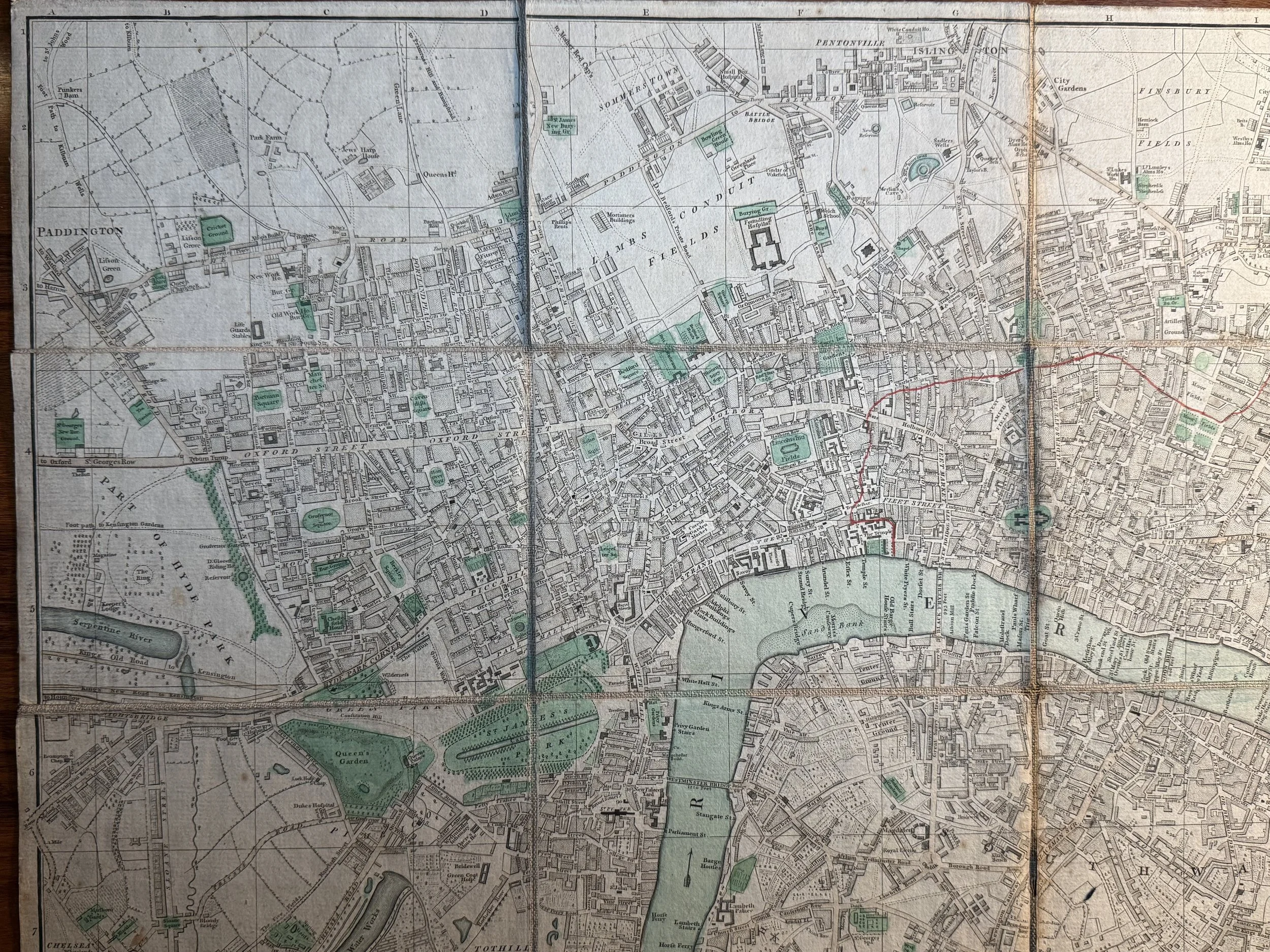 Image 3 of 17
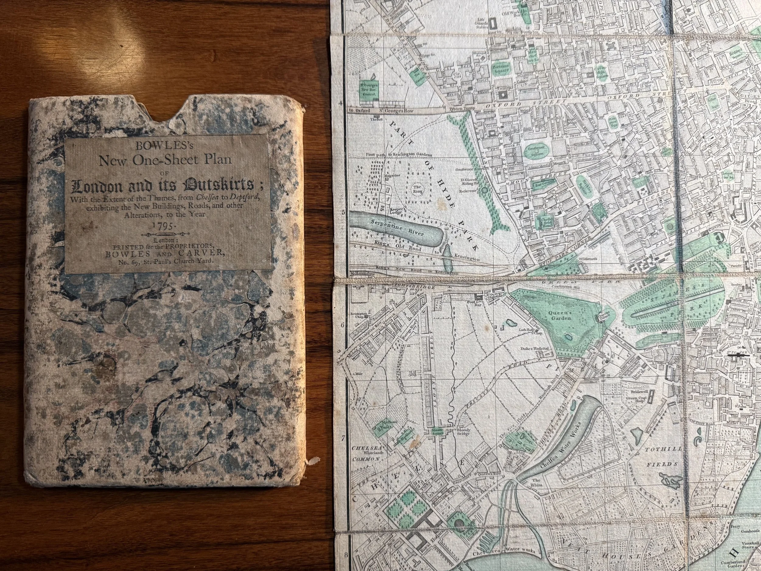 Image 4 of 17
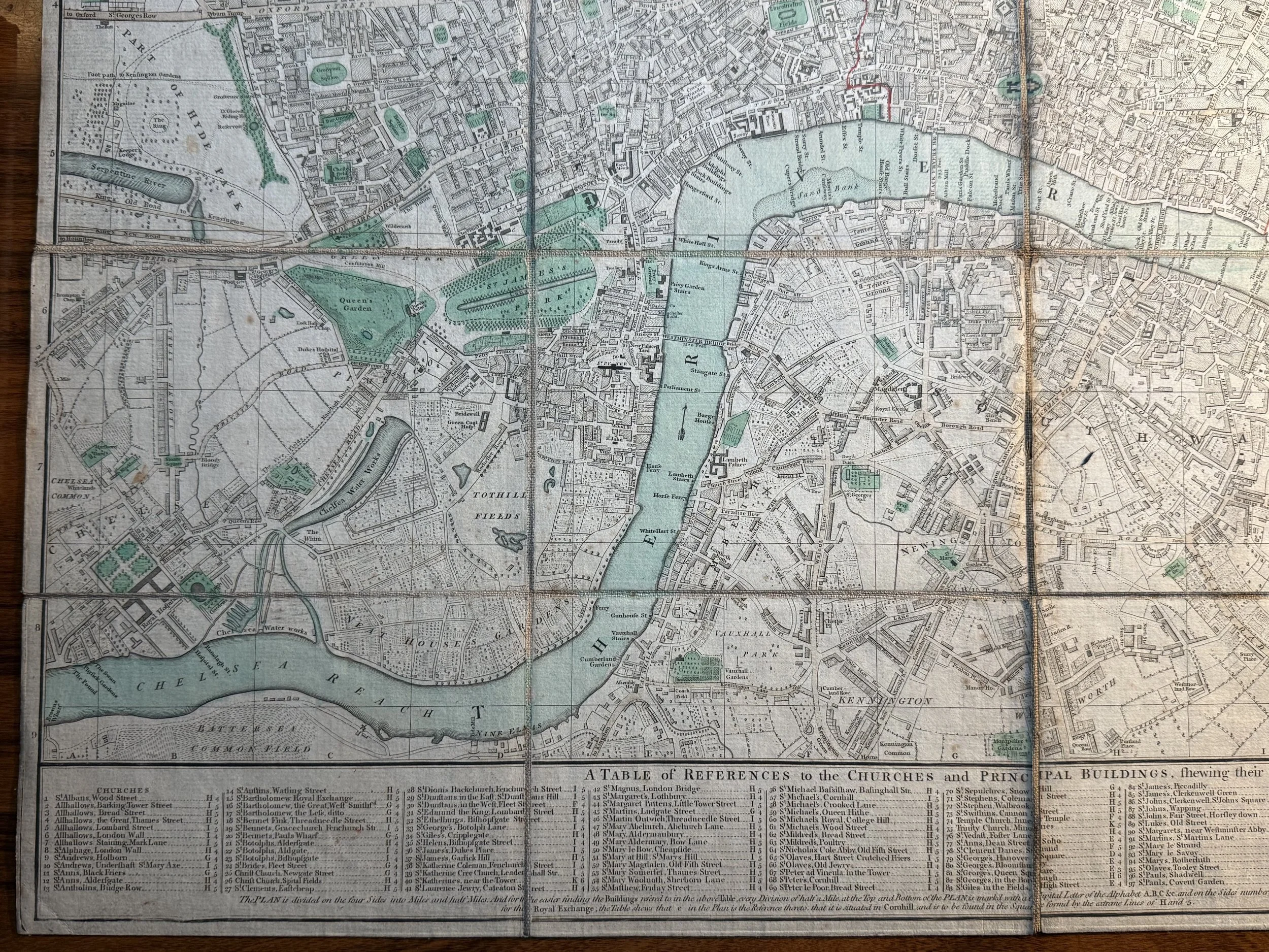 Image 5 of 17
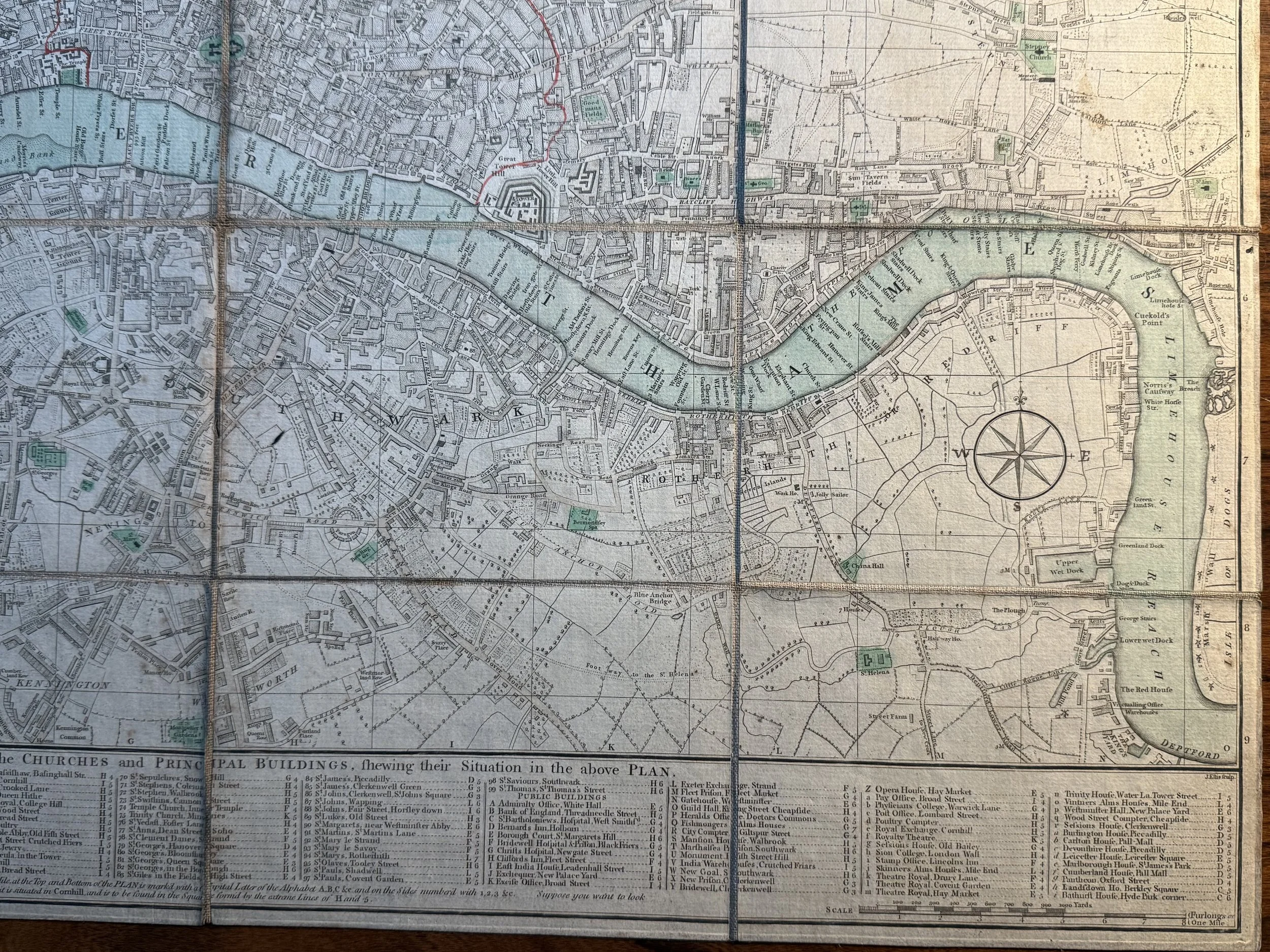 Image 6 of 17
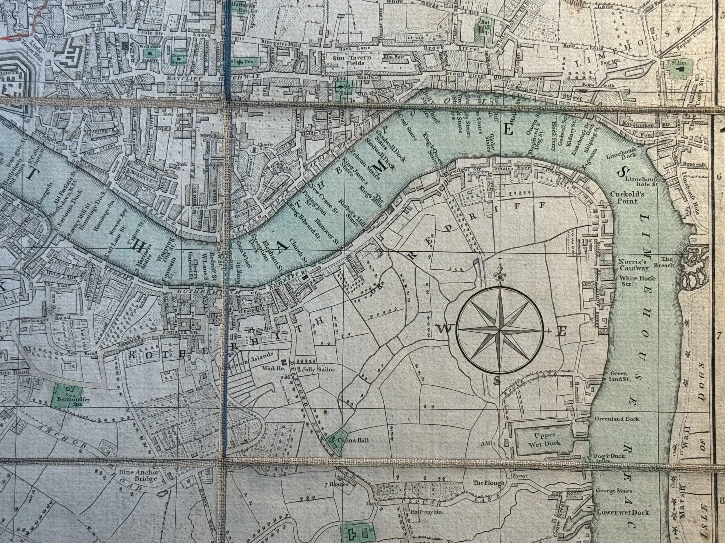 Image 7 of 17
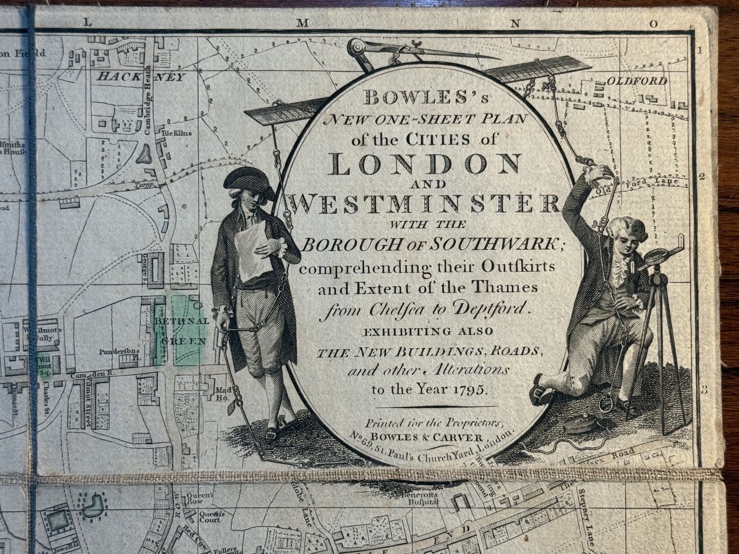 Image 8 of 17
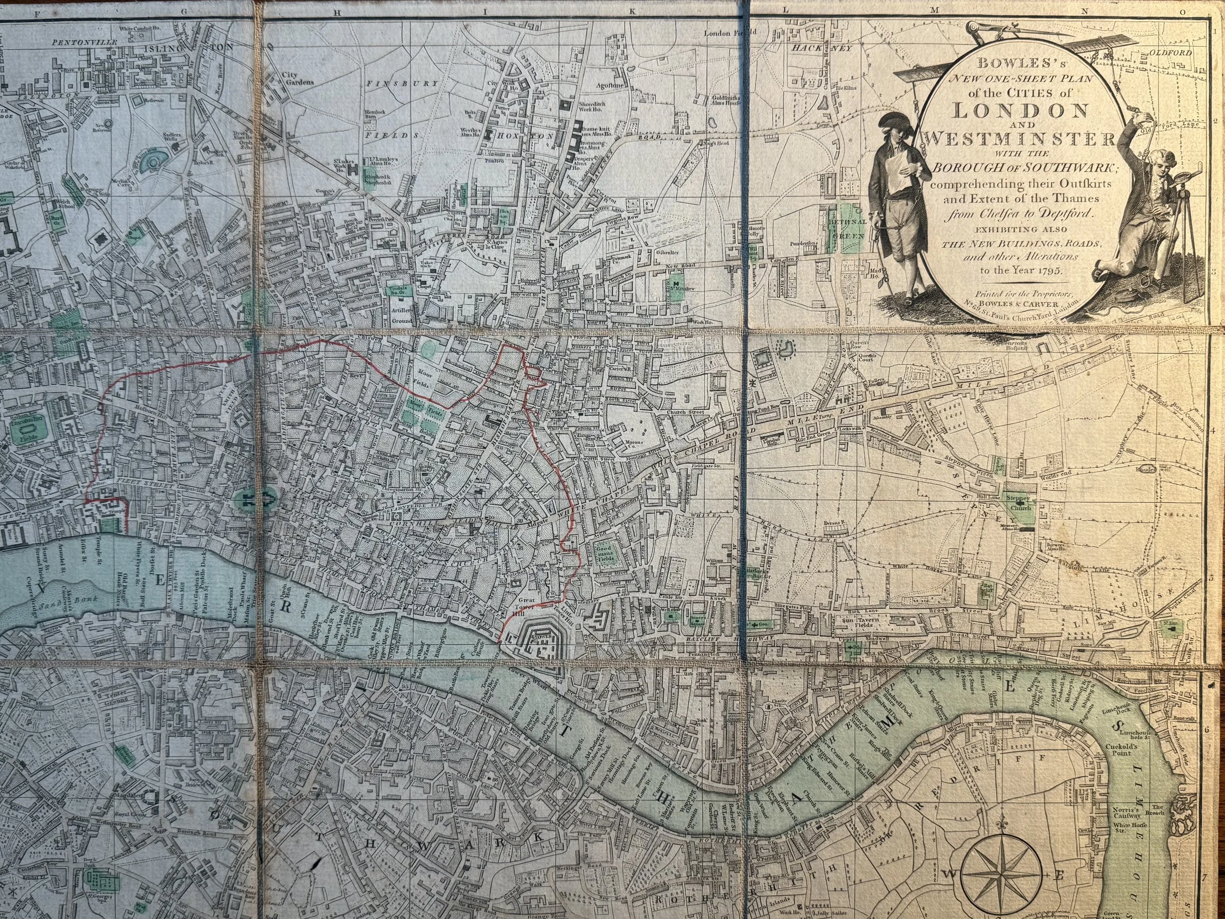 Image 9 of 17
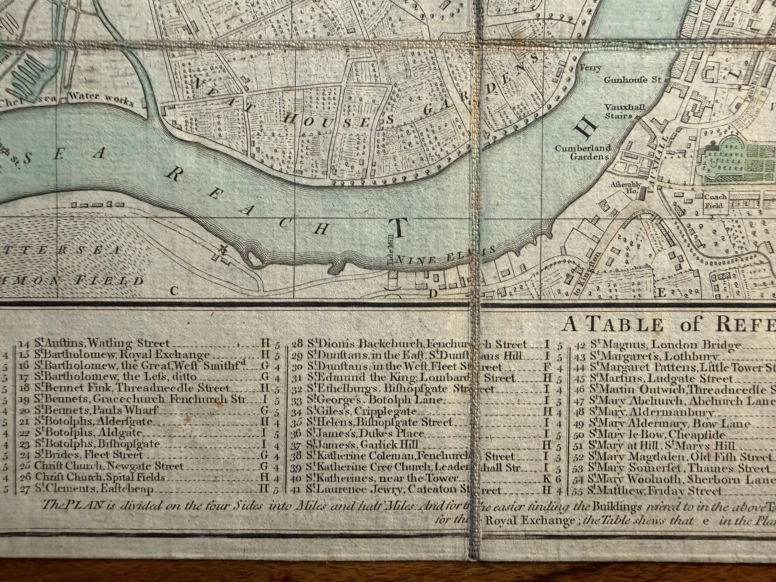 Image 10 of 17
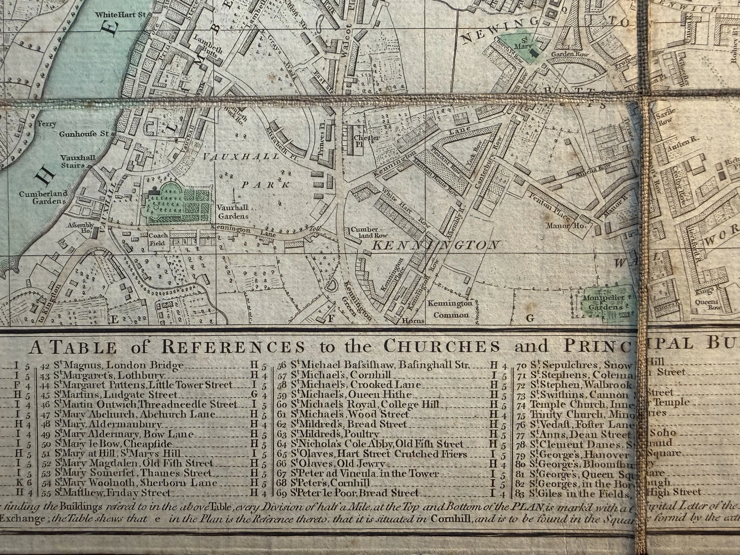 Image 11 of 17
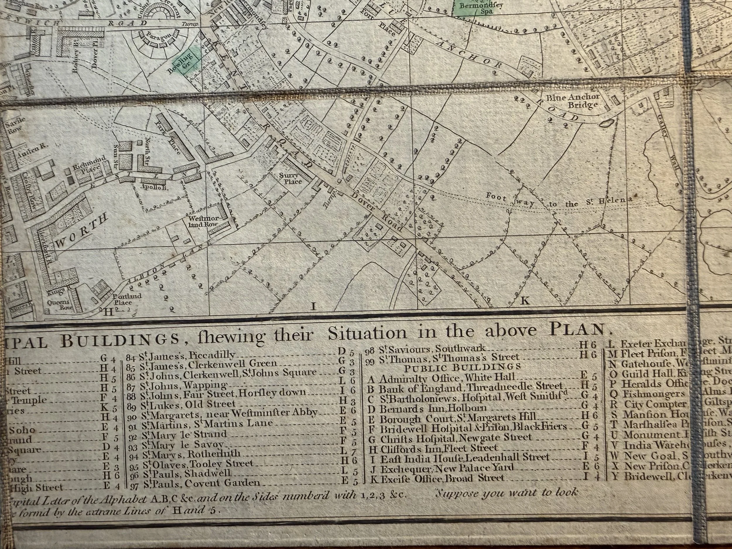 Image 12 of 17
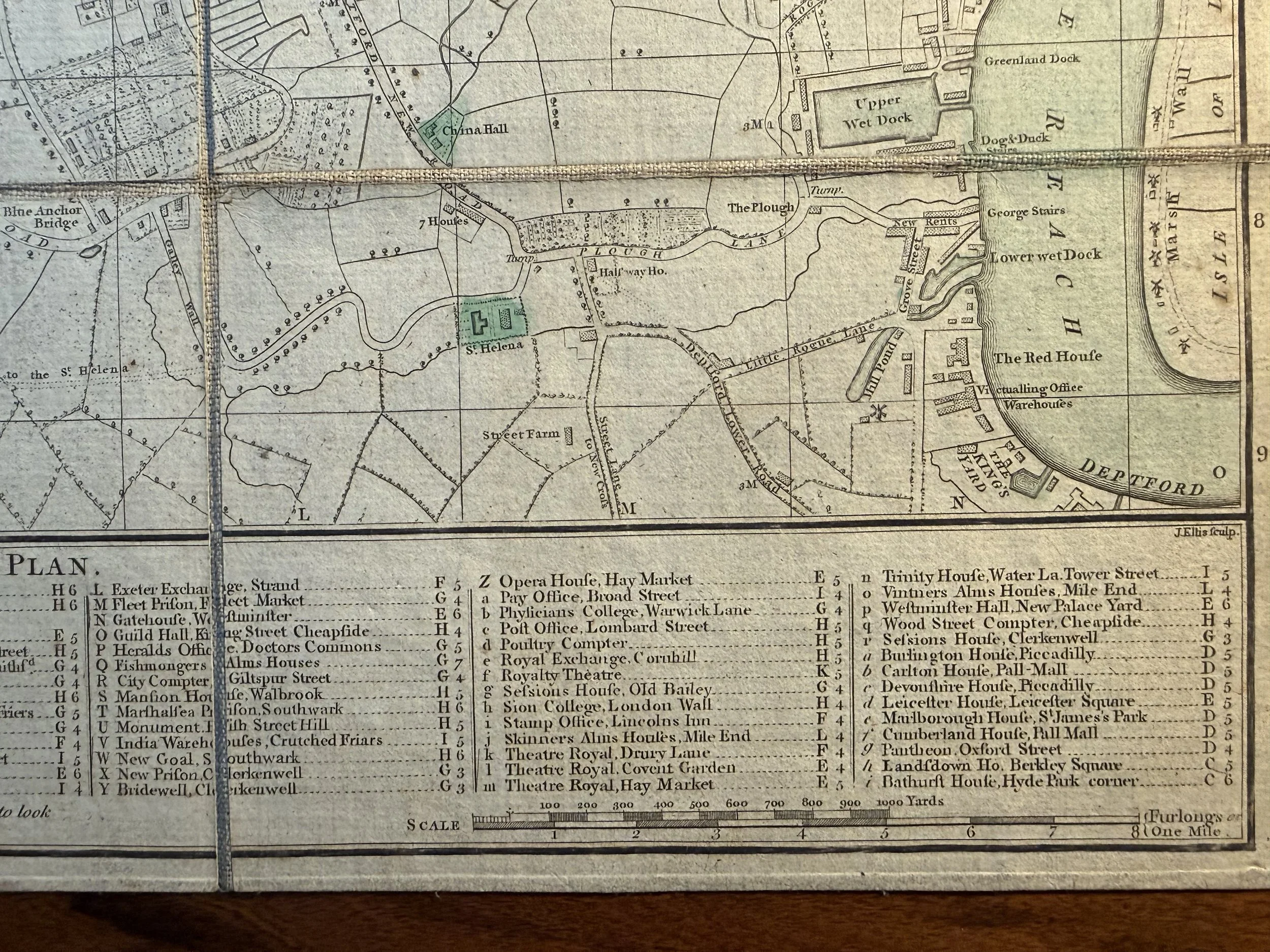 Image 13 of 17
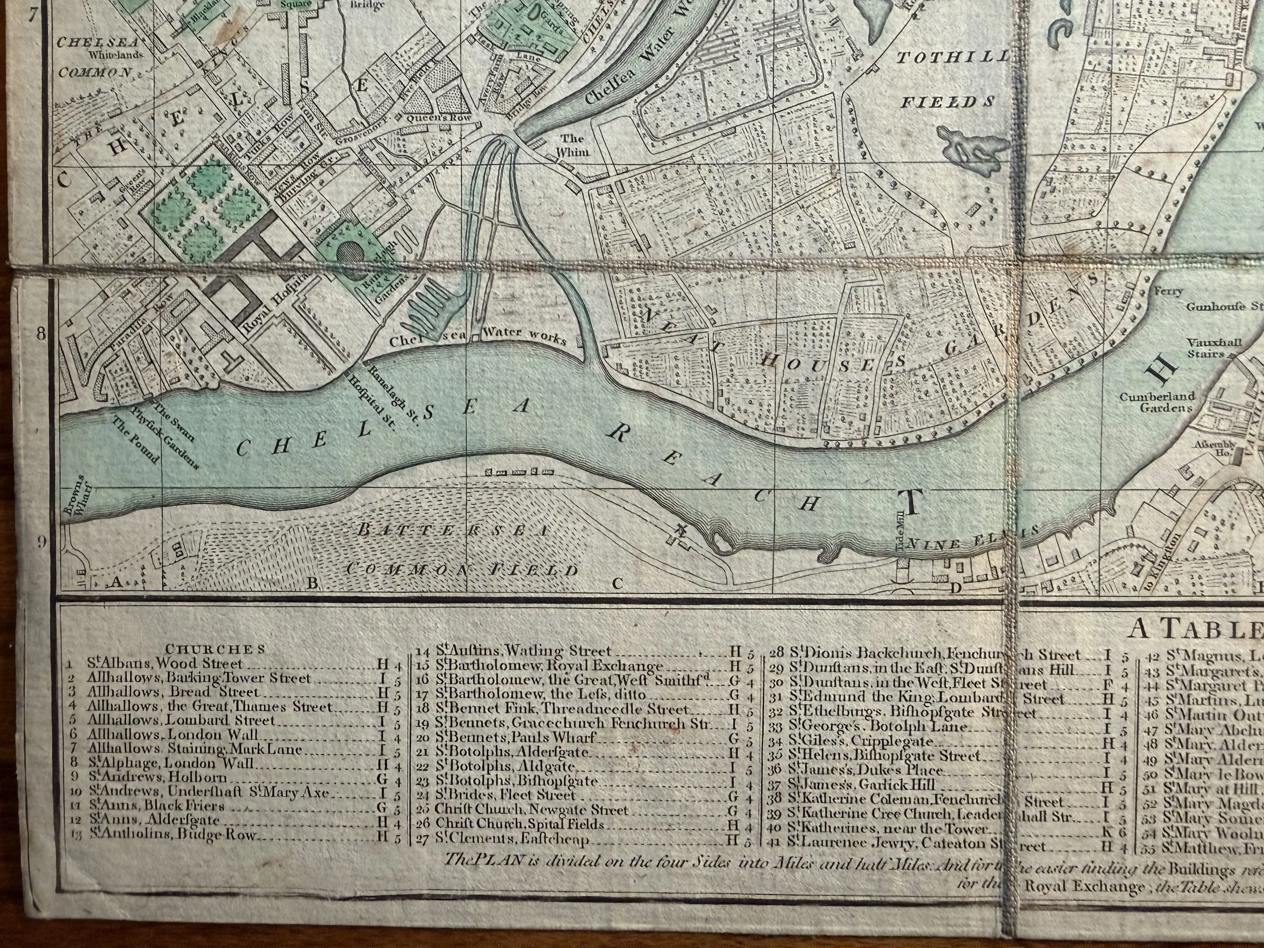 Image 14 of 17
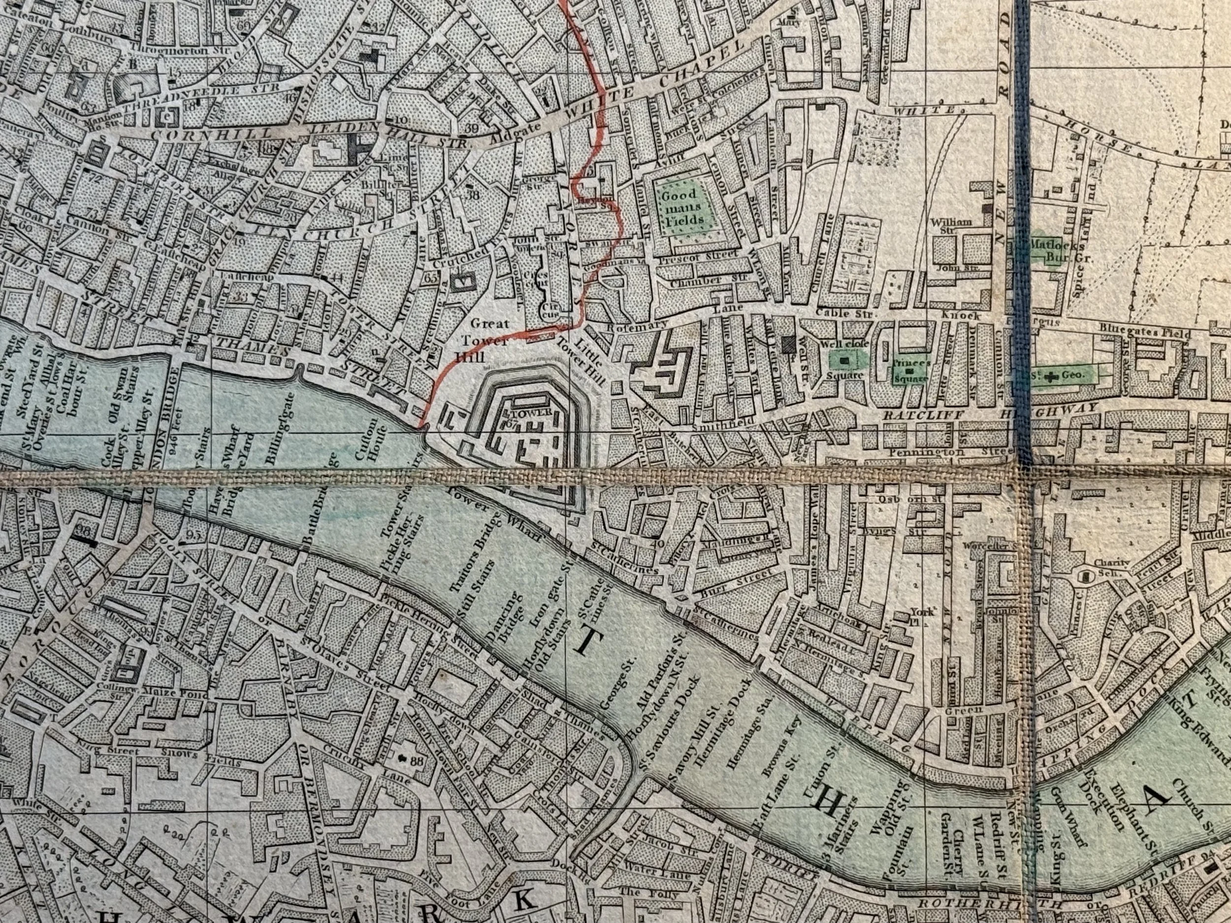 Image 15 of 17
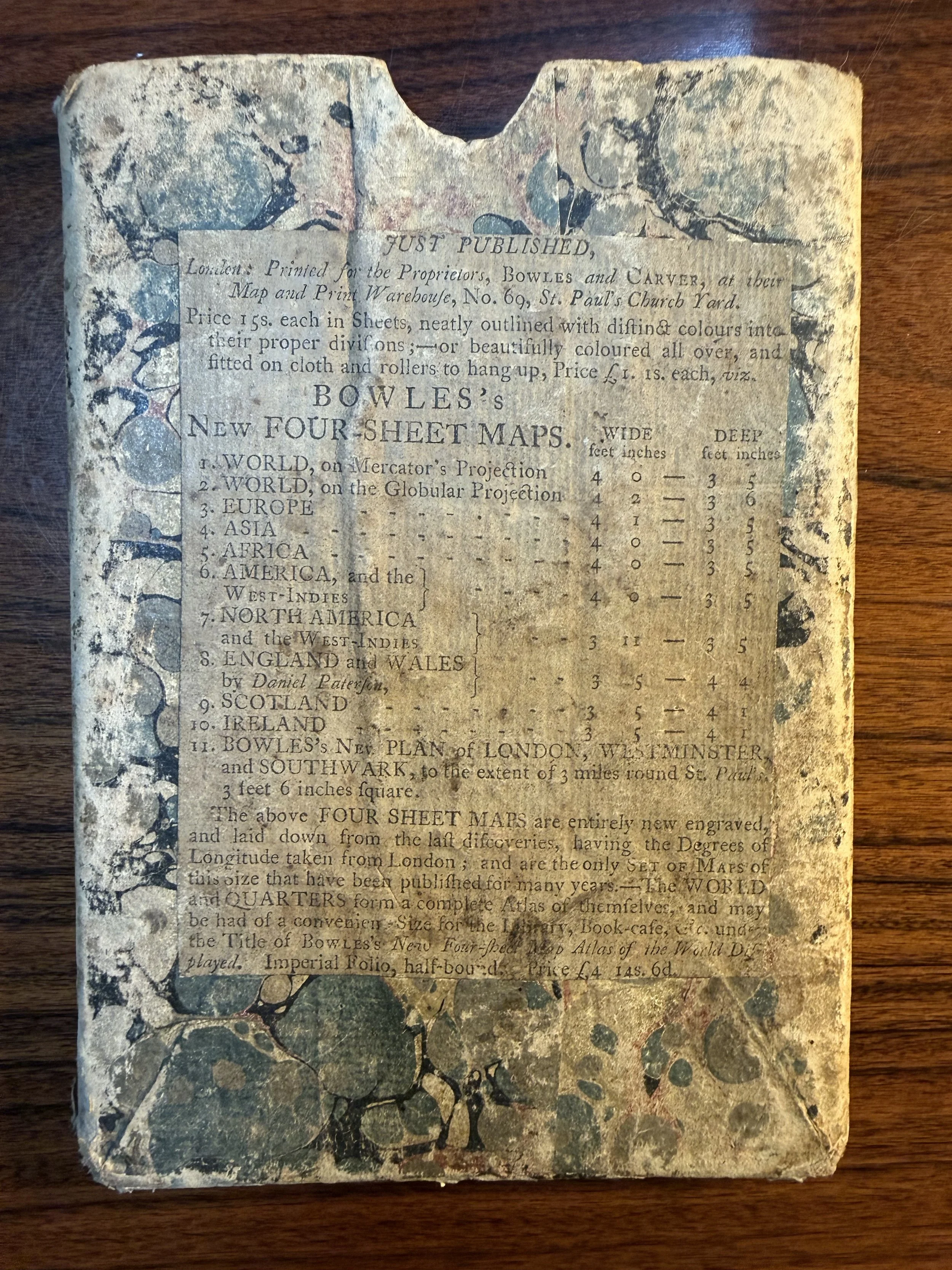 Image 16 of 17
 Image 17 of 17