Generalis Lotharingia Ducatus tabula, qua Accuratissimé Ostenduntur Ducatus Lotharingiae - Lorraine NE France - Nicolaes Visscher - Amsterdam, F. de Wit - c.1680
Nicolaes Visscher I (25 January 1618, Amsterdam – buried 11 September 1679, Amsterdam) was a Dutch engraver, cartographer and publisher. He was the son of Claes Janszoon Visscher. His son, Nicolaes Visscher II (1649–1702), also worked with him and continued the family tradition of mapmaking after his death. Visscher died in Amsterdam in 1679 and was buried in the Nieuwezijds Kapel on 11 September of that year, though a death year of 1709 is maintained by some sources.
His engraved double hemisphere map, Orbis Terrarum Nova et Accuratissima Tabula, was created in 1658 in Amsterdam. It also contains smaller northern and southern polar projections. The border is decorated with mythological scenes, one in each corner, drawn by the painter Nicolaes Berchem, showing Zeus, Neptune, Persephone and Demeter. It is an early example of highly decorated Dutch world maps.
Frederik de Wit (born Frederik Hendriksz; c. 1629 – July 1706) was a Dutch cartographer and artist.
Frederik de Wit was born Frederik Hendriksz. He was born to a Protestant family in about 1629, in Gouda, a small city in the province of Holland, one of the seven united provinces of the Netherlands. His father Hendrik Fredericsz (1608 – 29 July 1668) was a hechtmaecker (knife handle maker) from Amsterdam, and his mother Neeltij Joosten (d. before 1658) was the daughter of a merchant in Gouda. Frederik was married on 29 August 1661, to Maria van der Way (1632–1711), the daughter of a wealthy Catholic merchant in Amsterdam. From about 1648 until his death at the end of July 1706, De Wit lived and worked in Amsterdam. Frederik and Maria had seven children, but only one Franciscus Xaverius (1666–1727) survived them.
By 1648, during the height of the Dutch Golden Age, De Wit had moved from Gouda to Amsterdam. As early as 1654, he had opened a printing office and shop under the name "De Drie Crabben" (the Three Crabs) which was also the name of his house on the Kalverstraat. In 1655, De Wit changed the name of his shop to the "Witte Pascaert" (the White Chart). Under this name De Wit and his firm became internationally known.
This map is in excellent condition for its 344 year age with no visible defects. The vibrate engraving lines and colours are very good. Pricing and grading commensurate.
 Image 1 of 22
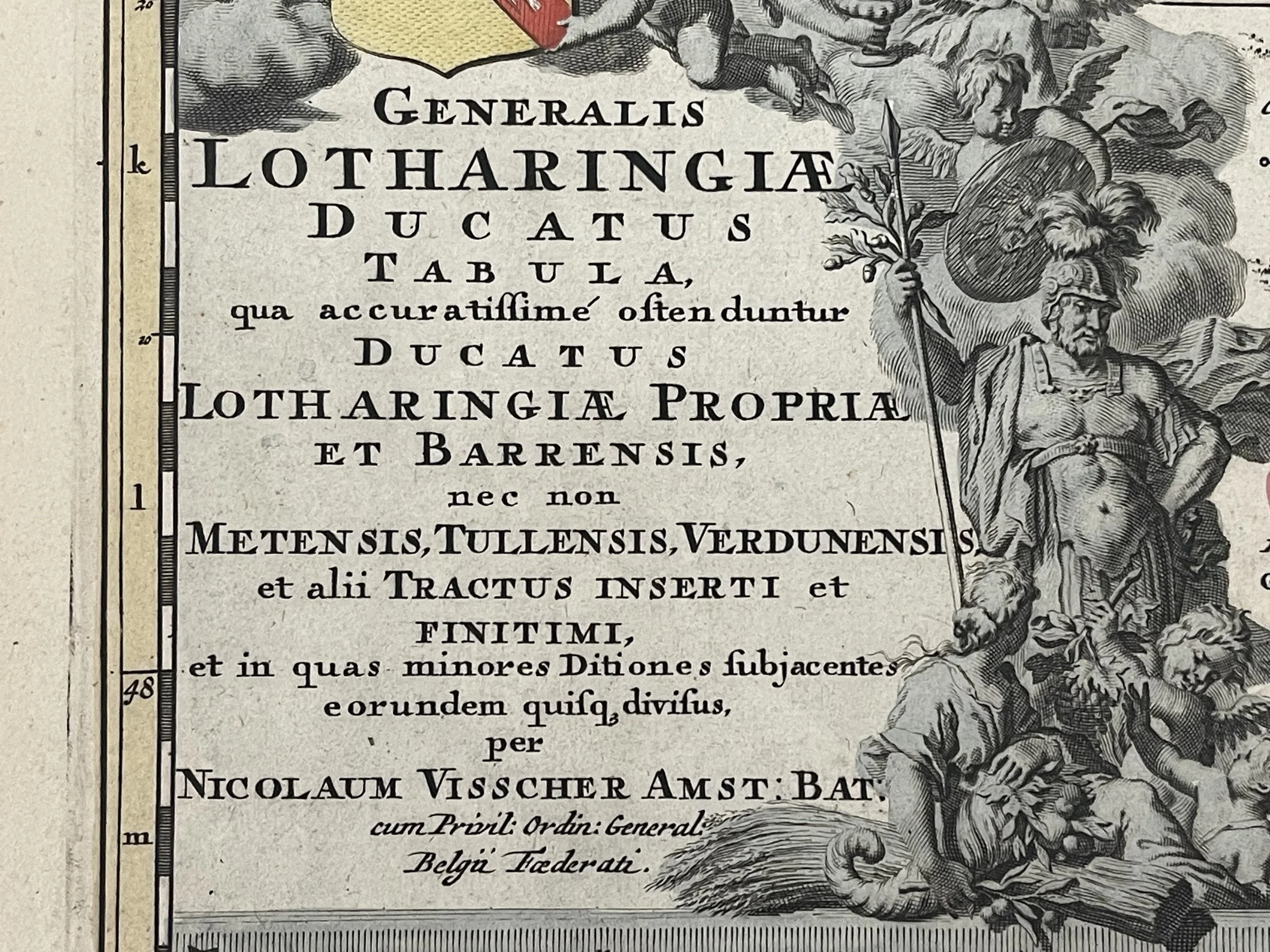 Image 2 of 22
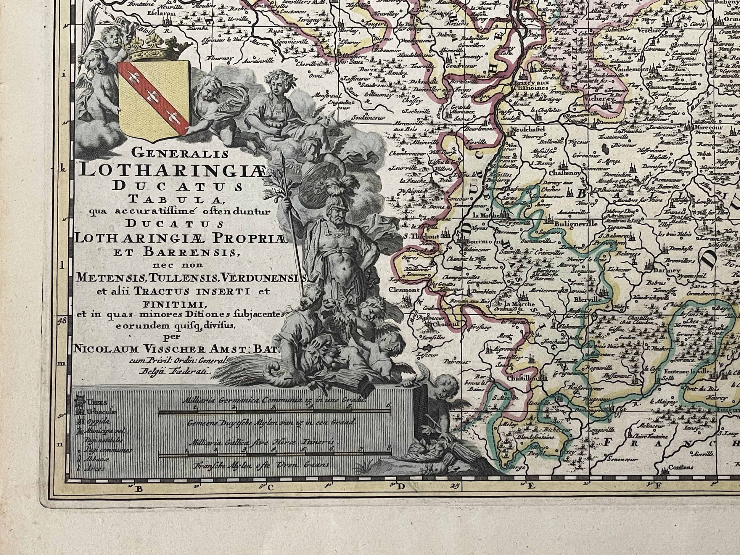 Image 3 of 22
 Image 4 of 22
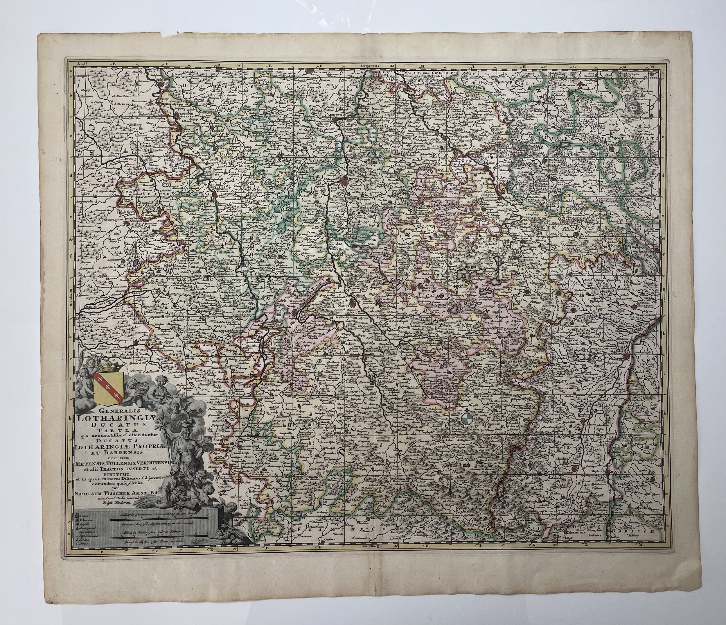 Image 5 of 22
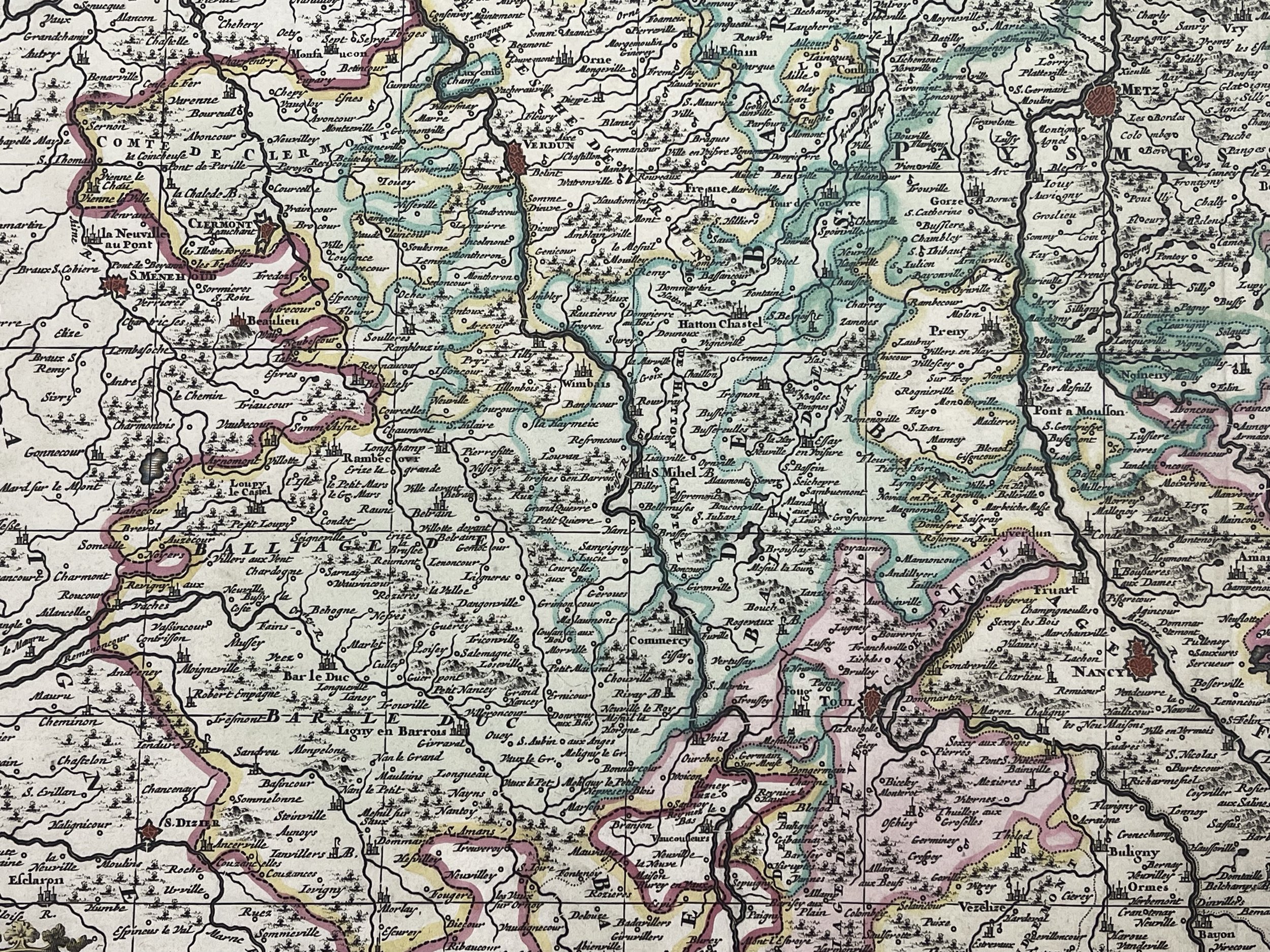 Image 6 of 22
 Image 7 of 22
 Image 8 of 22
 Image 9 of 22
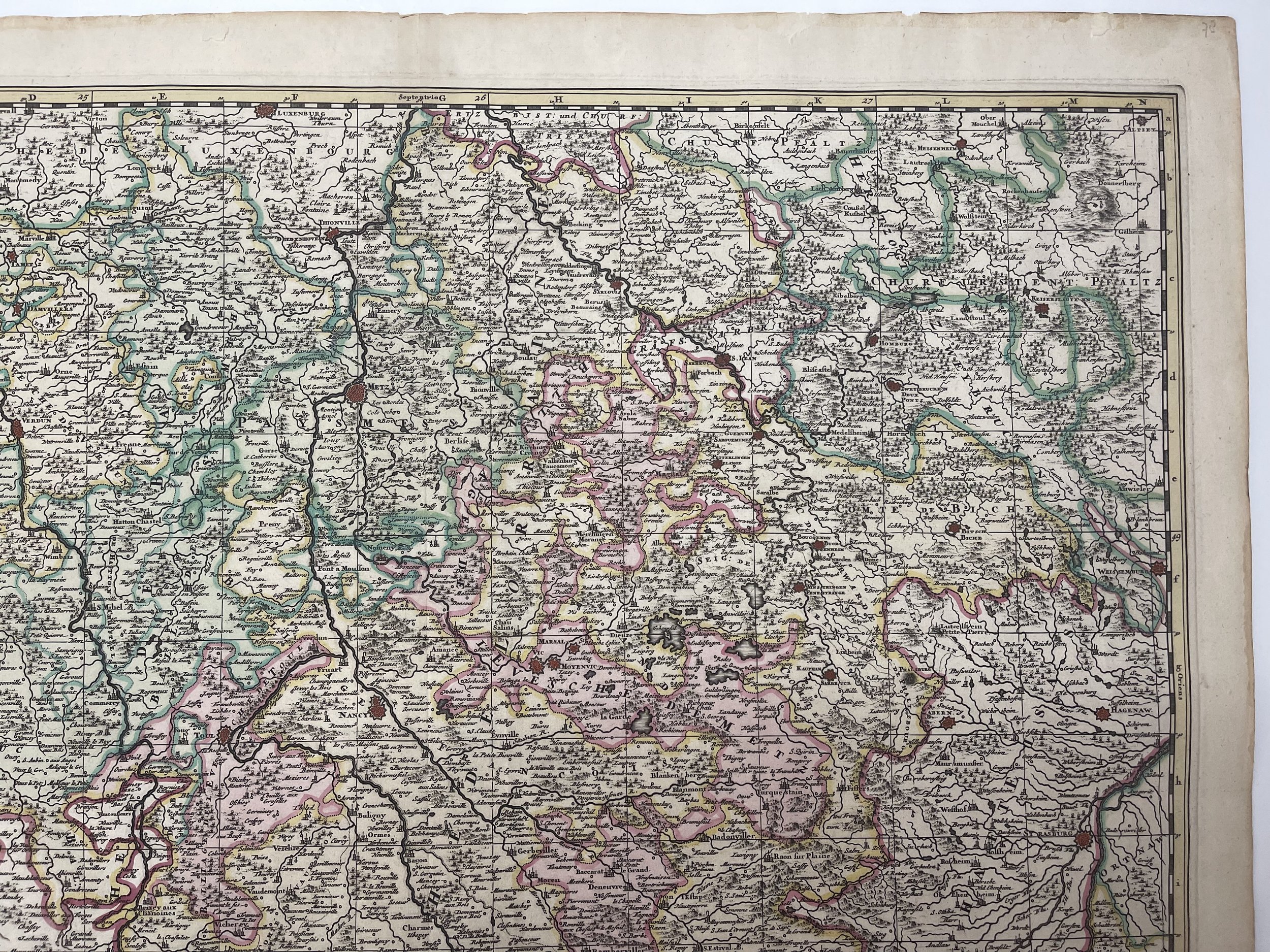 Image 10 of 22
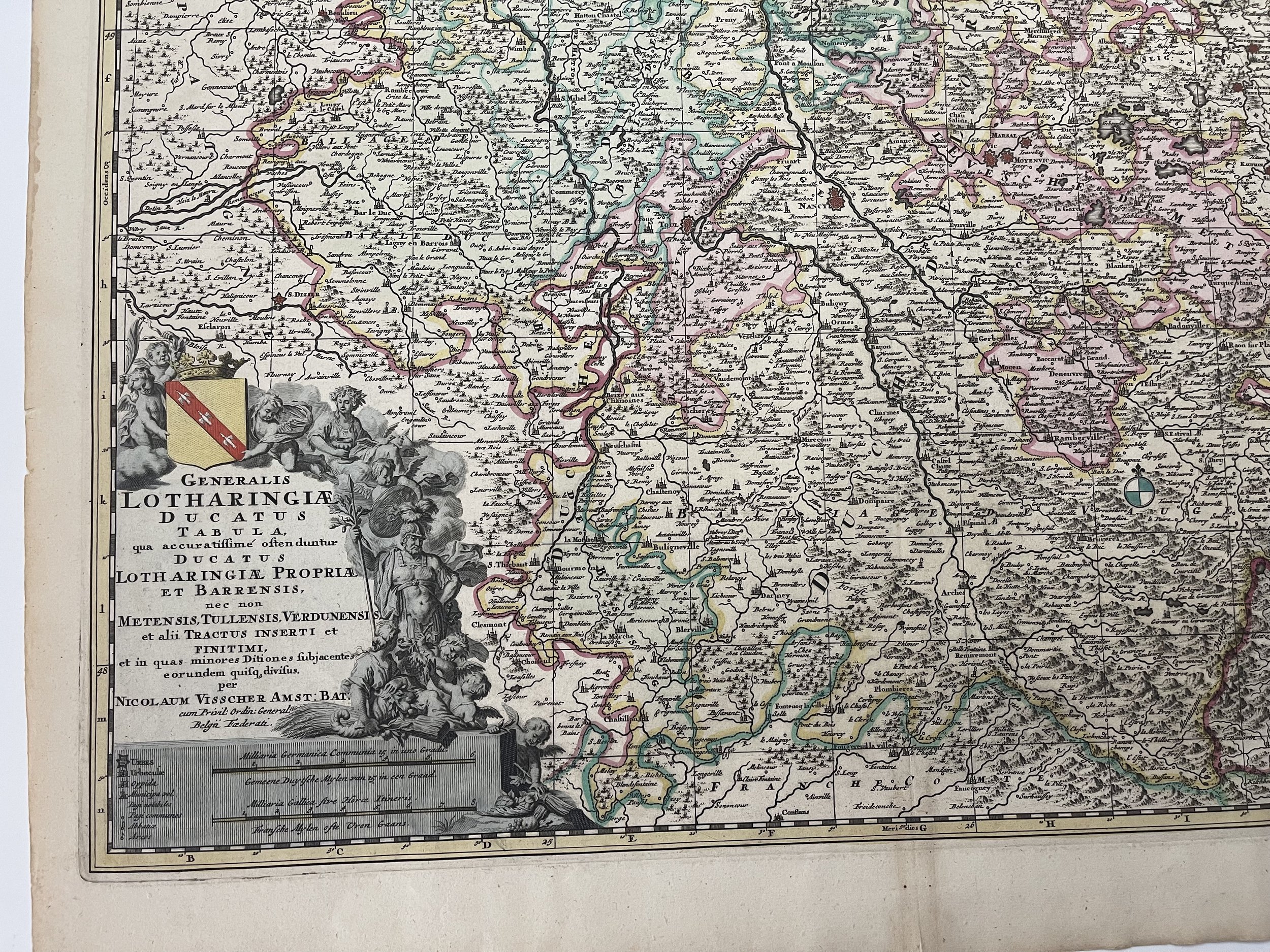 Image 11 of 22
 Image 12 of 22
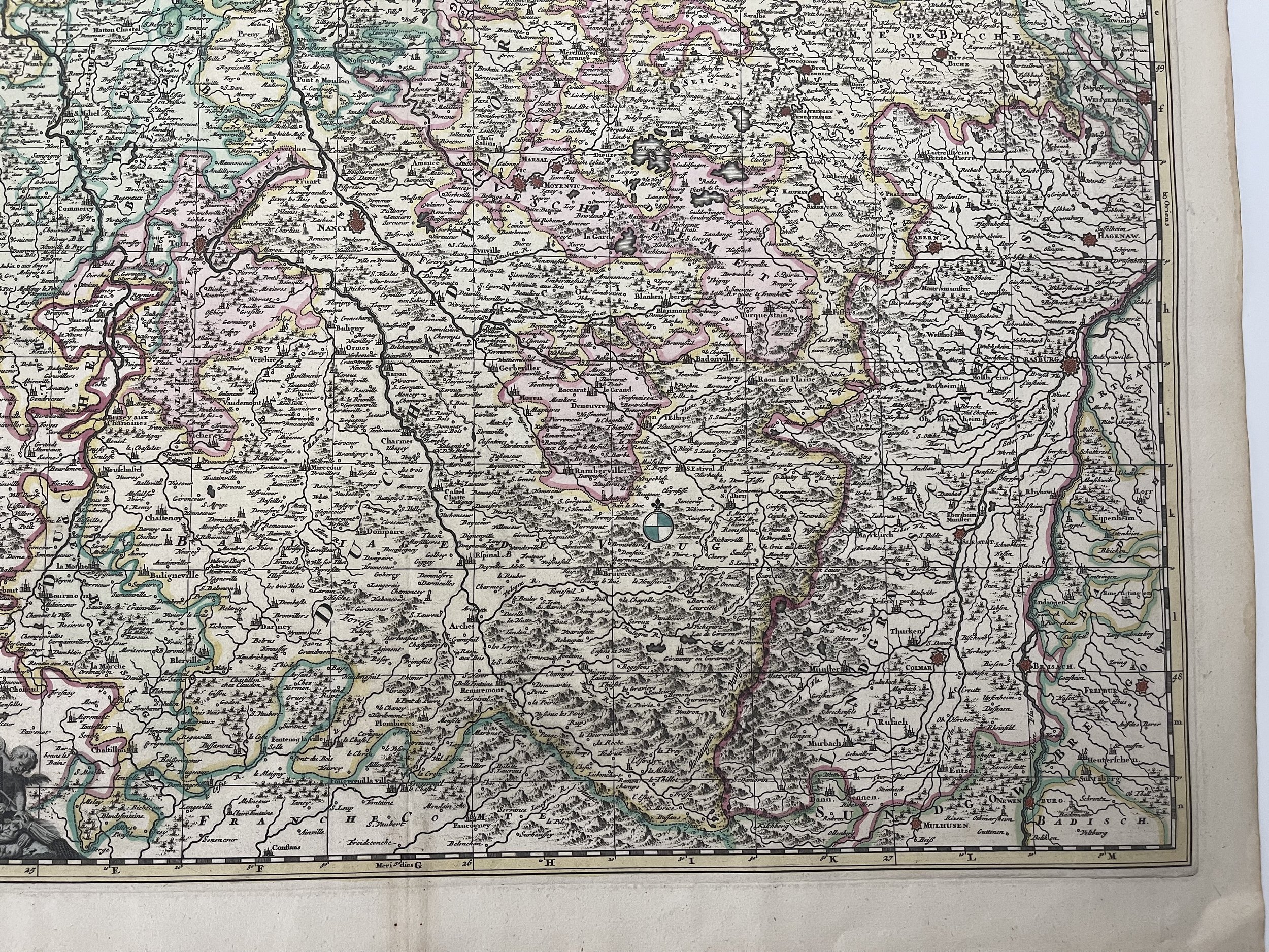 Image 13 of 22
 Image 14 of 22
 Image 15 of 22
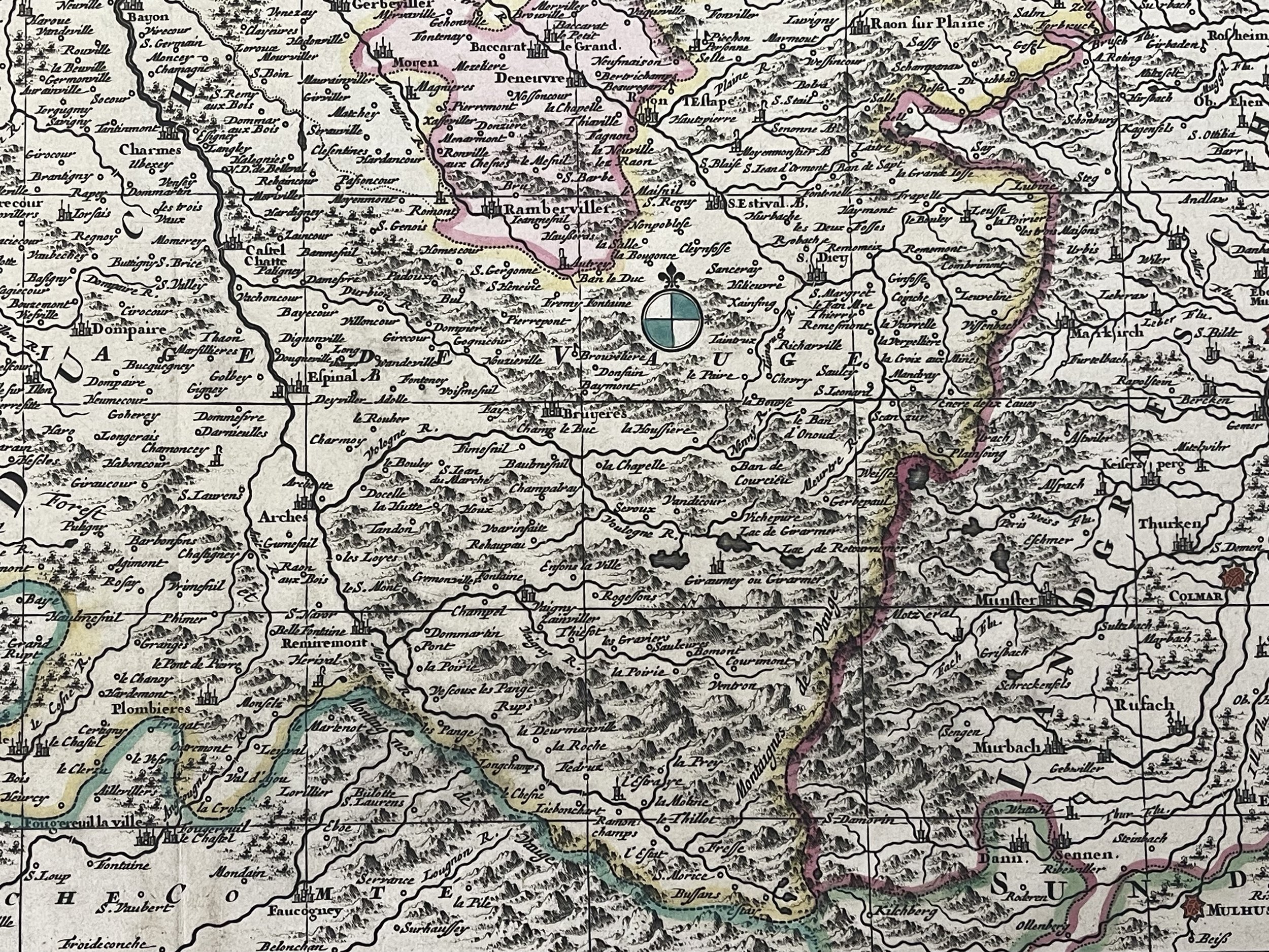 Image 16 of 22
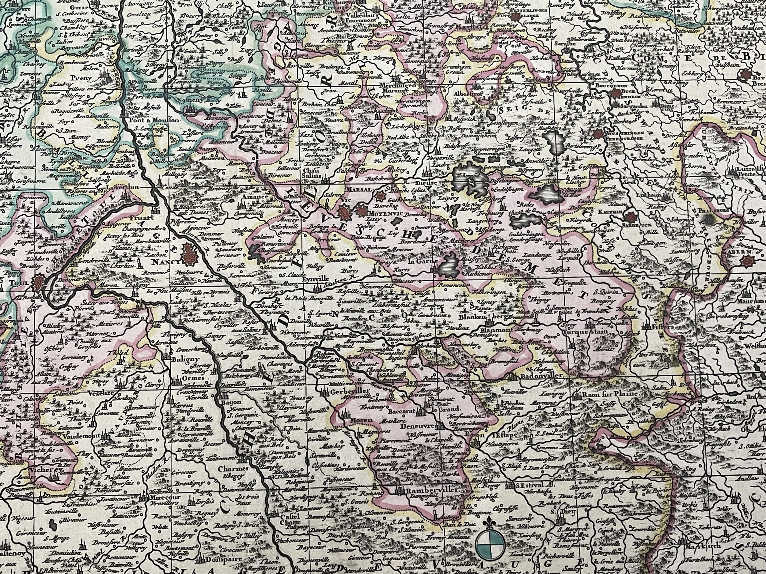 Image 17 of 22
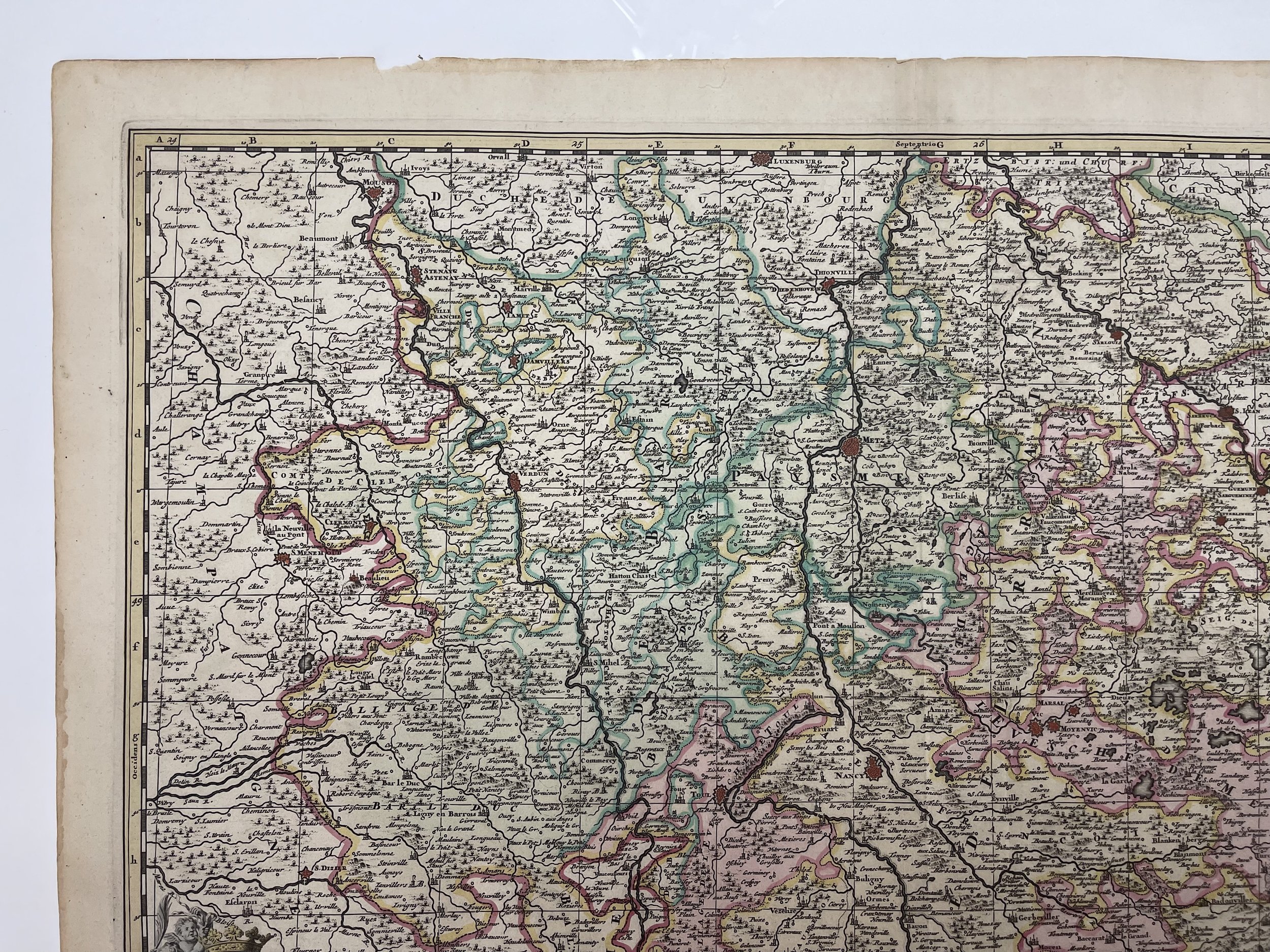 Image 18 of 22
 Image 19 of 22
 Image 20 of 22
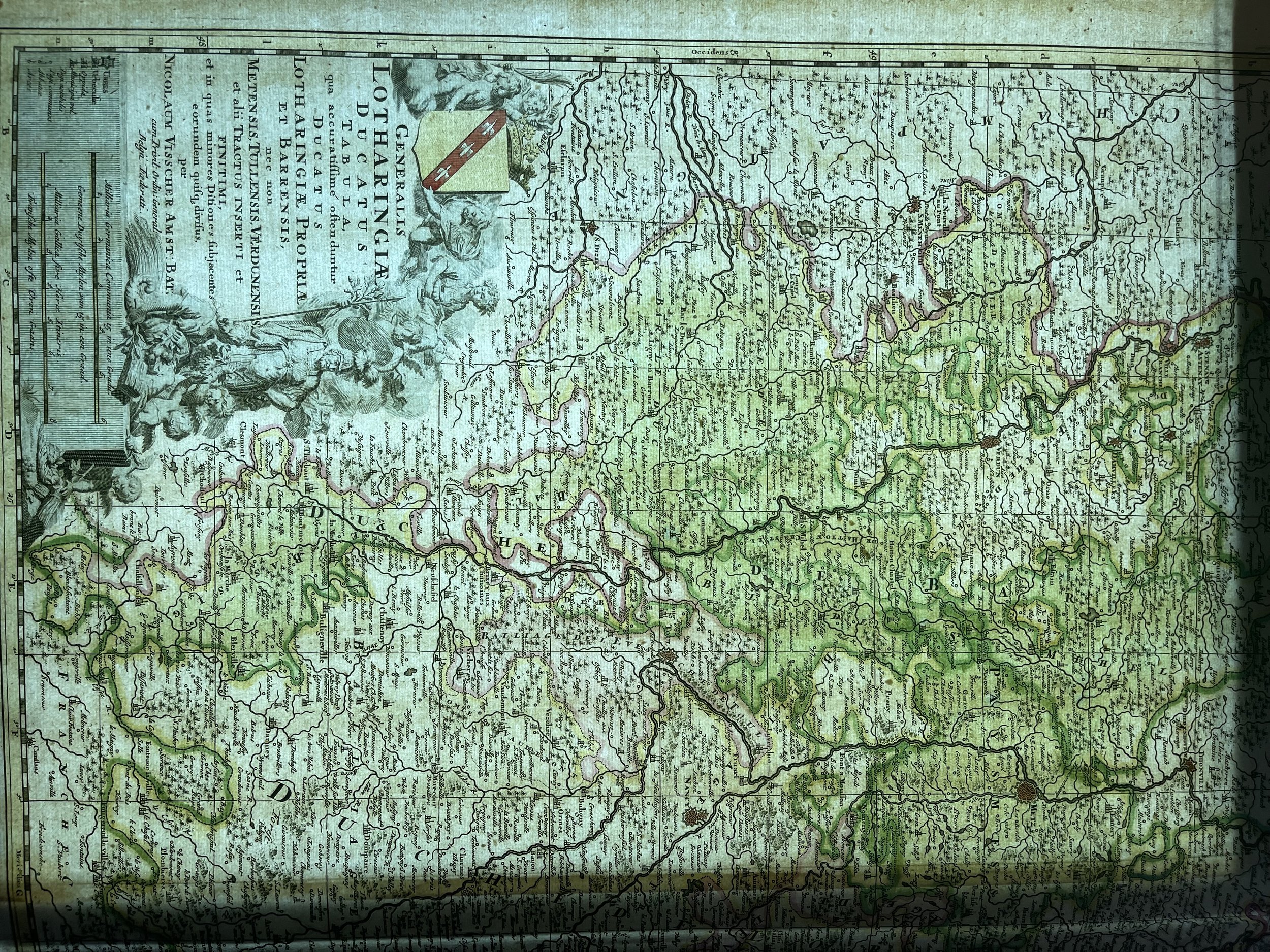 Image 21 of 22
 Image 22 of 22