Large Harbours and islands in the British Channel 1806 map: engraved to accompany the general chart of R. Adml. Knight, &c. / John Purdy, delint. ; J. Bye sculpt. Publisher P. Mason.
SCARCE - I have only located this map in two places. There is a damaged copy in the US Yale University Library and another documented in the Royal Museum Greenwich London.
Scale: circa 1:600,000. Chart of the English Channel, with parts of the North Sea and St Georges Channel. With eight insets and nineteen views. Rhumb line grid. Variation. Mercators projection. Coordinates given. Blue back Insets: [Mounts Bay] 1:130,000 bar; [Long Ships] 1:130,000 bar; [Portsmouth and part of the Isle of Wight] 1:80,000 bar; [Sheerness] 1:100,000 bar; [Exmouth] 1:73,000 bar; [Ushant] 1:120,000 bar; Scilly Isles 1:65,000 bar; [Dartmouth] 1:35,000 bar
John Purdy (1773–1843) was an important English hydrographer. His work and influence extended beyond hydrography with the coinage of the term pharology, the study of modern lighthouses and their designs. Purdy's work Memoir, descriptive and explanatory, to accompany the New Chart of the Atlantic Ocean was adapted and improved; continuing to be released in its fifteenth edition fifty years after his death.
Admiral Sir John Knight, KCB (bap. 21 February 1747 – 16 June 1831) was a senior British Royal Navy officer during the late eighteenth and nineteenth centuries most noted for his activities as a post captain during the American and French Revolutionary Wars. Serving with the Caribbean Fleet during the American war, Knight fought several significant battles and was commended for his service and made tutor of the young Prince William. During the French wars he served with the North Sea fleet under Admiral Adam Duncan and was engaged at the Battle of Camperdown against the Dutch. During the Napoleonic Wars that followed he held a senior administrative role at Gibraltar and retired in 1815 to his home and eight children. Although Knight was respected professionally, he was not popular with his men and fellow officers and was criticised for his ability to maintain discipline and for his close relationship with his family which some suggested had a negative impact on his performance as an officer.
In the period 1801 to 1804, Benjamin Smith the Younger born in 1774, worked on Charles Smith's New English Atlas, specifically on the maps for Devon, Sussex and Berkshire.
Joseph Bye 1802-1806 (fl. c.) – Printer & Engraver of lettering. Published his own work. 34, Duke Street, Smithfield
In 1810 whilst sailing to Portugal for business, Smith and partner engraver Joseph Bye were captured by a French privateer and imprisoned in France for 4 years until peace was declared in 1814. They returned to Edinburgh, where they worked as journeyman engravers for book sellers and map engravers W.H. Lizars. William Home Lizars (1788 – 30 March 1859) was a Scottish painter, engraver and publisher.
Joseph Bye and Benjamin Smith were sentenced to death for uttering forged notes in 1817.
This map is on heavy paper and is in excellent condition for its rarity and hydrographic sea chart use. There aren’t any examples in circulation that I can find, only in institutions as detailed above. Rare survivor. Pricing and grading commensurate.
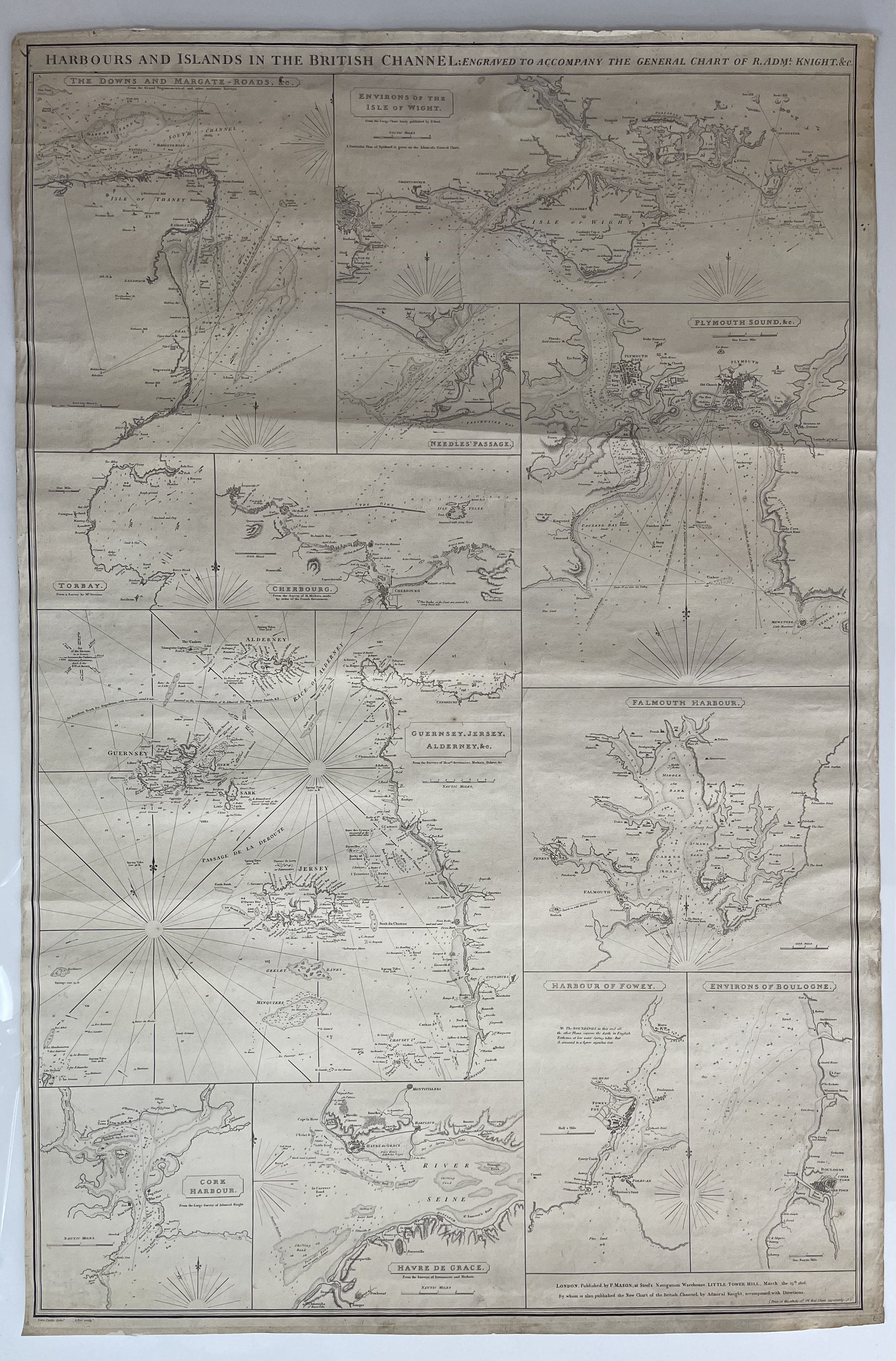 Image 1 of 26
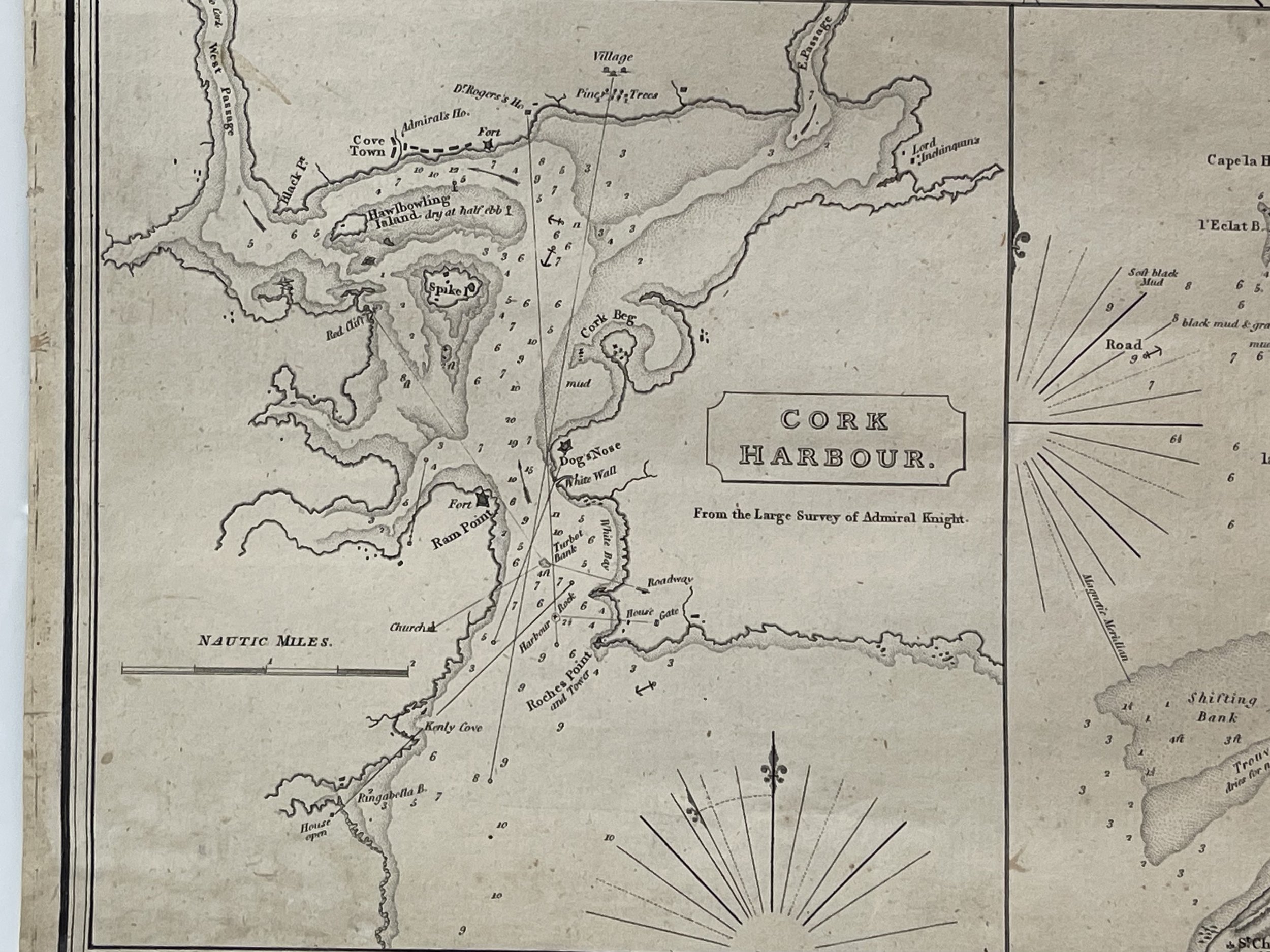 Image 2 of 26
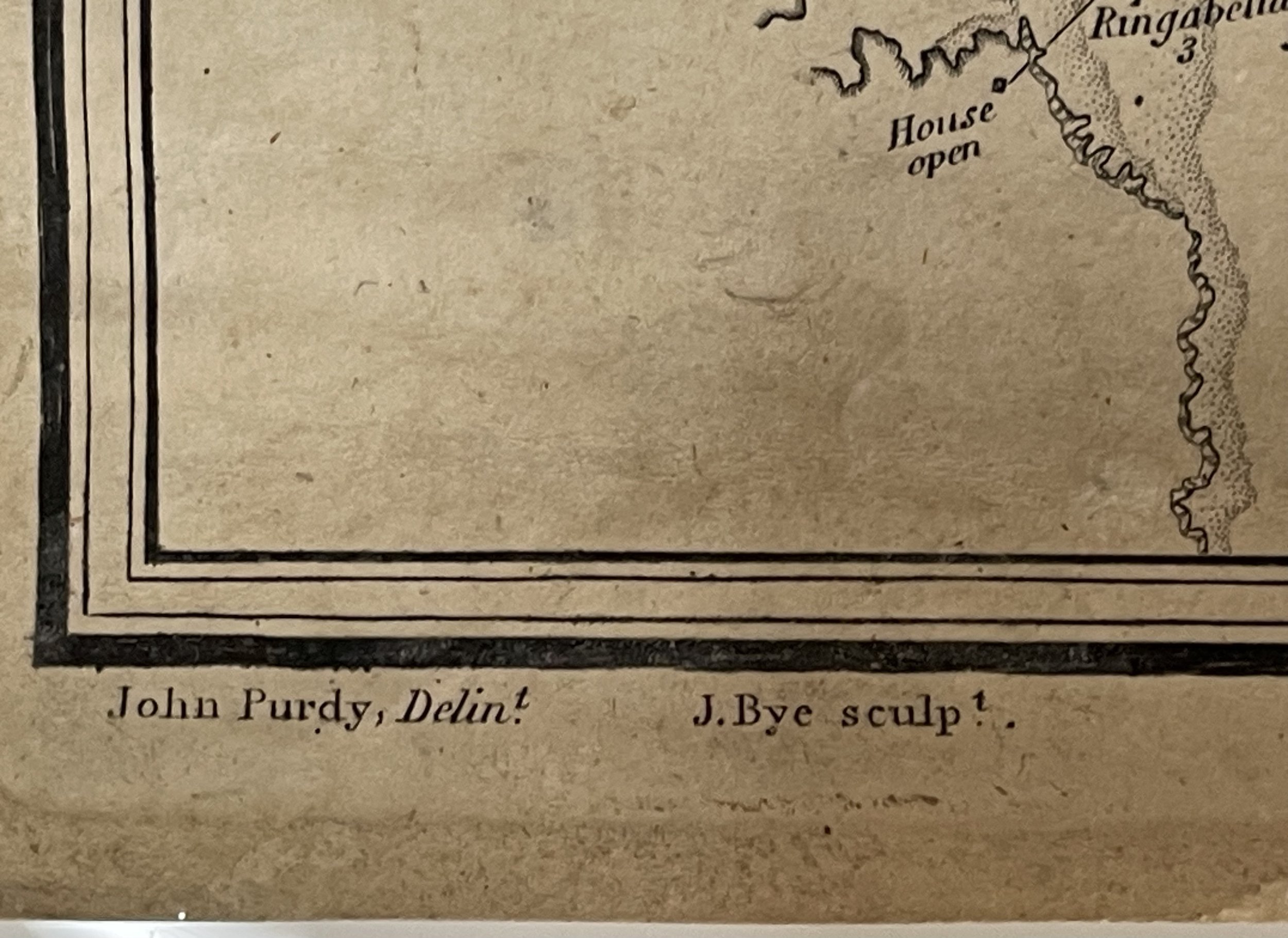 Image 3 of 26
 Image 4 of 26
 Image 5 of 26
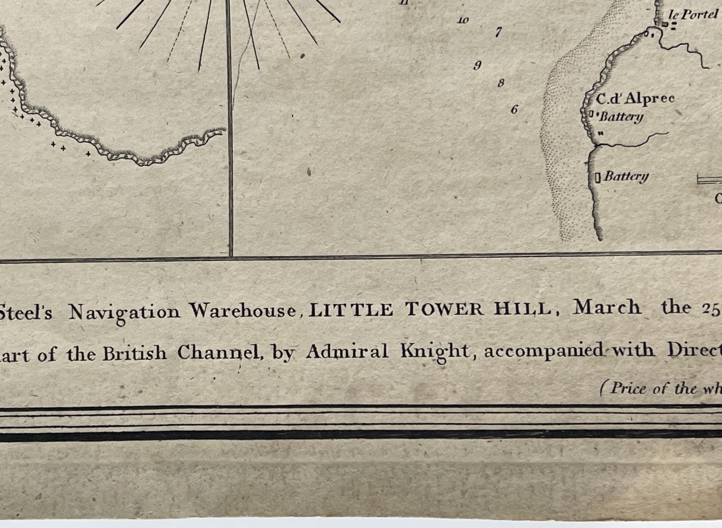 Image 6 of 26
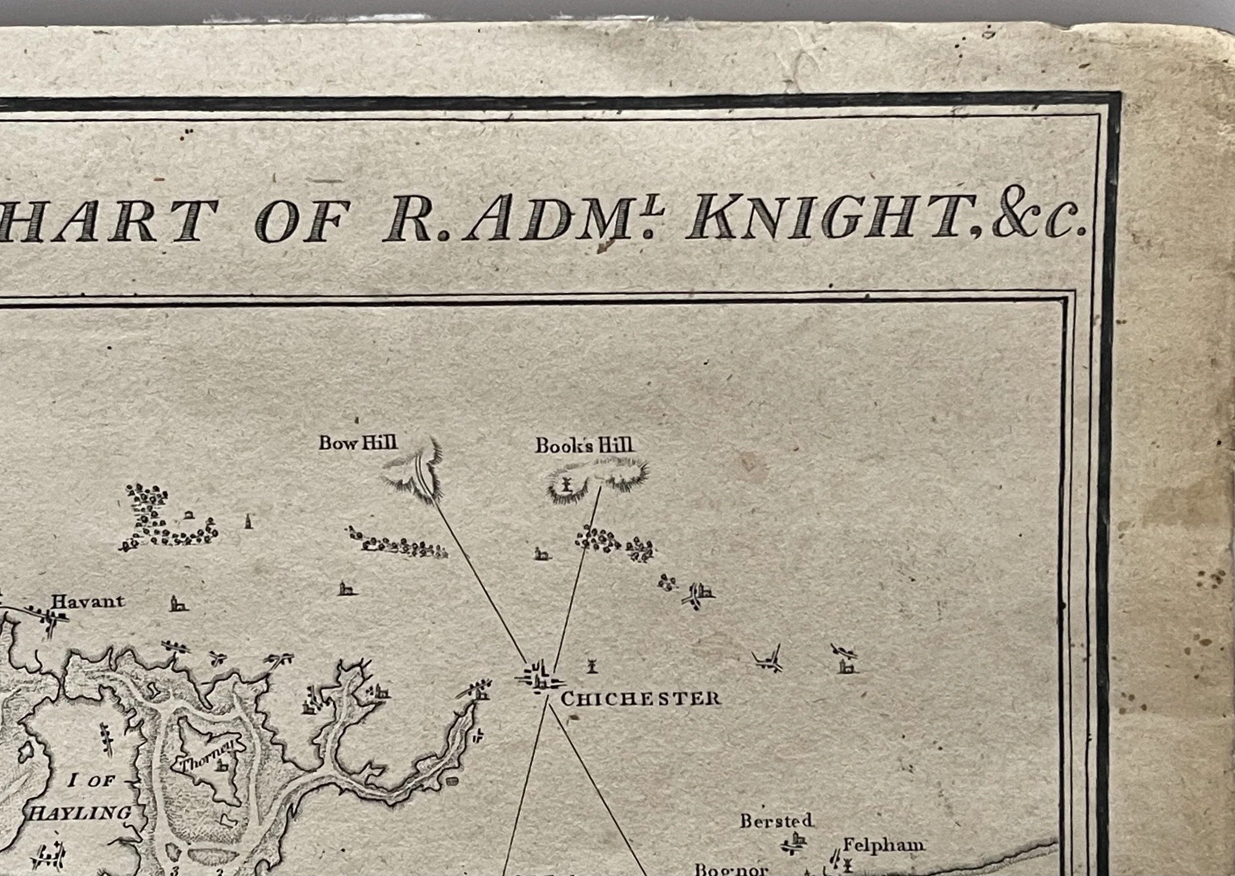 Image 7 of 26
 Image 8 of 26
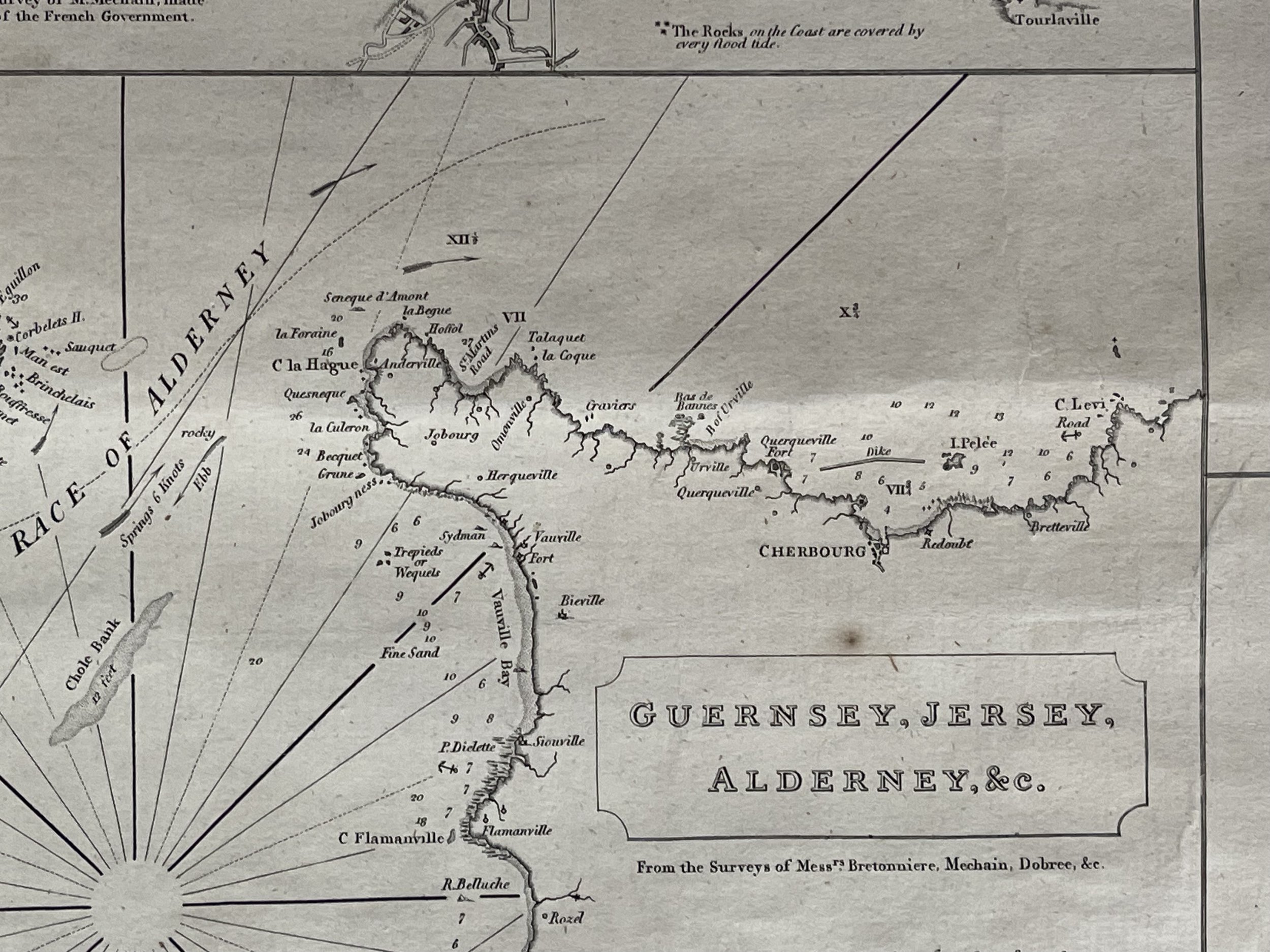 Image 9 of 26
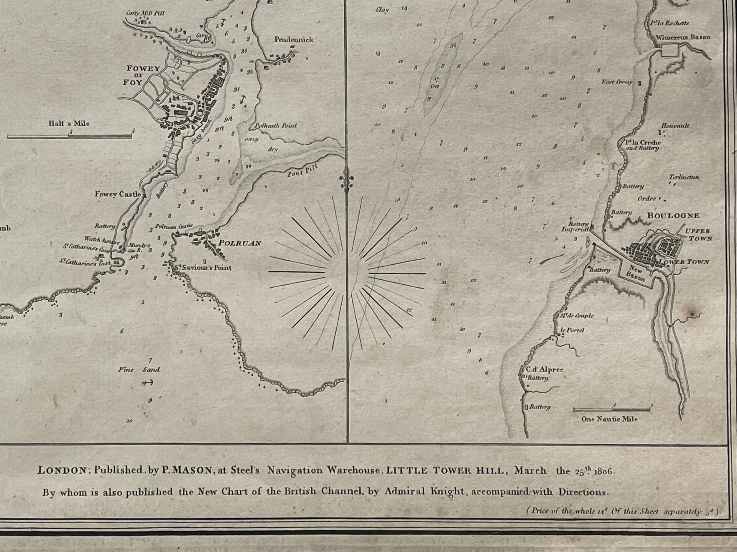 Image 10 of 26
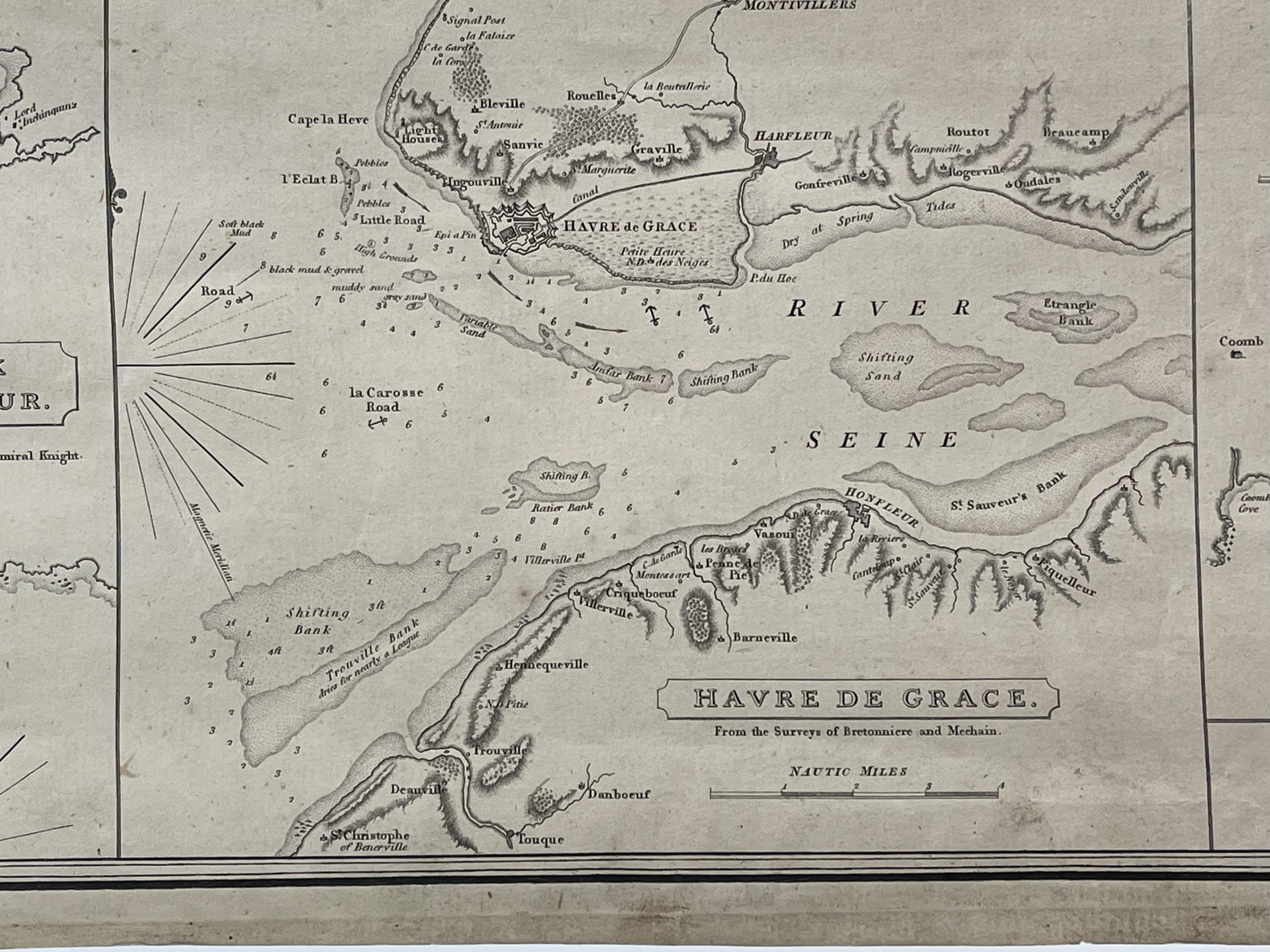 Image 11 of 26
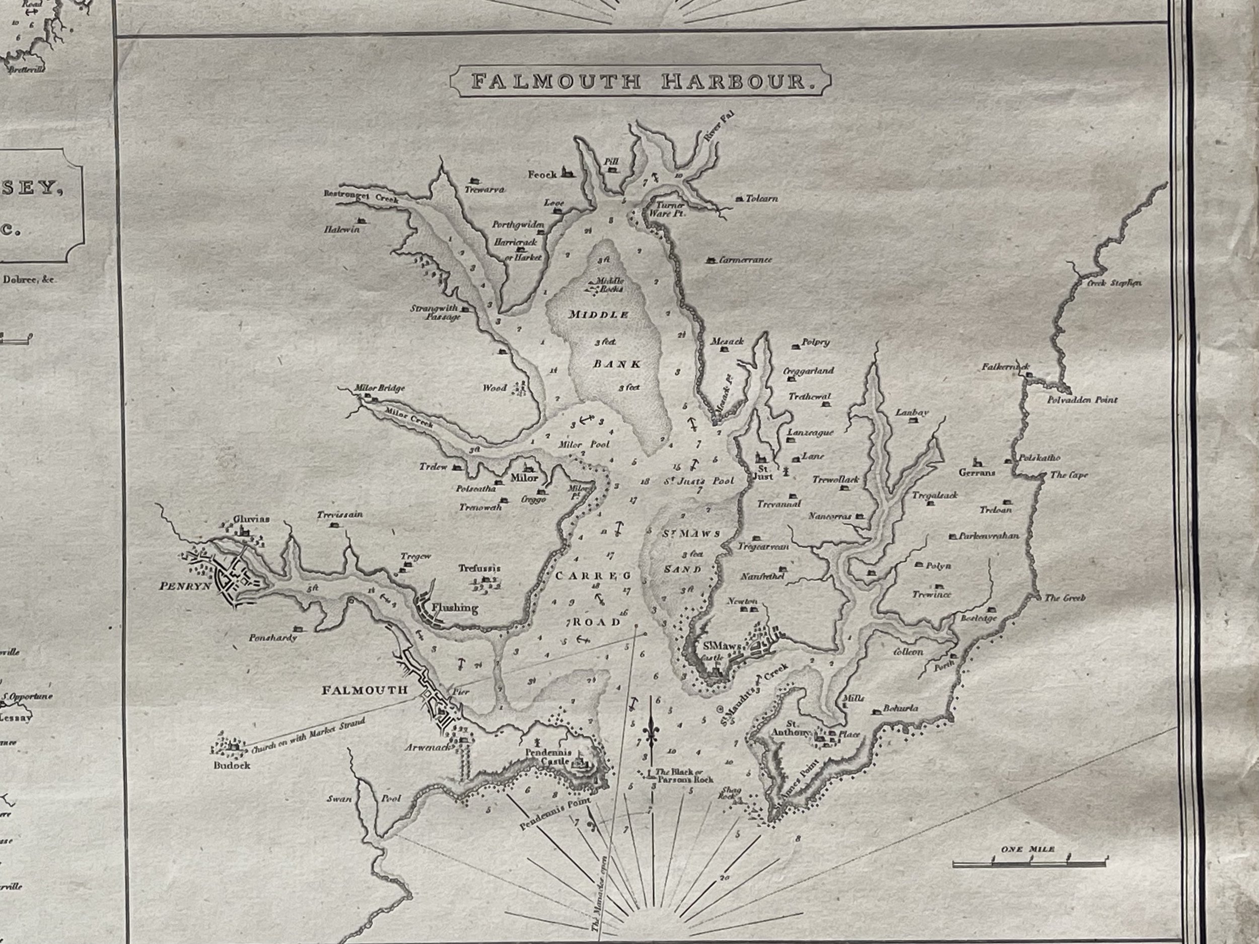 Image 12 of 26
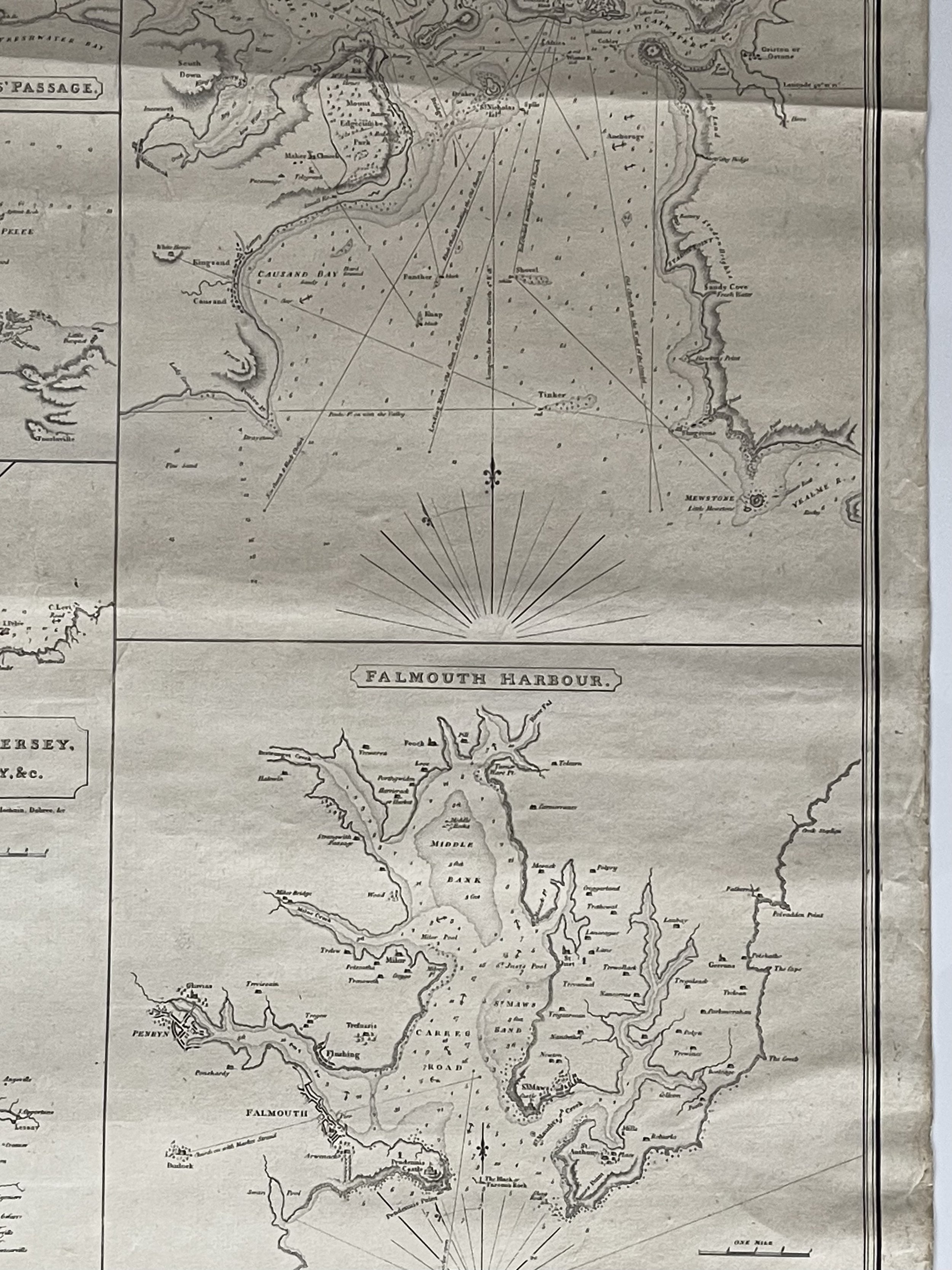 Image 13 of 26
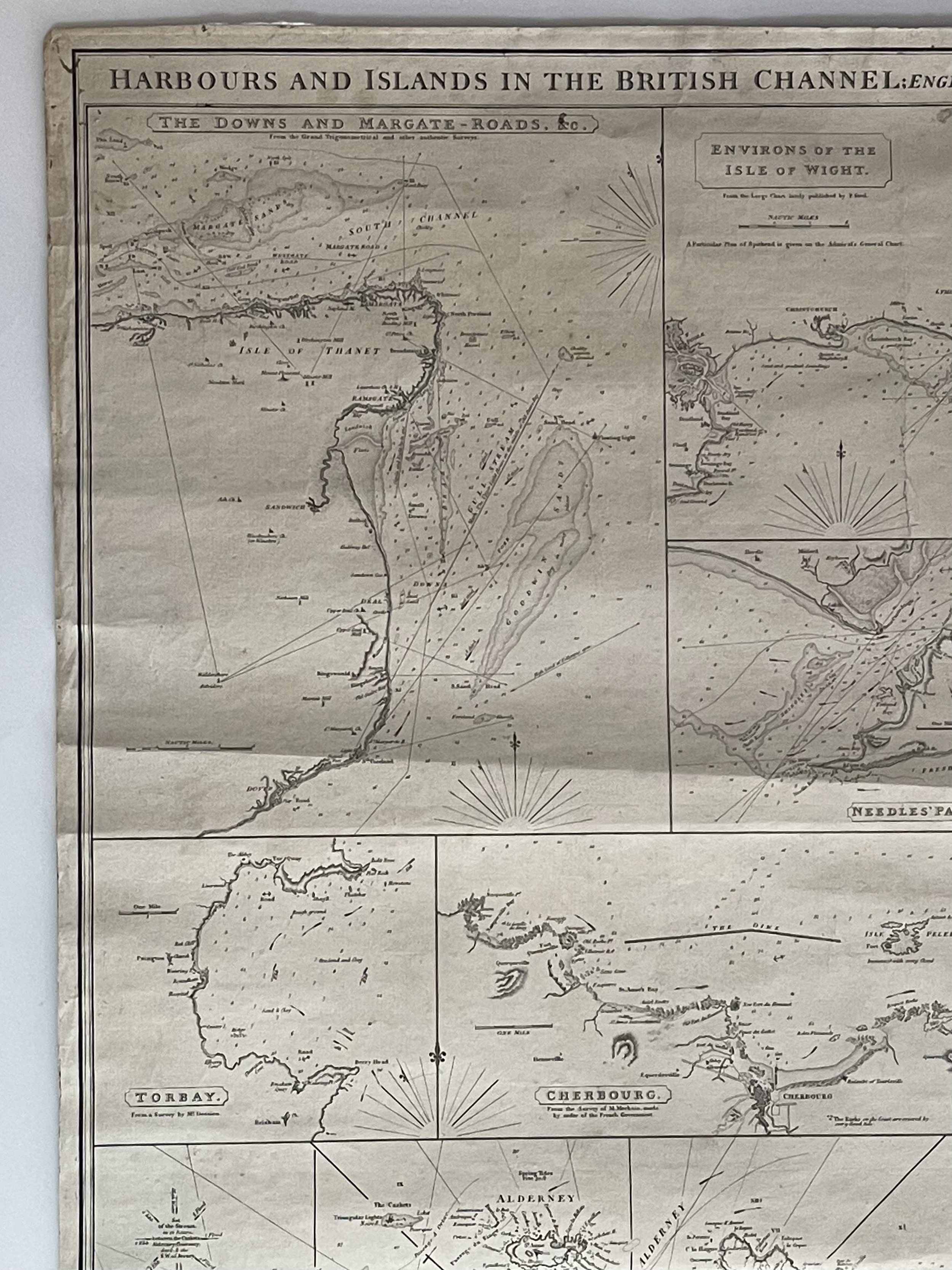 Image 14 of 26
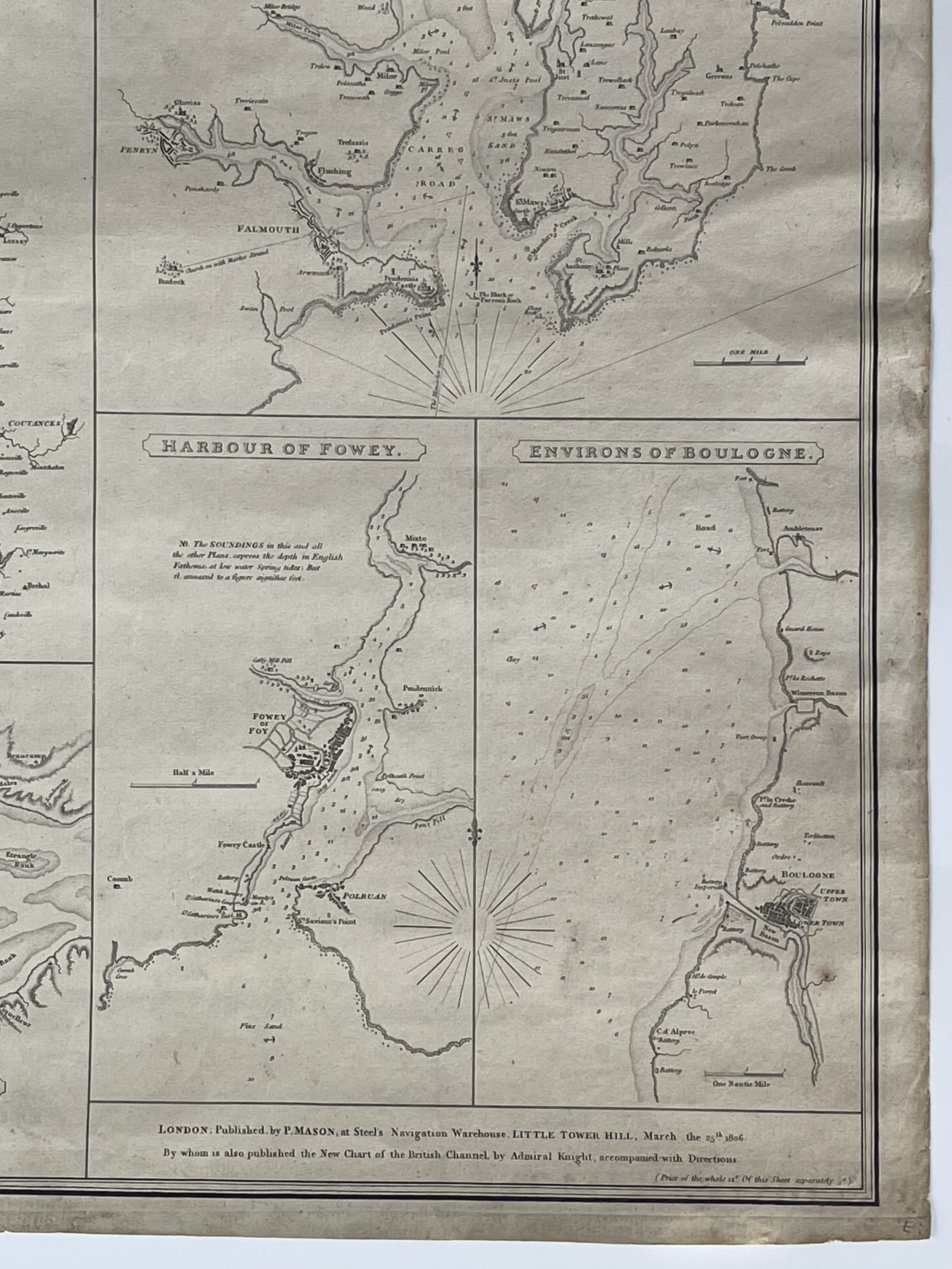 Image 15 of 26
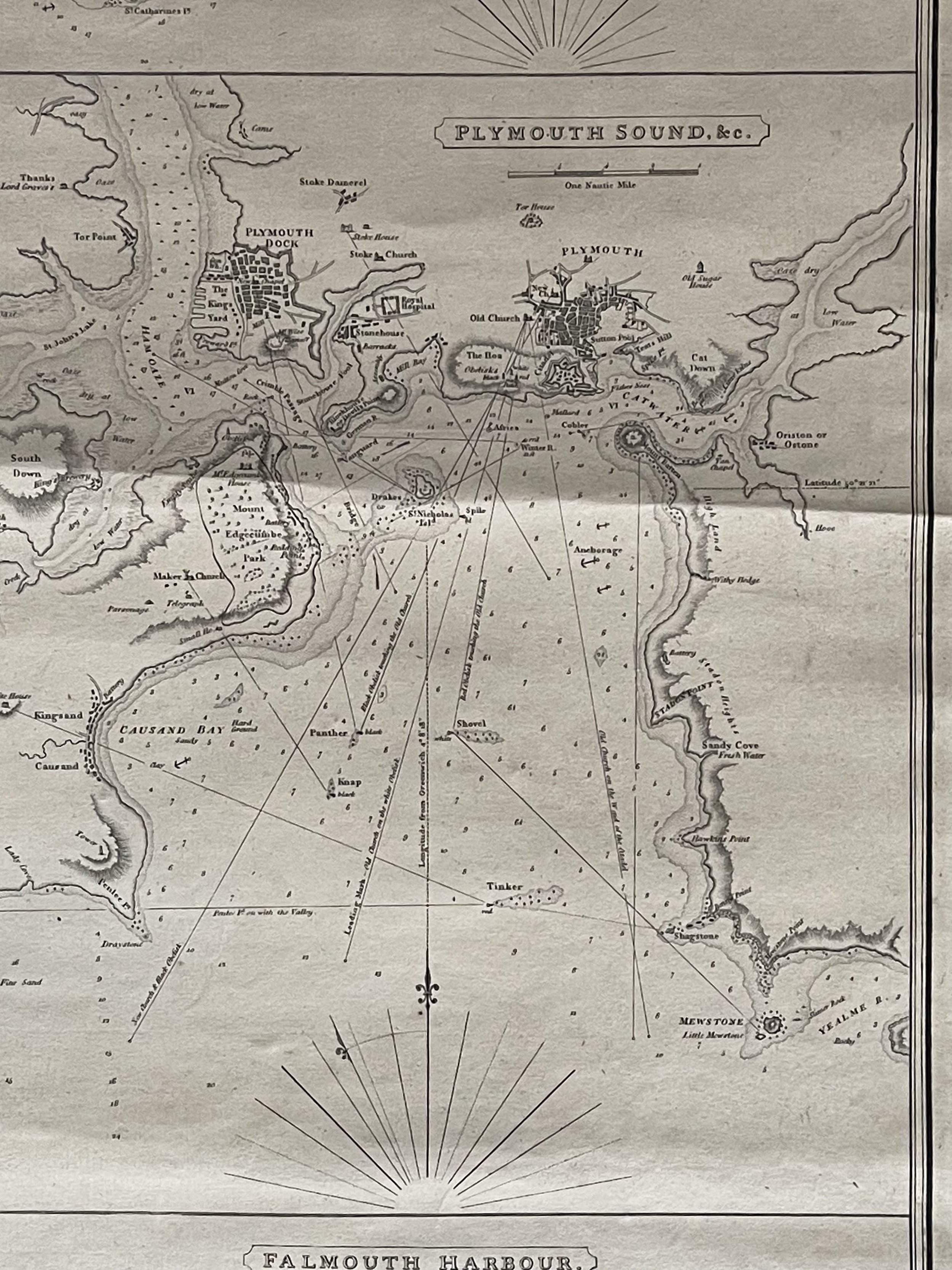 Image 16 of 26
 Image 17 of 26
 Image 18 of 26
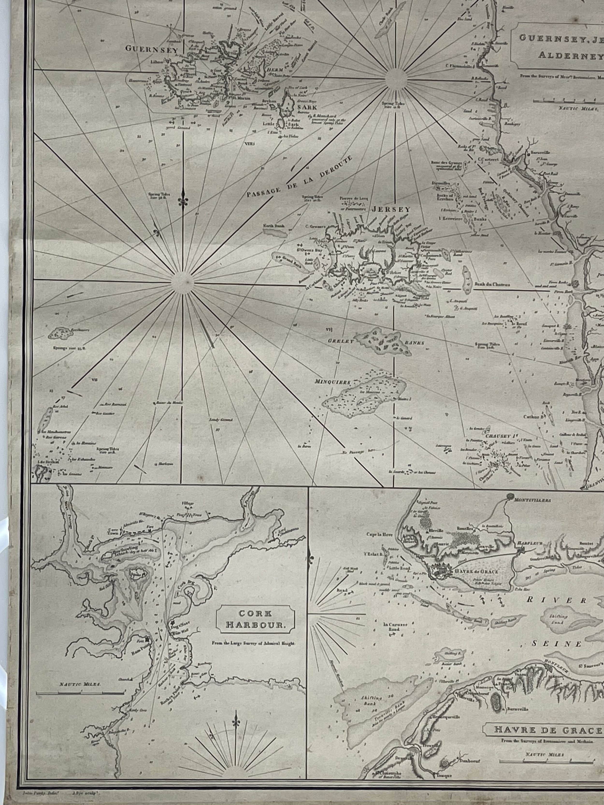 Image 19 of 26
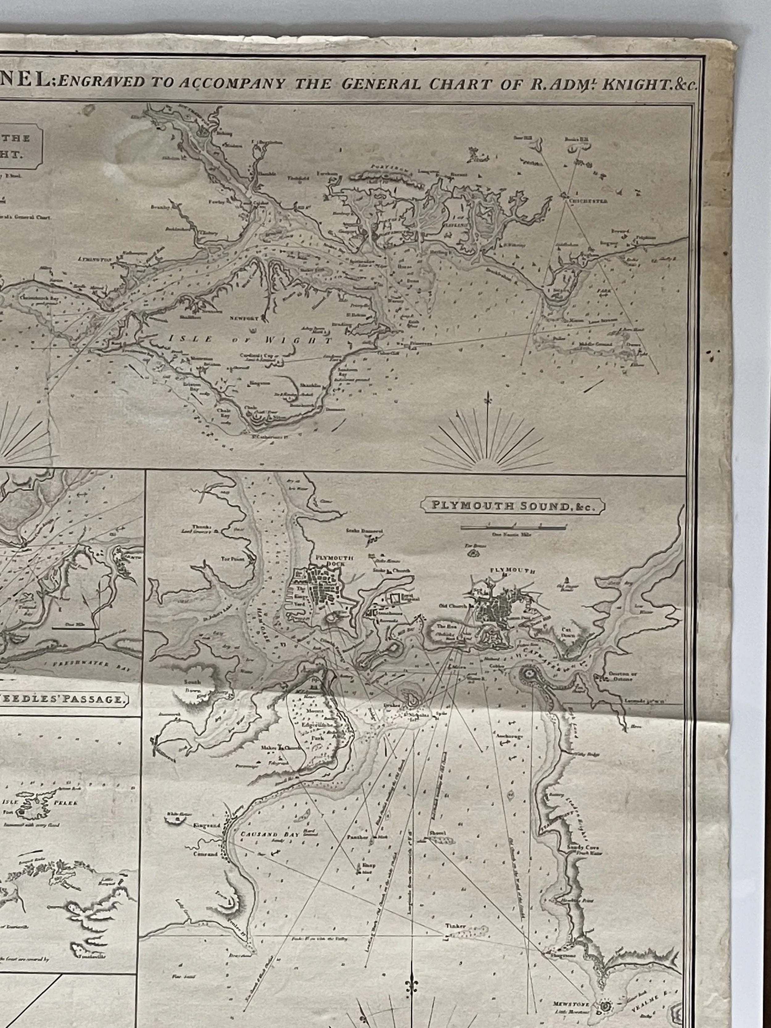 Image 20 of 26
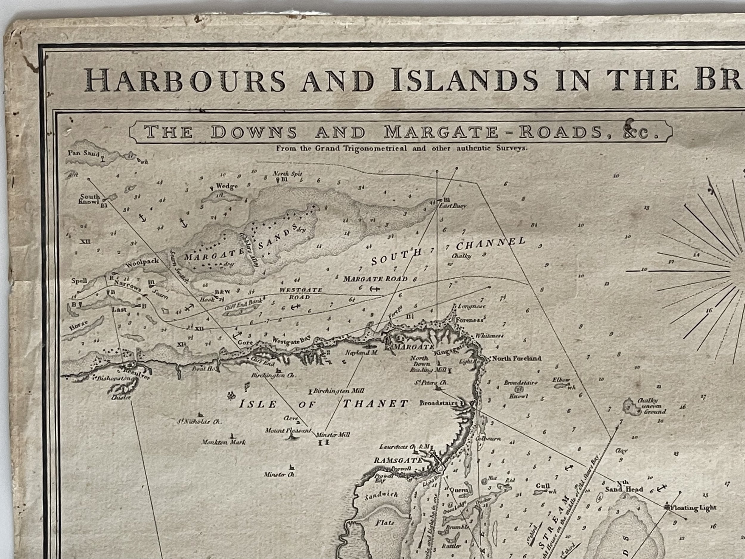 Image 21 of 26
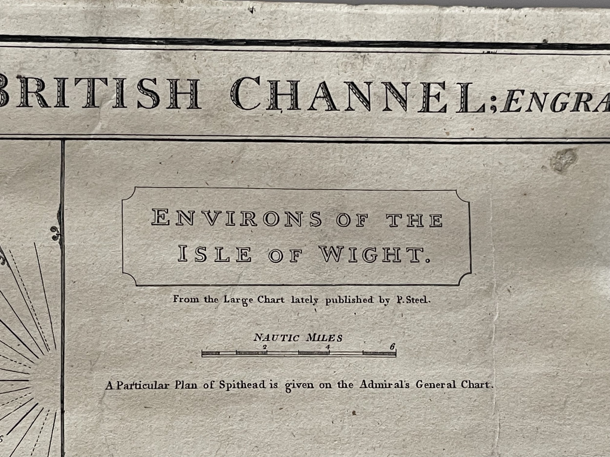 Image 22 of 26
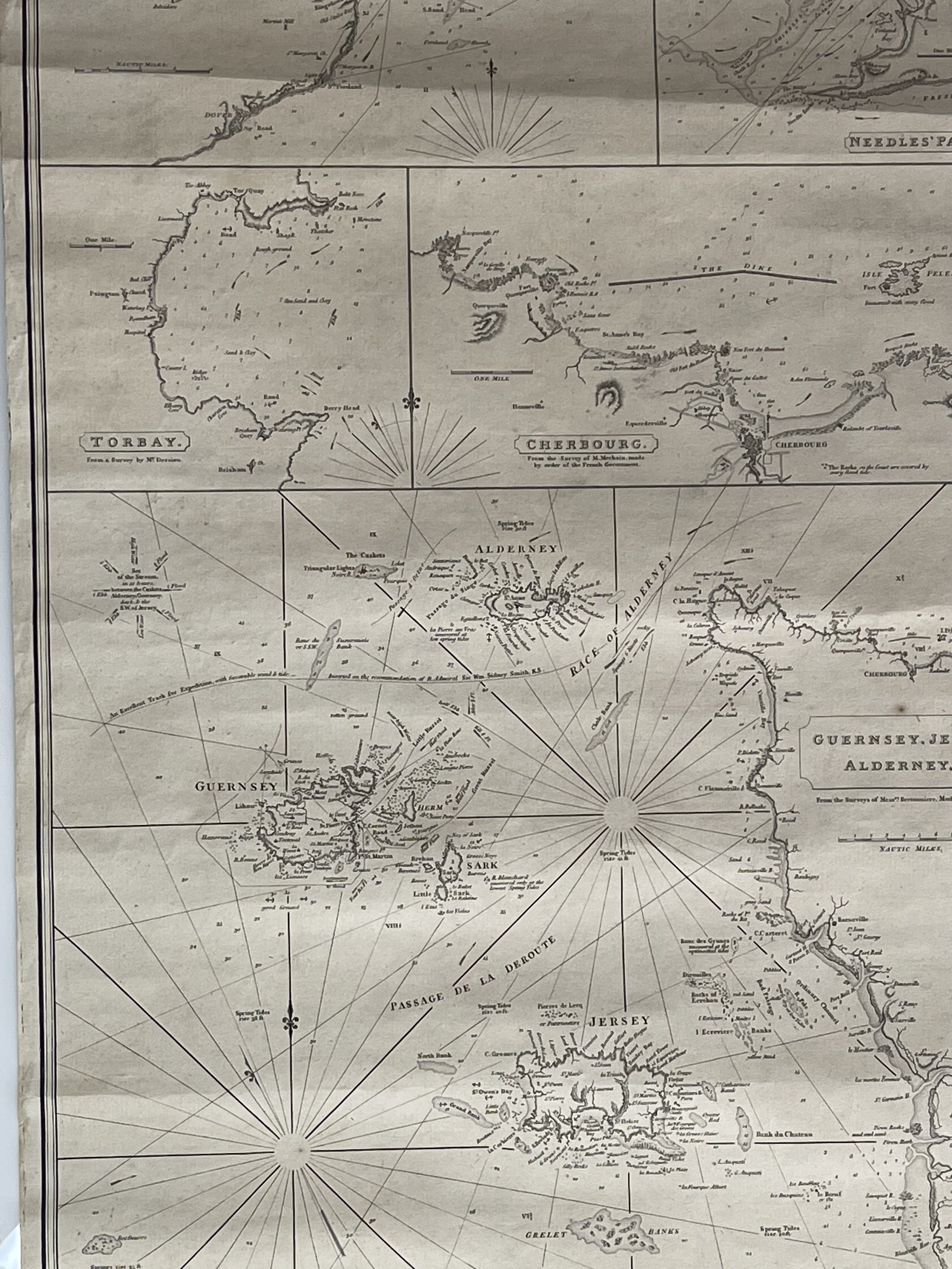 Image 23 of 26
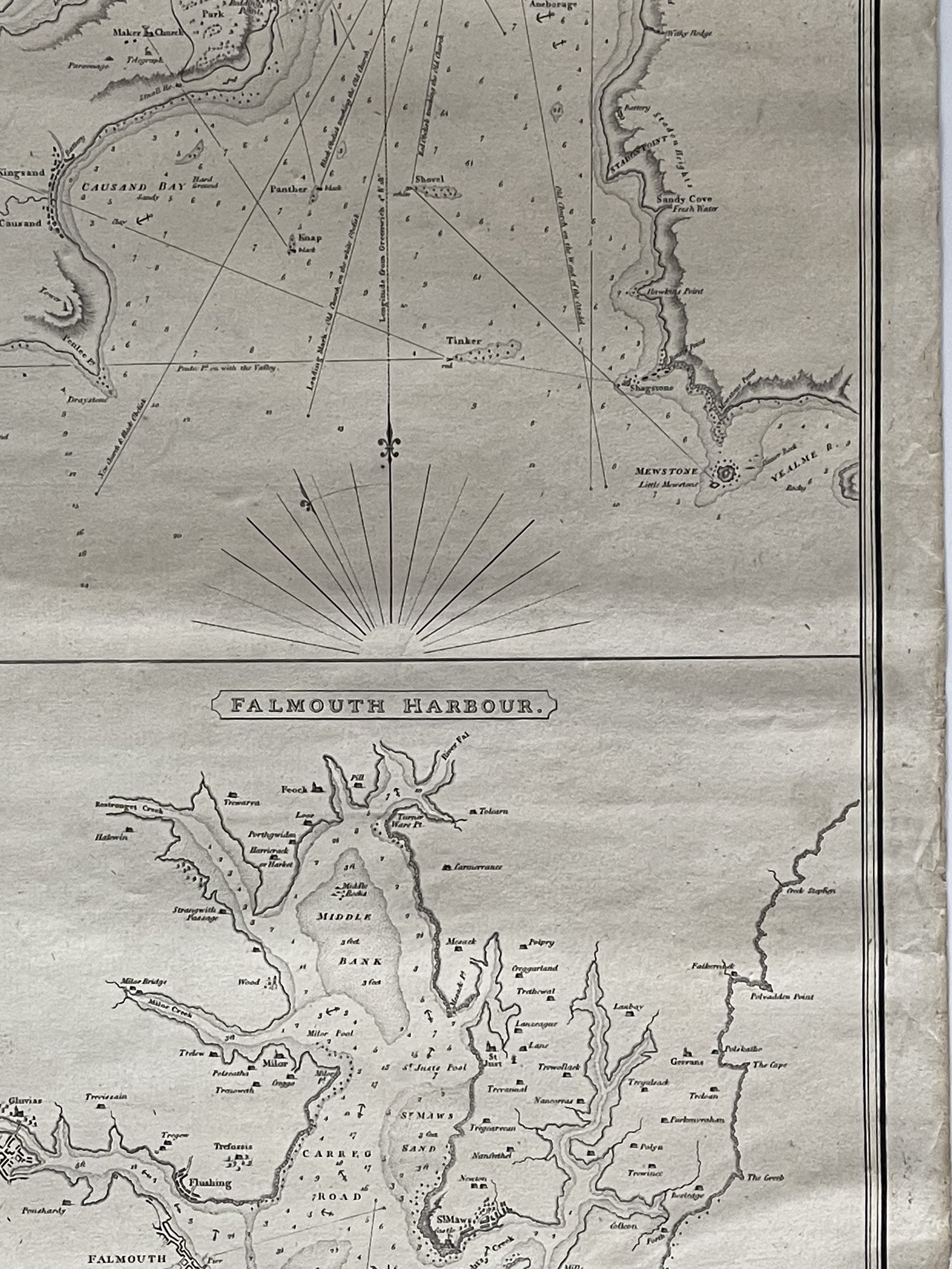 Image 24 of 26
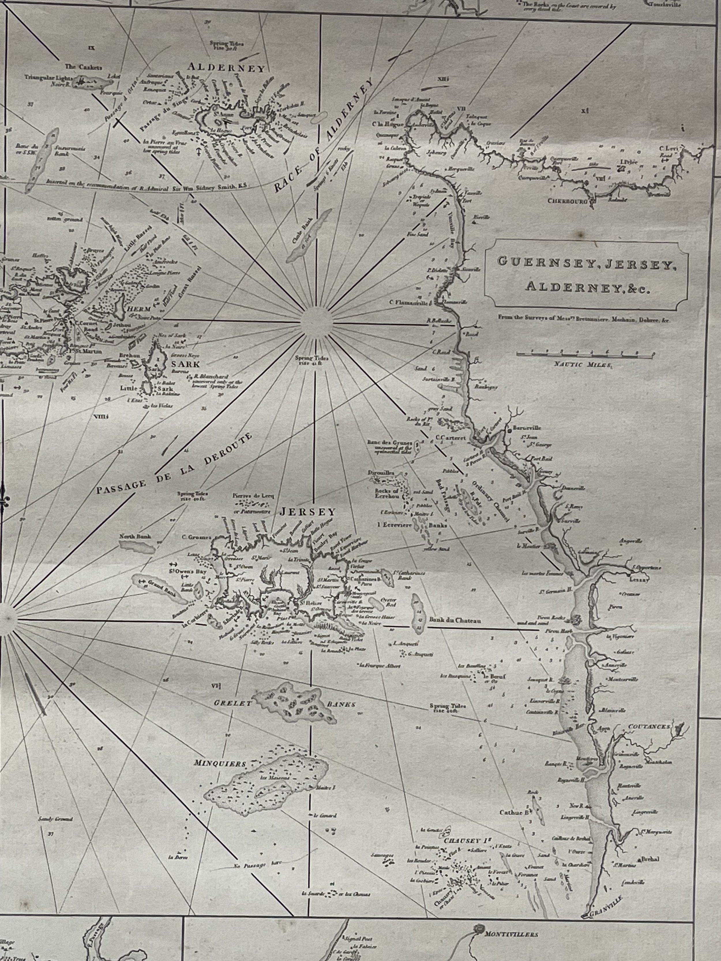 Image 25 of 26
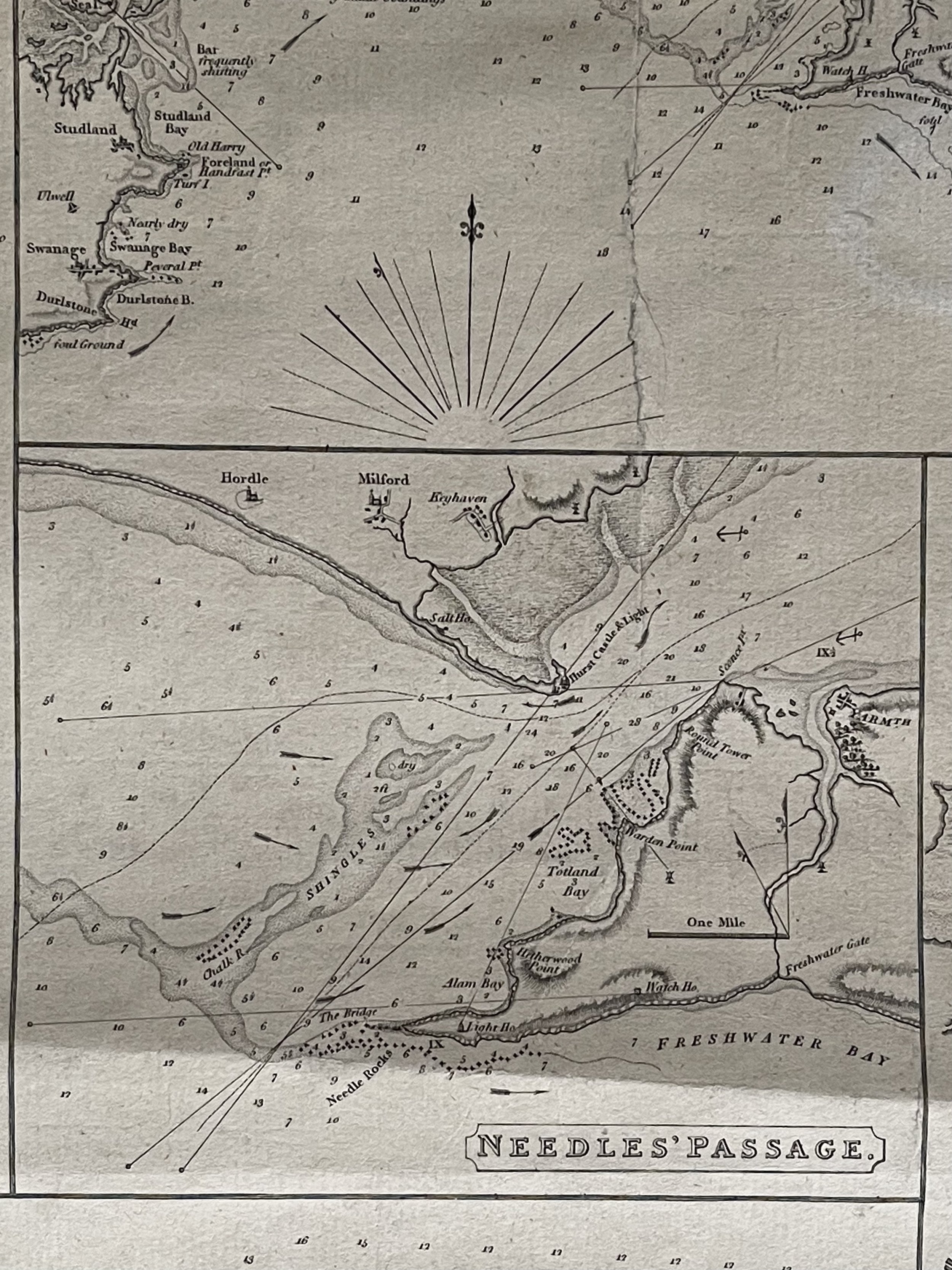 Image 26 of 26