Coloured map of Hampshire from an unusual folio by Richard Chiswell & Thomas Bassett's 1676 edition of John Speed’s “Theatre of the Empire of Great Britaine”. Considered to be one of the most decorative maps of the county, it also contains the northern part of the Isle of Wight. Inset is a plan of the town of Winchester together with the arms of the noble families of the county. A description of the county appears on the verso in English. Minor marginal defects, otherwise very good.
Originally engraved by Jodocus Hondius performed in this instance by John Speed (Speede). English text on back of map. Copper engraving with later hand colouring. Inset plan of Winchester.
Eight armorial coats of arms in left and right margin; highly decorative title cartouche showing the royal coat of arms; inset battle scene and historical description of the wars between Maud the Empresse entitled Lady of England and King Stephen. There is some water staining around the periphery that does not impede on the engraving. I have referenced the map in The printed Maps in the Atlases of Great Britain and Ireland 1579-1870 by Thomas Chubb. Page 37, Para 5 explains the maker (Jodocus Hondius performed by John Speede, solde by Thomas Bassett in Fleet Street and Richard Chiswell in St Pauls Churchyard). This citation by Chubb, also details the coats of arms present and this is reflected on this map. This edition also shows the plan of Winchester which is also cited in Chubbs scripture for the 1611 edition. Nevertheless, this edition shows the publishers to be Richard Chiswell & Thomas Bassett and this is shown in a small rectangular box above the scale (bottom right of the main photo, inset also in folio).
Until his late thirties, John Speed was a tailor by trade but his passion for history and map-making led him to gain a patron in Sir Fulke Greville, the poet and statesman, who found him a post in the customs and helped subsidise his map-making, giving him “full liberty to express the inclination of my mind”. He became acquainted with the publisher William Camden, whose descriptive text was used by Speed for most of the maps in his atlas “The first edition of the Theatre of Empire of Great Britain” was published most probably in 1612 although the original bears the date 1611 on the main title page. The maps were engraved in Amsterdam by Jodocus Hondius, one of the foremost engravers of his time. Speed’s maps are unique historical documents of their time and the town plans featured on the maps are in most cases the first information we have of their early appearance. Their artistry has guaranteed the collectability of these maps in the centuries that have followed.
John Speed (1551 or 1552 – 28 July 1629) was an English cartographer, chronologer and historian of Cheshire origins. The son of a citizen and Merchant Taylor in London, he rose from his family occupation to accept the task of drawing together and revising the histories, topographies and maps of the Kingdoms of Great Britain as an exposition of the union of their monarchies in the person of King James I and VI. He accomplished this with remarkable success, with the support and assistance of the leading antiquarian scholars of his generation. He drew upon and improved the shire maps of Christopher Saxton, John Norden and others, being the first to incorporate the hundred-boundaries into them, and he was the surveyor and originator of many of the town or city plans inset within them. His work helped to define early modern concepts of British national identity. His Biblical genealogies were also formally associated with the first edition of the King James Bible. He is among the most famous of English mapmakers.
Delicate and beautiful map with a small unobtrusive tear at the top middle page fold line. Grading and pricing commensurate.
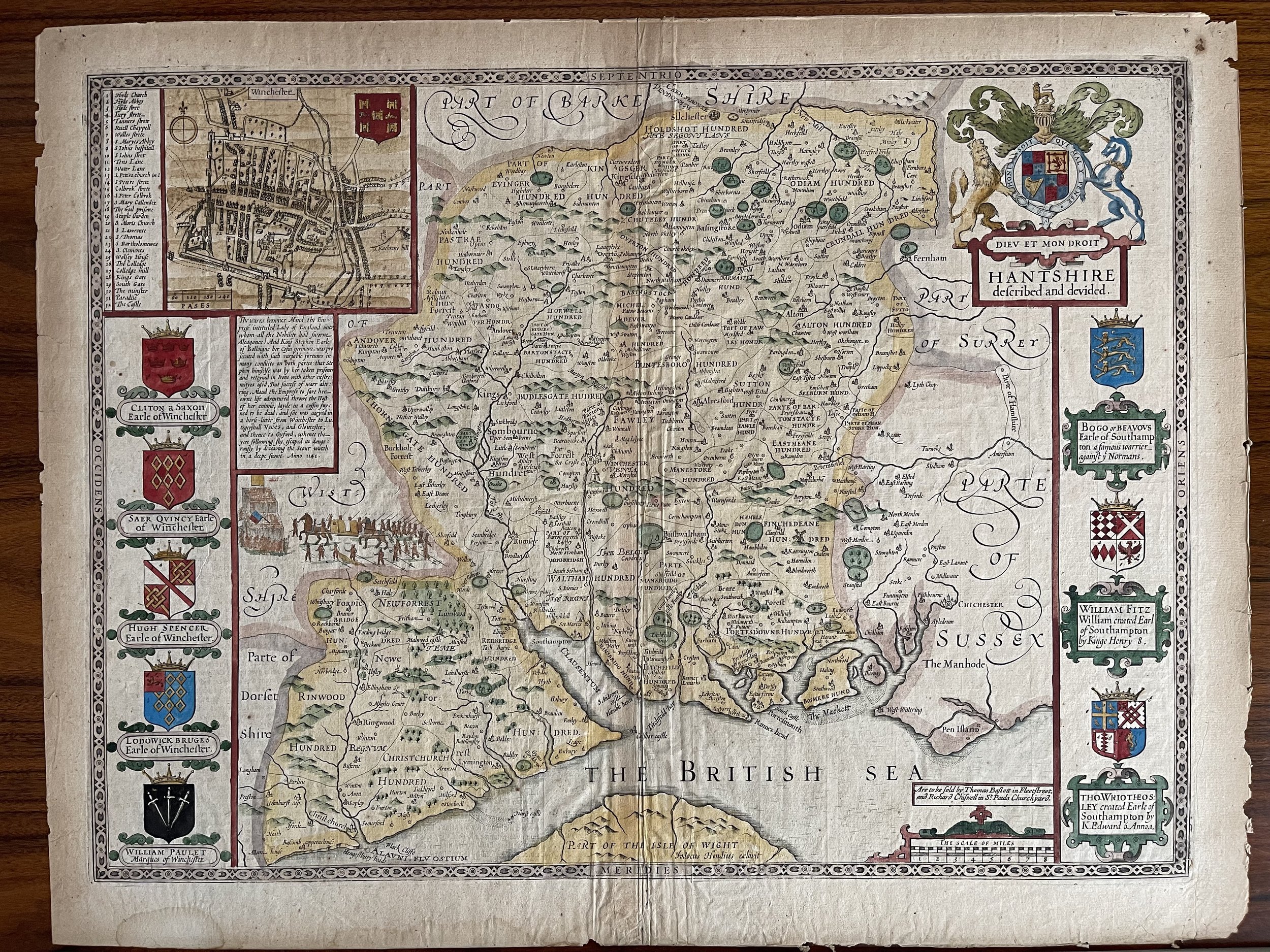 Image 1 of 17
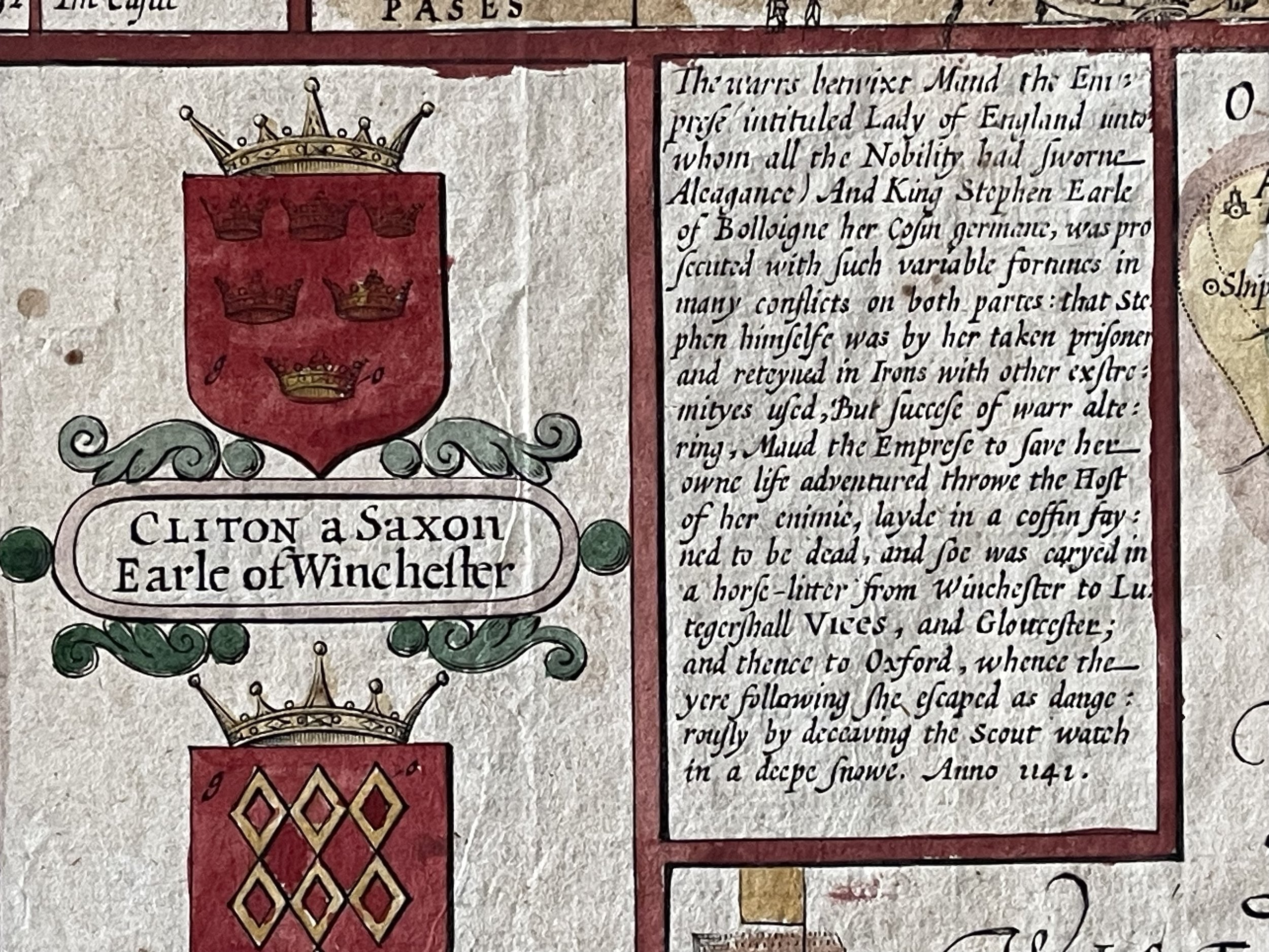 Image 2 of 17
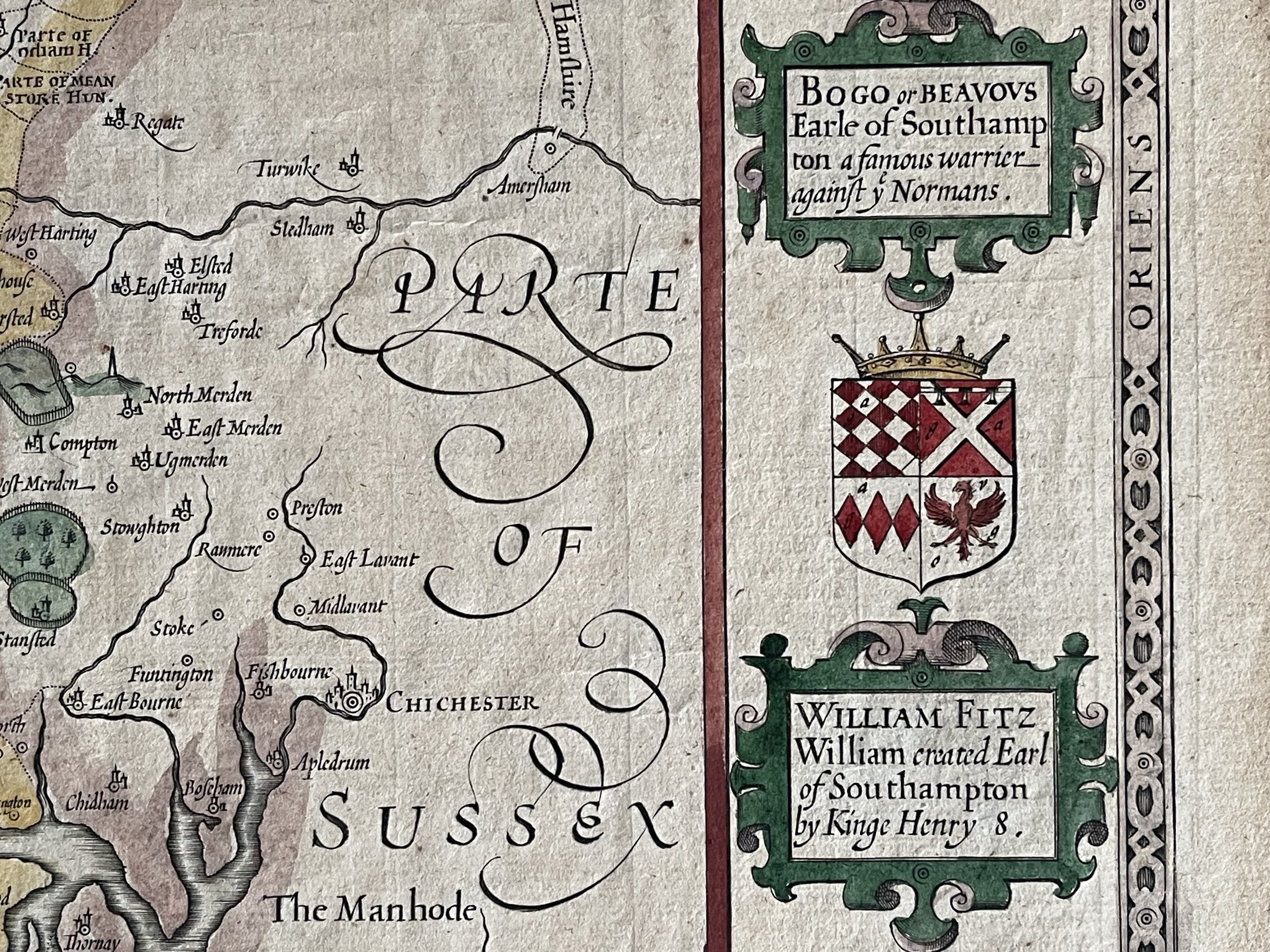 Image 3 of 17
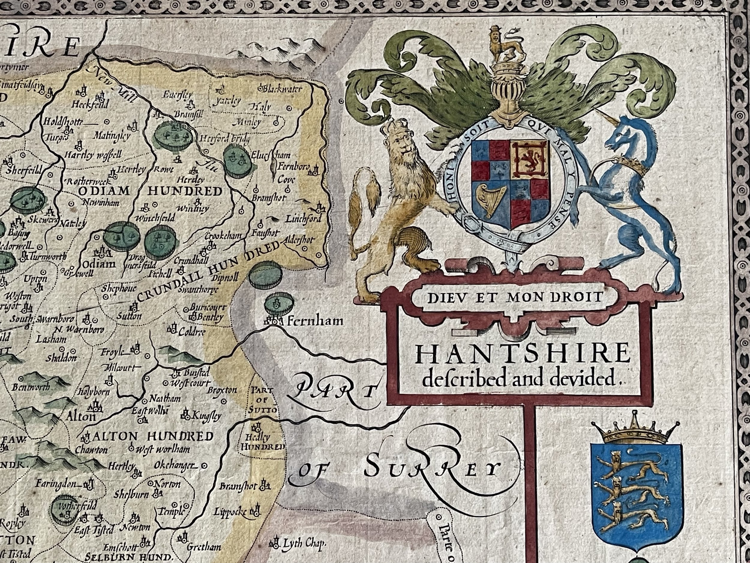 Image 4 of 17
 Image 5 of 17
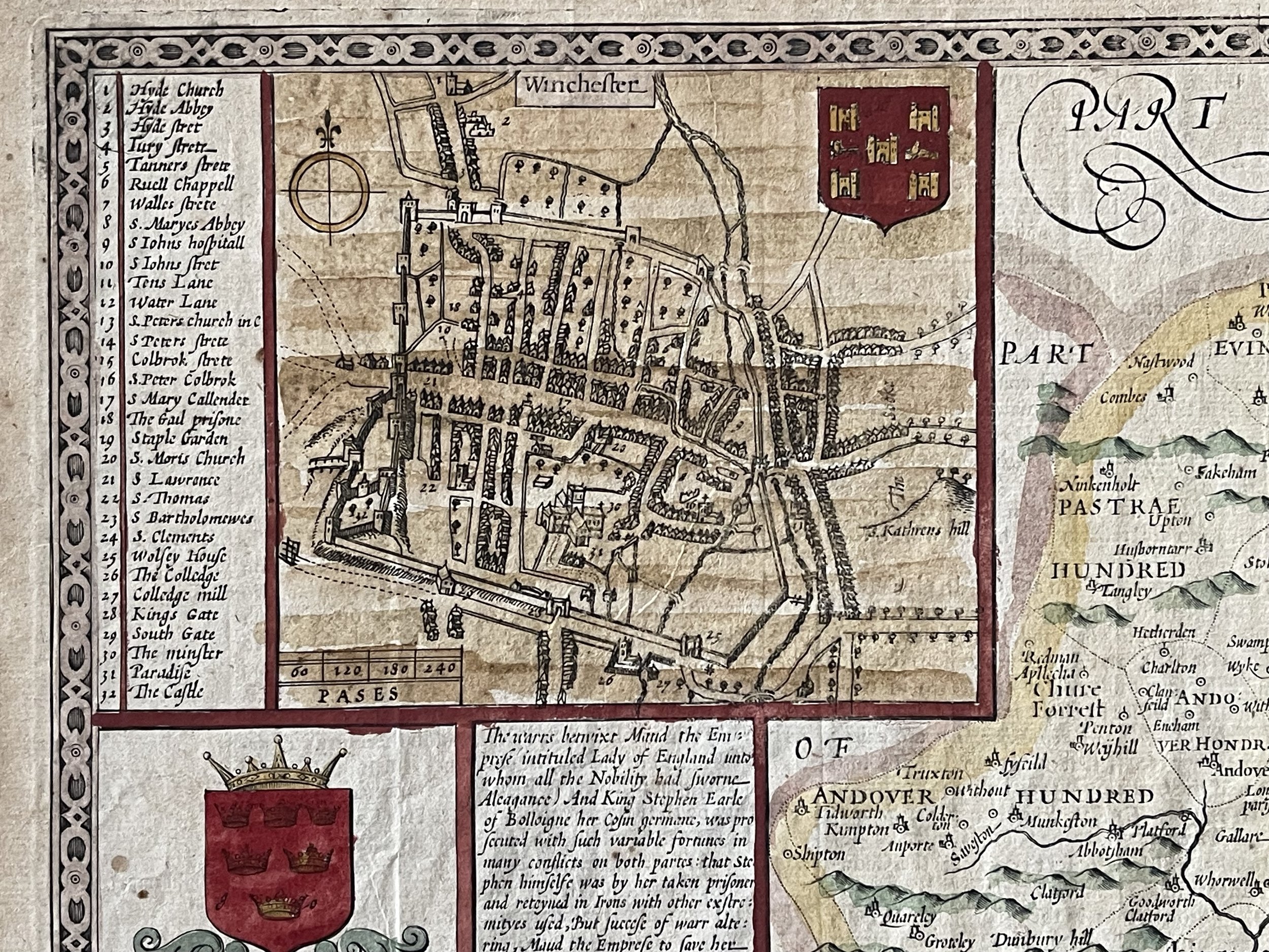 Image 6 of 17
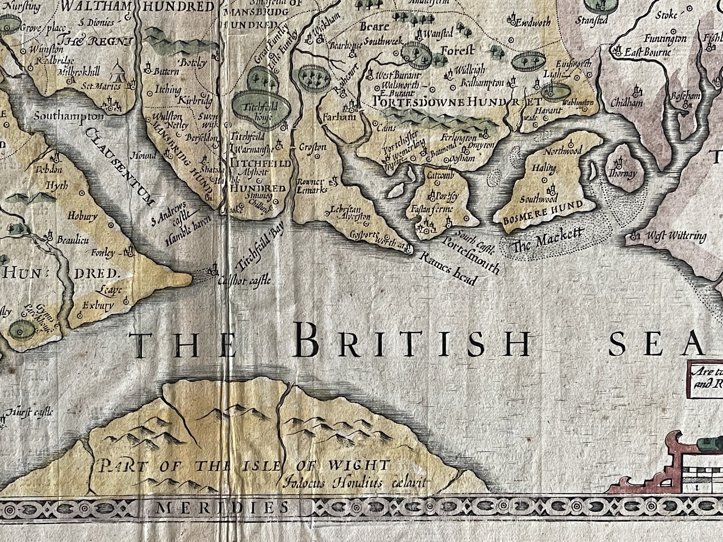 Image 7 of 17
 Image 8 of 17
 Image 9 of 17
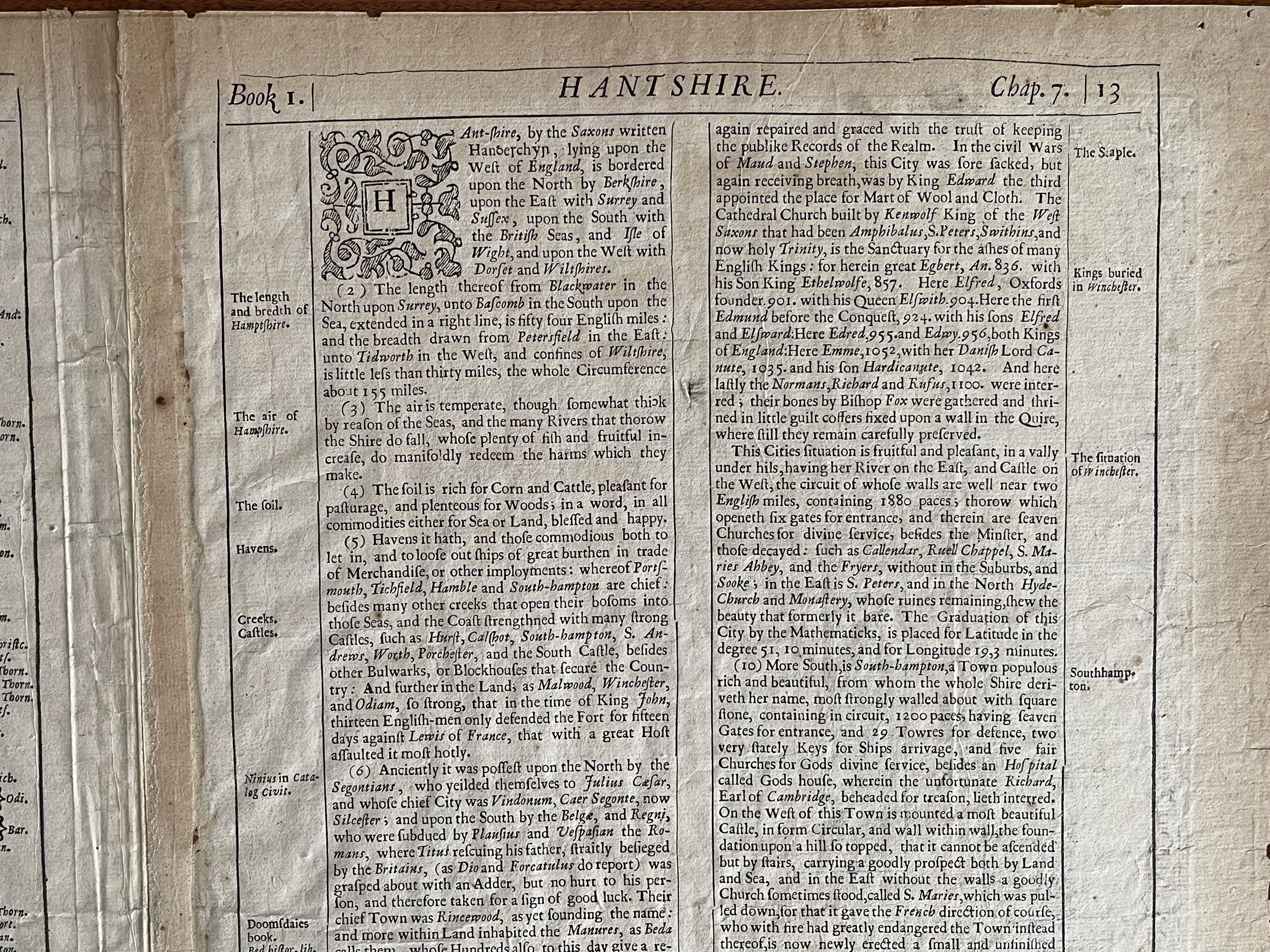 Image 10 of 17
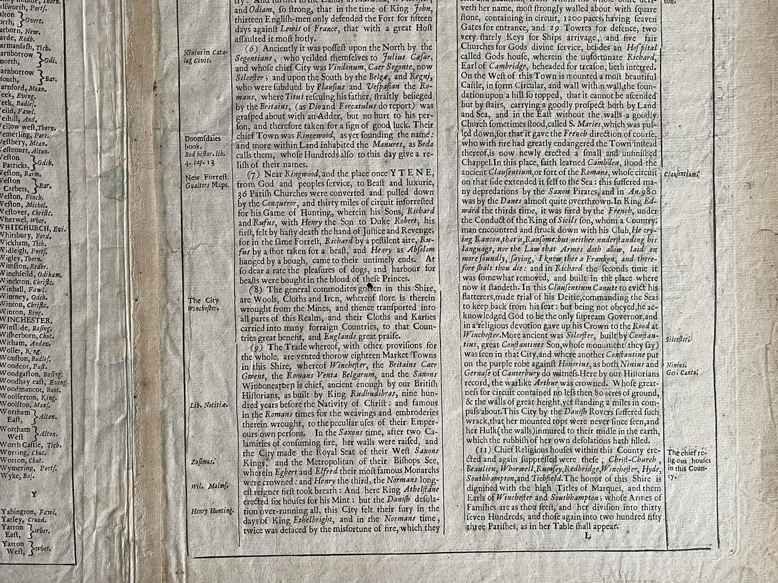 Image 11 of 17
 Image 12 of 17
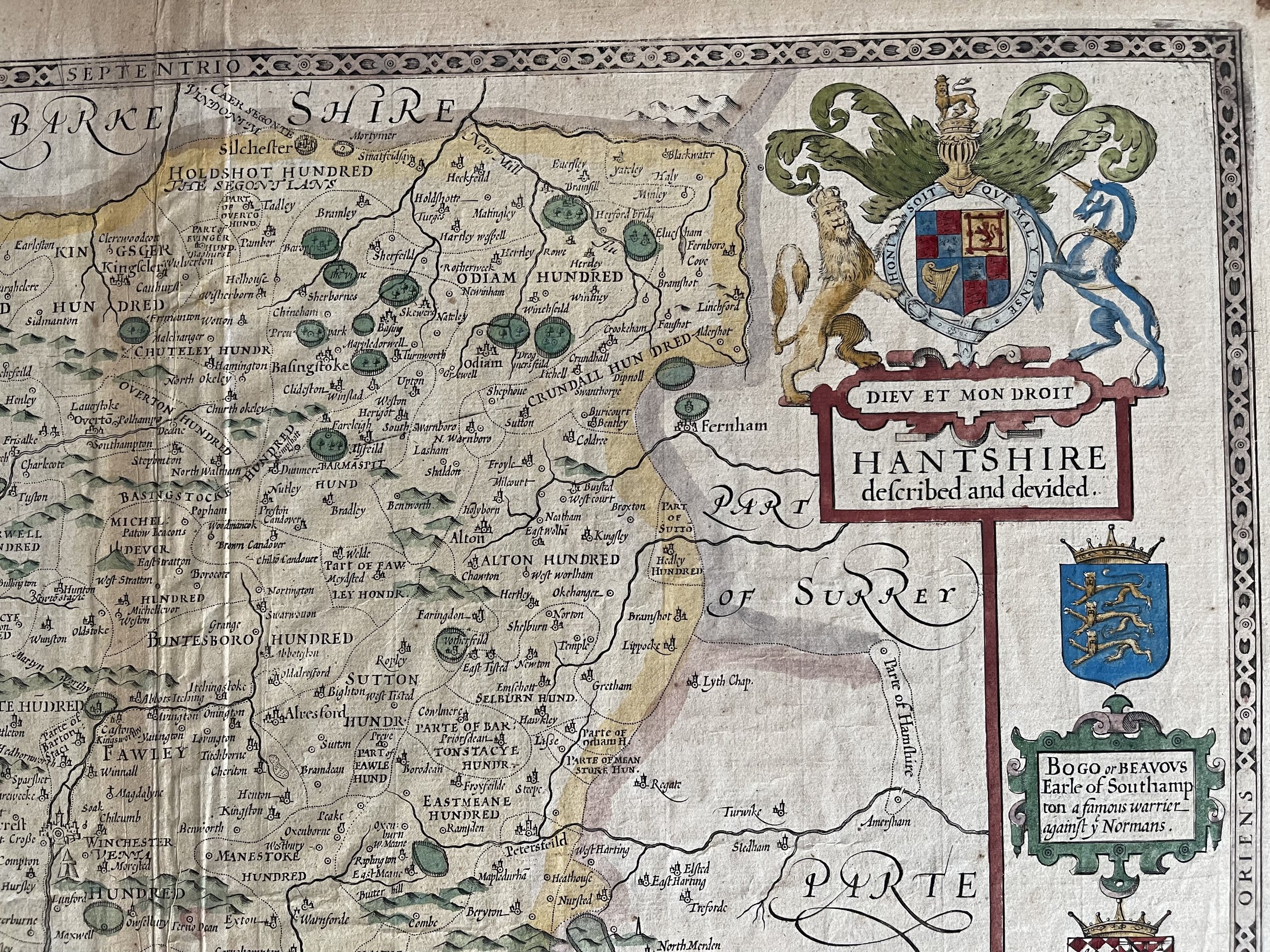 Image 13 of 17
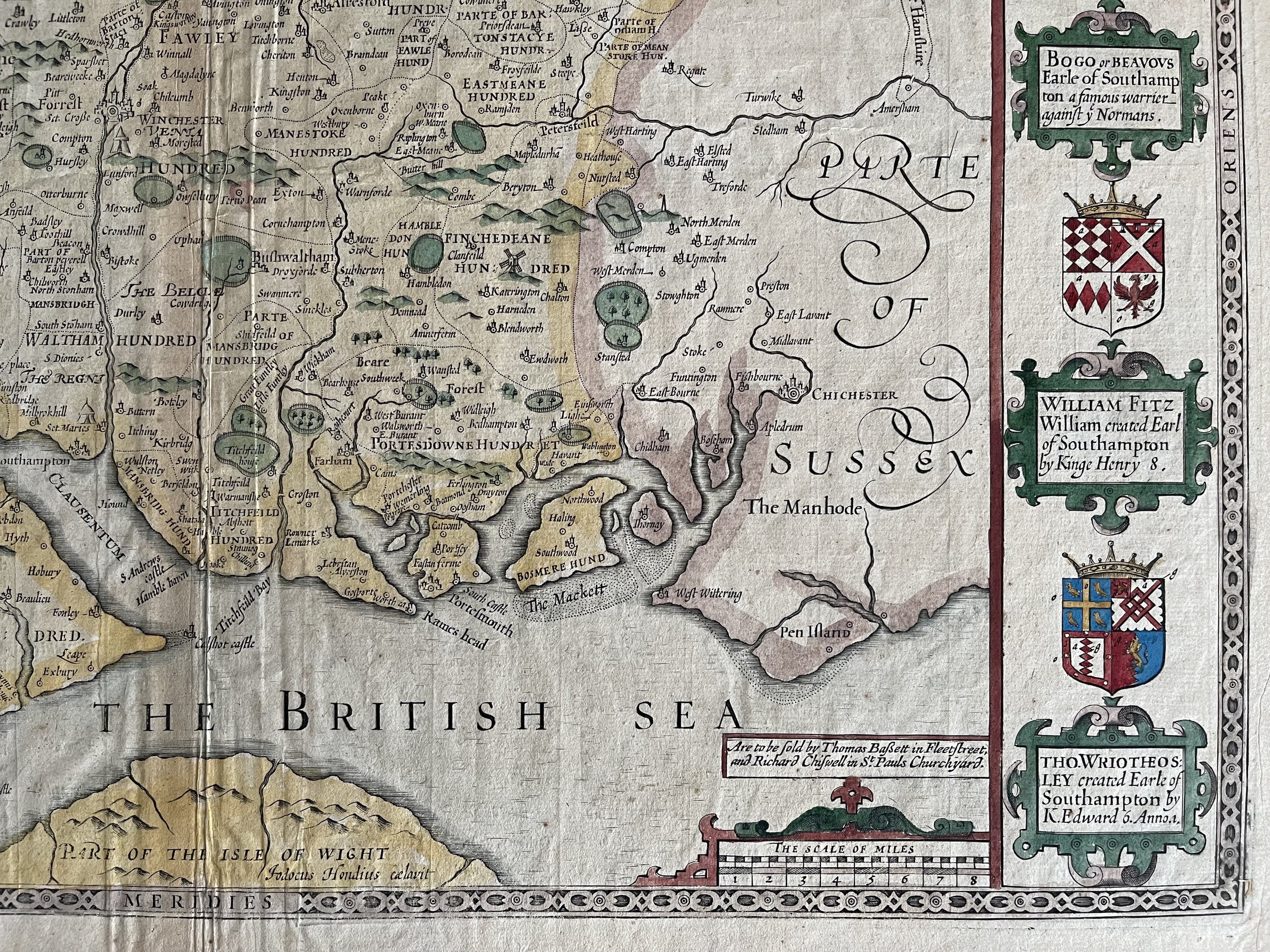 Image 14 of 17
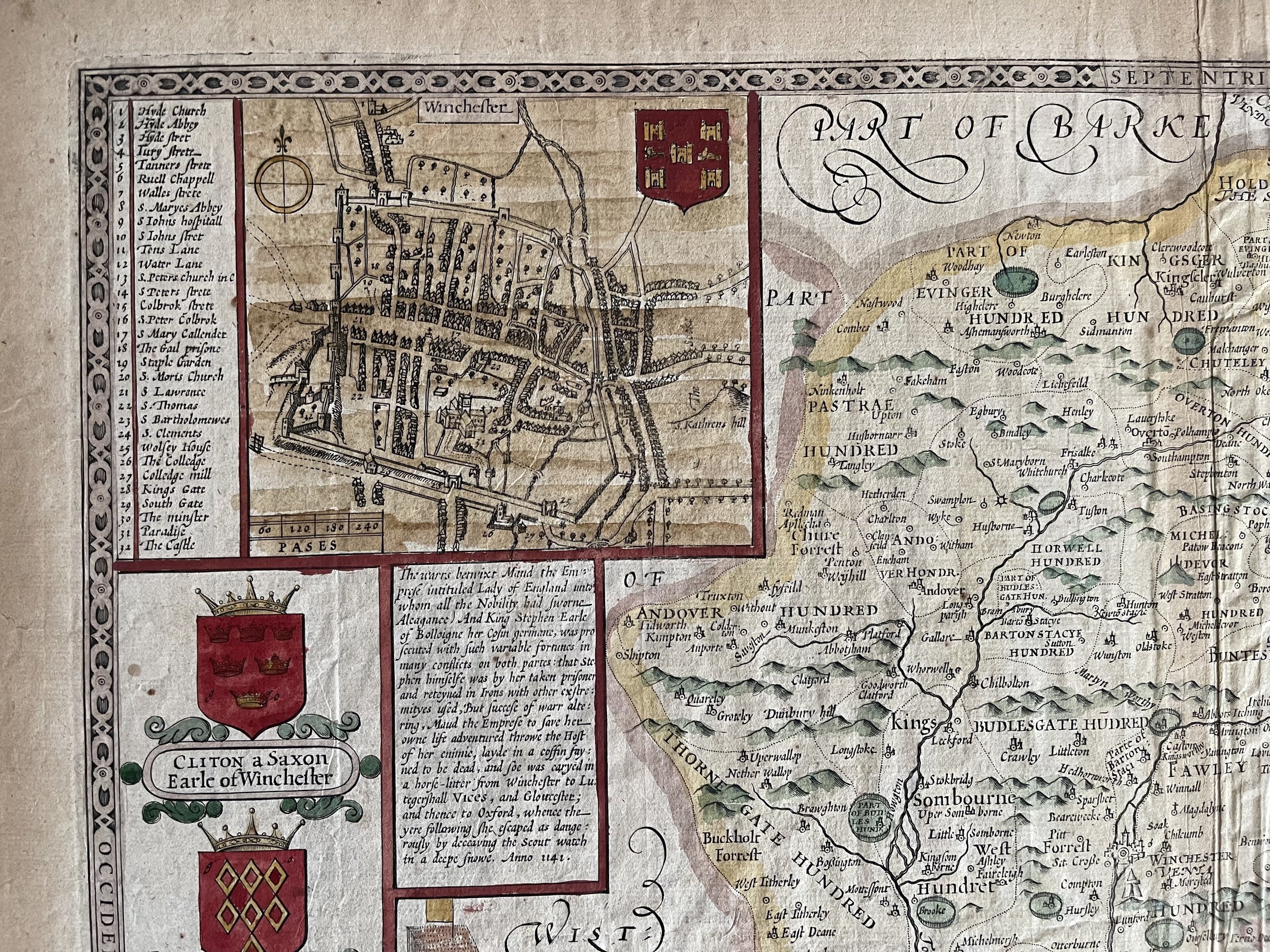 Image 15 of 17
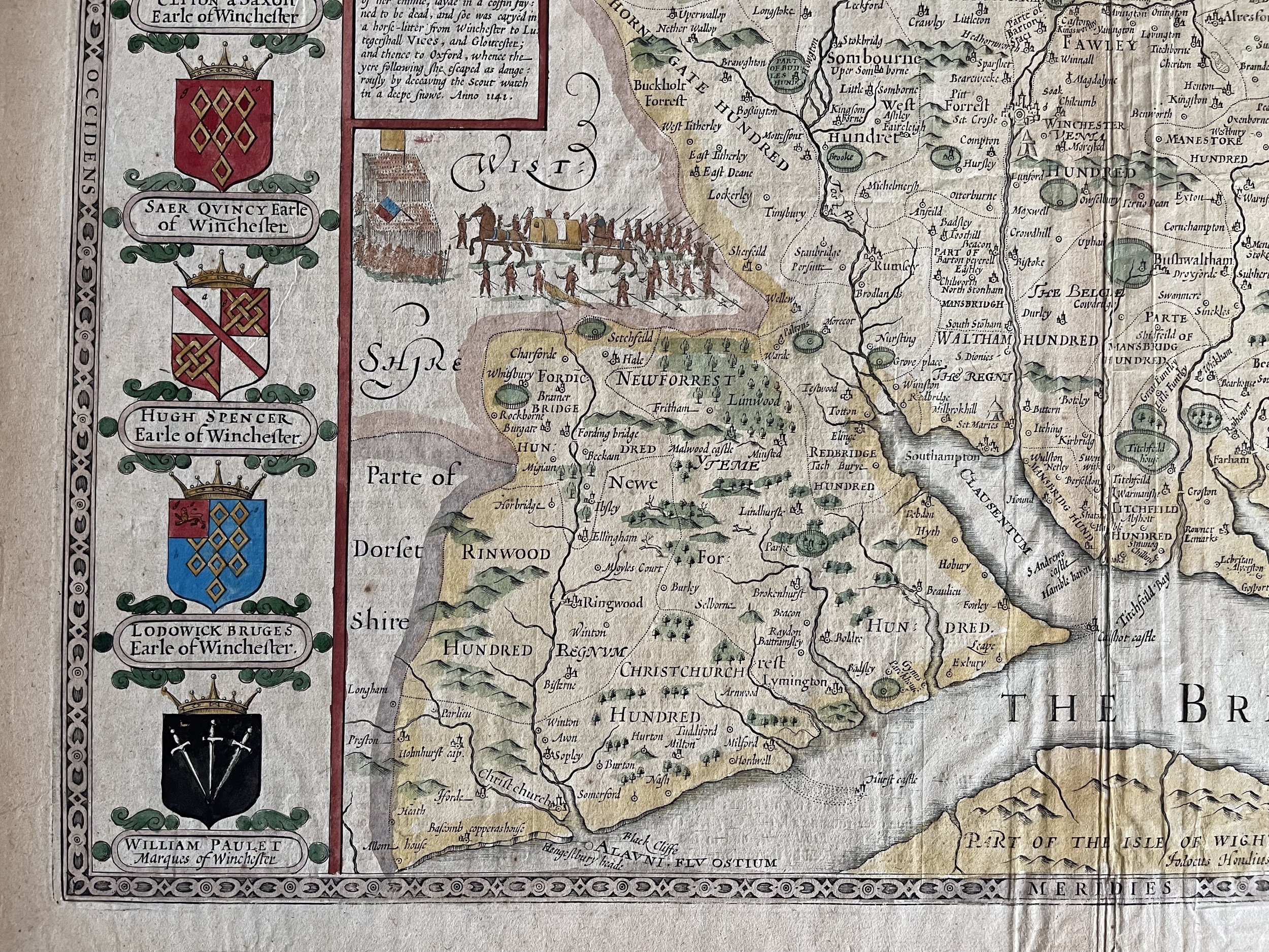 Image 16 of 17
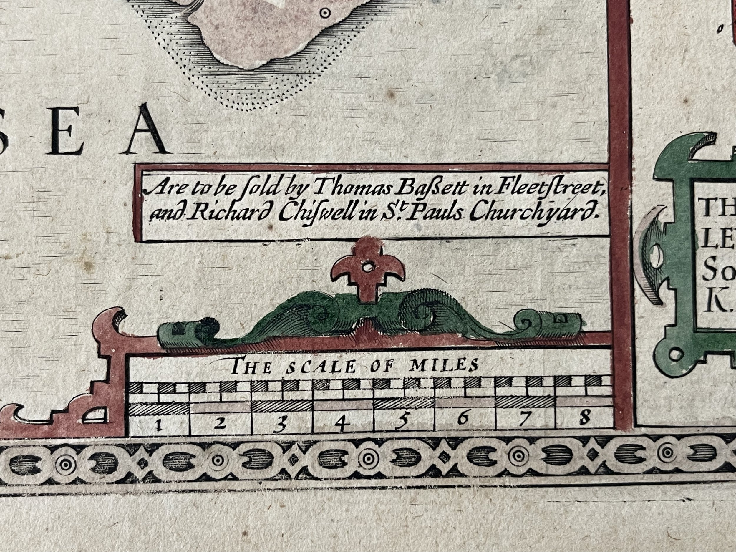 Image 17 of 17