Globe Terrestre & Globe Celestre with Compass Rose, &c - George-Louis Le Rouge 1748
Decorative pair of Globes, with the Celestial Globe extended outward to show a model of solar system.
Also includes an elaborate compass rose and two smaller models depicting eclipses of the sun and moon.
George-Louis Le Rouge (1712-1790), originally known as Georg Ludwig, was born in Hanover, Germany. He received his education there and established himself as a skilled surveyor and military engineer. In the early 1740s, he relocated to Paris and started working as an engraver and publisher on Rue des Grands Augustins. During this time, he adopted a French pseudonym that would later become well-known.
Le Rouge's forty-year career was largely dedicated to translating various English works into French. His maps and charts were heavily influenced by English sources. Drawing on his experience as a surveyor and engineer in Germany, he became a prolific and talented cartographer, producing thousands of maps, atlases, and plans. His works ranged from small town views and garden maps to expansive depictions of multiple continents. In addition, Le Rouge served as the Geographical Engineer for Louis XV, King of France.
As he grew older, Le Rouge gained recognition for his publications of North American maps, including his 1778 work, Atlas ameriquain septentrional. He was also renowned for creating the Franklin/Folger chart of the Gulf Stream, which he collaborated on with Benjamin Franklin. The two corresponded in the 1780s and together produced a French version of Franklin's famous chart, originally printed in 1769.
Beautiful engraving. A few minute worm holes (see Lightbox photo). but engraving generally in very good condition for its 275 year age. Laid Paper watermark also shown. Pricing and grading commensurate.
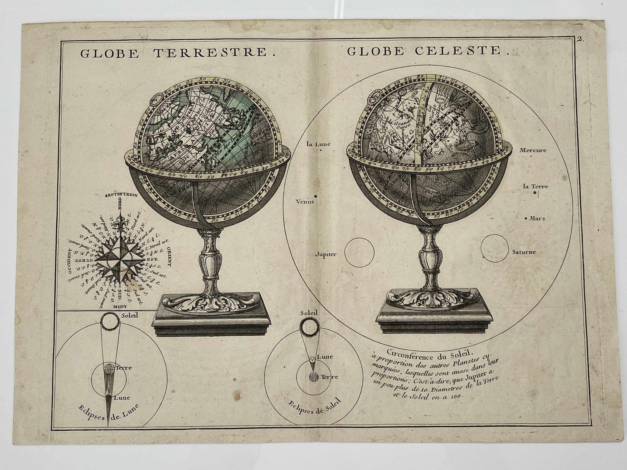 Image 1 of 11
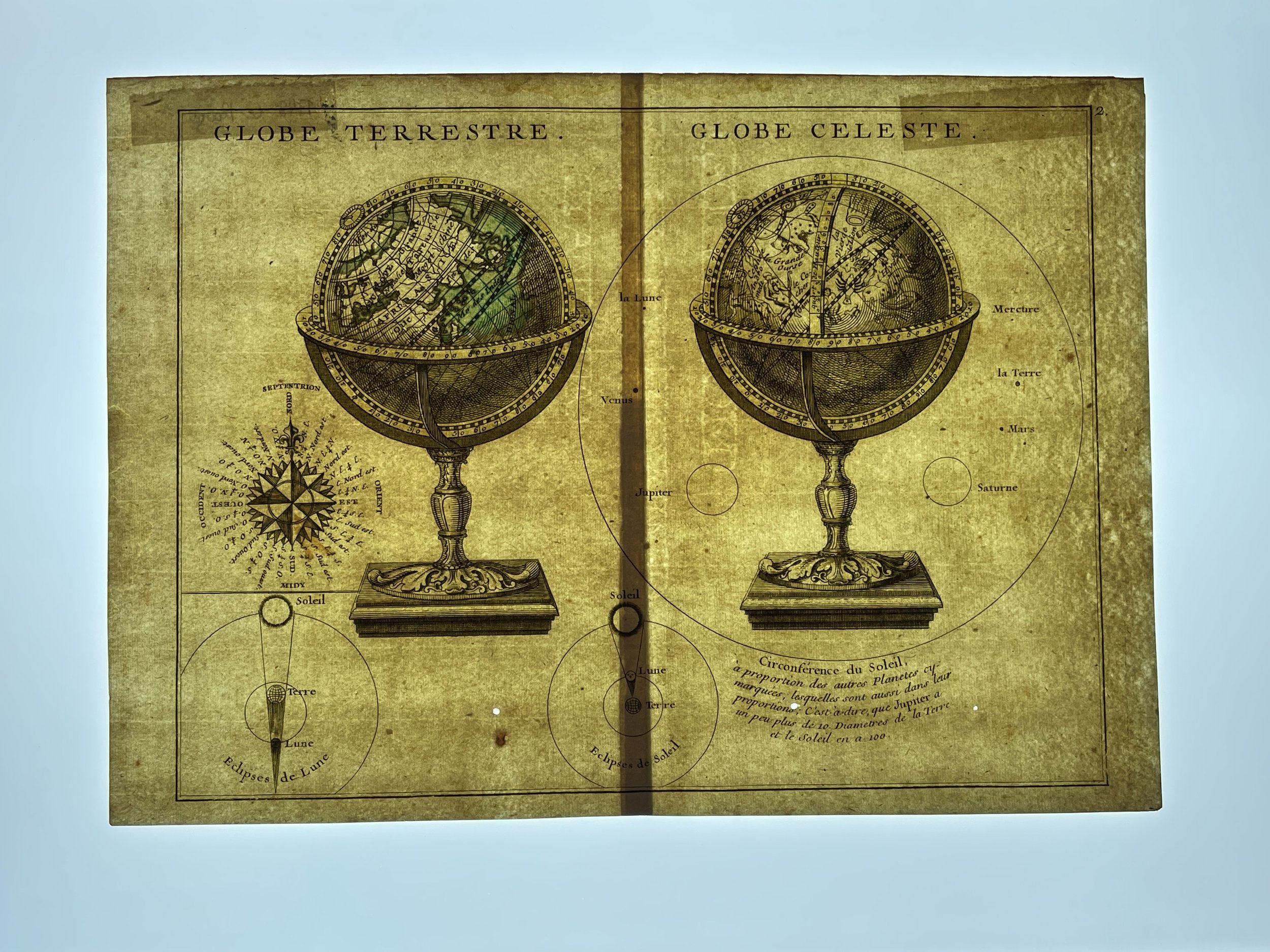 Image 2 of 11
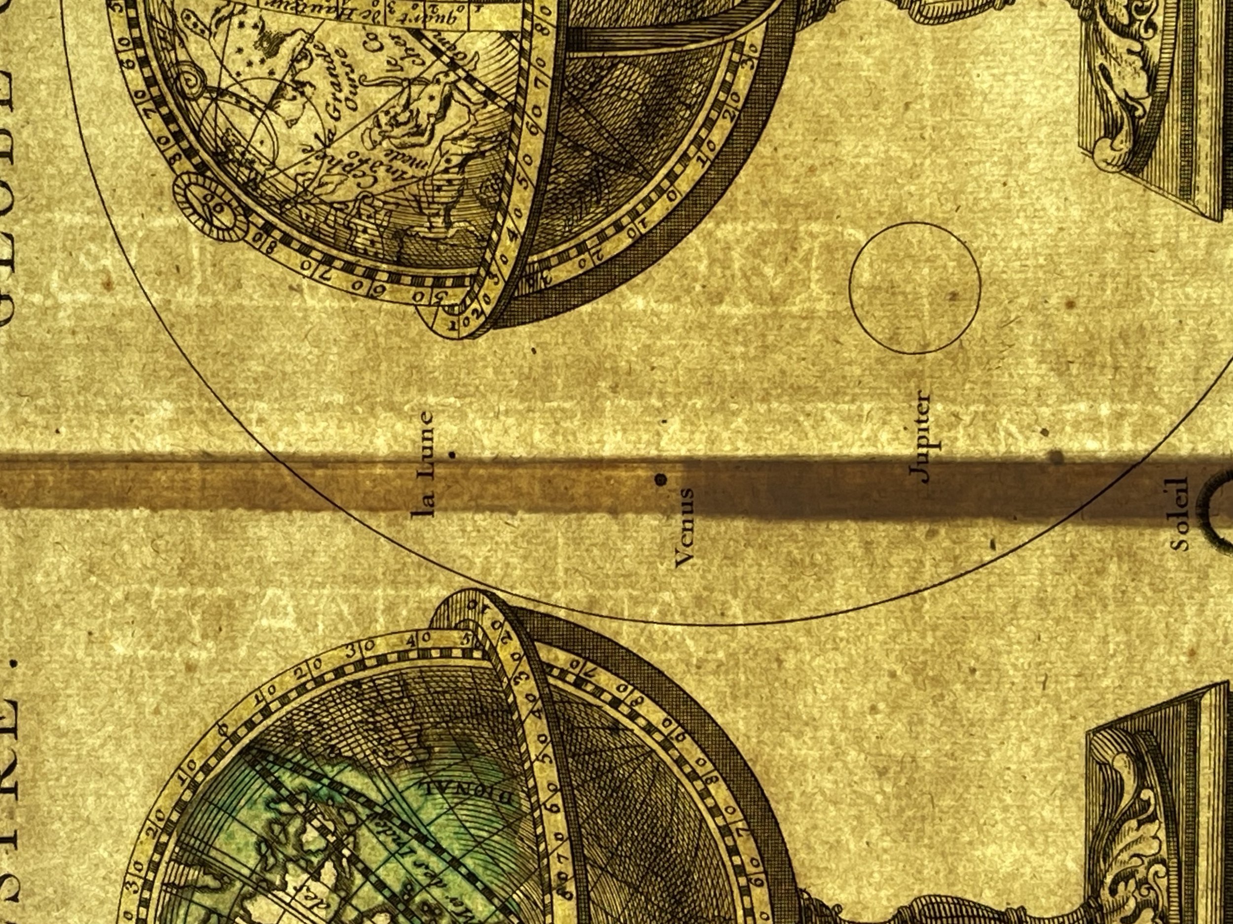 Image 3 of 11
 Image 4 of 11
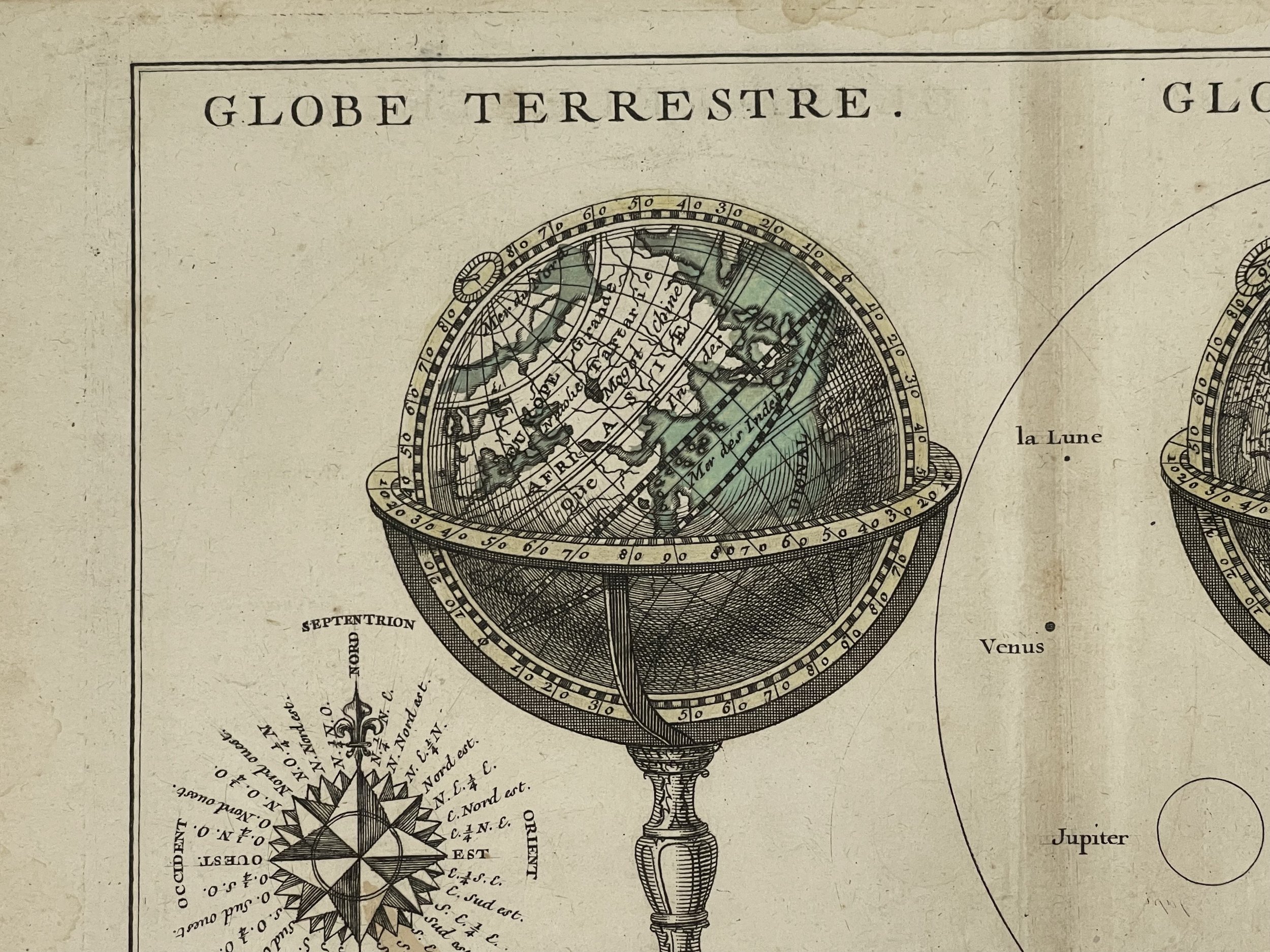 Image 5 of 11
 Image 6 of 11
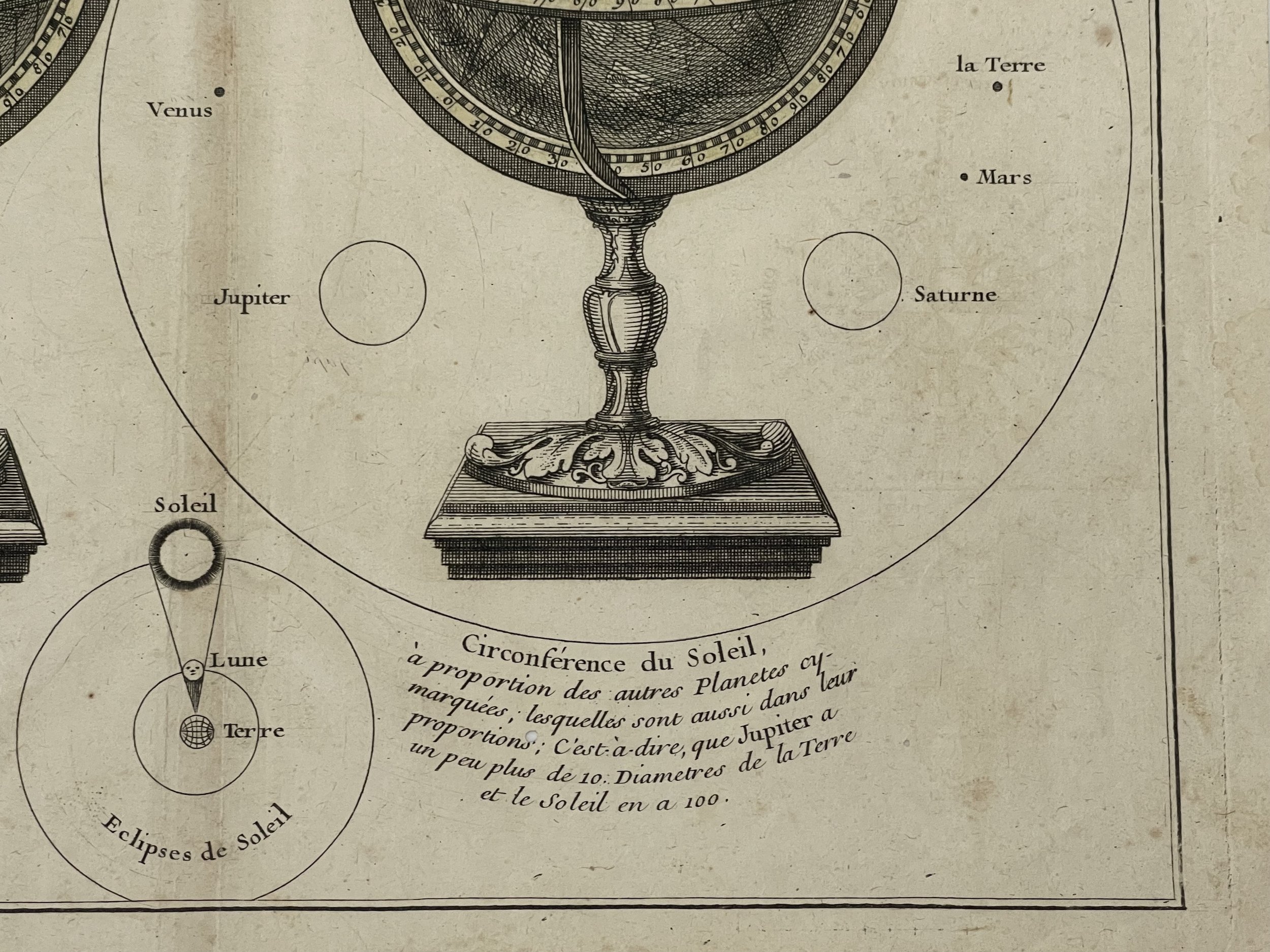 Image 7 of 11
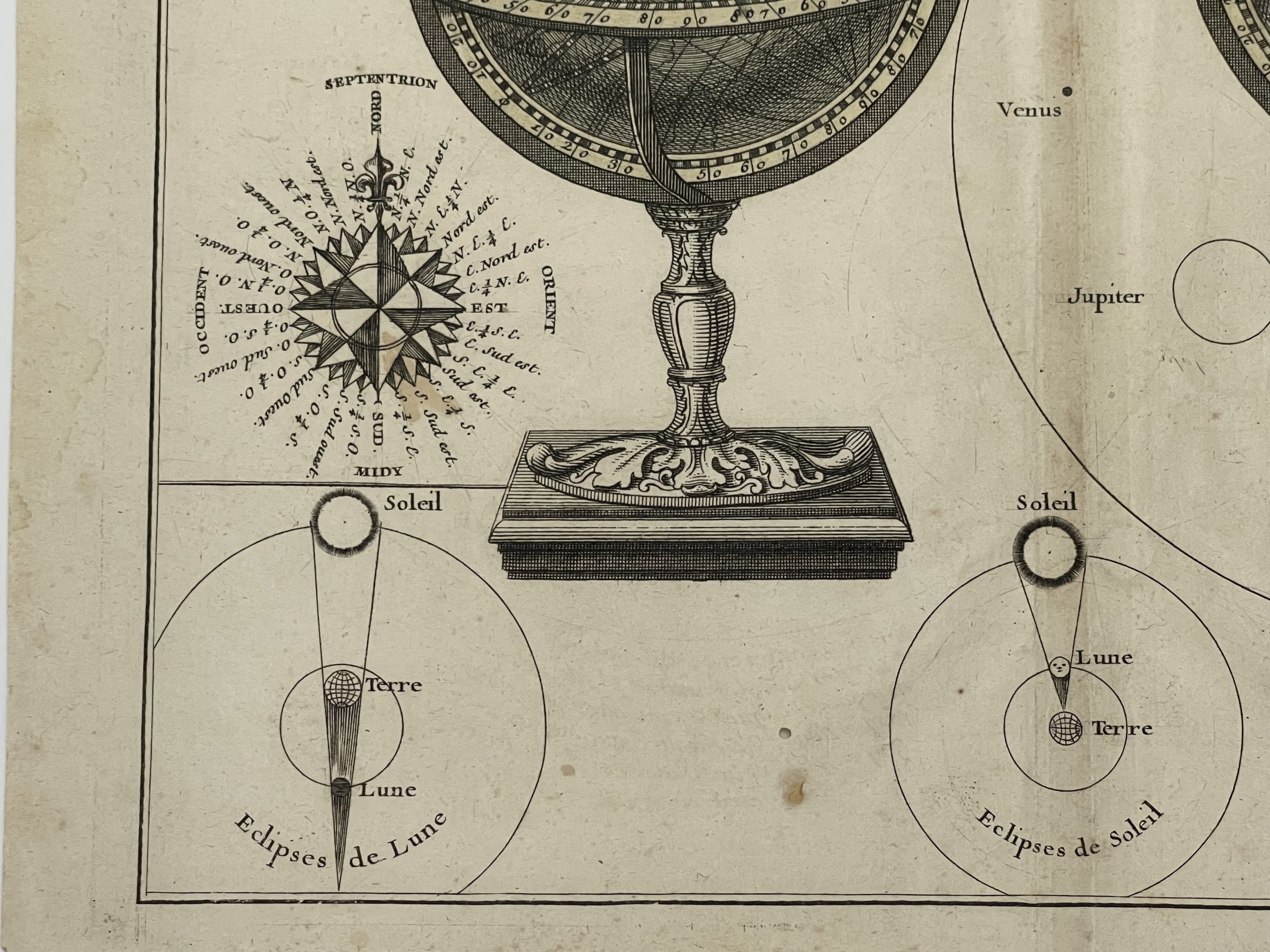 Image 8 of 11
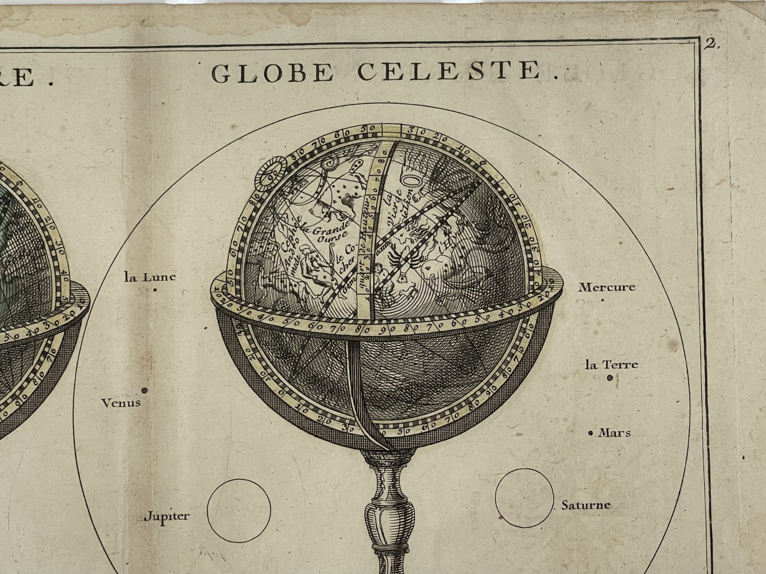 Image 9 of 11
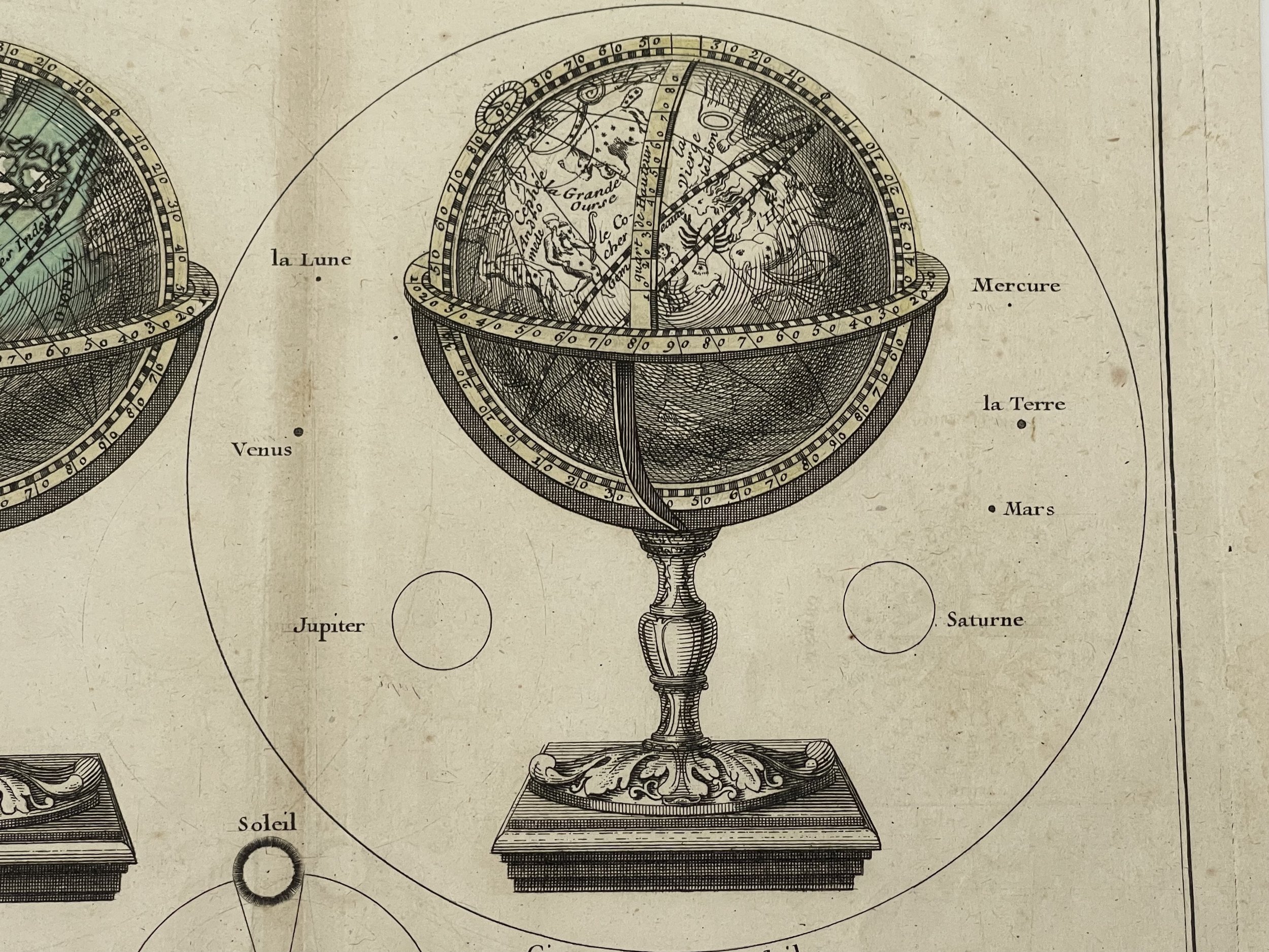 Image 10 of 11
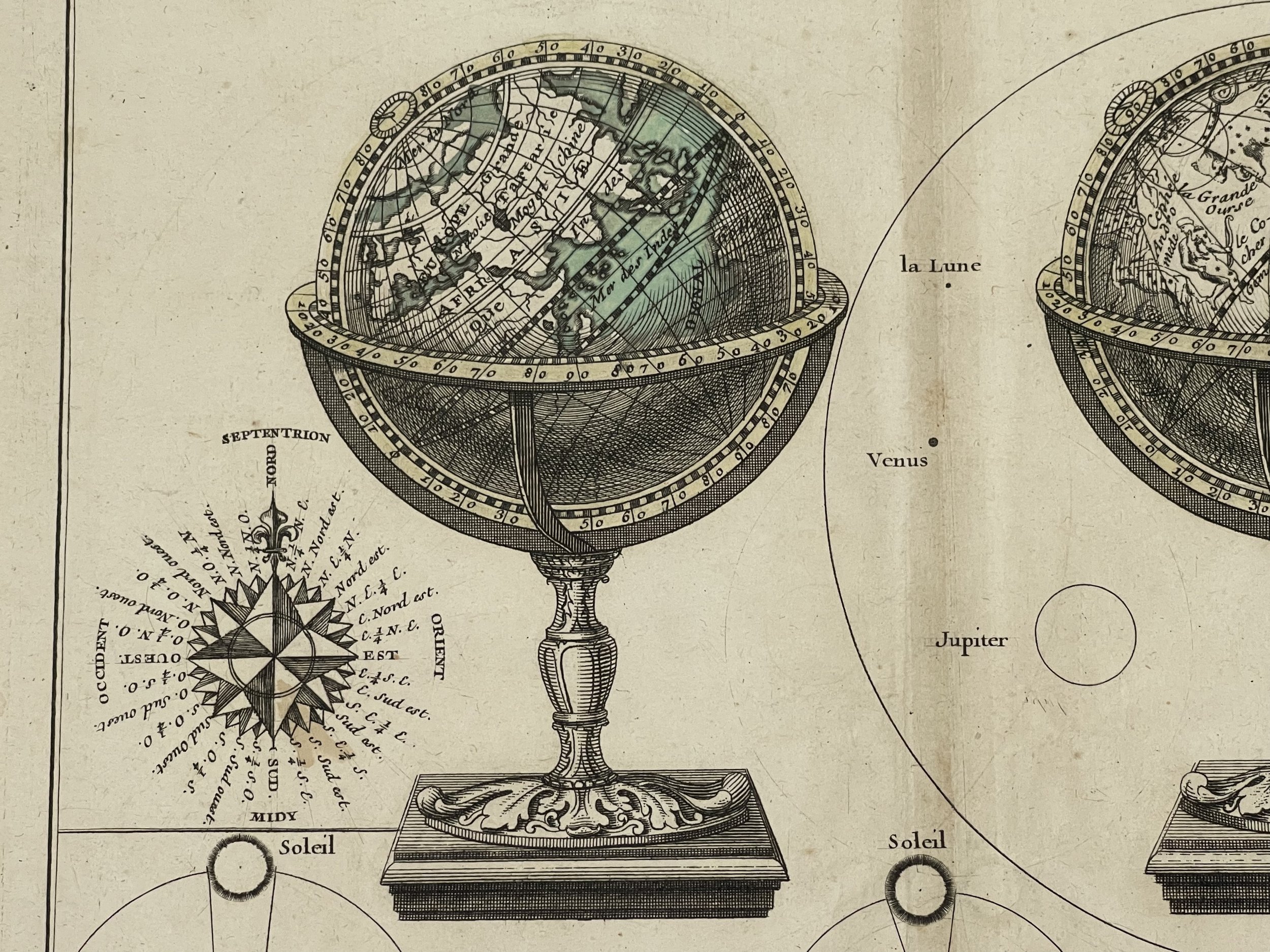 Image 11 of 11