Espagne Spain - N. Sanson / Anthonie de Winter
Antique map Spain titled 'Espagne par N. Sanson le Fils Geog. du Roy'. Miniature map of Spain, with Portugal and the Balearic island of Mallorca, Menorca and Ibiza. Coloured and in very good condition. Pricing and grading commensurate.
Winter, Anthonie de (1653 - 1707)
Anthonie de Winter (1653-1707) was a Dutch engraver, etcher, publisher and art dealer. Son of Hendrik de Winter, a seal-engraver and silversmith. Little is known of his education, but it probably involved an apprenticeship to his father prior to his being made a member of the guild of St. Luke in Amsterdam, later joining the guild of booksellers as an engraver. He engraved maps for Nicolas Sanson in 1683, Jacob Lootsman in 1696, and contributed to the Vries Zee Atlas in 1698. He also engraved playing cards with Carel de Waganaer.
Nicolas Sanson (20 December 1600 – 7 July 1667) was a French cartographer who served under two kings in matters of geography. He has been called the "father of French cartography.
He was born of an old Picard family of Scottish descent, at Abbeville, on 20 (or 31) December 1600, and was educated by the Jesuits at Amiens.
In 1627 he attracted the attention of Richelieu by a map of Gaul which he had constructed (or at least begun) while only eighteen. Sanson was royal geographer. He gave lessons in geography both to Louis XIII and to Louis XIV; and when Louis XIII, it is said, came to Abbeville, he preferred to be the guest of Sanson (then employed on the fortifications), instead of occupying the lodgings provided by the town. At the conclusion of this visit the king made Sanson a councillor of state.
Active from 1627, Sanson issued his first map of importance, the "Postes de France", which was published by Melchior Tavernier in 1632. After publishing several general atlases himself he became the associate of Pierre Mariette, a publisher of prints.
In 1647 Sanson accused the Jesuit Philippe Labbe of plagiarizing him in his Pharus Galliae Antiquae; in 1648 he lost his eldest son Nicolas, killed during the Fronde. Among the friends of his later years was the great Condé. He died in Paris on 7 July 1667. Two younger sons, Adrien (d. 1708) and Guillaume (d. 1703), succeeded him as geographers to the king
In 1692 Hubert Jaillot collected Sanson's maps in an Atlas nouveau. See also the 18th-century editions of some of Sanson's works on Delamarche under the titles of Atlas de géographie ancienne and Atlas britannique; and the Catalogue des cartes et livres de géographie de Sanson (1702).
 Image 1 of 11
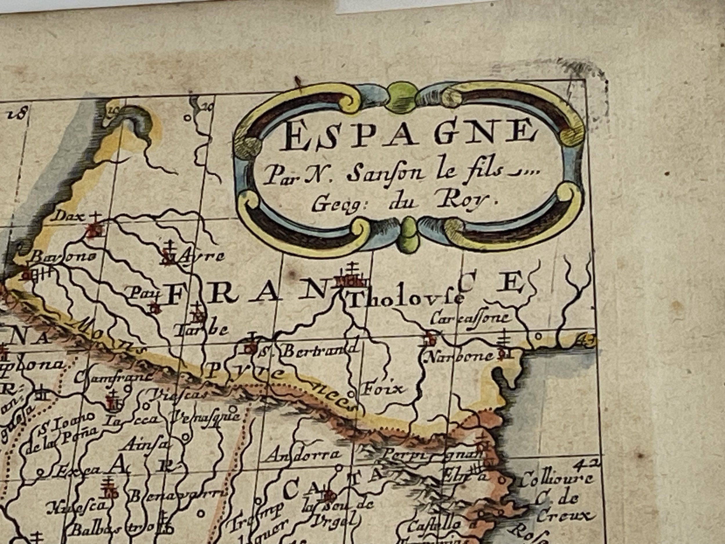 Image 2 of 11
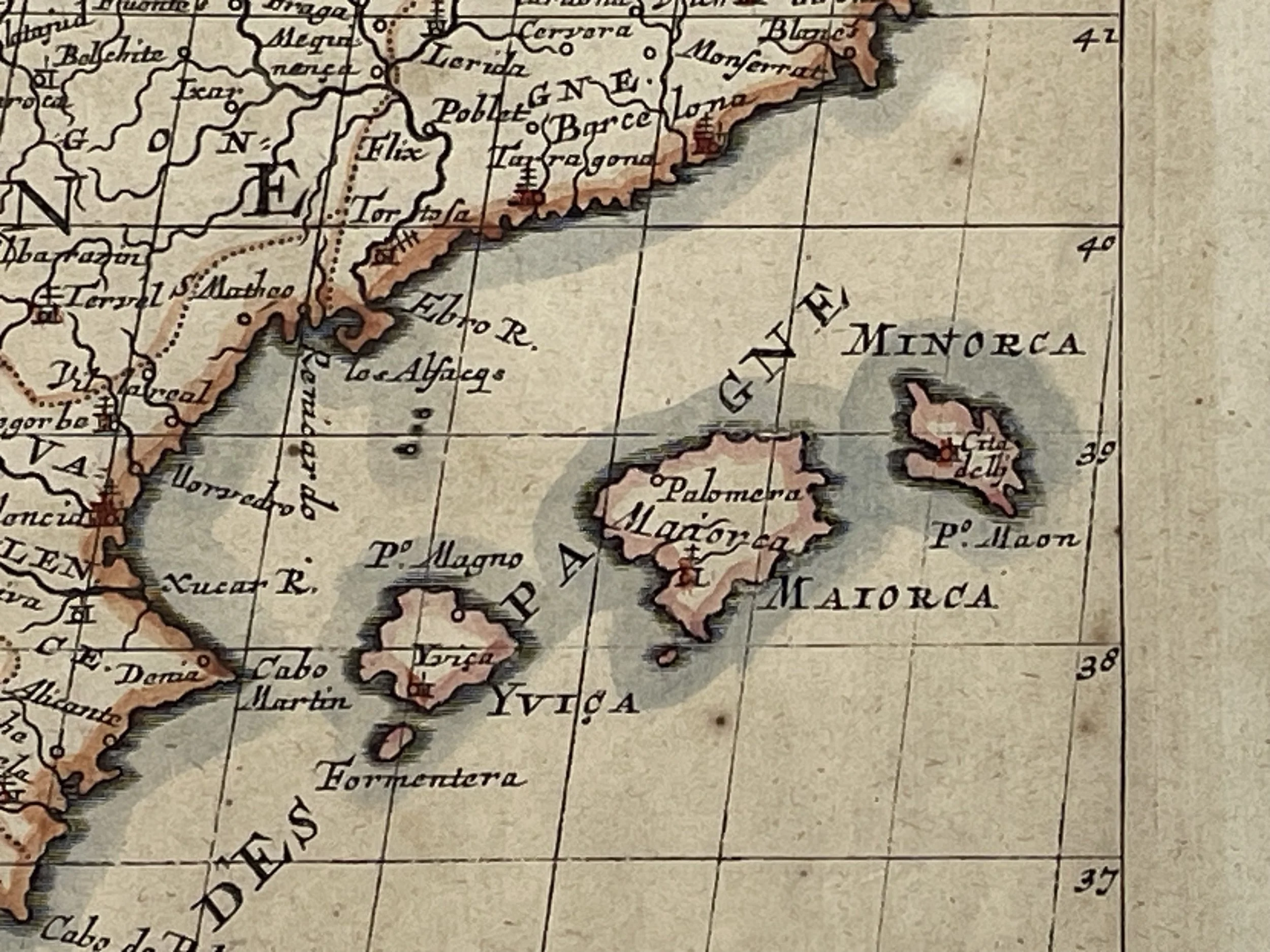 Image 3 of 11
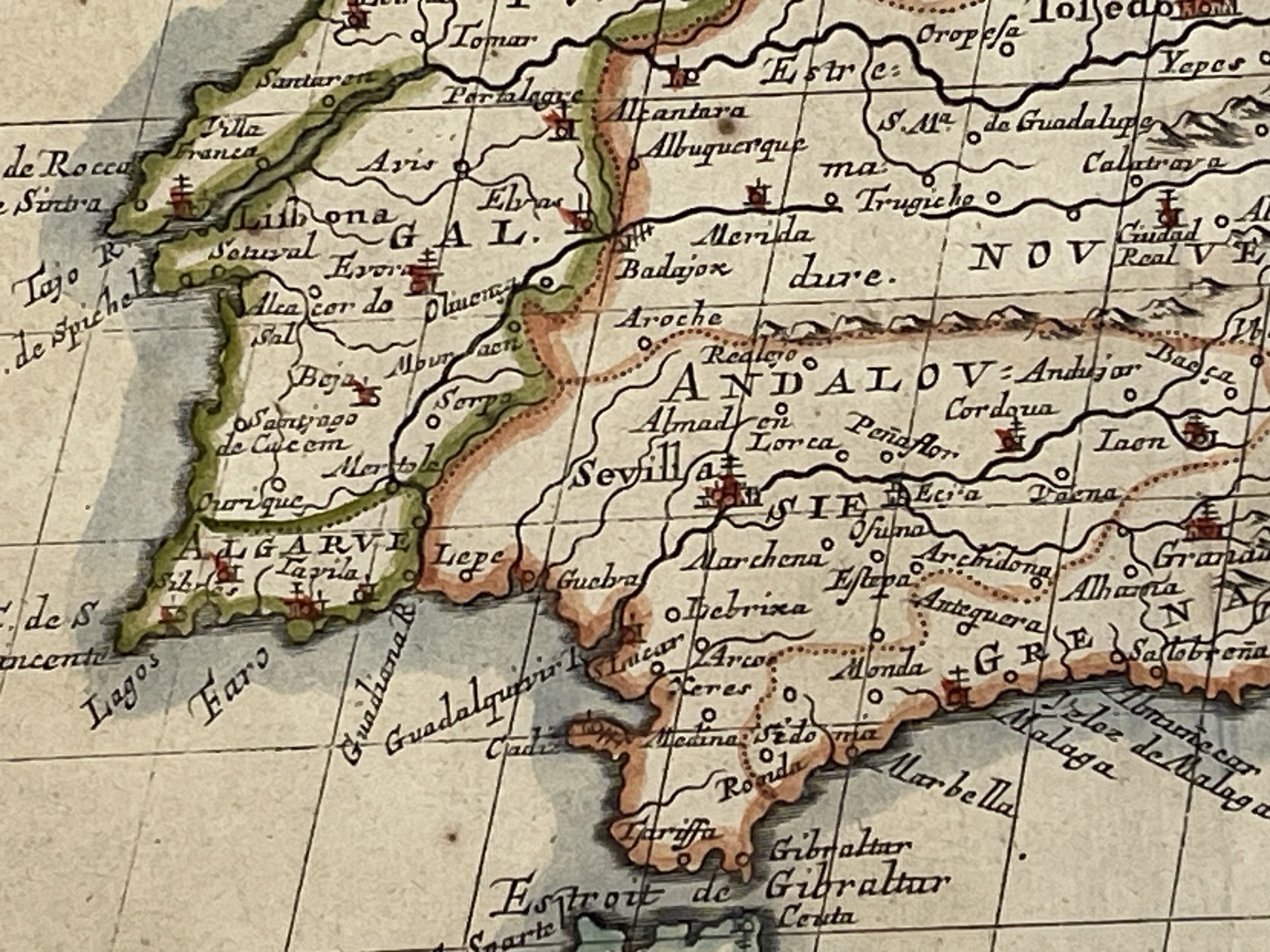 Image 4 of 11
 Image 5 of 11
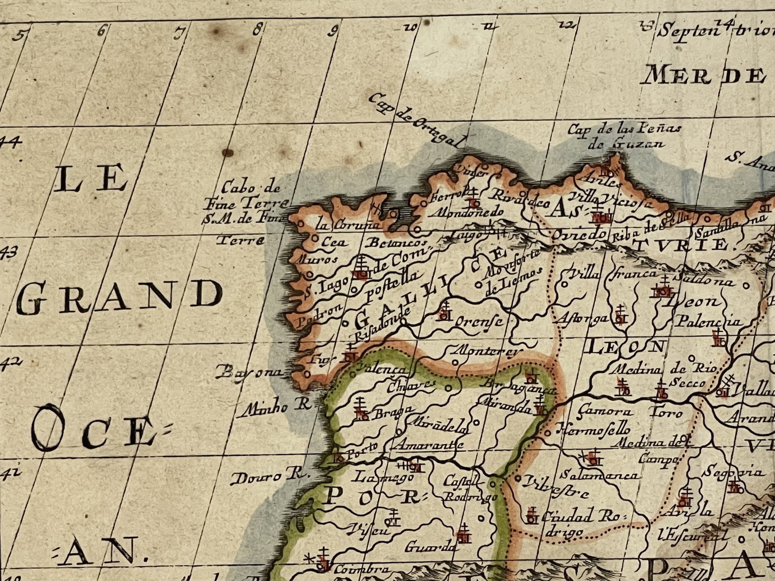 Image 6 of 11
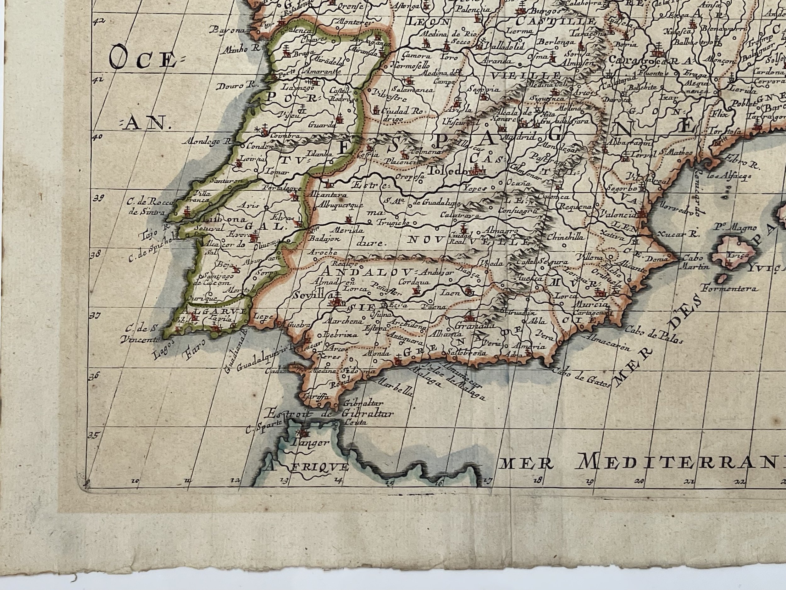 Image 7 of 11
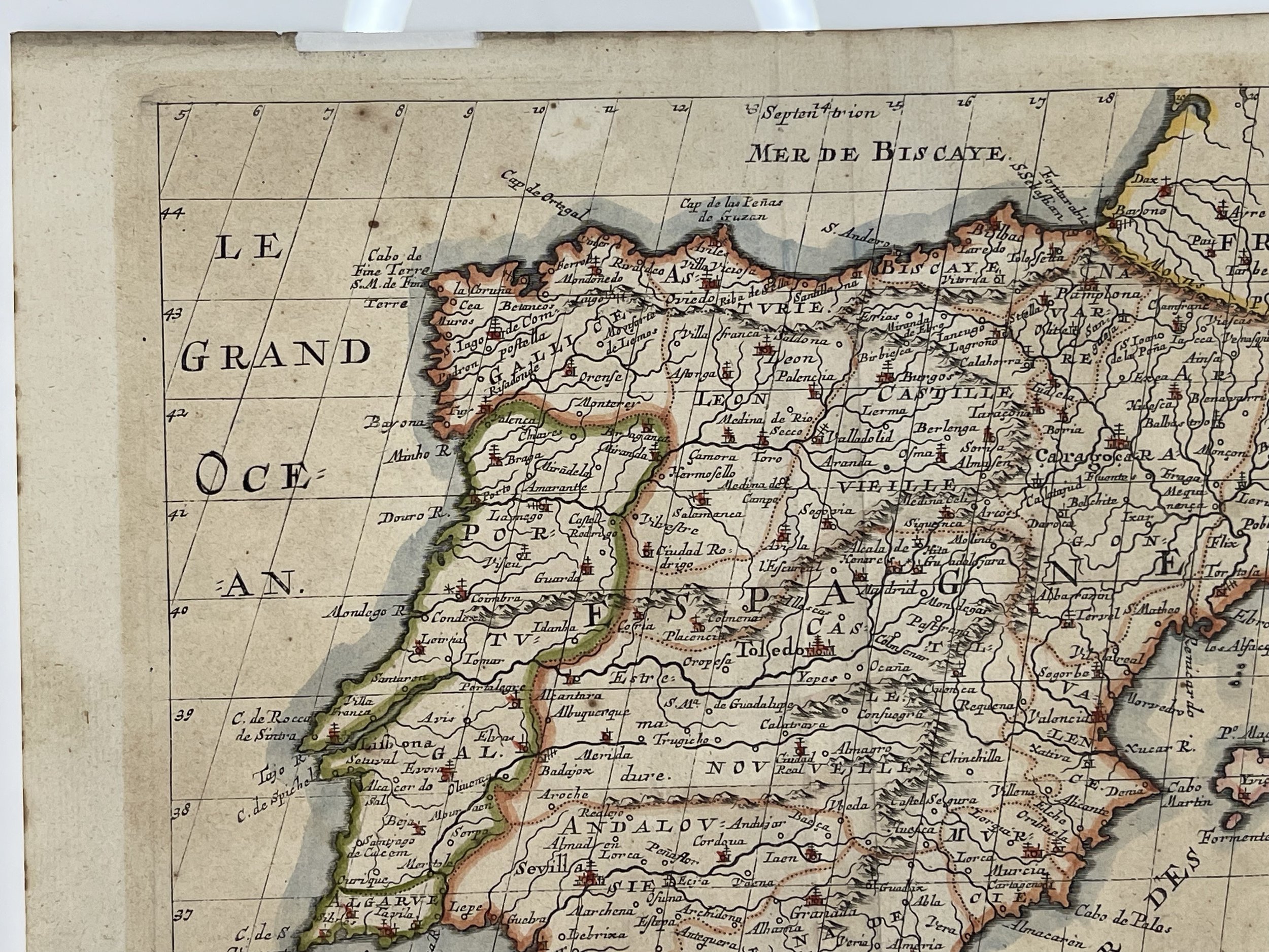 Image 8 of 11
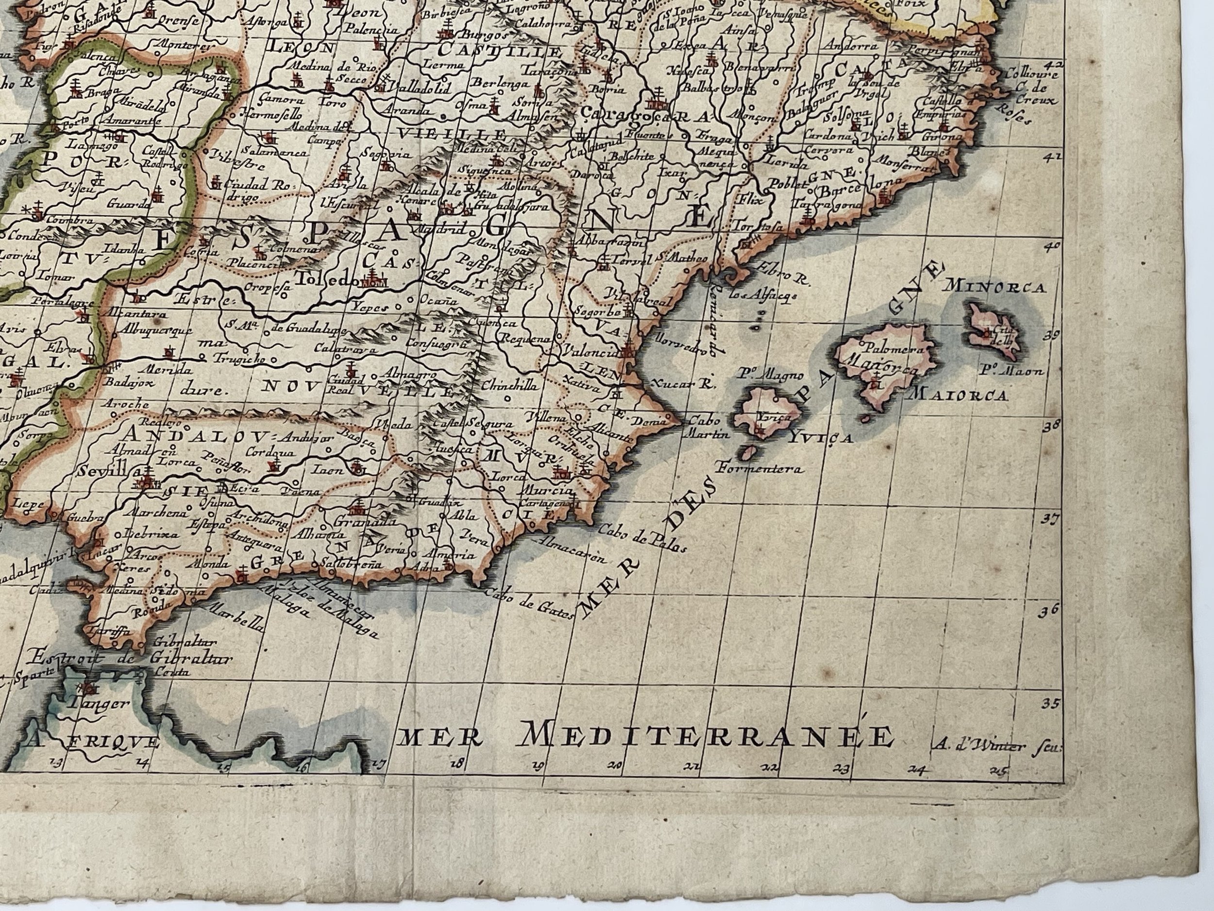 Image 9 of 11
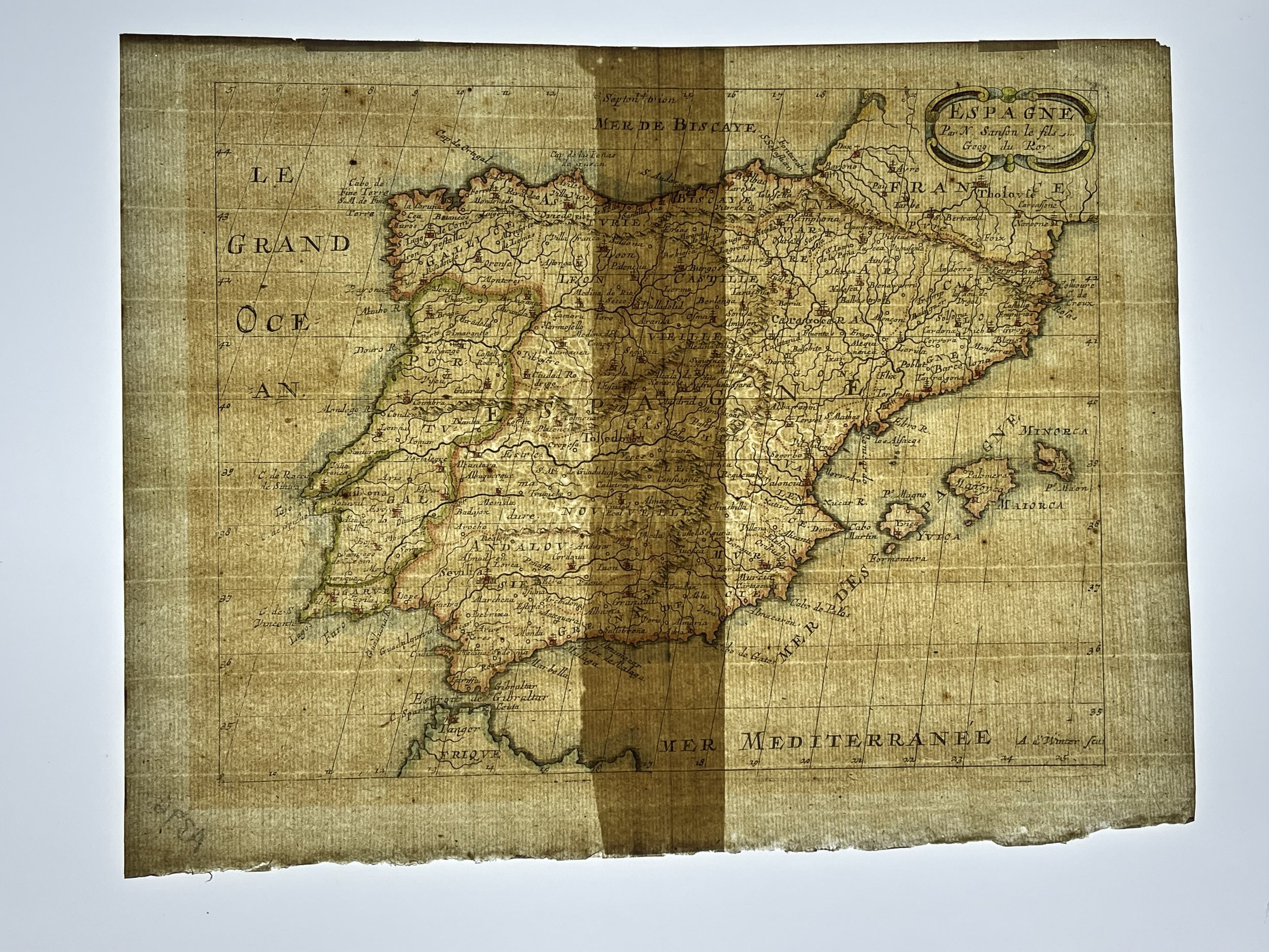 Image 10 of 11
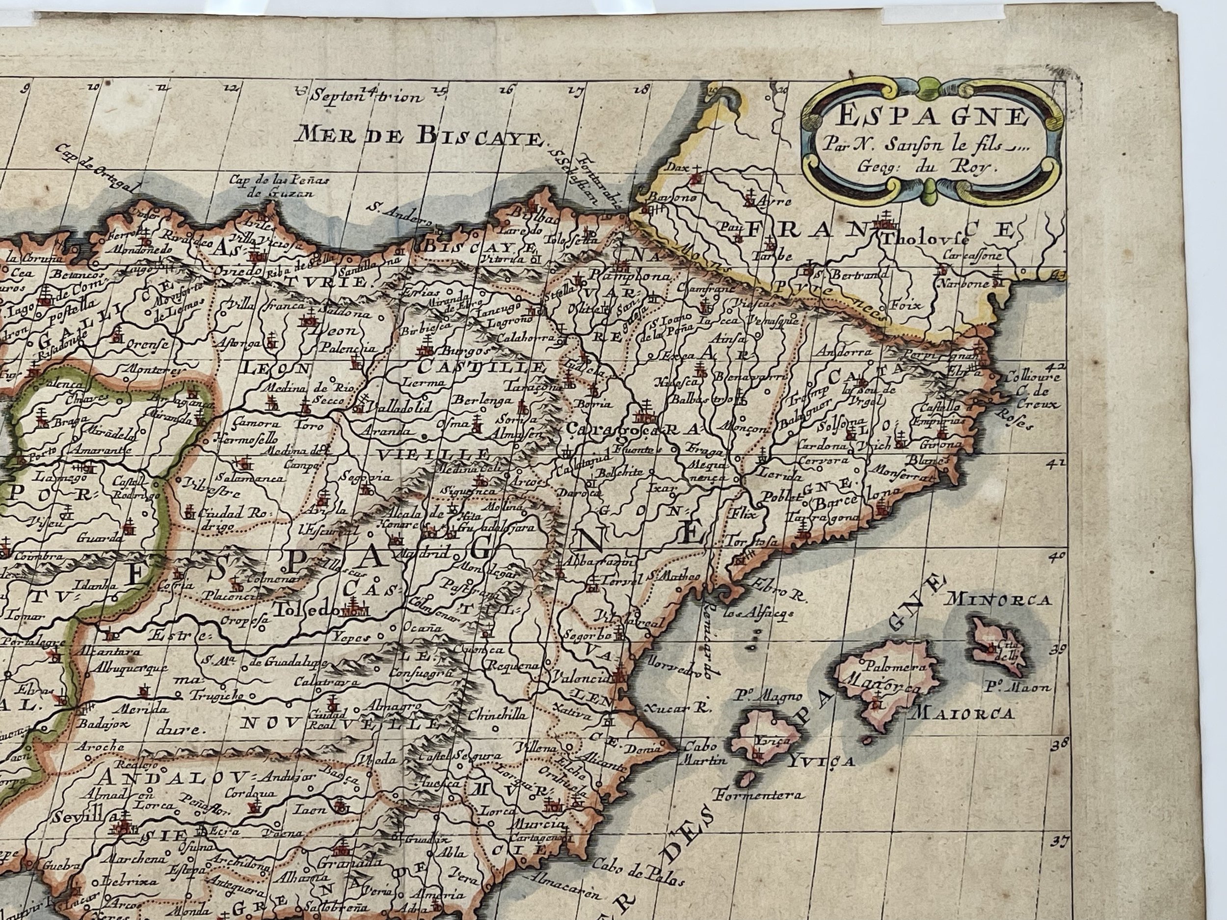 Image 11 of 11