Copper-engraved map, with full modern colour, very large markings, in very good condition. Sun bleaching discolouration due to it 415+ years of age which is quite normal. Sheet size: 22 x 26 inches.
A highly decorative map of Denbighshire by one of the greatest English cartographers
Denbighshire in Wales, clearly a mountainous region, was surveyed by Christopher Saxton, which was Speed's source for this map. William Smith, Pursuivant at the College of Arms, was the apparent source for the coats of arms: one of which is that of Robert Dudley, Earl of Leicester, Queen Elizabeth's favorite. In the town plan of Denbigh, in the upper right corner is a circular inset displaying what appears to be a castle. It is actually an unfinished and indeed never finished church that Leicester had tried to have built in Denbigh. Apparently, his unpopularity was part of the reason the church was never completed. The map is decorated with a sea monster, a classical god on horseback, and a ship. Henry Overton's edition of this map includes the few roads that snaked their way through the county.
Provenance - Thomas Chubb The Printed Maps in the Atlases of Great Britain and Ireland 1579-1870, Page 30, Number 11. Performed by John Speede and are to be solde in Popes head Alley against the exchange by John Sudbury and George Humble Cum Privilegio Anno Domini 1610. (SeePhoto).
John Speed (1551 or 1552 – 28 July 1629) was an English cartographer, chronologer and historian of Cheshire origins. The son of a citizen and Merchant Taylor in London, he rose from his family occupation to accept the task of drawing together and revising the histories, topographies and maps of the Kingdoms of Great Britain as an exposition of the union of their monarchies in the person of King James I and VI. He accomplished this with remarkable success, with the support and assistance of the leading antiquarian scholars of his generation. He drew upon and improved the shire maps of Christopher Saxton, John Norden and others, being the first to incorporate the hundred-boundaries into them, and he was the surveyor and originator of many of the town or city plans inset within them. His work helped to define early modern concepts of British national identity. His Biblical genealogies were also formally associated with the first edition of the King James Bible. He is among the most famous of English mapmakers.
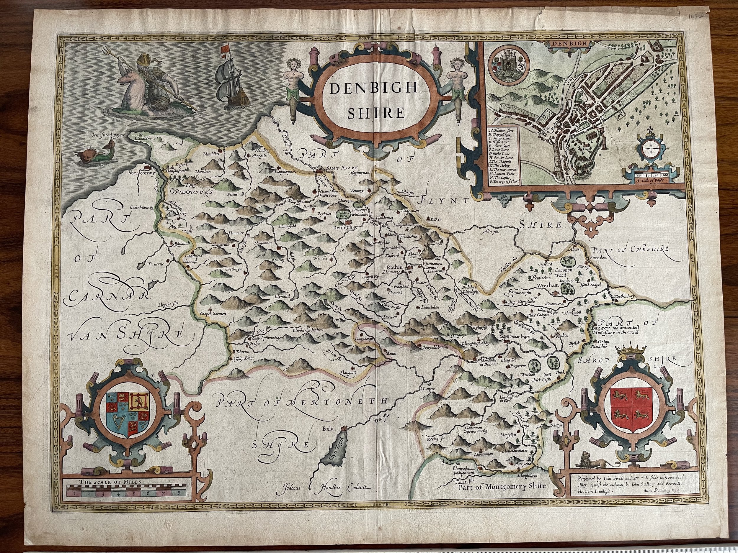 Image 1 of 16
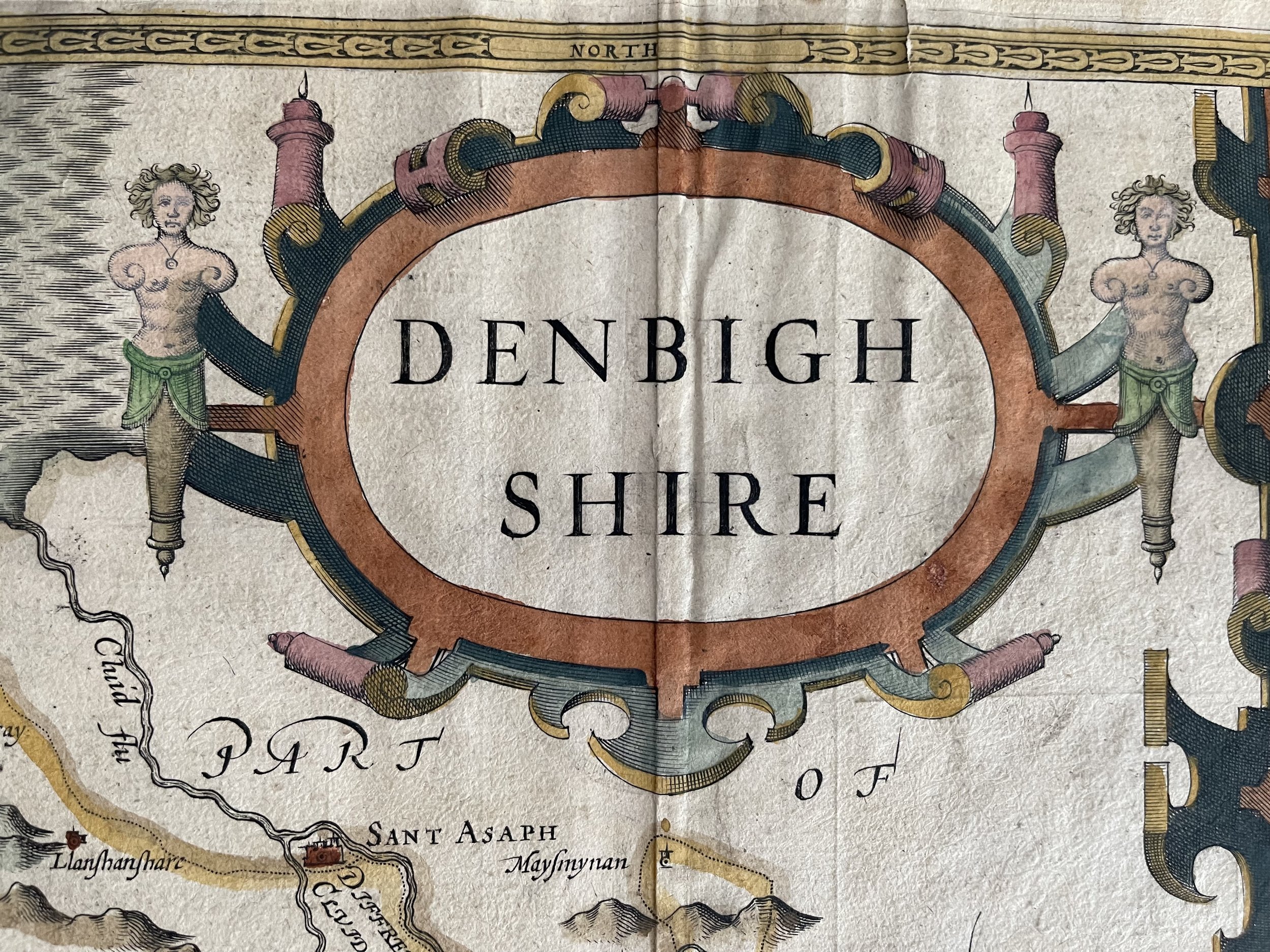 Image 2 of 16
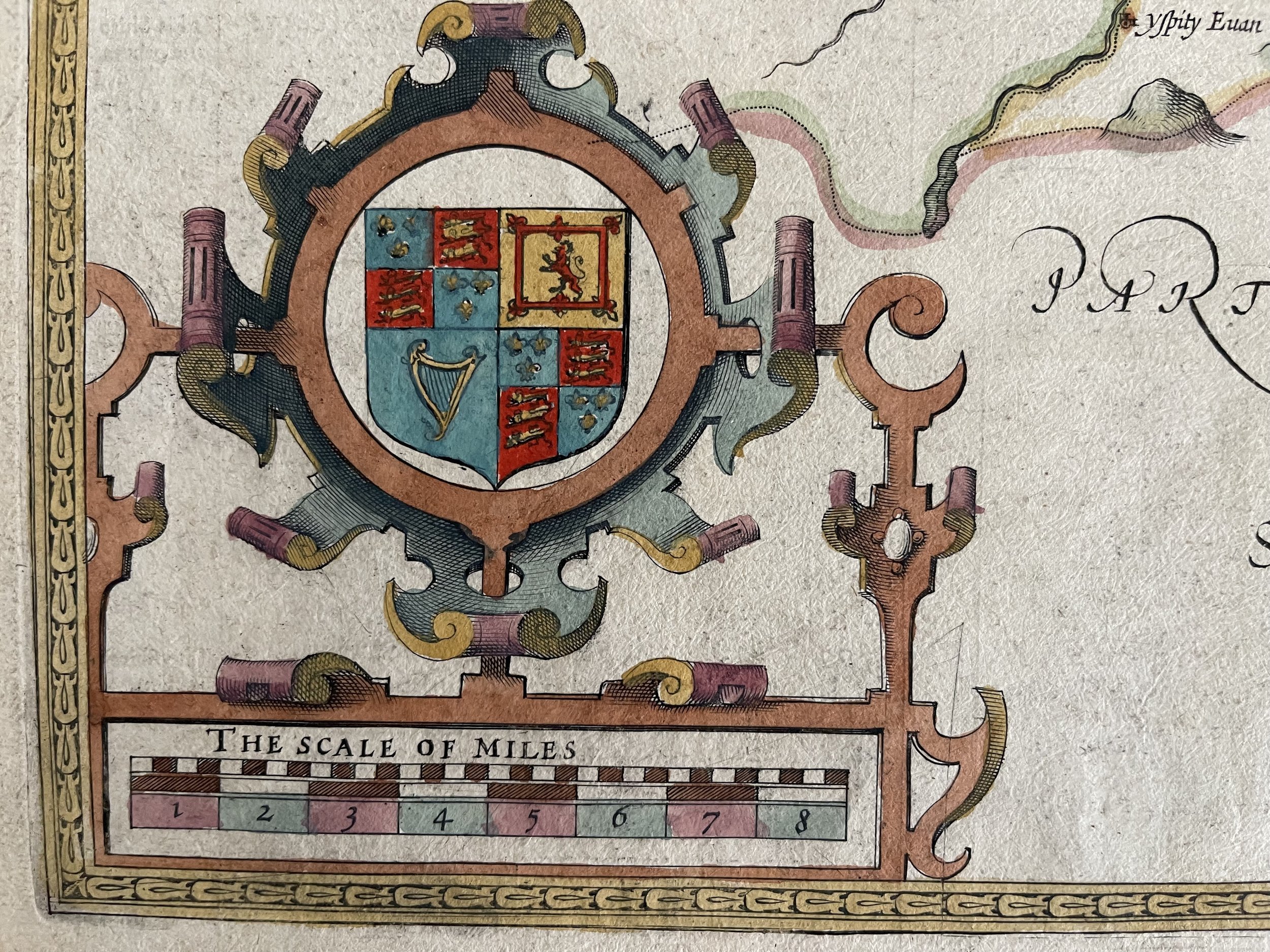 Image 3 of 16
 Image 4 of 16
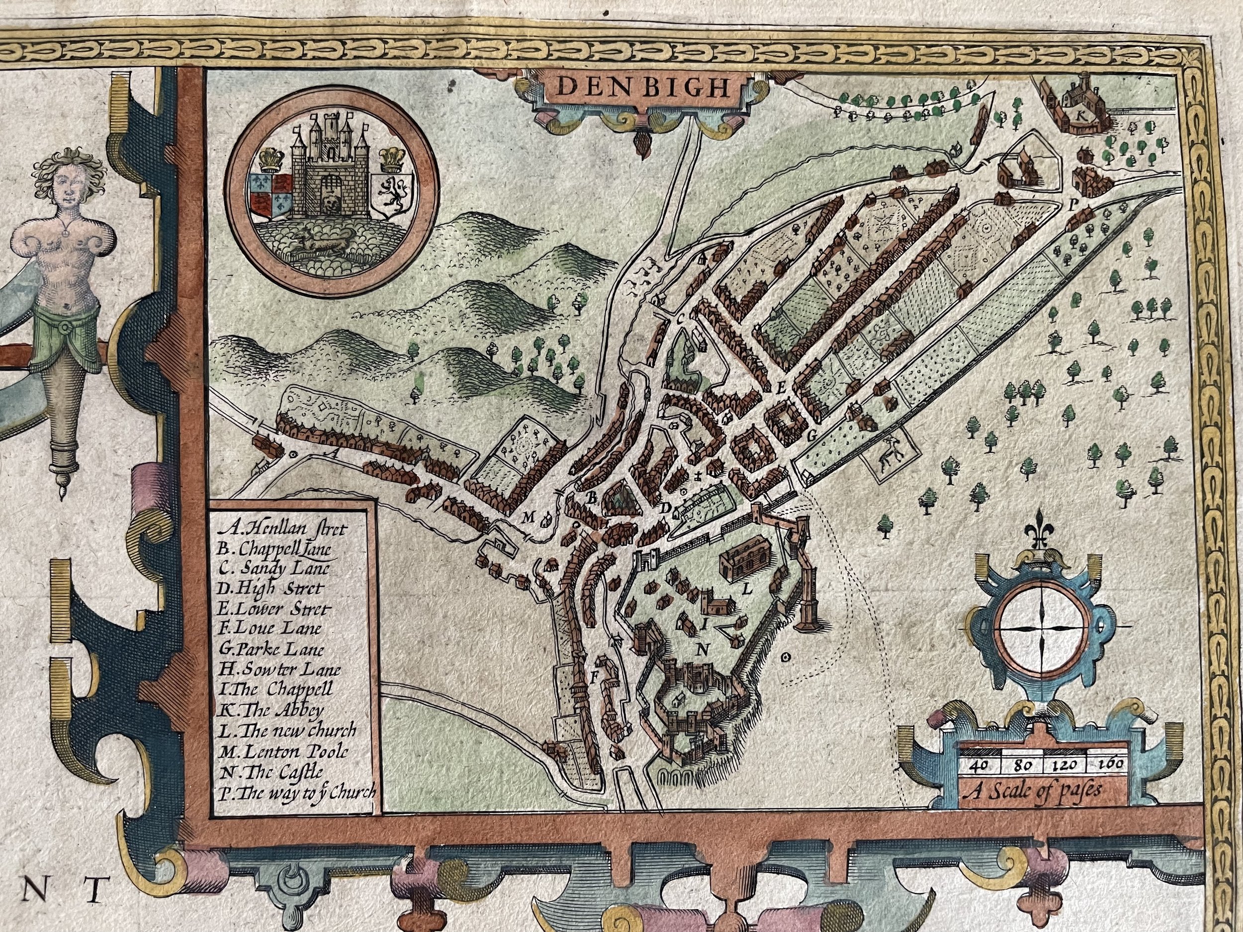 Image 5 of 16
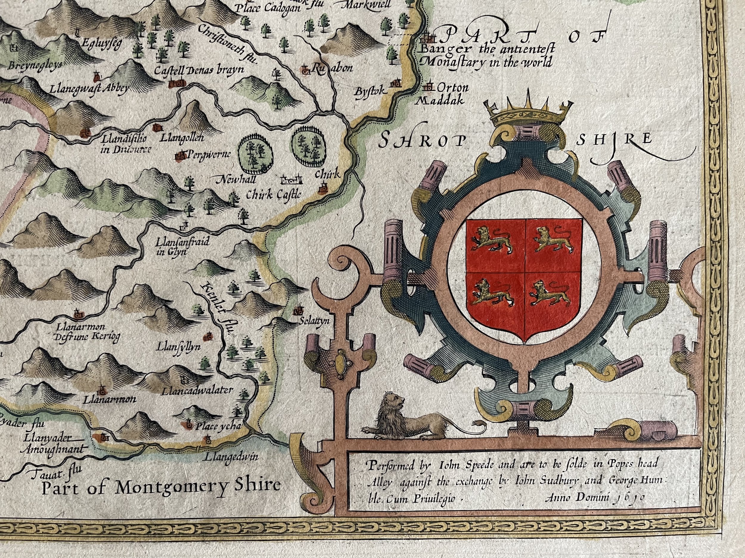 Image 6 of 16
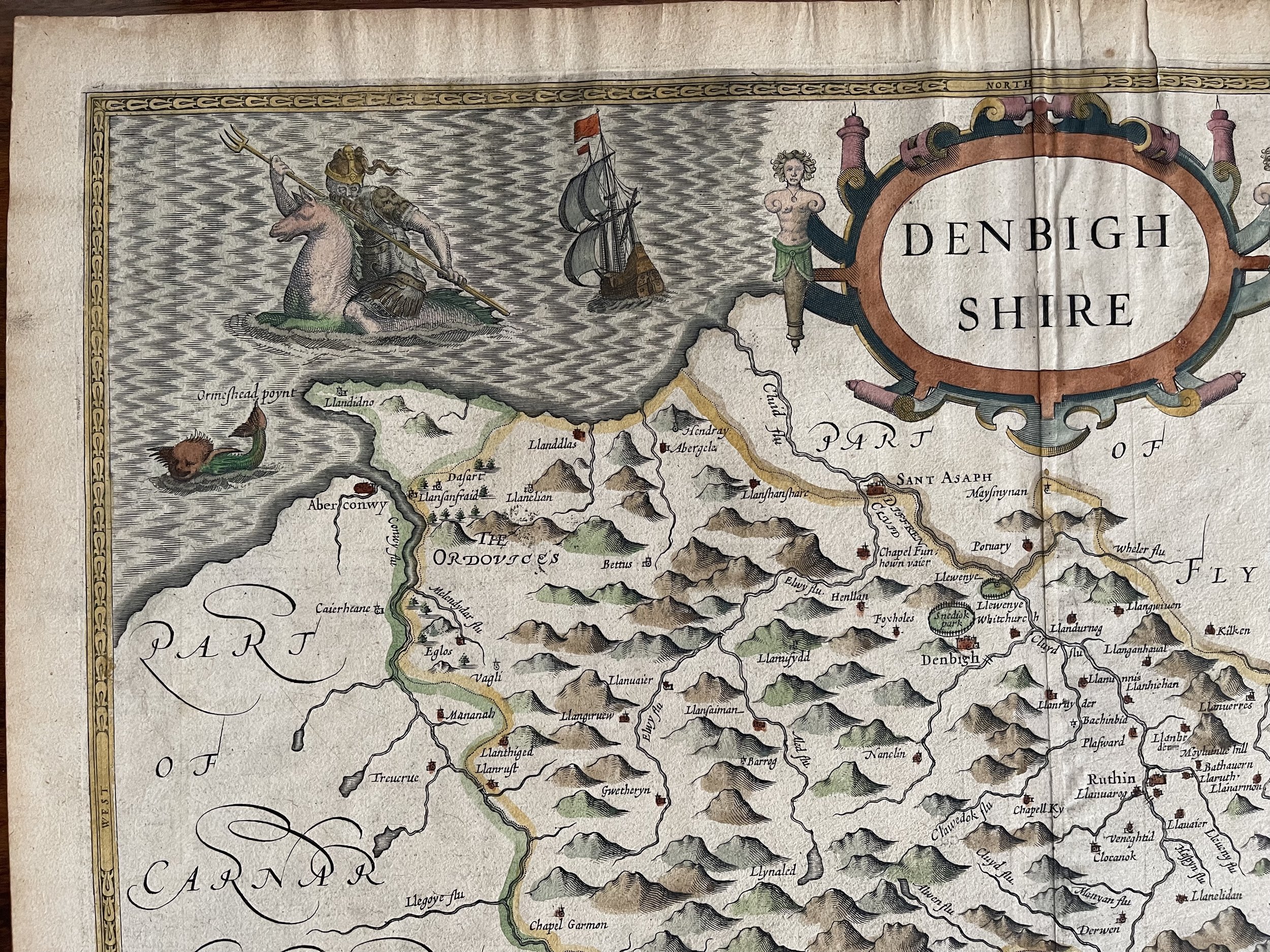 Image 7 of 16
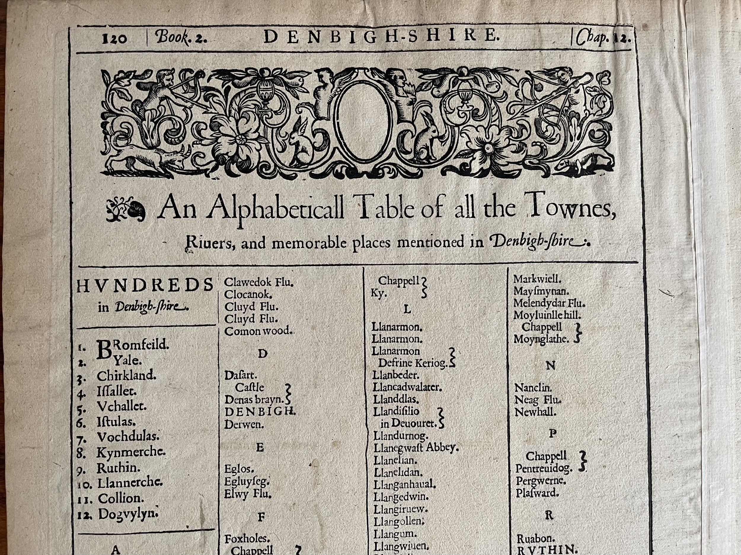 Image 8 of 16
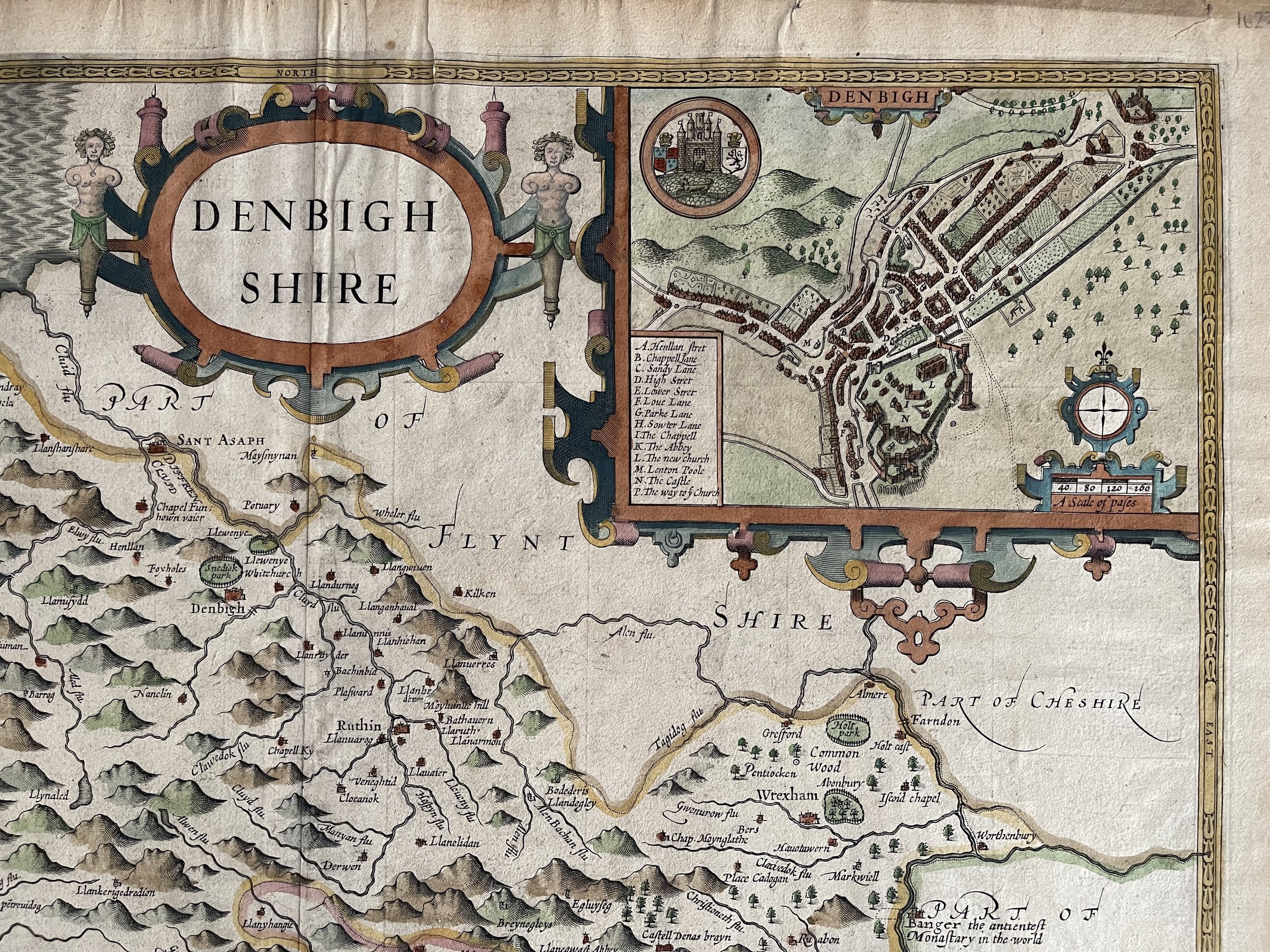 Image 9 of 16
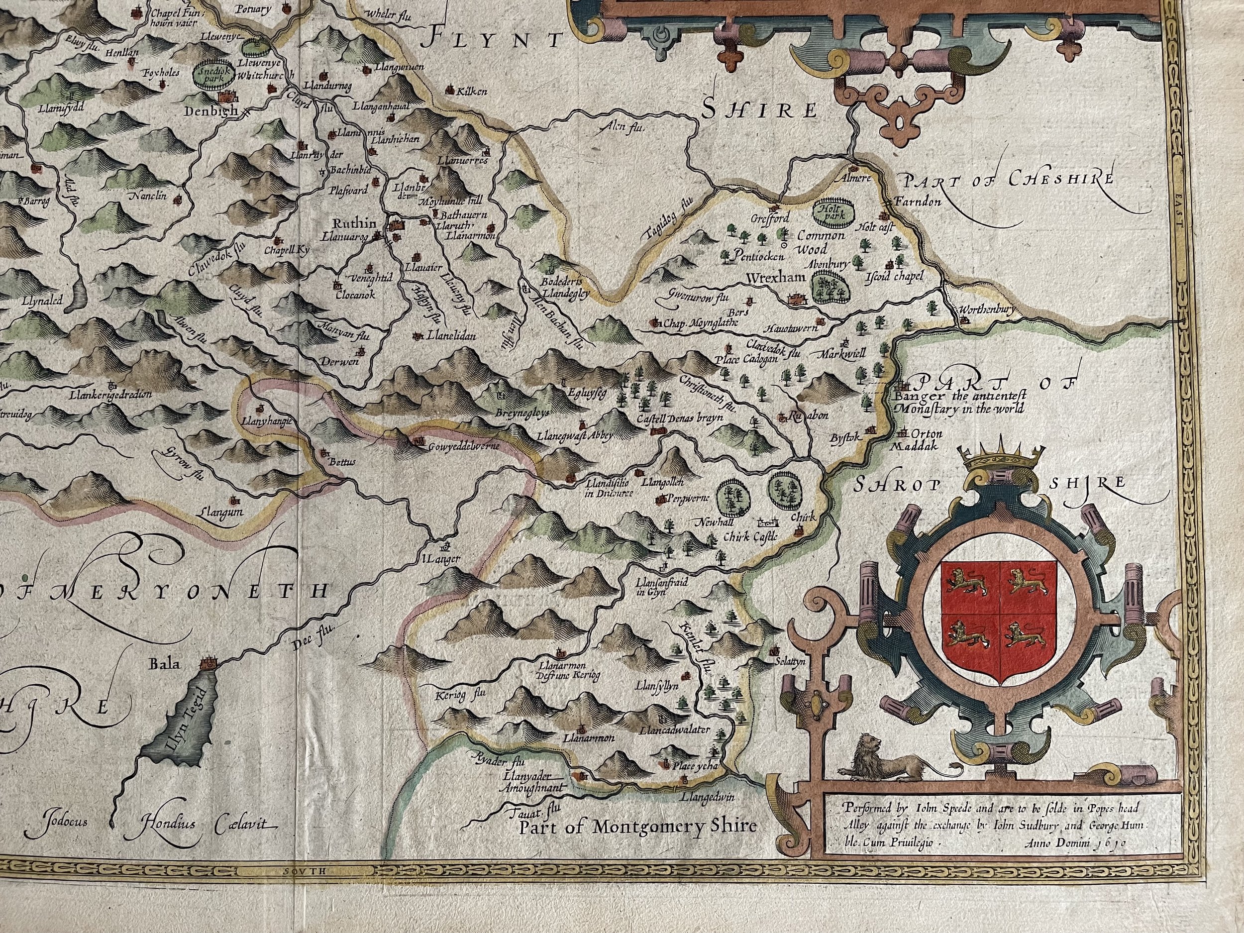 Image 10 of 16
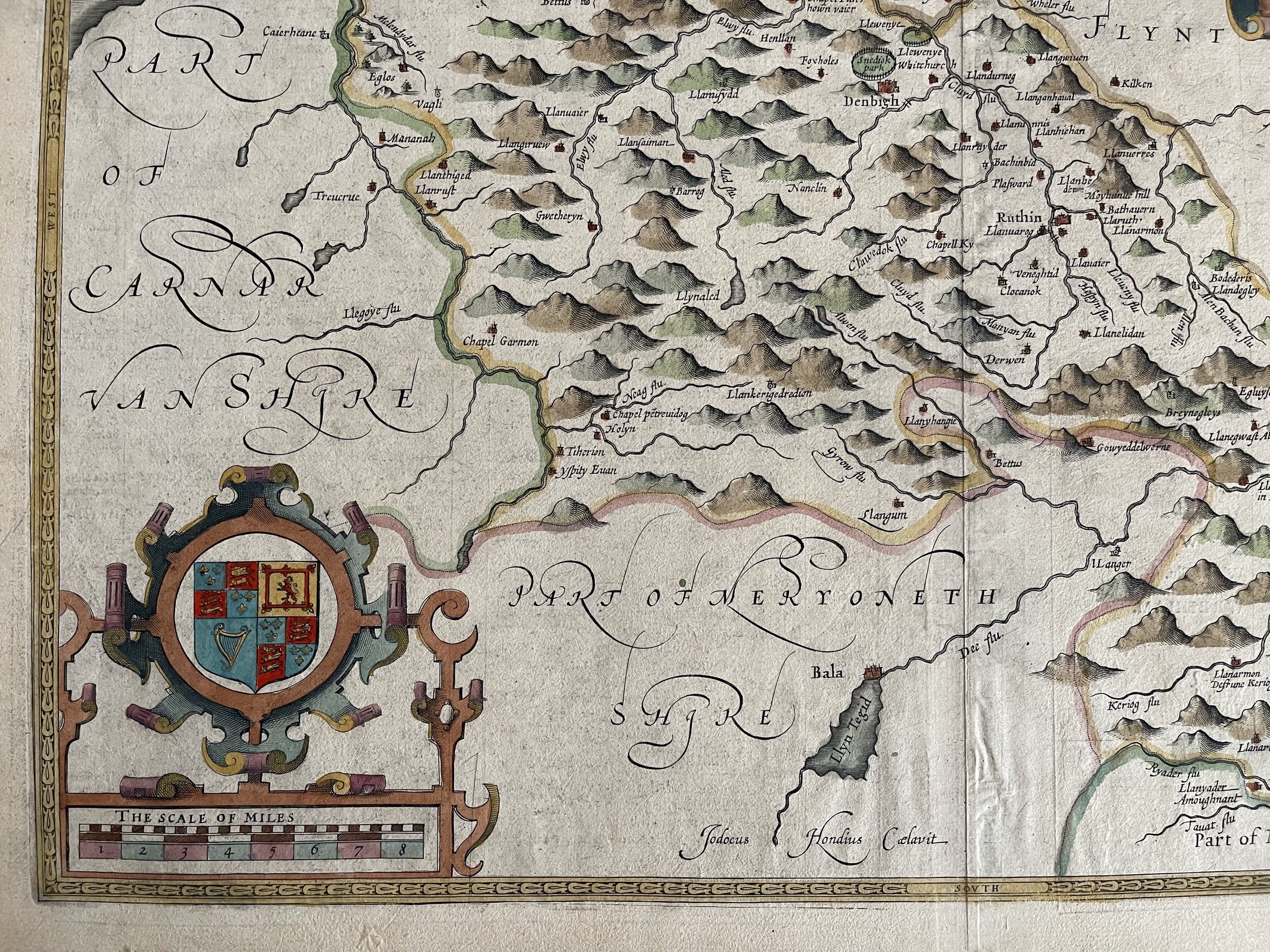 Image 11 of 16
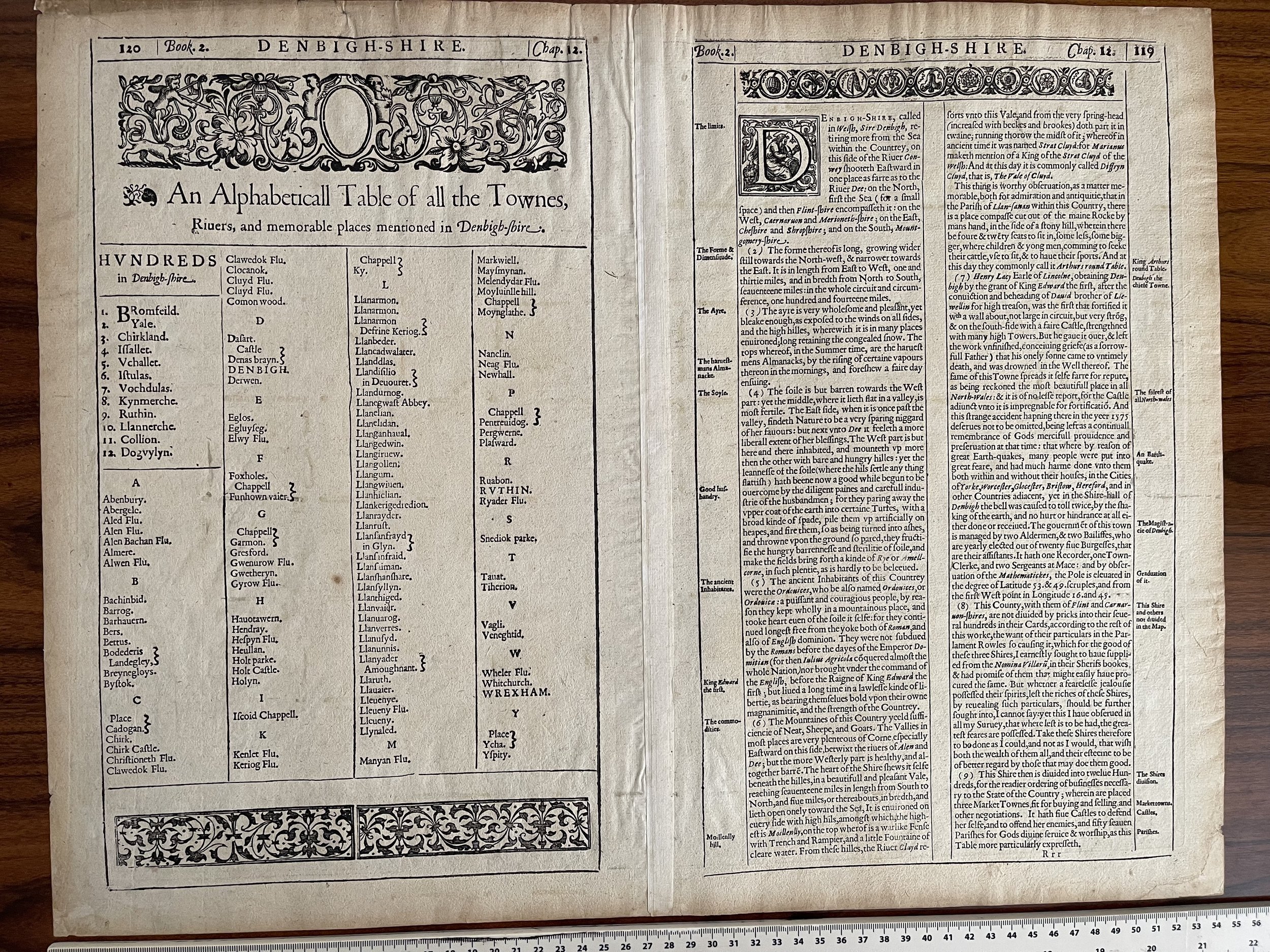 Image 12 of 16
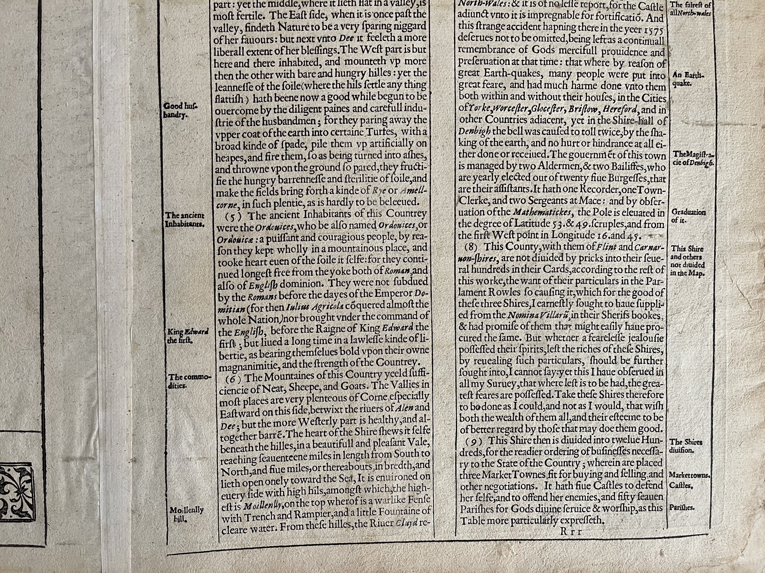 Image 13 of 16
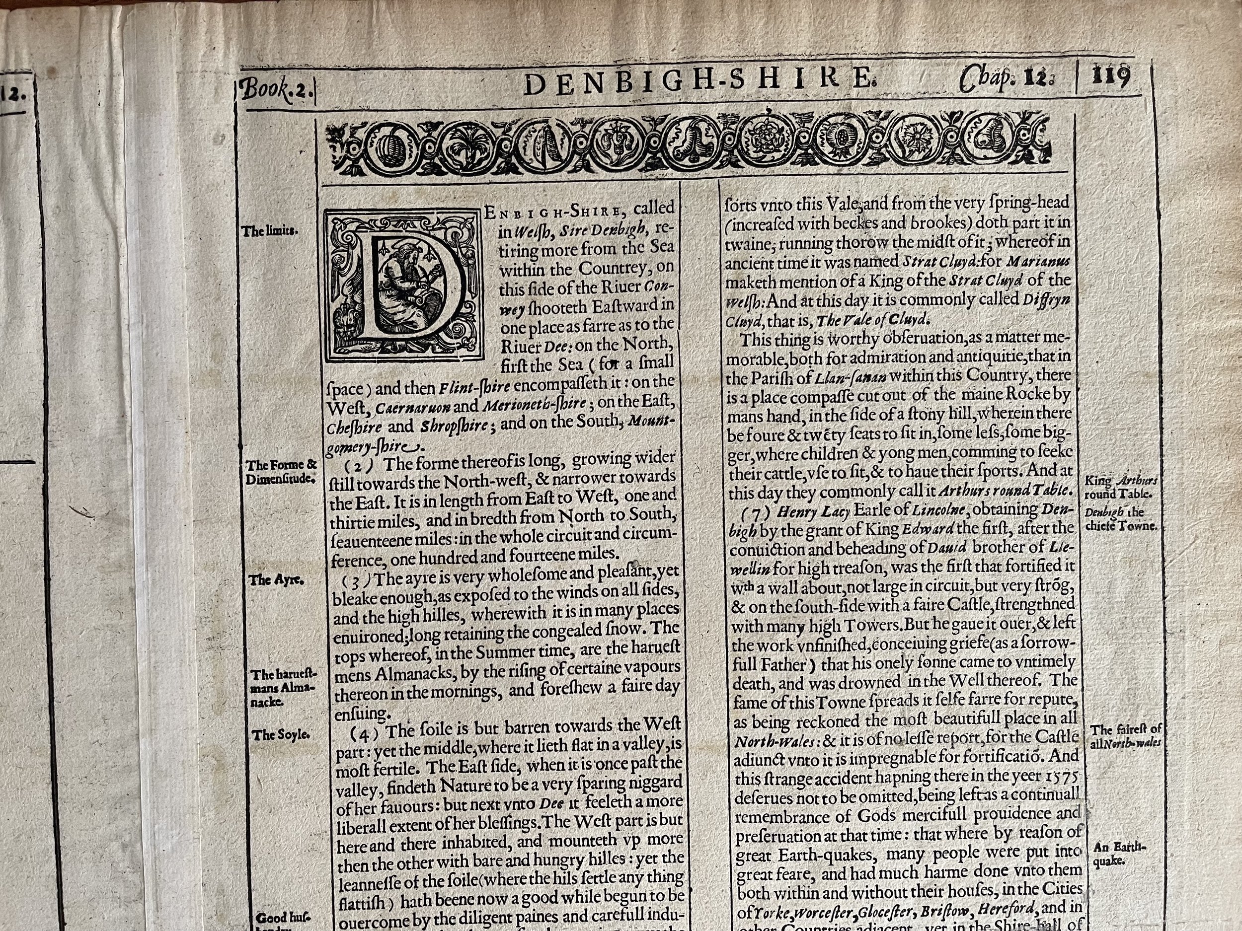 Image 14 of 16
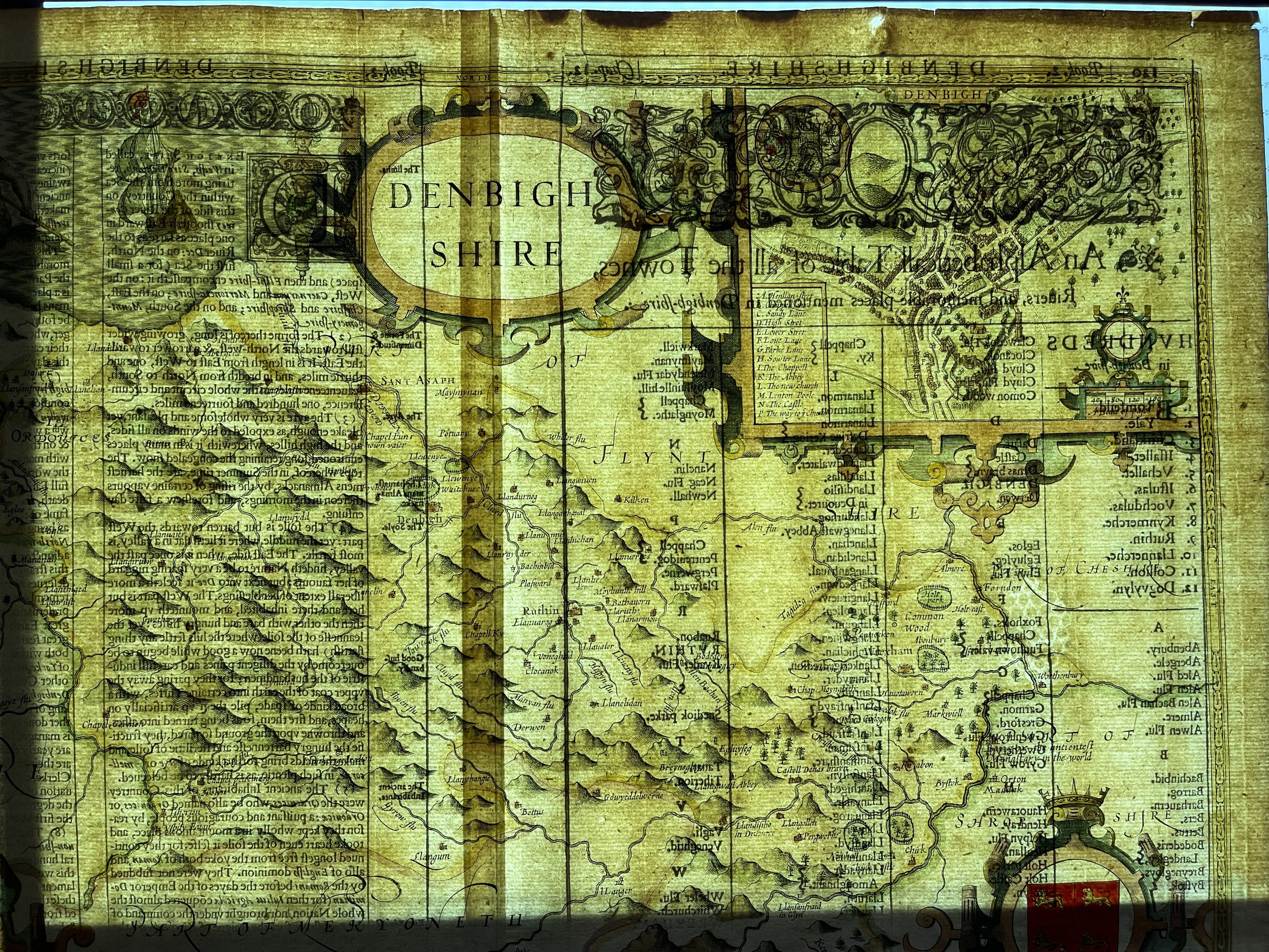 Image 15 of 16
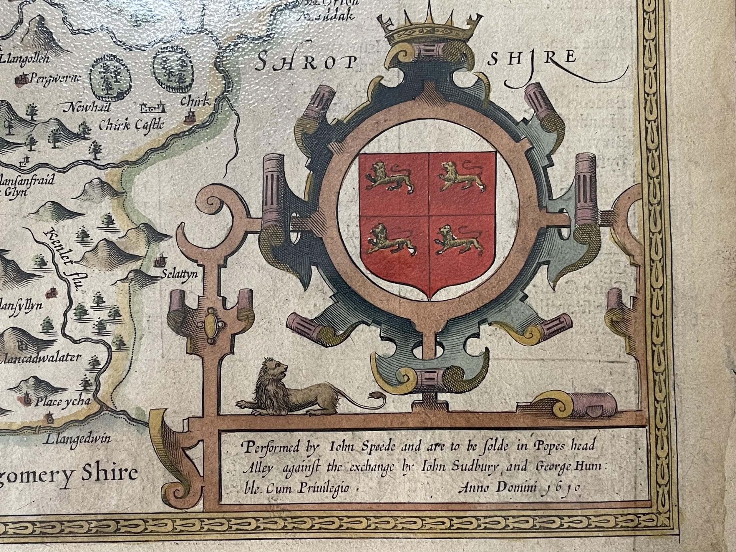 Image 16 of 16