Comitatus Flandriae in omnes ejusdem subjacentes Ditioes cum adjacentibus accuratißime divisus sumtibus.
Original coloured copper engraved map by J. B. Homann (1664-1724) from around 1720 Nuremberg. Includes the cities of Brugge, Lille, Bruxelles, Tournai, Arras, Mons, Antwerpen, Oudenaards, Valenciennes, Maubeuge.
Highly detailed map of the region, centered on Brugge, and including Brussels, Ghent, Yperen, Dendermonde, Douai, Lilie, Duynkurke, Oostende, etc. Includes large decorative cartouche. A nice highly detailed map. Minor dampstain in lower left corner, else a nice example.
This map of Flanders shows the coastline of the North Sea between Gravelines and the Scheldt estuary, with Antwerp and Brussels to the east. With a beautiful title cartouche to the upper left corner.
Johann Baptist Homann (20 March 1664 - 1 July 1724) was a German geographer and cartographer, who also made maps of the Americas.
Homann was born in Oberkammlach near Kammlach in the Electorate of Bavaria. Although educated at a Jesuit school, and preparing for an ecclesiastical career, he eventually converted to Protestantism and from 1687 worked as a civil law notary in Nuremberg. He soon turned to engraving and cartography; in 1702 he founded his own publishing house Homann Heirs publishing company. He lived his entire life in Bavaria, particularly in Nuremberg. Initially, Johann trained to become a priest before converting to Protestantism and working as a notary. The firm flourished, becoming the leading map publisher in Germany and an important entity in the European map market. In 1715, Johann was named Imperial Geographer to the Holy Roman Empire by Charles VI and made a member of the Prussian Academy of Sciences. In the same year he was also named a member of the Prussian Academy of Sciences in Berlin. Of particular significance to cartography were the imperial printing privileges (Latin: privilegia impressoria). These protected for a time the authors in all scientific fields such as printers, copper engravers, map makers and publishers. They were also very important as a recommendation for potential customers.
Most importantly for his business, his reputation and contacts gained him imperial printing privileges which protected his publications and recommended him to customers. Johann is best known for publishing the Grosser Atlas ueber die ganze Welt, or the Grand Atlas of the World, published in 1716.
After Johann died in 1724, the business passed to his son, Christoph (1703-1730). Upon Christoph’s early death, the company passed to subsequent heirs, with the name of the company changing to Homann Erben, or Homann Heirs. The firm continued in business until 1848 managed by Johann Michael Franz and Johann Georg Ebersberger. After subsequent changes in management the company folded in 1852. The company was known as "Homann Erben", "Homanniani Heredes", or "Heritiers de Homann" abroad.
Pricing and grading commensurate.
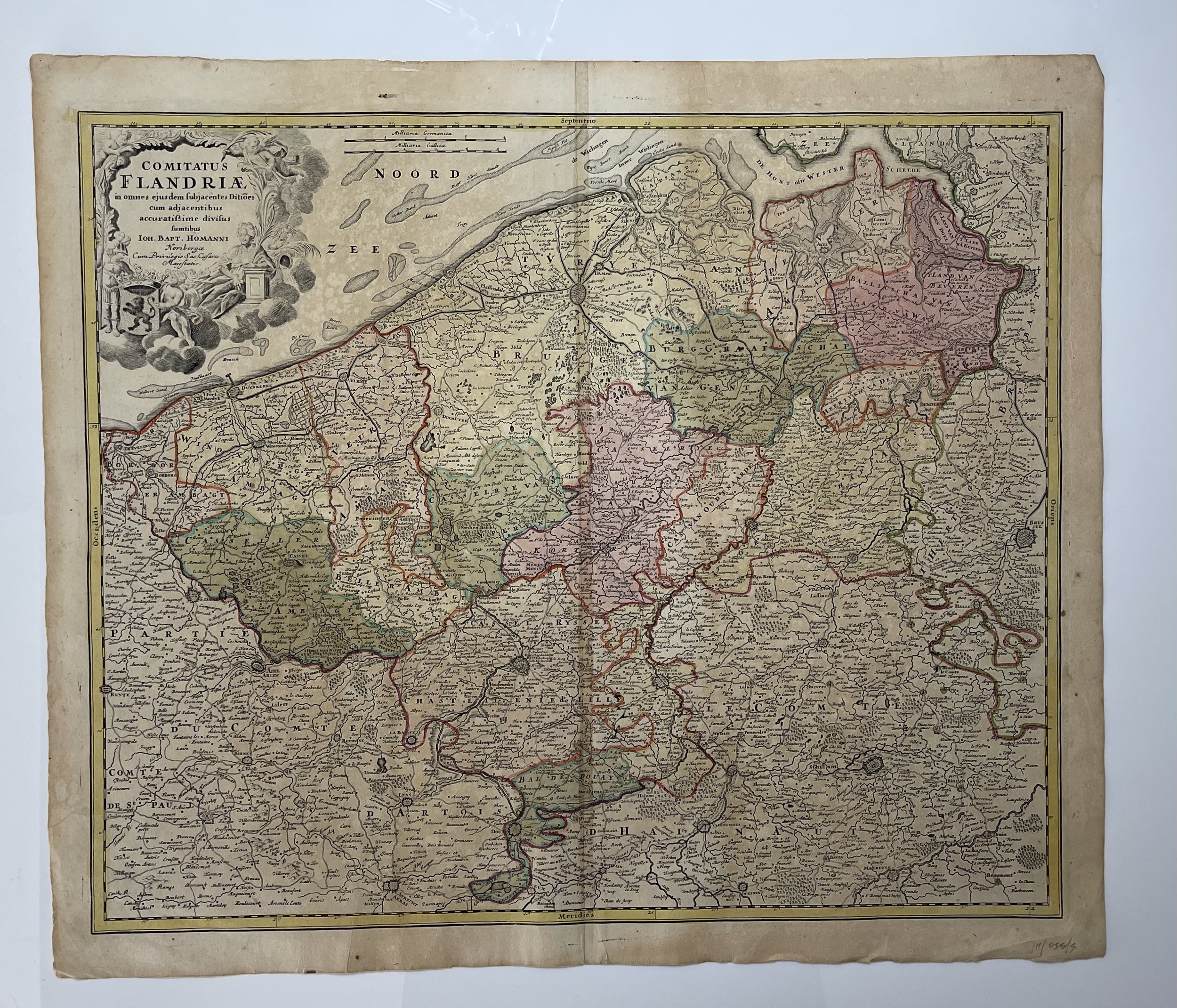 Image 1 of 13
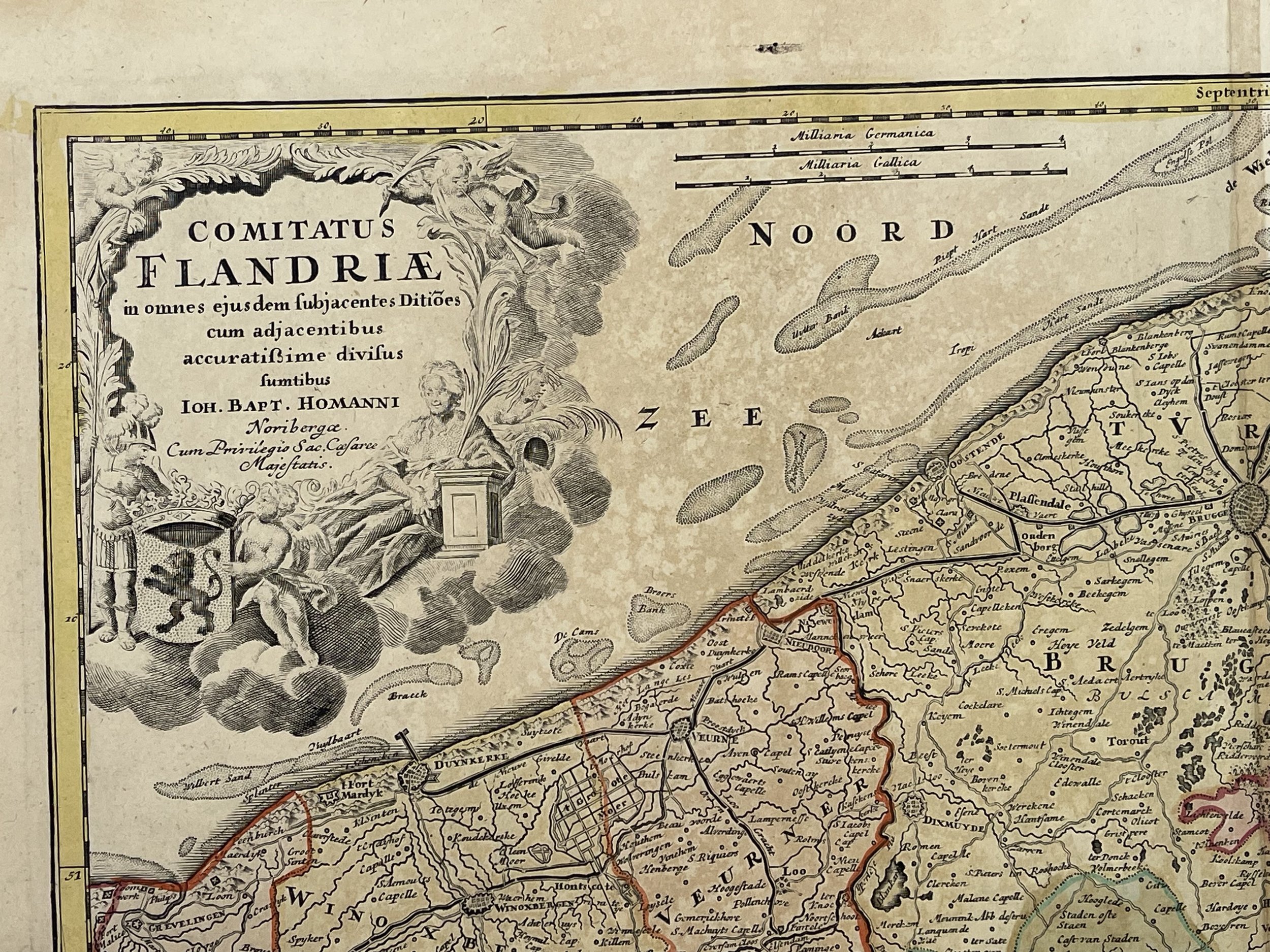 Image 2 of 13
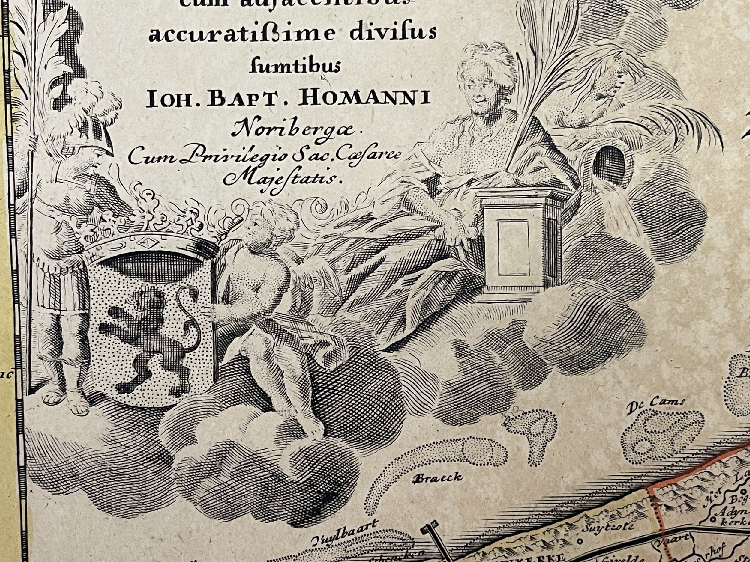 Image 3 of 13
 Image 4 of 13
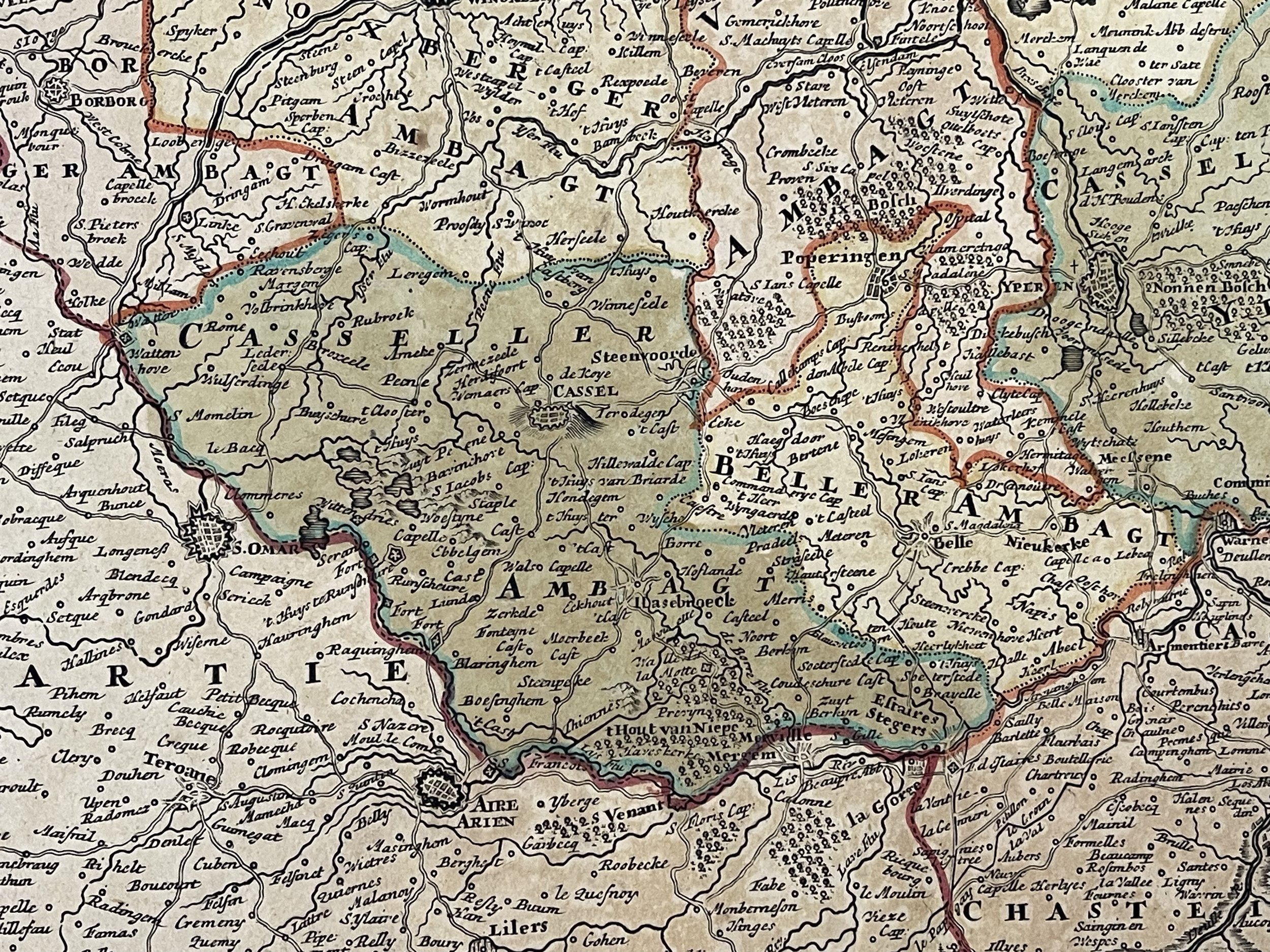 Image 5 of 13
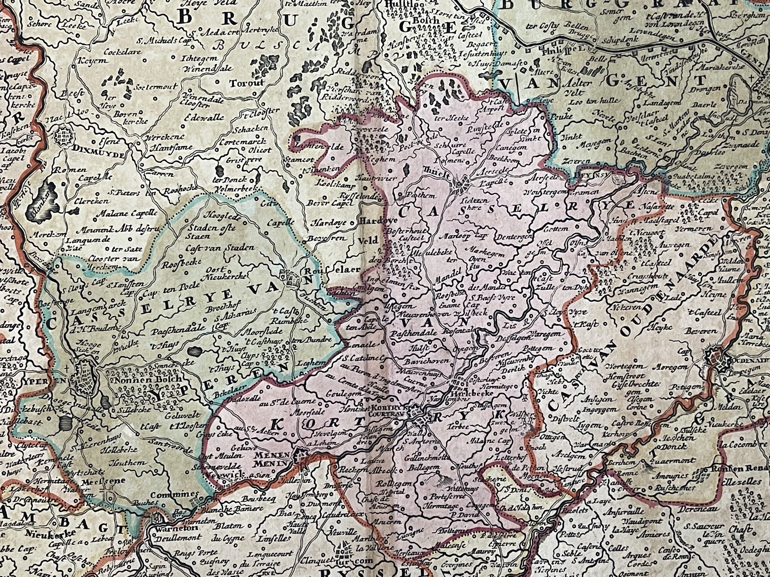 Image 6 of 13
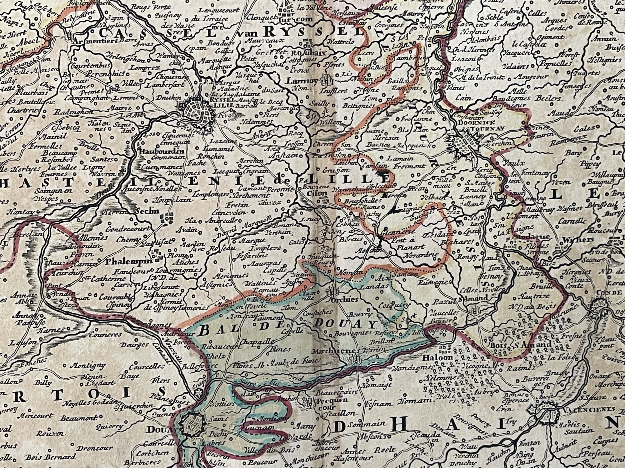 Image 7 of 13
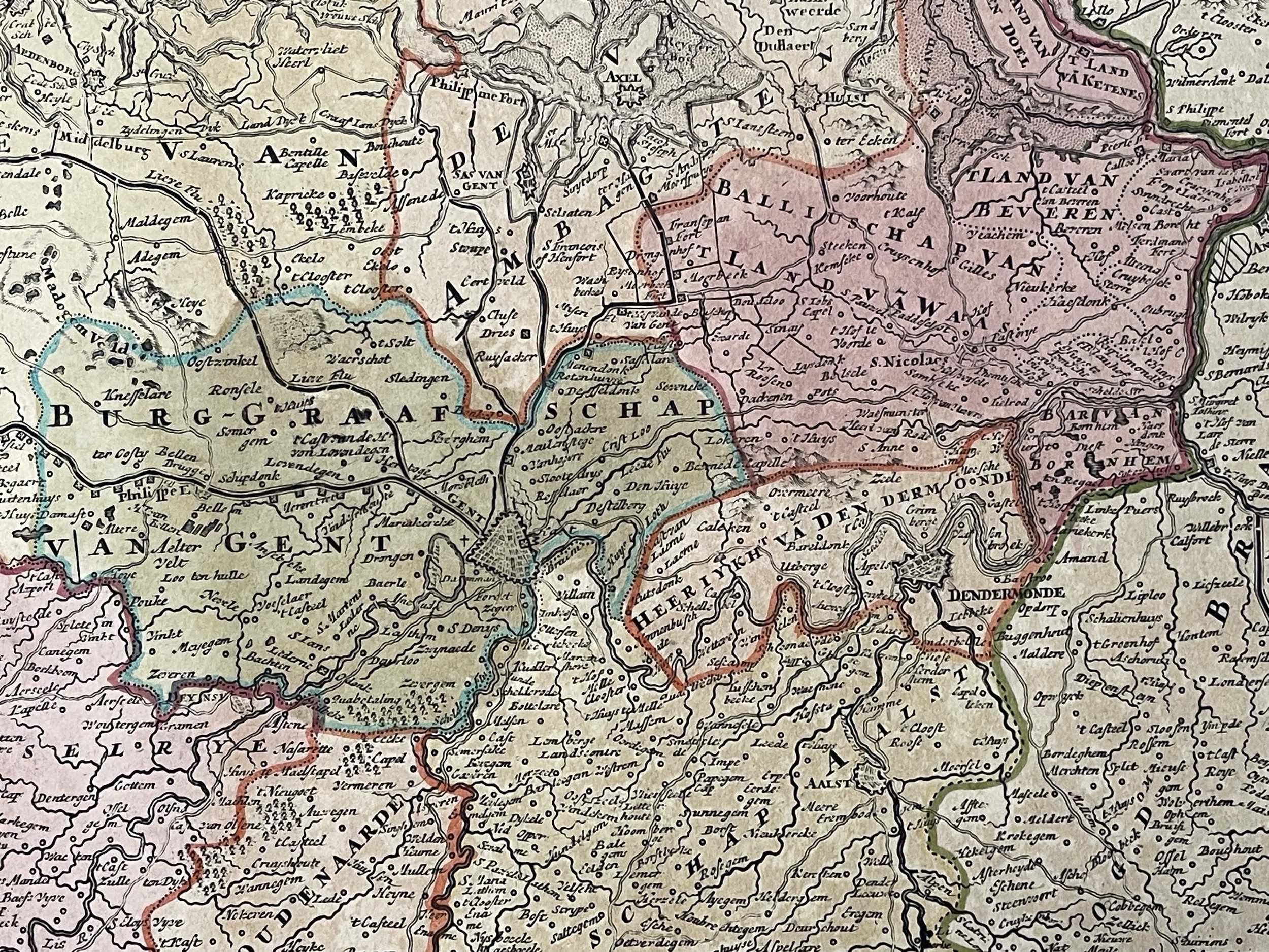 Image 8 of 13
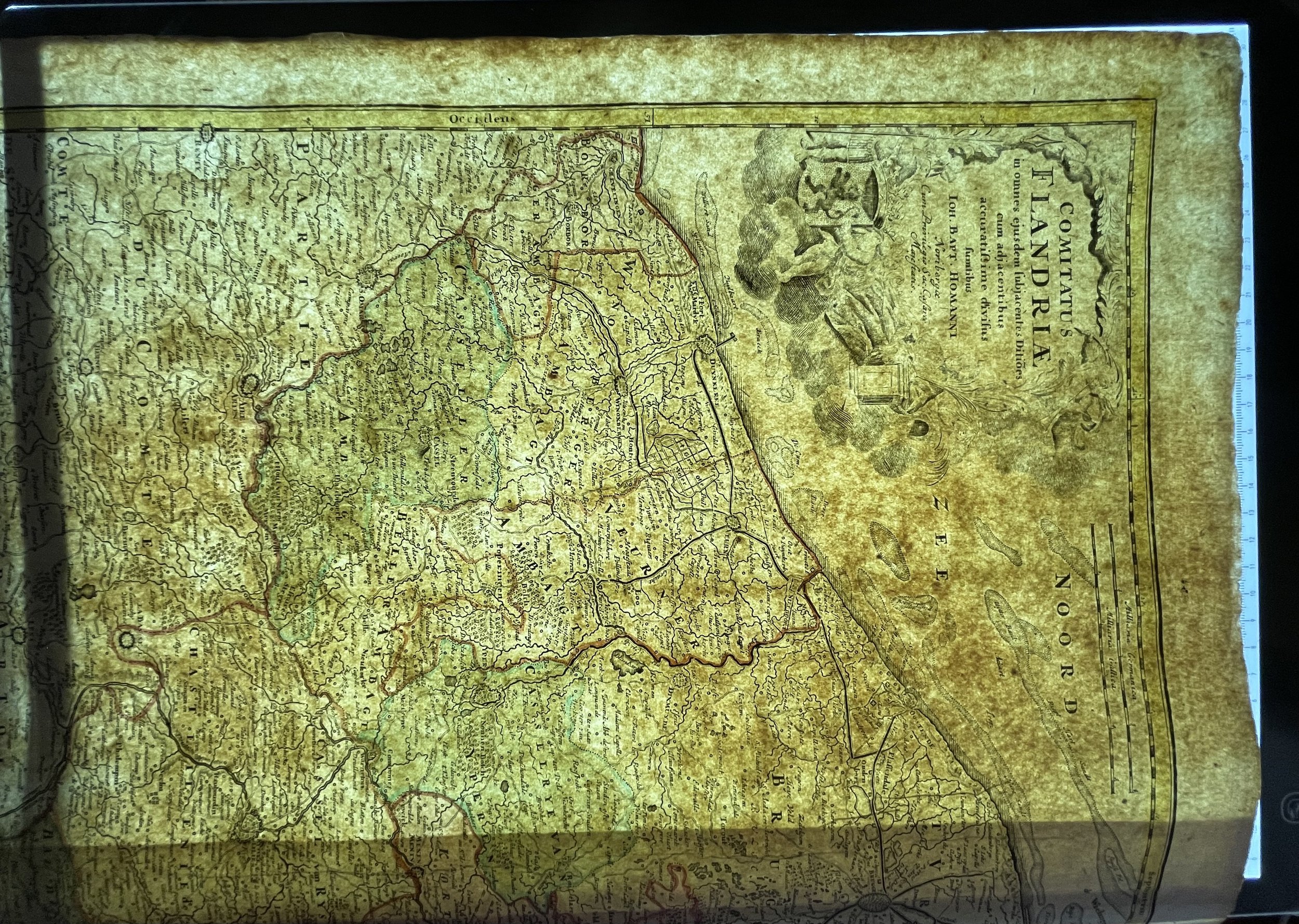 Image 9 of 13
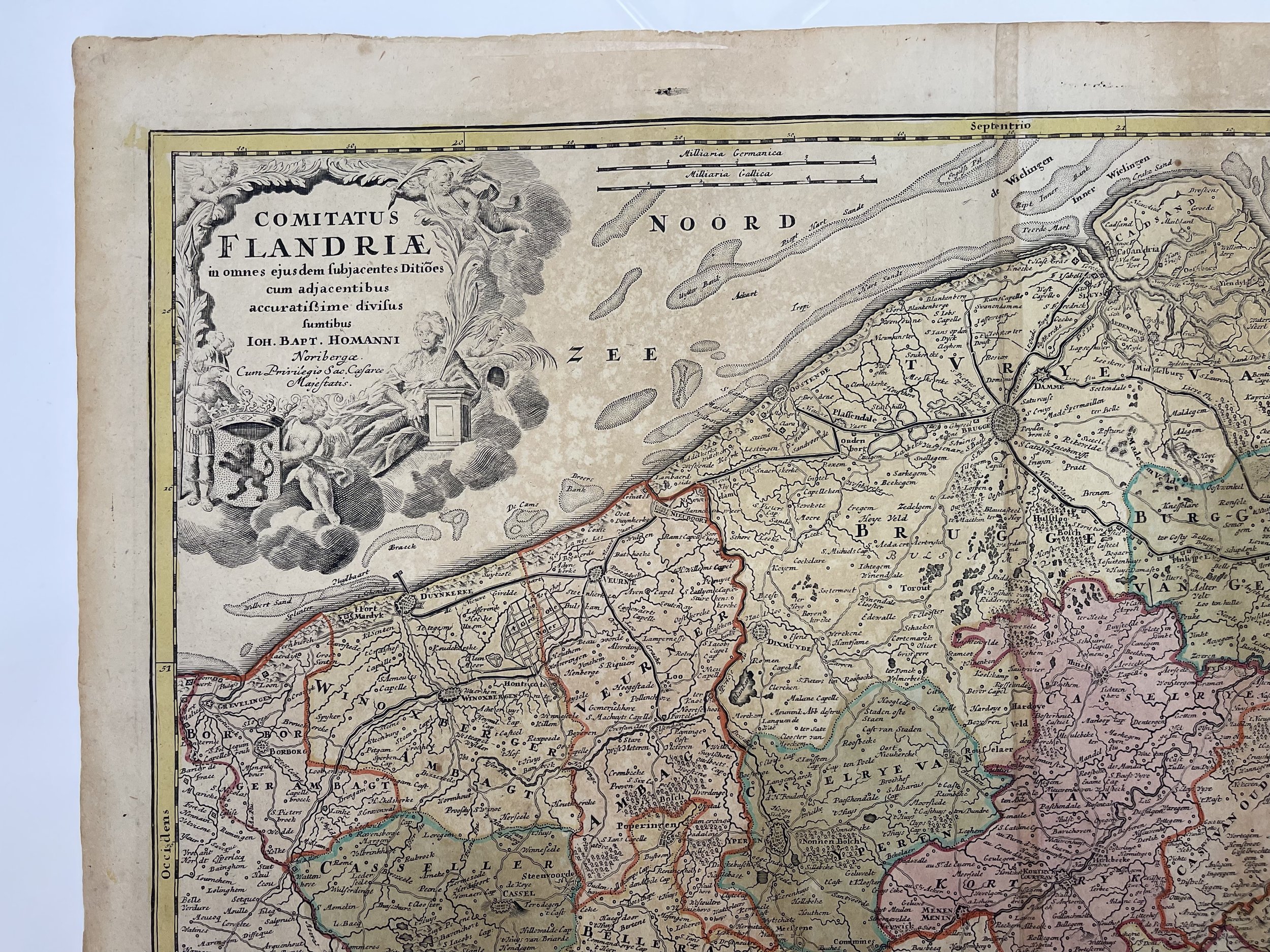 Image 10 of 13
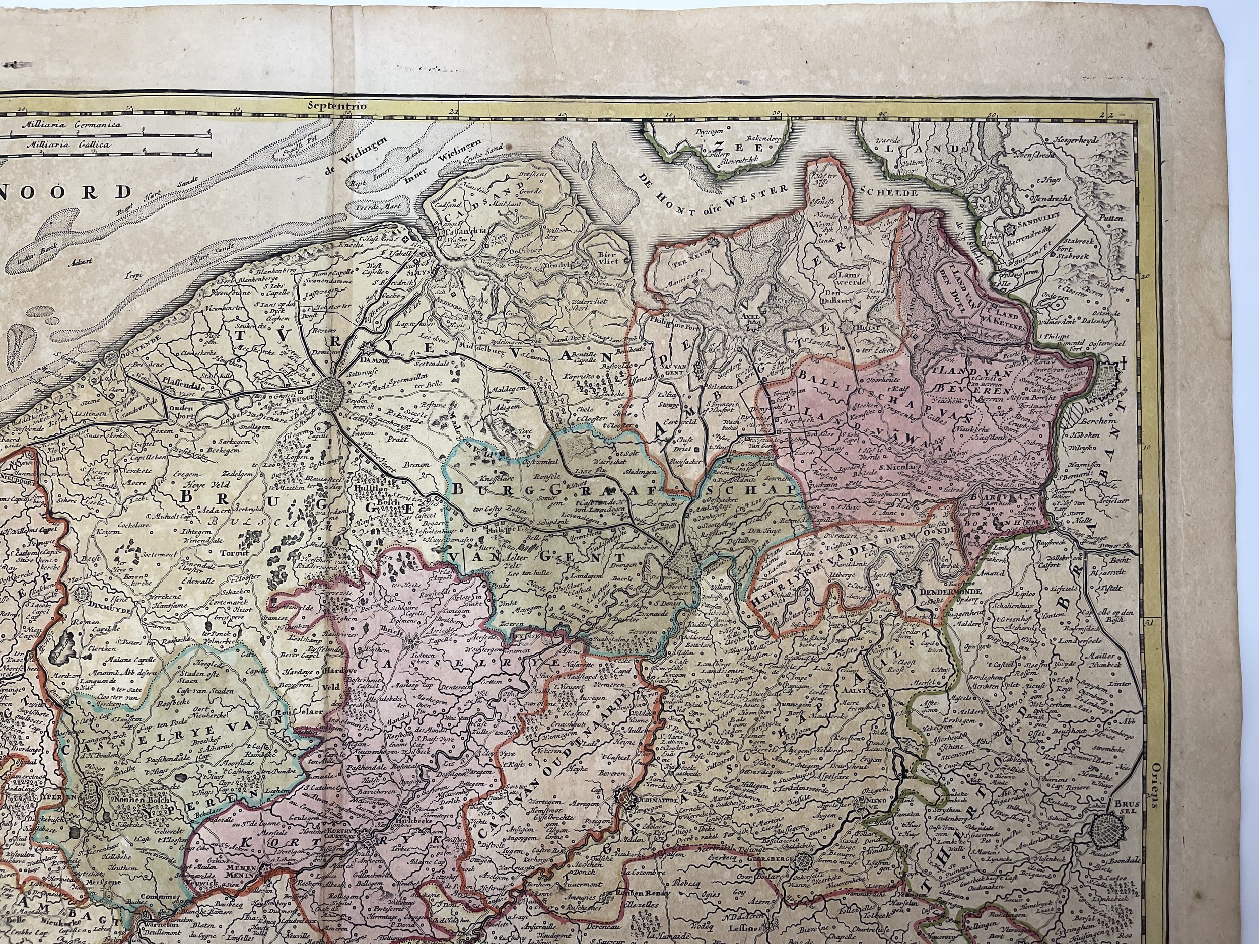 Image 11 of 13
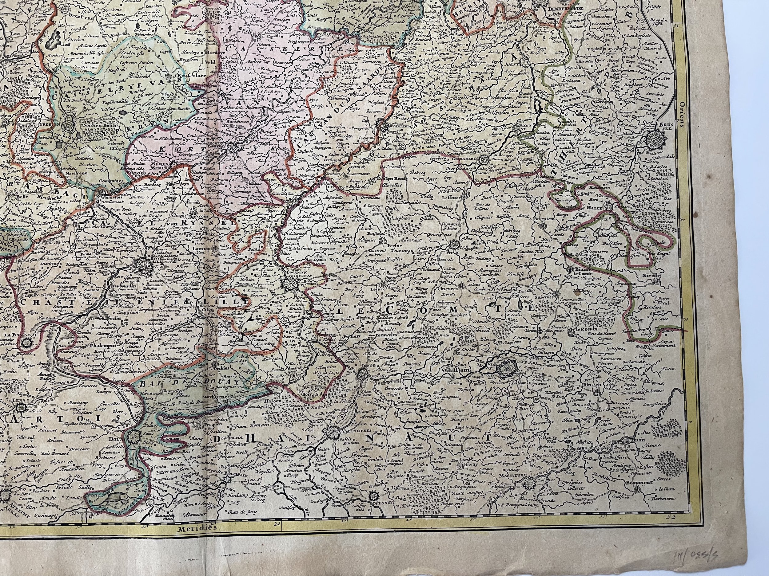 Image 12 of 13
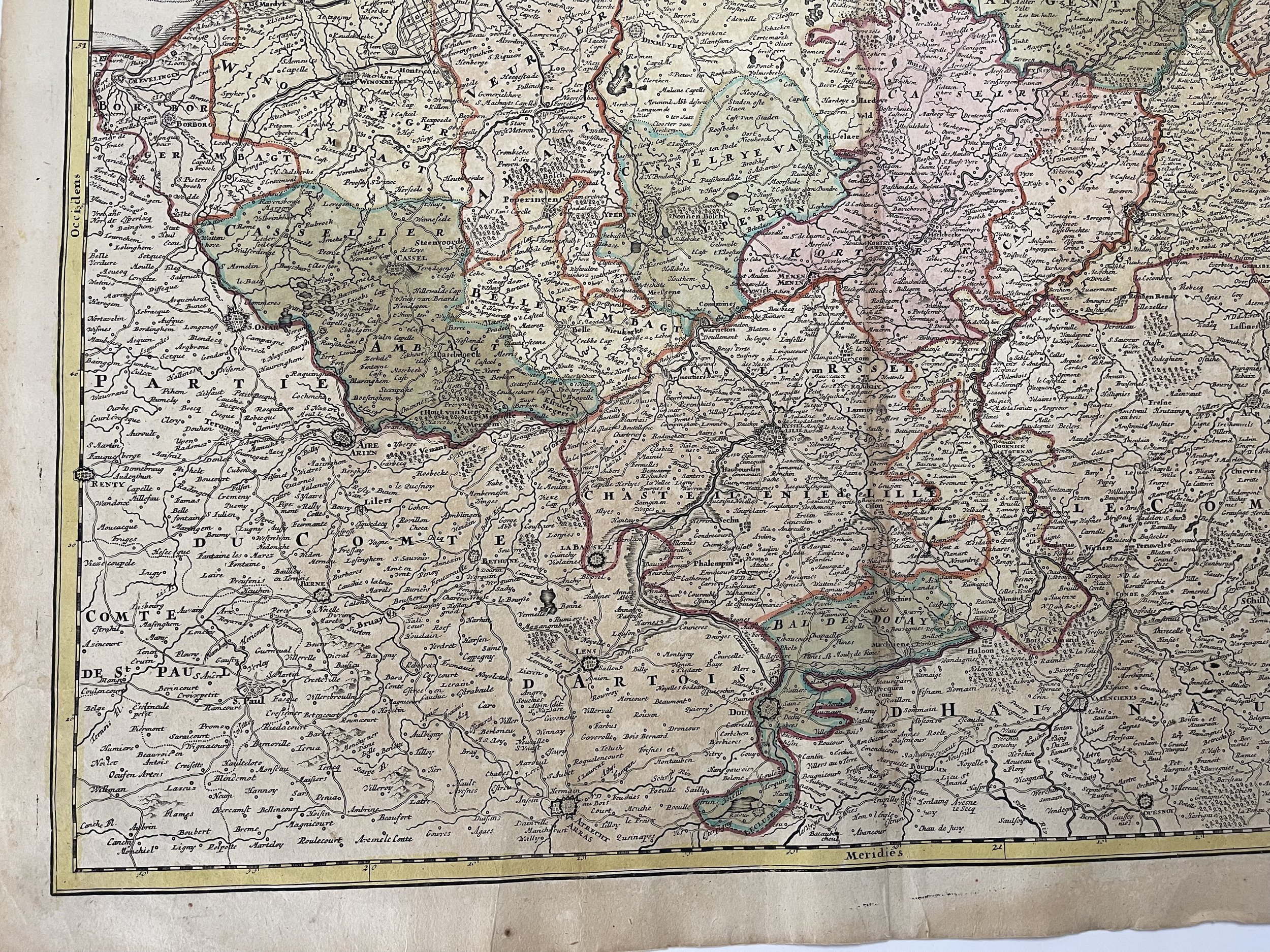 Image 13 of 13