https://www.peninsulapmg.com/foo.html     2022-06-04  
Skip to Content
Peninsula Maps & Globes
Home
Shop
About
Contact
English
0
0
Peninsula Maps & Globes
Home
Shop
About
Contact
English
0
0
Home
Shop
About
Contact
English
Back
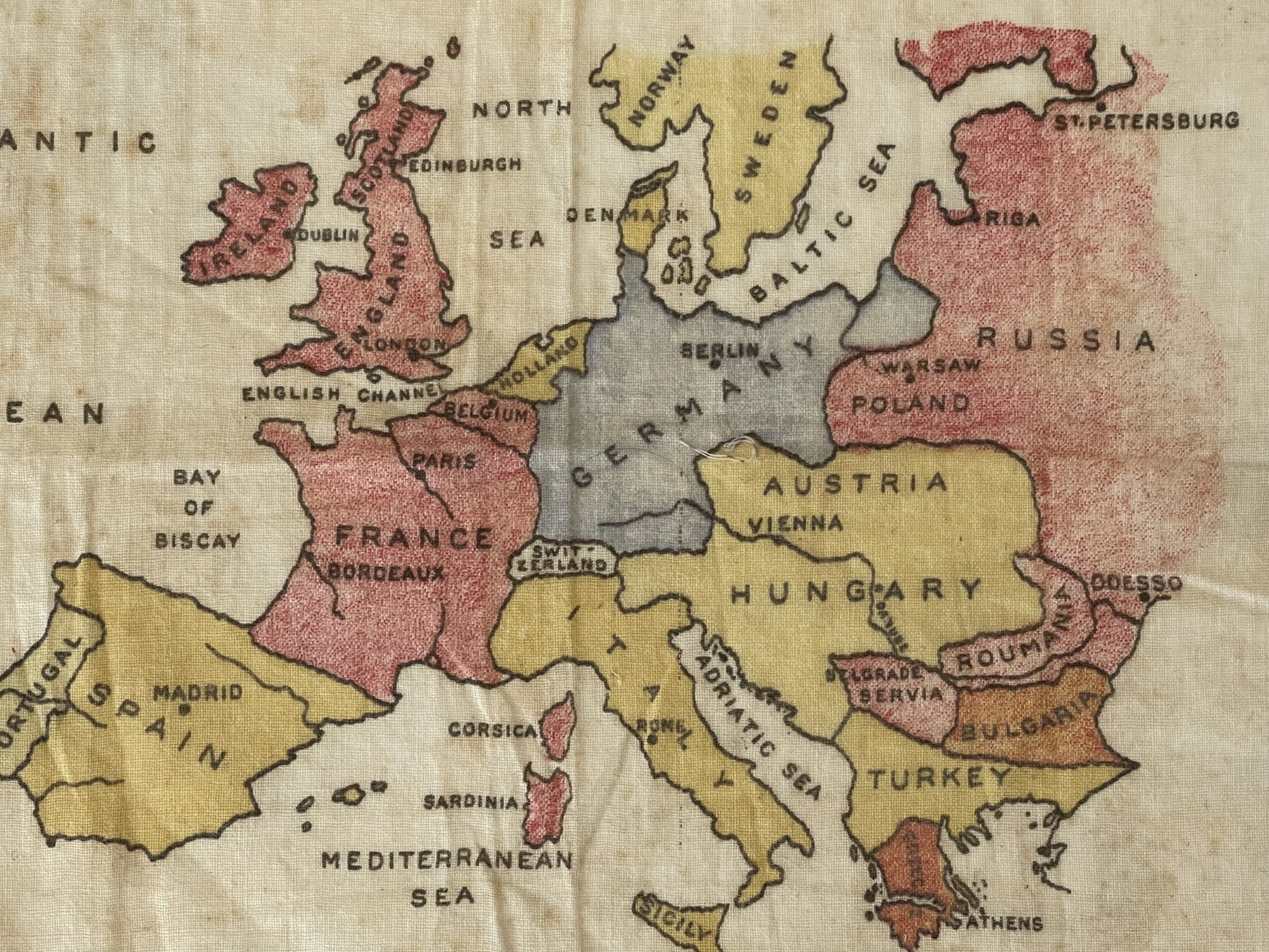
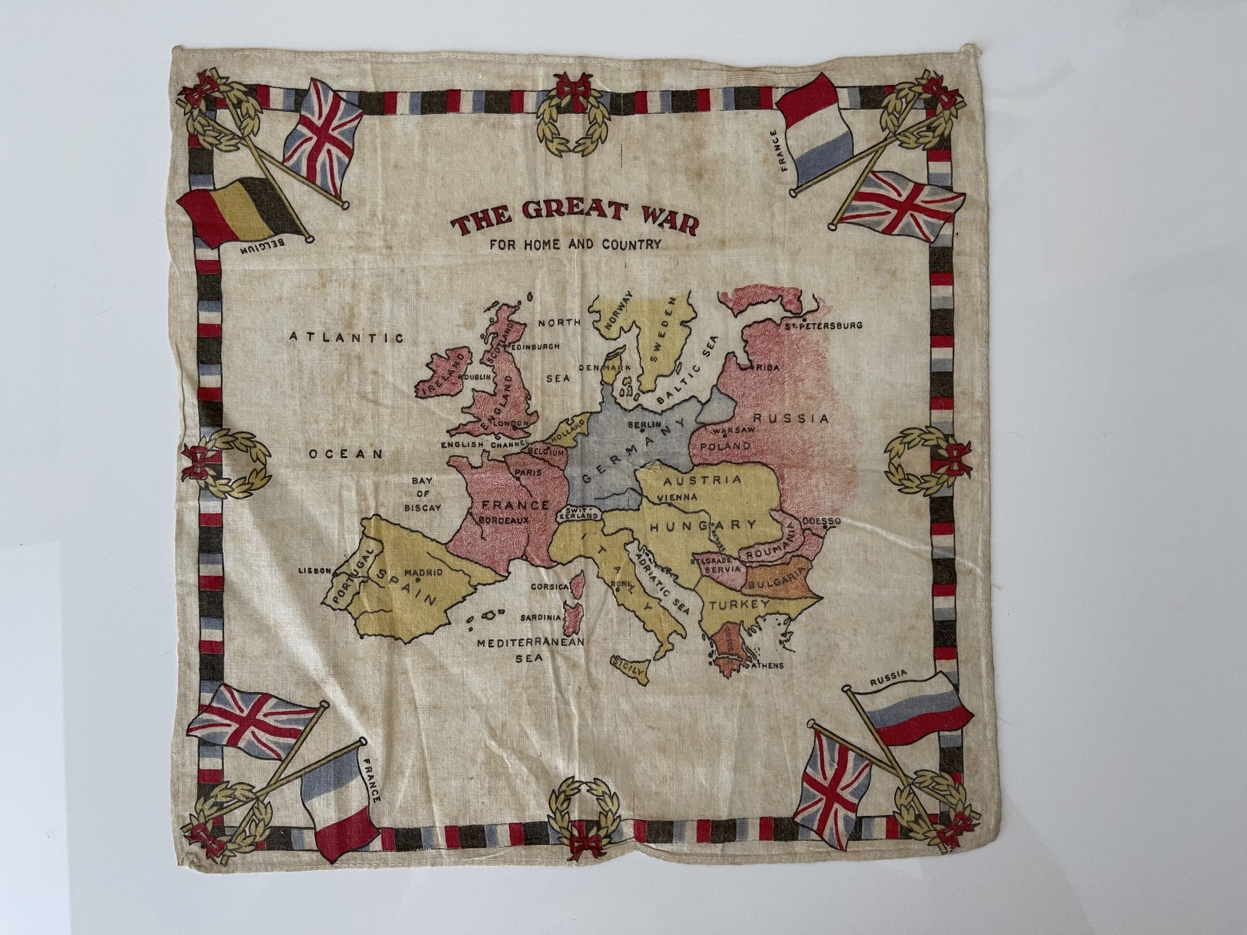
Peninsula Shop Cloth lithograph Map - WW1 Continental Europe - c1918
IMG_7880.jpeg Image 1 of 8
IMG_7880.jpeg
IMG_7882.jpeg Image 2 of 8
IMG_7882.jpeg
IMG_7881.jpeg Image 3 of 8
IMG_7881.jpeg
IMG_7886.jpeg Image 4 of 8
IMG_7886.jpeg
IMG_7883.jpeg Image 5 of 8
IMG_7883.jpeg
IMG_7887.jpeg Image 6 of 8
IMG_7887.jpeg
IMG_7884.jpeg Image 7 of 8
IMG_7884.jpeg
IMG_7885.jpeg Image 8 of 8
IMG_7885.jpeg
IMG_7880.jpeg
IMG_7882.jpeg
IMG_7881.jpeg
IMG_7886.jpeg
IMG_7883.jpeg
IMG_7887.jpeg
IMG_7884.jpeg
IMG_7885.jpeg

Cloth lithograph Map - WW1 Continental Europe - c1918

£50.00

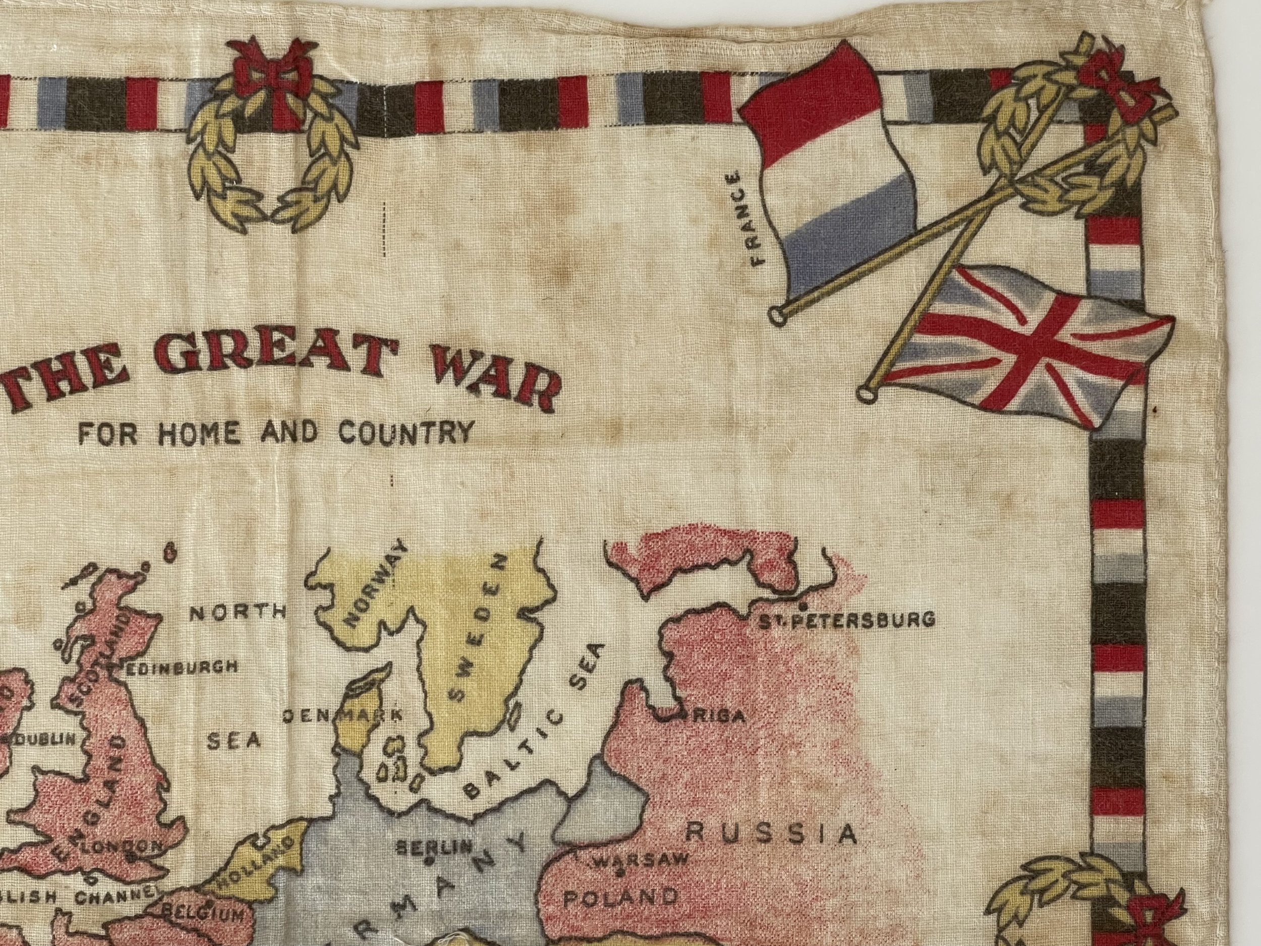
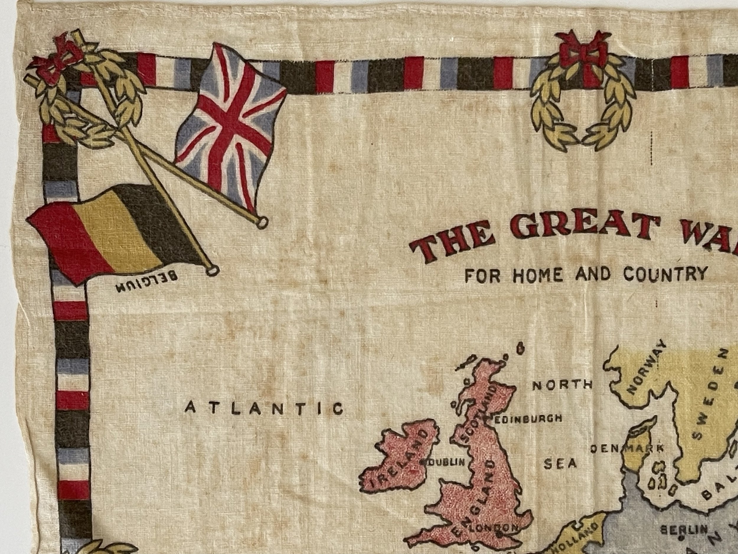
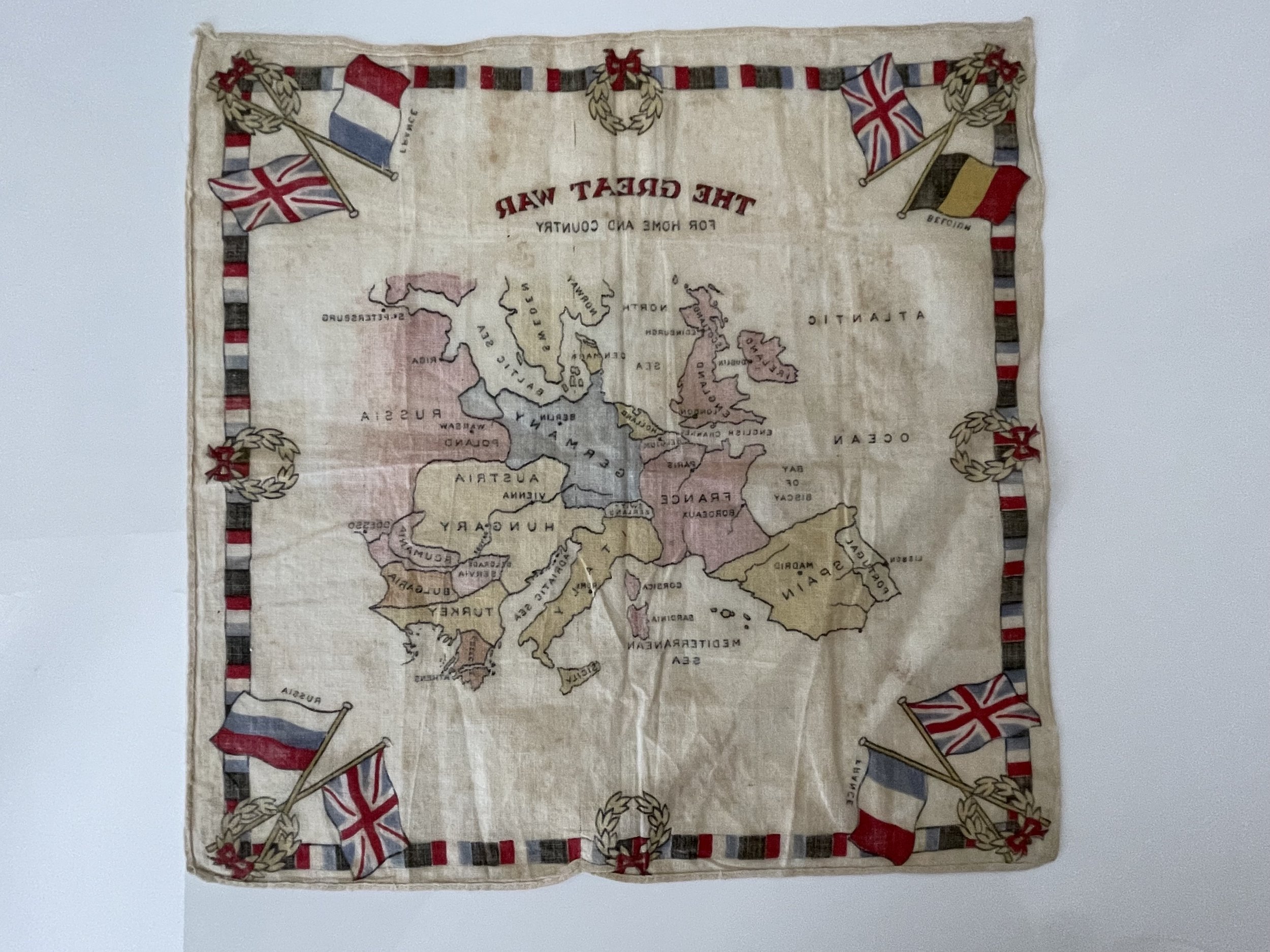
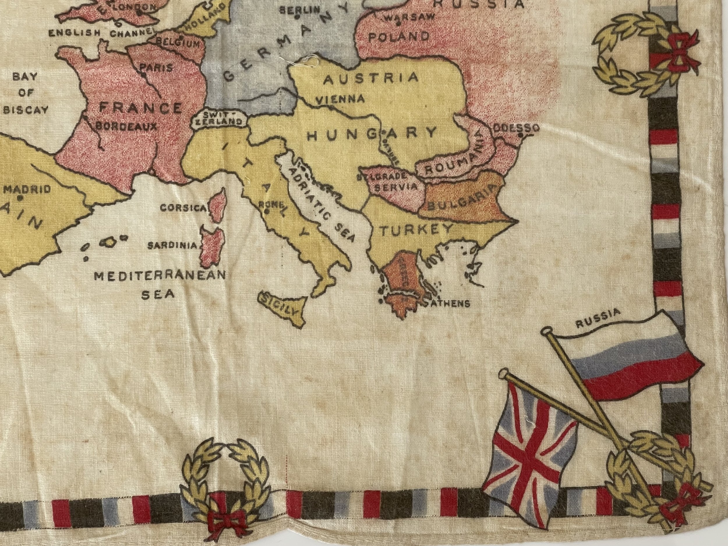
Striking and highly detailed fine unusual vintage original coloured lithographic cloth map of the European continent during the First World War, with its political divisions, printed on fabric.

Decorative borders with the flags of France, the United Kingdom, Belgium and Russia adorn the map.

Date: C 1918 ( undated )

Dimension: Paper size approx.: cm 30,7 x 30,4

Condition: Map is clear and printed on fabric. Map coloured. Map folded. Some mild staining, condition are as seen in the images.

Pricing and grading commensurate.

Add To Cart

Striking and highly detailed fine unusual vintage original coloured lithographic cloth map of the European continent during the First World War, with its political divisions, printed on fabric.

Decorative borders with the flags of France, the United Kingdom, Belgium and Russia adorn the map.

Date: C 1918 ( undated )

Dimension: Paper size approx.: cm 30,7 x 30,4

Condition: Map is clear and printed on fabric. Map coloured. Map folded. Some mild staining, condition are as seen in the images.

Pricing and grading commensurate.

Code : A1013

Cartographer : Cartographer / Engraver / Publisher: Unknown

Date : Publication Place / Date - Circa 1918

Size : Sheet size: Image Size:   30.7 x 30.4 cm

Availability : Available

Type - Genuine - Antique

Grading A

Where Applicable - Folds as issued. Light box photo shows the folio leaf centre margin hinge ‘glue’, this is not visible otherwise.

Tracked postage, in casement. Please contact me for postal quotation outside of the UK. 
Peninsula Maps & Globes - London England

Made with Squarespace

Contact: pmgmapsandglobes01@gmail.com