ADMIRALTY SEA CHART of SCOTLAND - WEST COAST ARGYLLSHIRE LOCH LINNHE - SOUTHERN PART
No. 2814a. Complete as one sheet.
There are three Rose Compasses shown on this chart. Issued by the Royal Naval Admiralty HYDROGRAPHIC Office.
Working as an executive agency of the Ministry of Defence, the UK Hydrographic Office UKHO play a leading role in providing expert advice on hydrography to the UK and international governments. They source, compile and analyse a wide range of data to help our partners build an understanding of the marine environment. The UKHO was originally founded in 1795.
Scale :- 1:24,230, Price Six Shillings.
Engraved:- 1862. Originally surveyed and published by the Admiralty, 20th June 1862 Latest new edition:- 1941. Latest large correction:- Latest small correction:- 1949. Dimensions of overall sheet:- 40 X 36”, 102 X 92cm, approx. Vertically presented.
There are a few Beacons & Lighthouses, coloured red, shown on this chart. This chart is for historical use only, and should not be used as a present-day chart
Loch Linnhe is a sea loch on the west coast of Scotland. The part upstream of Corran is known in Gaelic as An Linne Dhubh (the black pool, originally known as Loch Abar), and downstream as An Linne Sheileach (the salty pool). The name Linnhe is derived from the Gaelic word linne, meaning "pool".
Loch Linnhe follows the line of the Great Glen Fault and is the only sea loch along the fault. About 35 kilometres (20 miles) long, it opens onto the Firth of Lorne at its southwestern end. The part of the loch upstream of Corran is 15 km (9 mi) long and an average of about 2 km (1 mi) wide. The southern part of the loch is wider, and its branch southeast of the island of Lismore is known as the Lynn of Lorne. Loch Eil feeds into Loch Linnhe at the latter's northernmost point, while from the east Loch Leven feeds in the loch just downstream of Corran and Loch Creran feeds into the Lynn of Lorne. The town of Fort William lies at the northeast end of the loch, at the mouth of the River Lochy.
1645 - According to the Bard Fr. Allan MacDonald, an important figure in Scottish Gaelic literature, Loch Linnhe was said in local Scottish folklore to be the home of an each-uisge, or "water horse", whose back could accommodate all the children who wished to ride him. But when they did, the water-horse would gallop off into the nearest lake to drown and eat the children on his back. Fr. Allan MacDonald later recalled that during his childhood in nearby Fort William, "Many's the horse I wouldn't get on as a child for fear it would be the each-uisge.
The Battle of Inverlochy occurred on 2 February 1645 during the Wars of the Three Kingdoms when a Royalist force of Highlanders and Confederate Irish troops under the overall command of James Graham, 1st Marquess of Montrose, routed and largely destroyed the pursuing forces of Archibald Campbell, 1st Marquess of Argyll, who had been encamped under the walls of Inverlochy Castle.
After being researched, the area was designated as a battlefield by Historic Scotland in 2011
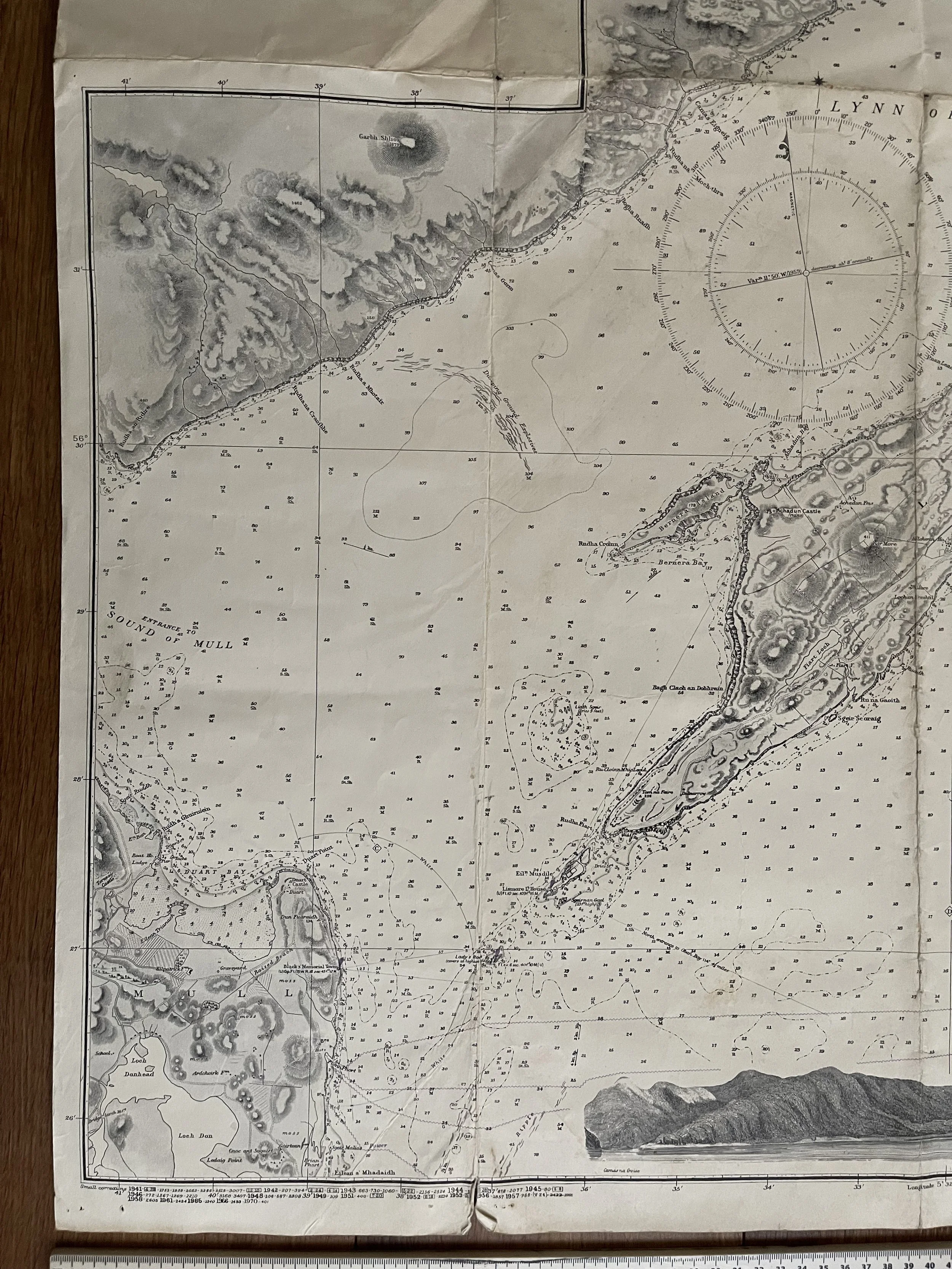 Image 1 of 14
 Image 2 of 14
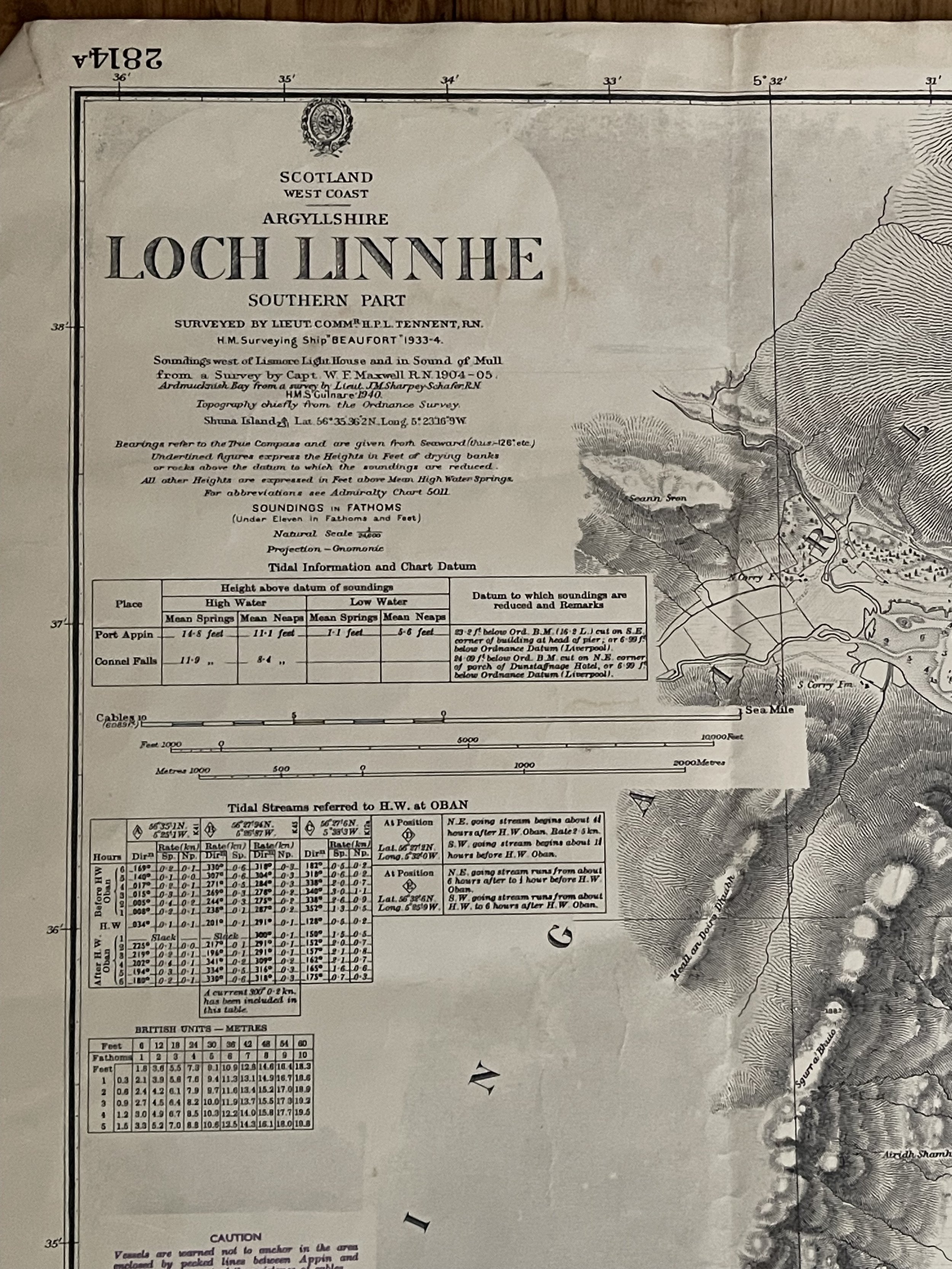 Image 3 of 14
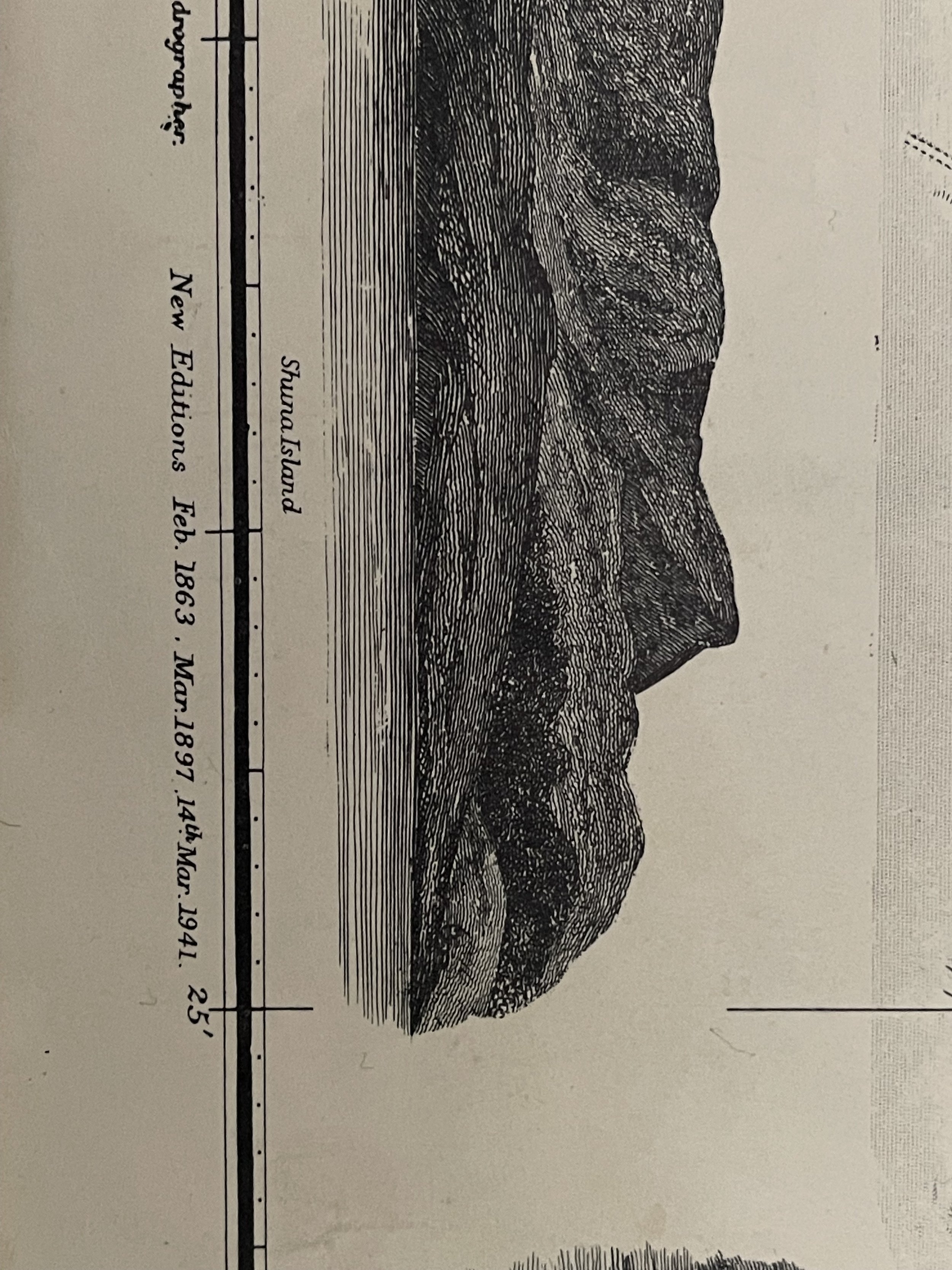 Image 4 of 14
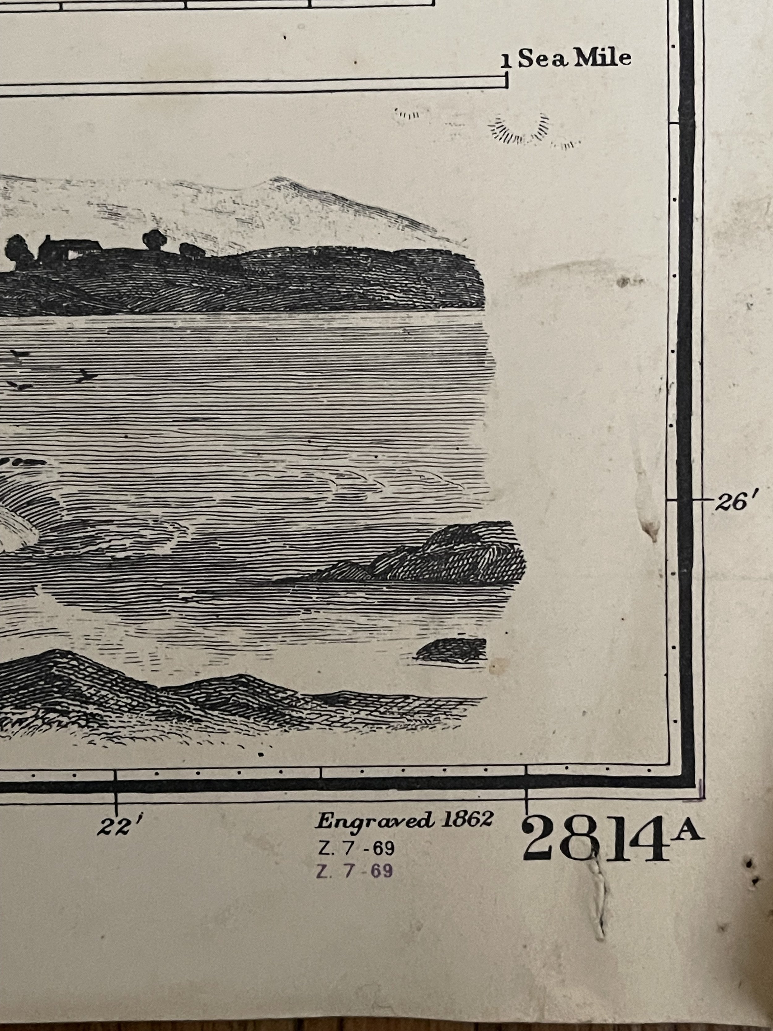 Image 5 of 14
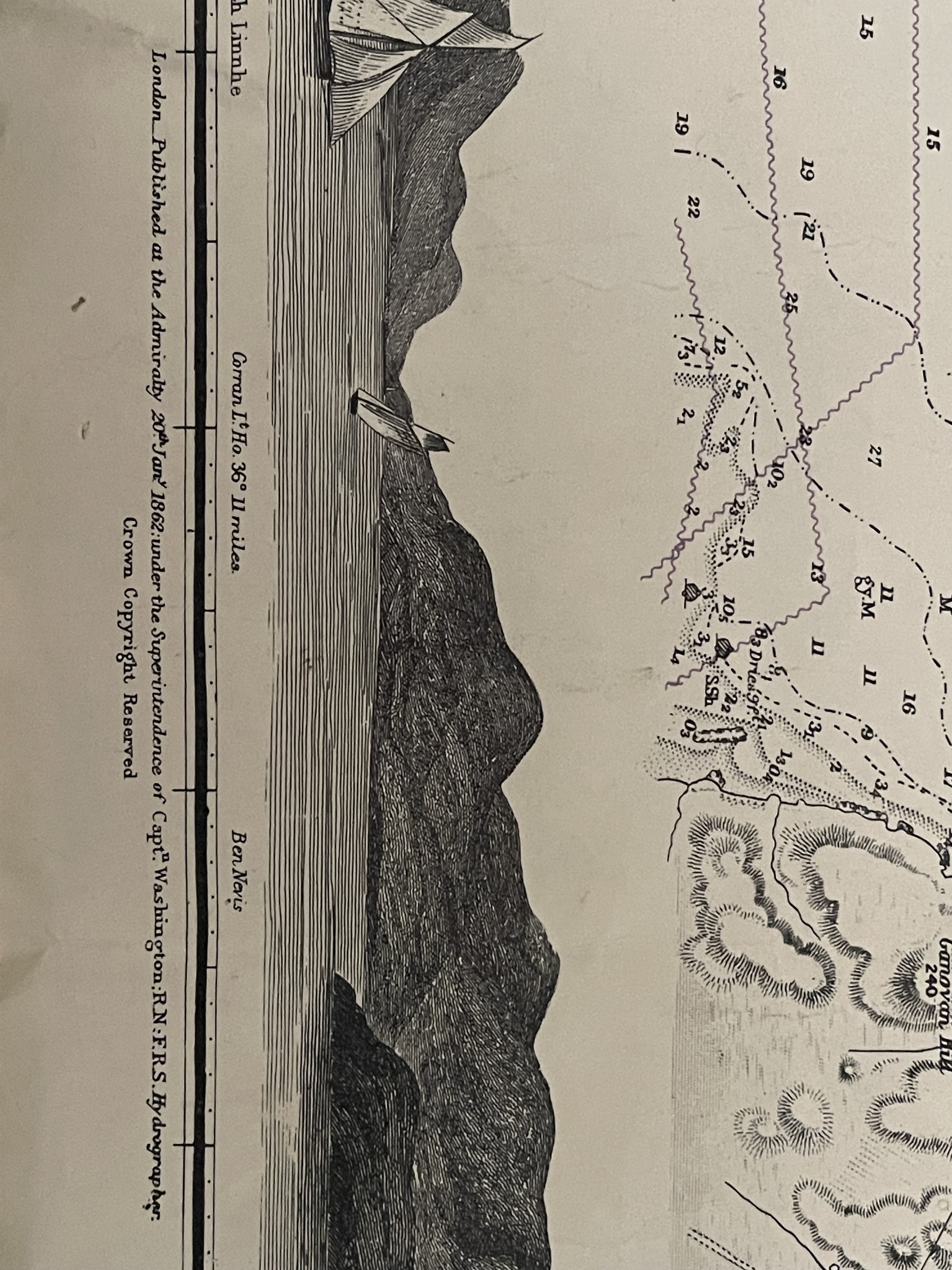 Image 6 of 14
 Image 7 of 14
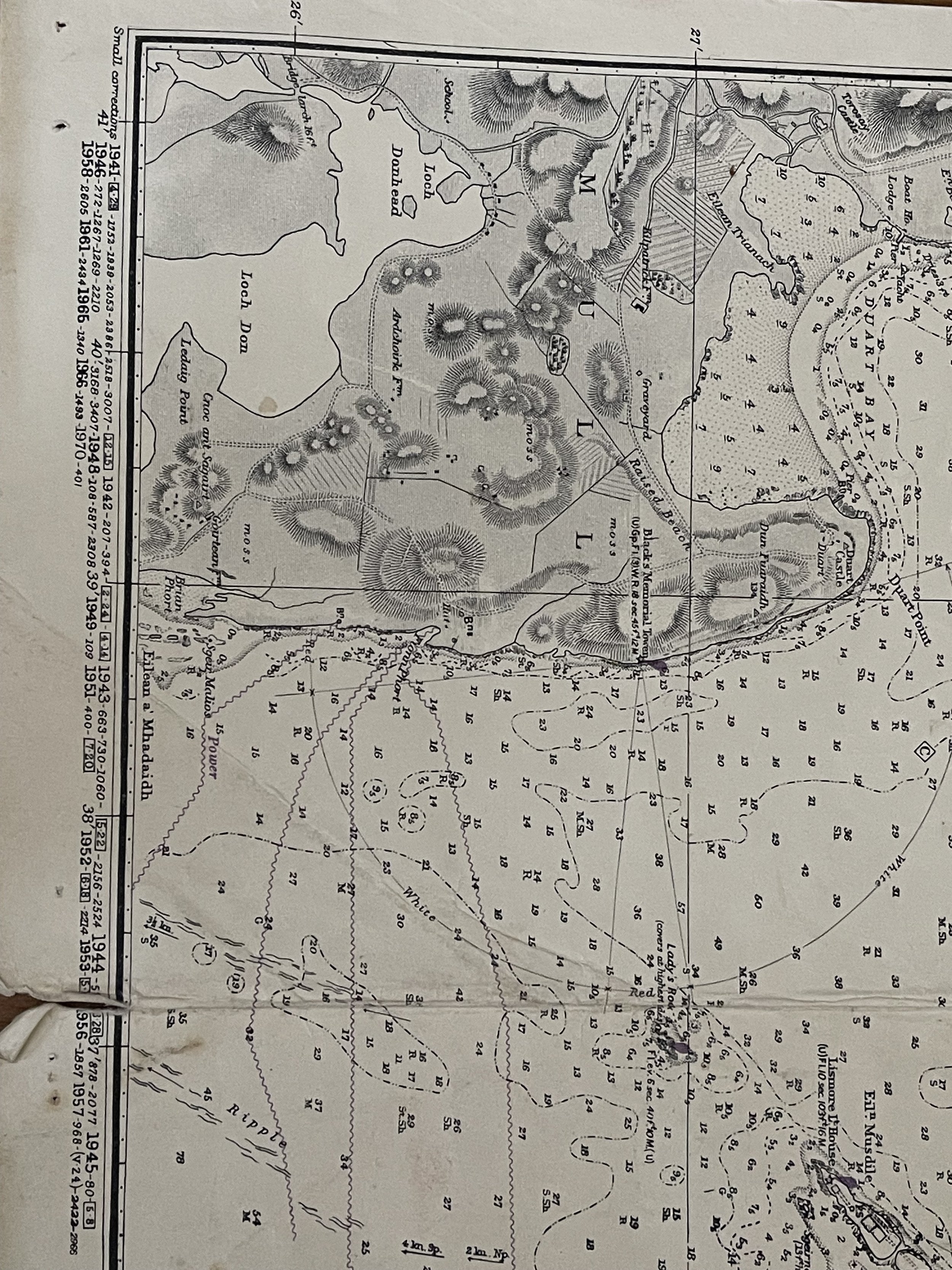 Image 8 of 14
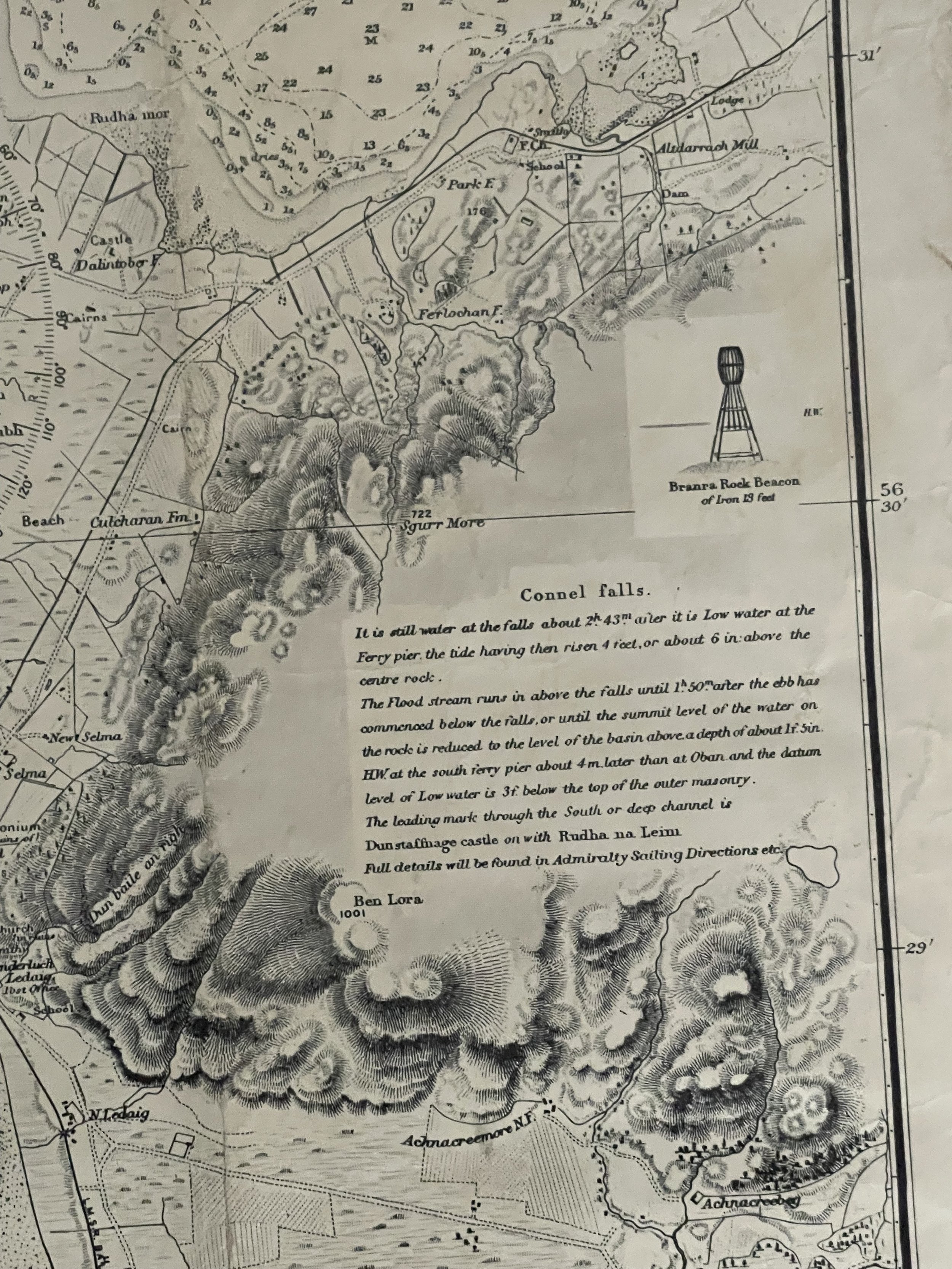 Image 9 of 14
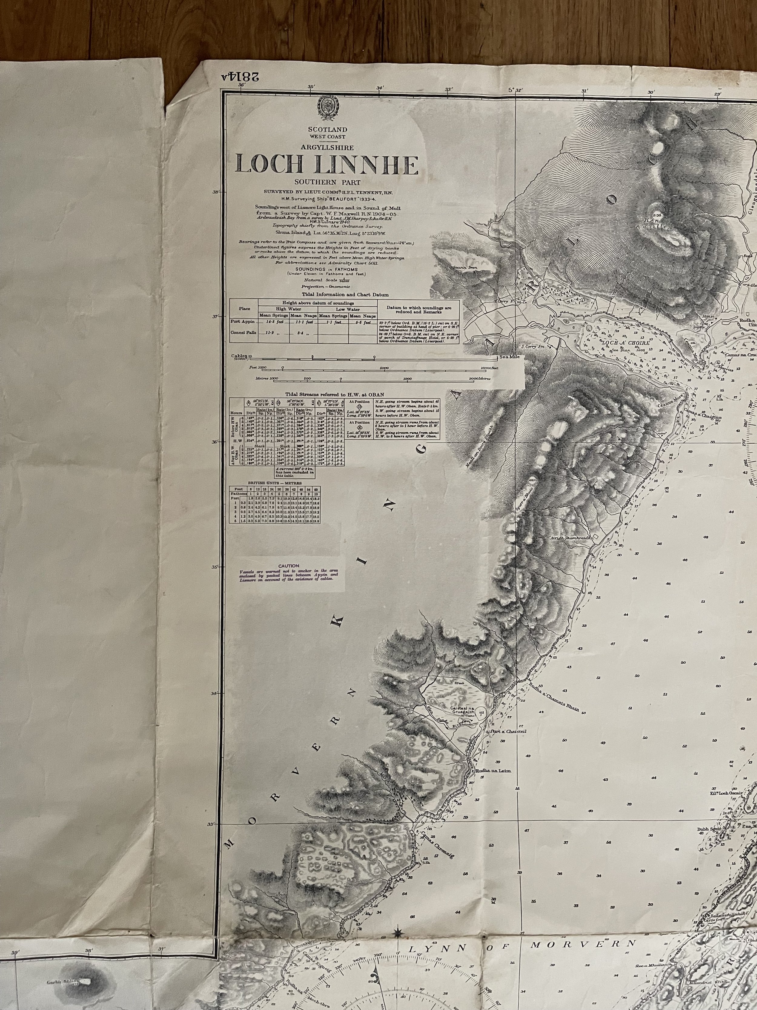 Image 10 of 14
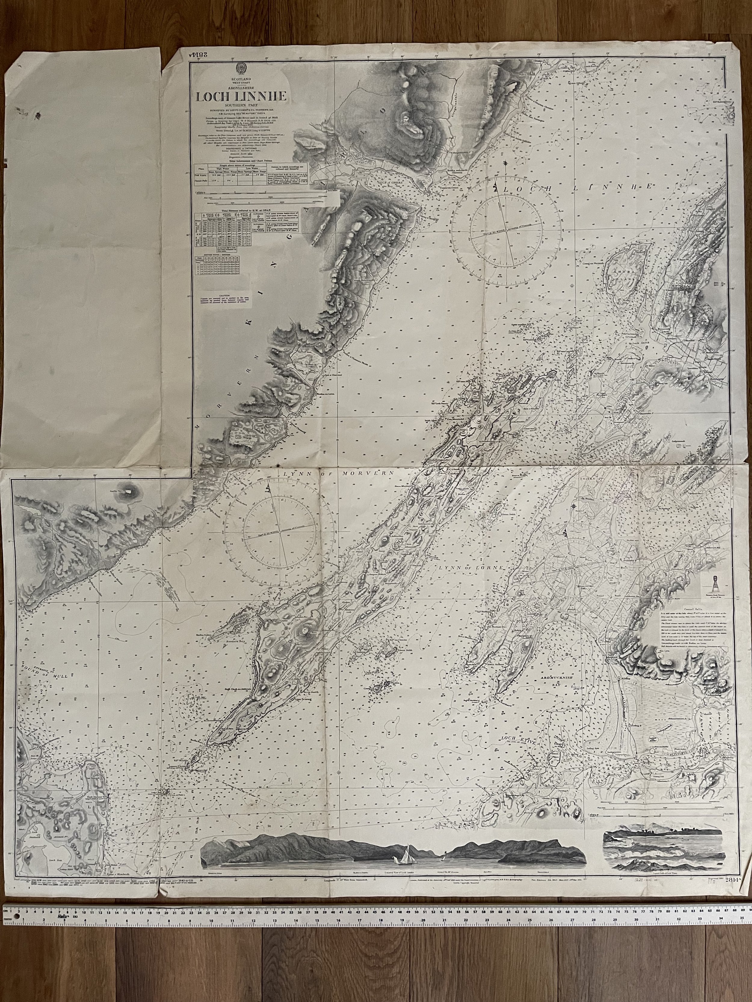 Image 11 of 14
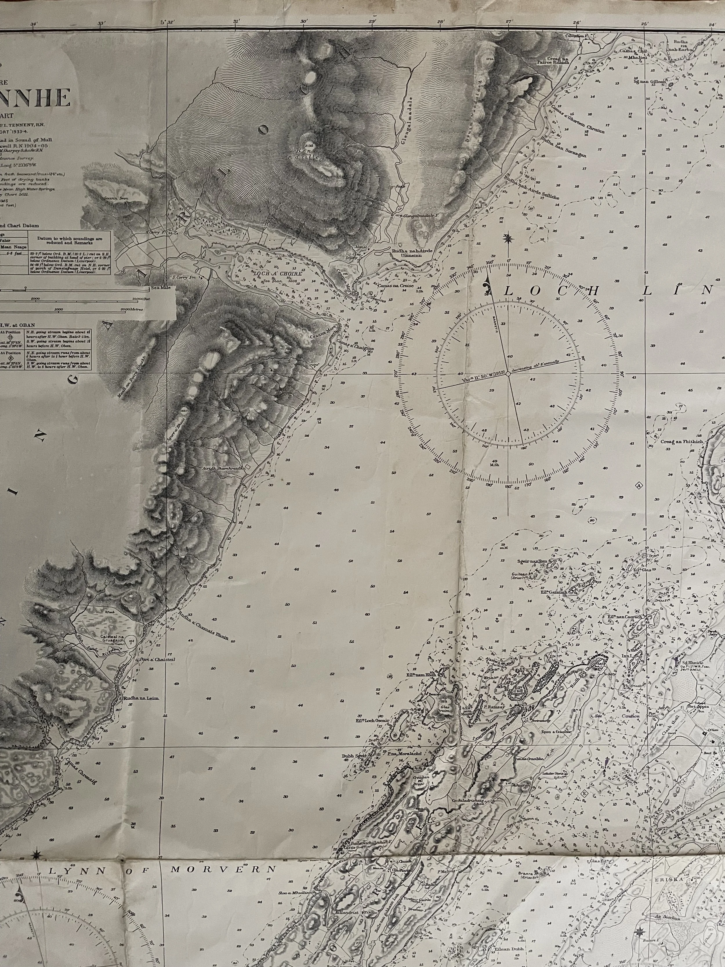 Image 12 of 14
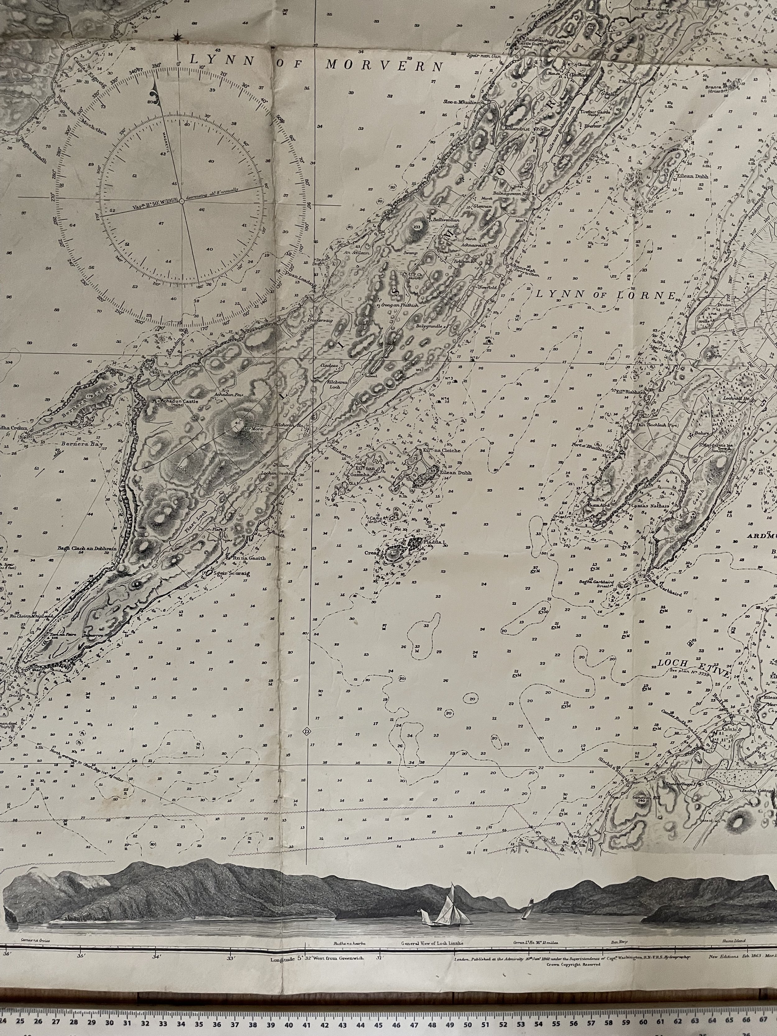 Image 13 of 14
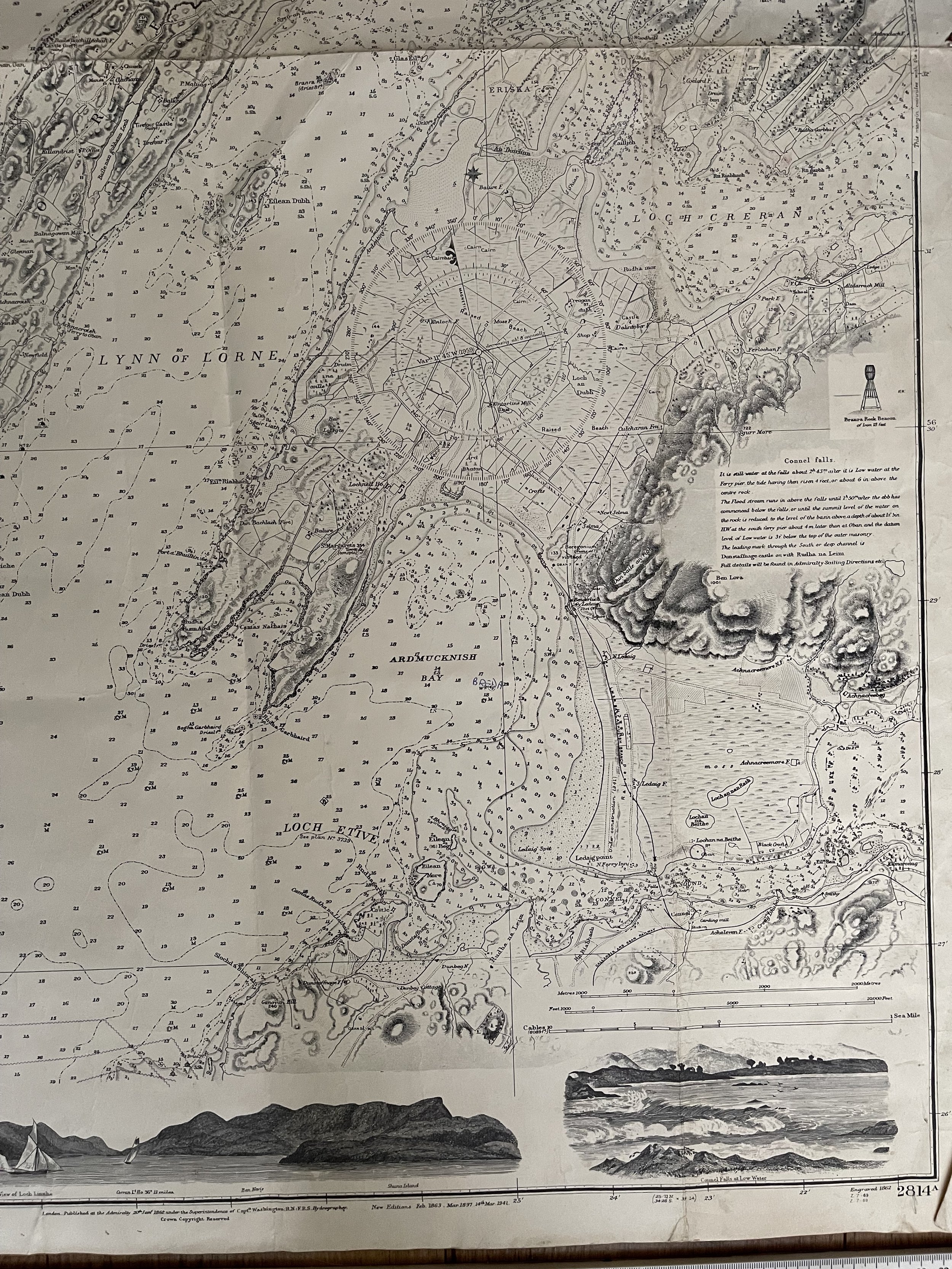 Image 14 of 14