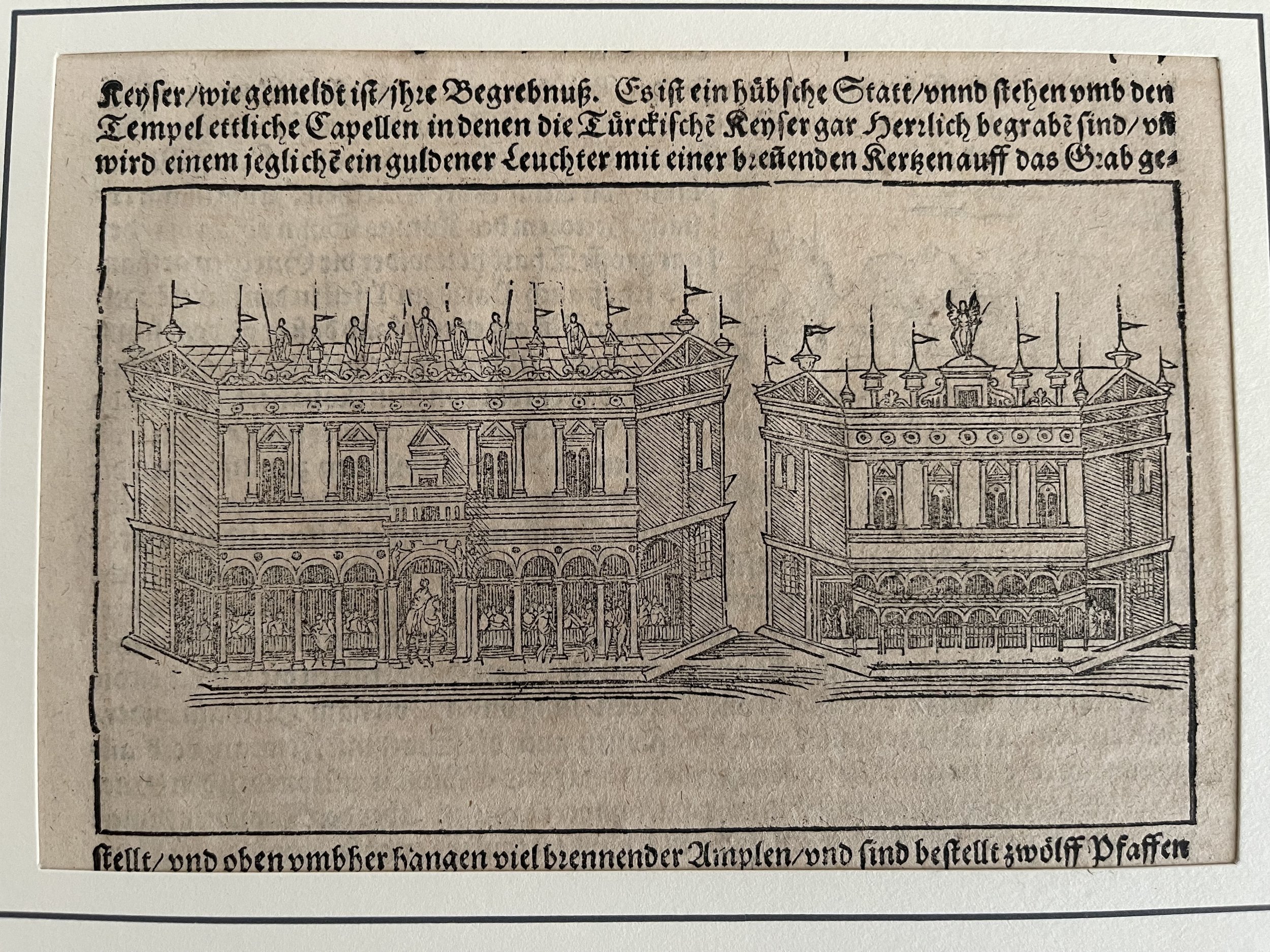
 Image 1 of 3
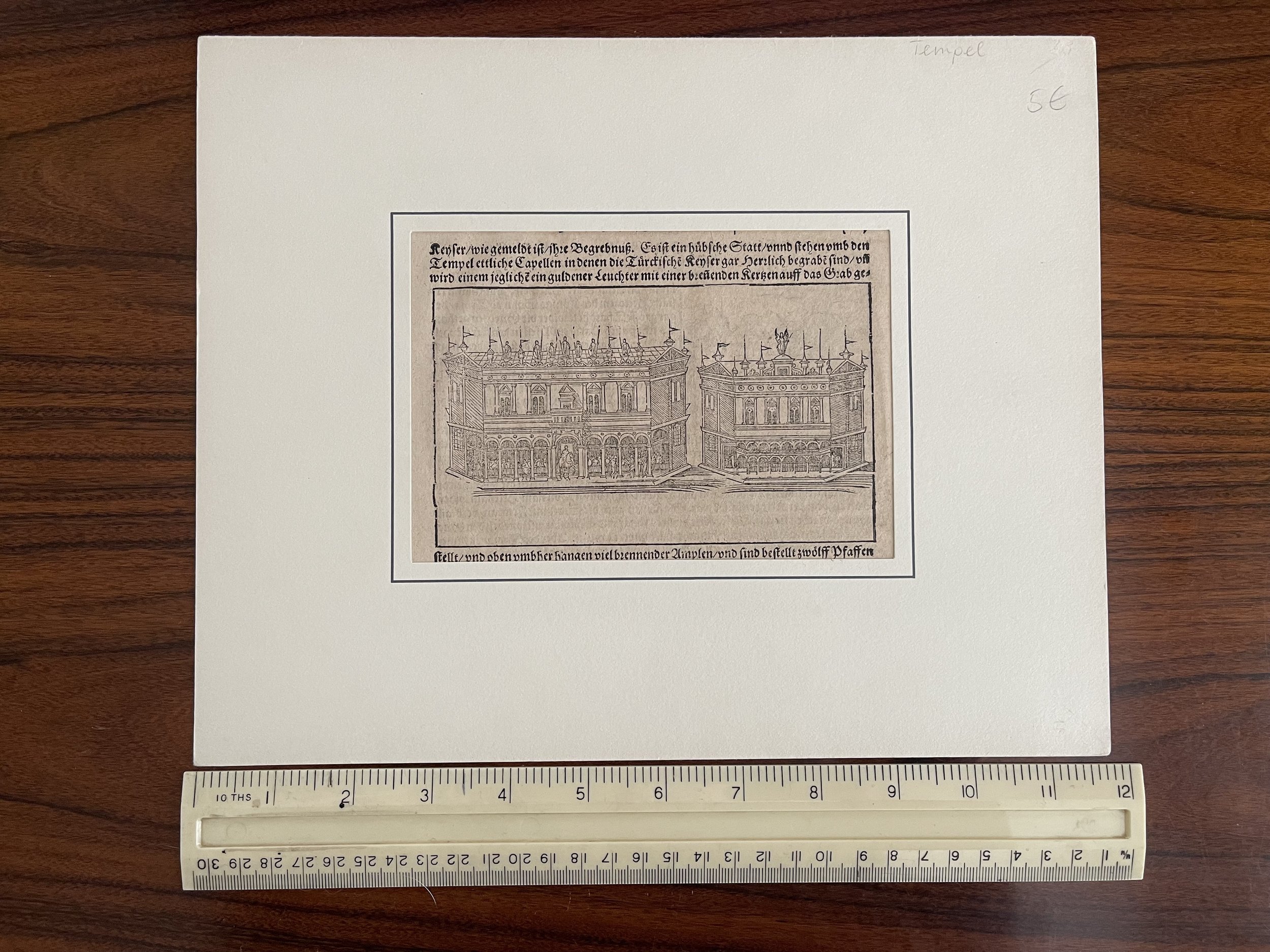 Image 2 of 3
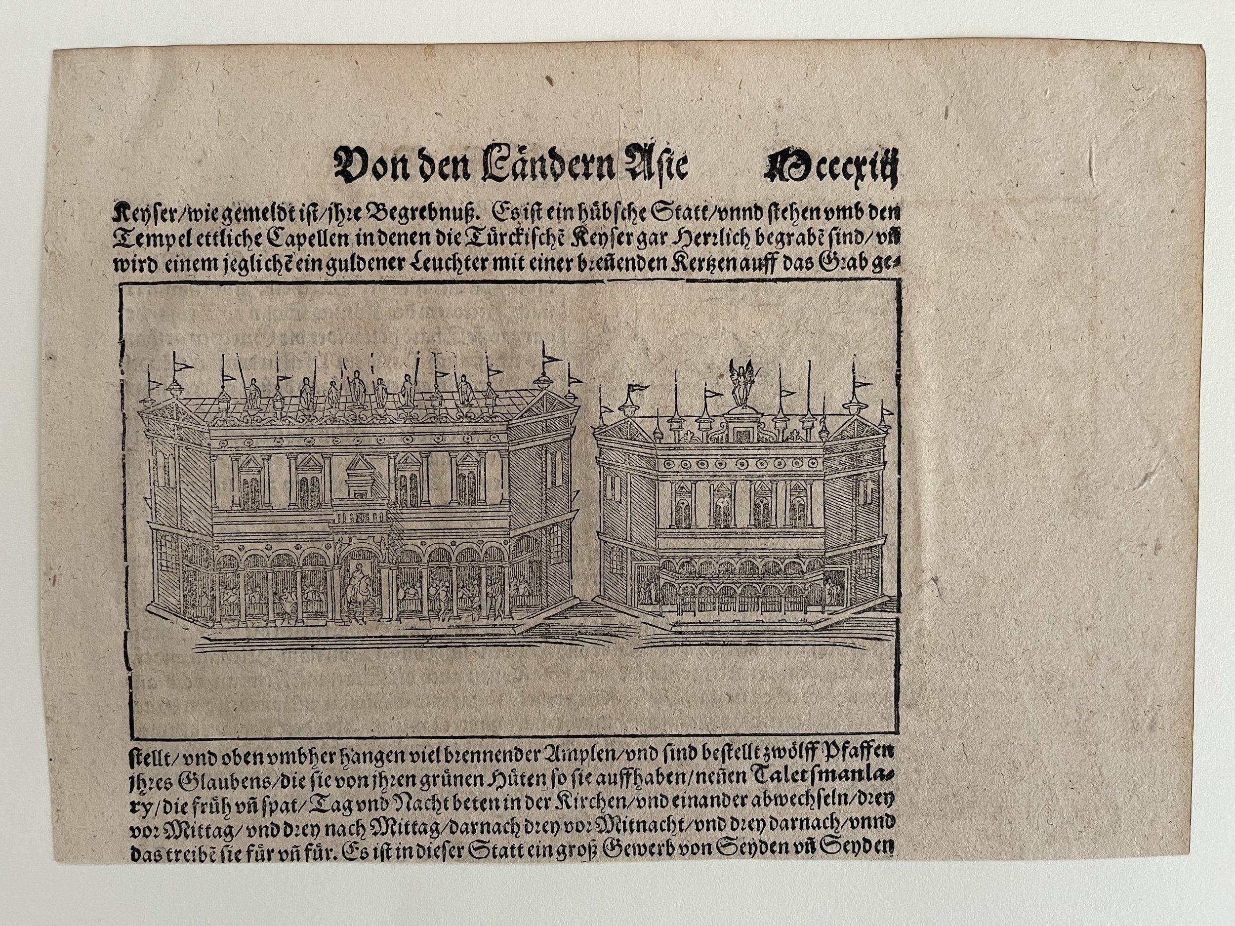 Image 3 of 3
Code : A24
Cartographer : Cartographer / Engraver / Publisher: Sebastian Münster
Date : Publication Place / Date - Germany 1545 Approx
Size : Sheet size: Image Size: 16 cm x 11 cm approx
Availability : Available
Type - Genuine Antique
Grading - A
Tracked postage, in casement. Please contact me for postal quotation outside of the UK.